Tag Archives: wanstead

Snow Survey of London (1946 – 2025)

Winter 2024/25, considering the DJF mean, sits 68th out of 79 winters back to 1946/47.

It was the 13th snowless winter in the series . The only ‘top 10’ winter for snowfall of the past 30 years was 2009/10!

Snow is a very rare commodity in lowland Great Britain – even rarer in the Home Counties, and in our part of east London. Pulling back the curtains on a cold winter’s morning to be greeted by a fresh fall of deep, crisp and even snow is something most children experience and hold dear for life. The slush, ice and chaos that inevitably follows all too quickly is forgotten.

OLYMPUS DIGITAL CAMERAMy memories of winters in the 1970s and 1980s is that they were far snowier and colder than they are today. But were they *always* cold and snowy? I decided to have a look back through the archives to find out. My first stop was the Met Office’s now defunct Snow Survey of Great Britain. This excellent compilation of reports logged by observers nationwide was printed annually as part of British Rainfall. But through lack of interest and cuts printing ceased after the 1991-92 season. Data continued to be collected though the modern version of the survey uses satellite technology to estimate daily UK snow depths – the Met Office website says that this is far less subjective than an individual nipping out at 9am every morning to ‘stick in a ruler’ and, those within sight of high ground, to observe where the snow line is. This does a disservice to the hundreds of observers who down the years diligently logged all their information as objectively as possible. But on to the data…

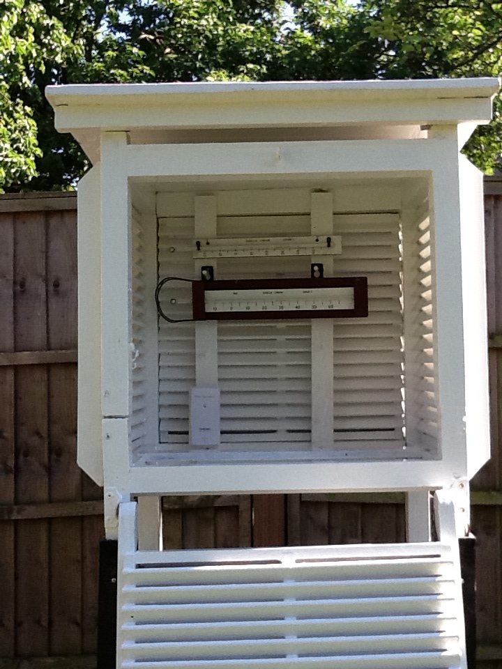
Regional data was not included in the survey until the 1965-66 season. Though Wanstead isn’t listed I have taken an estimate from data supplied from stations at Eastcote (53m), East Barnet (70m), Charlton Park (46m), Twickenham (13m), Teddington (9m). Because this area is influenced by Thames streamer snowfall that blows in off the North Sea and is funnelled upriver I have also considered readings from Epping (107m), Rayleigh (73m) and Southend (27m). Indeed, in some years Wanstead’s snowfall is much more similar to Rayleigh and Southend than it is to Greenwich and Teddington. Though my site is only 18m it seems to catch the snow much better than surrounding areas – probably to do with the fact that Aldersbrook is surrounded by greenery. People walking down from Wanstead village often remark that Wanstead Park is far snowier than the village a couple of dozen metres or so higher. Before 1965 I have used data from Woburn, Bedfordshire, which at 89m and 40 miles away as the crow flies, is the closest station in that long running series.

The mean temperature of a winter can look cold but it doesn’t always tell the full story. You can have a winter dominated by high pressure over the near continent making things very dry. But the anticyclones that ridge from Central Europe to the Azores can leave us in the ‘warm’ part of the high – and often lead to days of anticyclonic gloom; cold grey, dank and boring weather with little sunshine. On paper a season can look cold but in reality totally unremarkable; it is the number of days with ‘snow lying’ that people remember. For snow to settle it needs to be cold! For this reason I haven’t bothered with ‘snow falling’ data as it can snow at 4C in very dry air – yet nothing settles. Most weather geeks find ‘snow falling’ the most frustrating when it doesn’t stick. So on to the results.

The Top 20 winters in Wanstead, using 'snow lying' and 'mean temperature' in stats. Click the image to view all 67 winters
The Top 20 winters in Wanstead, using ‘snow lying’ and ‘mean temperature’ in stats. Click here to view all 79 winters back to 1946/47

Once I worked out the ‘snow lying’ days I decided to devise a winter index by dividing ‘snow lying’ by seasonal mean temperature. Because the results using Celsius were problematic in that 1962/63 becomes very skewed upwards I decided to use Kelvin.

The results are quite surprising. Coming out top, not surprisingly, is 1962-63 with an index of 25.2 and 69 days of snow lying. Second is 1946-47 with an index of 21.1. Third is 1981-82  with an index of 10.5 – surprisingly ahead of 1978/79, the first winter in the series that I can recall; I remember returning home from school one night in December 1978 and the snow being as deep as the twelve-inch step to our house.

The index of 25.2 for the 1962/63 winter and 21.1 for 1946/47 – over double the amount of 1981/82 – shows how ‘off the scale’ those two winters really were. My father, who doesn’t share my enthusiasm for the weather, can distinctly recall the severe conditions of 1962/63. He said the roads were so thick with snow that when the thaw finally arrived in March he’d become so used to driving on snow that he crashed through somebody’s front garden wall, after losing control of his Mini on surface water sat on the ice.

More recent winters, which pale by comparison, rank surprisingly highly. The 2009/10 winter comes in at Number 10, higher than the legendary 1986/87, where the coldest day in recent times was recorded in London, which came in at Number 12. It should be noted that January 1987, when on the 12th the temperature did not rise above -5.5C all day, was sandwiched by a mild December and February.

OLYMPUS DIGITAL CAMERAJust by looking at winters with a mean of, say, 5C doesn’t tell you much about snowfall. When you look at 1985-86 (mean 4.1C)  there were 22 days of snow lying at 9am – yet 2005/06 was colder (3.9C) and only 3 mornings saw snow lying – though that winter was particularly dry – the 13th driest in the series.

The median for ‘snow lying’ days in this series is six. The rolling median of the past 30 years, however, is only 2 so, with this in mind, if it does snow you should get out there and make the most of it.

You can view over 70 years of winters in this area, all ranked using my winter index here.

Screen Shot 2017-12-21 at 14.44.05

*It should be noted that a day of ‘snow lying’ only qualifies if there is more than 50% cover at the observation time of 9am. This means that it could snow 1cm at 10am – if that snow thaws by 9am the next day it won’t count. Though 8 winters appear snowless it is possible that these winters did see temporary coverings

Will it be a White Christmas this year?

Will it be a white Christmas this year? It’s the question most forecasters get asked year after year as the big day looms less than a month away.

The snow probably won't arrive until after Christmas this year
The snow probably won’t arrive until after Christmas this year

It always fascinates me why Christmas and snow are so closely associated with each other when the odds, especially in London, are so stacked against it happening.

Perhaps it is the Christmas card scenes of Dickensian winters that get people yearning for the white stuff. Indeed, the image of snow covered cobbled streets can probably be blamed on Charles Dickens. The backdrop of A Christmas Carol, and a host of other books, were written when winters, and Yuletide, were generally much colder than they are now. Perhaps it was also the cold Decembers, which came during notably cold years as he was coming of age, that sowed the seed of his impressions of life in London. The Central England Temperature (CET)  for December 1829 and 1830 were 1.4C and 1.8C respectively. To give you perspective the average mean temperature for the Wanstead region in December is 5.6C. Of course we had a taste of what a Dickensian December was like three years ago in 2010 when the average mean temperature was 1.5C. Though bear in mind the mean for 2010 was 10.5C – way above the 8.2C and 8.7C mean temps of 1829 and 1830!

Christmas toys of yesteryear also took every opportunity to perpetuate the snow myth

But back to this Christmas… First of all, what do we mean by a white Christmas? The definition used most widely – notably by the bookies – is for a single snowflake, even if it lands in the midst of heavy rain, to be observed falling in the 24 hours of 25 December at a specified location recognised by the Met Office. Interestingly, the Met Office uses weather observations from Gravesend-Broadness, some 12 miles away, to show current conditions in Wanstead. A lot, however, could be said by us weather anoraks about the different microclimates between here and south of the Thames.

Technically, there has not been a white Christmas in Wanstead for over 30 years. In 2010, we could still see the Christmas card Victorian snow scene in small patches of our gardens, but these were leftovers of a previous dump, so it doesn’t count. Frustratingly, there has been snow on several Boxing Days in Wanstead (1995 and 1996) and in the weeks running up to Christmas, but not on Christmas day itself. The most typical Wanstead Christmas day weather is mild and dry, although it has rained on 12 of the last 33 Christmas days.

So why does it often snow either side of Christmas but not on the actual day? For Wanstead, Christmas is at the beginning of the period when it’s likely to snow. Looking at climate history, wintry weather is more likely between January and March than December.

iced anemOn average, snow or sleet falls in the UK 5 days in December, compared with 7.6 days in January, 6.8 days in February and 6 days in March. White Christmases were more frequent in the 18th and 19th centuries, even more so before the change of calendar in 1752, which effectively brought Christmas back by 12 days. Climate change has also brought higher average temperatures over land and sea and this generally reduces the chances of a white Christmas.

For snow to fall we need moisture in the atmosphere. Snowflakes start their lives as ice crystals thousands of feet up, and when these tiny ice crystals collide they stick together in clouds to become snowflakes. If enough ice crystals stick together, they’ll become heavy enough to fall to the ground.

Precipitation falls as snow when the air temperature is below 2°C. It is a myth that it needs to be below zero to snow. In fact, in this country, the heaviest snowfalls tend to occur when the air temperature is between zero and 2°C. The falling snow does begin to melt as soon as the temperature rises above freezing, but as the melting process begins, the air around the snowflake is cooled. If the temperature is warmer than 2 °C then the snowflake will melt and fall as sleet rather than snow, and if it’s warmer still, it will be rain.

It sounds a simple combination, but getting precipitation on the days when there are temperatures low enough for snow are few and far between.

temple snowChristmas day in Wanstead, on the balance of probability and from previous patterns, is most likely to be a green and mostly cloudy but dry one. Some brightness is possible with temperature peaking at around 10°C. You can read my full methodology on why I think this may happen here.

Though my attempt to find the probability of a White Christmas effectively rules one out, there is still an outside chance that one could happen.

At this time of year the UK can effectively become a battleground between cold polar continental air to the north or east and moisture-laden mild tropical maritime air to the south and west. Where these air masses meet, snow is possible, but a lot depends on which air mass wins the battle. When battleground situations occur, in one location it can be snowing, but just 20 miles or so down the road it can be raining. This is because there is a fine line between the boundary of the warm and cold air.

There's nothing like an open coal fire. It's even better when it is cold enough outside to have one
There’s nothing like an open coal fire. It’s even better when it is cold enough outside to have one

In years gone by, Wanstead and the surrounding area has often ended up in the cold air mass or the warm air mass. In these situations dry and mild or dry and cold weather is often the result. Of course, in a cold air mass situation there is always the chance of showery activity of the North Sea. The weather so far this winter has not been anything out of the ordinary, so I’m afraid there is nothing to suggest a white Christmas is likely.

If it does turn very cold on December 24, pray for clouds to appear and we could be in with a chance. But at the end of the day we still need that vital combination of temperature and moisture. Snow, like Christmas in that sense, requires some magic.

Winter Forecast 2013/14 (with no apologies to the Daily Express)

Much has been printed in the tabloids over the past month or so that we are in for a severe winter. Not a week goes by without the Daily Express splashing that the ‘Worst winter EVER is on the way’. Just this morning the same rag told us that three months of ‘exceptionally cold’ weather are due. On closer inspection the story elaborated the scene with quotes from James Madden of Exacta Weather, one of the ‘experts’ feeding these fantastical stories.

The Temple, Wanstead Park, always looks that much more stunning with a covering of snow

Quite how Mr Madden and other experts arrive at these forecasts is a bit of a mystery. The mystery has deepened further since I decided to crunch a few numbers and try to predict what is in store for the months ahead. Looking at data for this area stretching back over 130 years to 1881 I decided to calculate a seasonal average and arrived at a final figure using singularities – basically looking at the weather patterns we’ve had during October and November.

Many professionals would scoff at this method of pattern-matching, so I’ve incorporated a couple of other ‘now’ factors and taken on board current variables such as sea surface temperatures in the Atlantic and Pacific.

The figure I arrived at, taken as an average of the closest matching autumn periods, is a mean temperature of 4C with rainfall totalling 133mm over the months of December, January and February – that’s about a degree colder than average and 90% of average rainfall. The probability of a winter with a mean temperature of between 4C and 5C is 37% – the most likely outcome. With this in mind a winter in the form of 1986-87 is possible – though whether we would see the same extremes of temperature and snowfall that we experienced in January 1987 is open to question.

Here is a link of my method to predict the coming winter.

The Met Office, with all their computing power and expertise, seem to be hinting at something similar – ie slightly colder than normal. The opening couple of weeks to my forecast seem quite plausible, looking at tonight’s models. Look at the similarity in the synoptic charts for December 8th here.

Shoulder of Mutton lake, Wanstead PArk
Shoulder of Mutton pond, Wanstead Park

Over the last few years the snow lovers among us have been spoiled after a run of very mild winters during the late Nineties and early Noughties that prompted climate expert Dr David Viner to utter the immortal words that one day “children just aren’t going to know what snow is”. It was only a matter of a few years before the words from the senior research scientist at the University of East Anglia seemed a bit hollow.

Mark Twain, born this day in 1835 , once uttered the famous phrase: “Climate is what we expect; weather is what we get” – there is always a chance we could suddenly lurch back to milder winters. This winter could spring a surprise, be it very cold or very mild. But judging what’s happened over the last 130-odd years – a 1962/63 or a balmy 1989/90 look very unlikely.

* Forecasting models use probability on any given outcome. Millions of observations are fed into the Met Office database (and other countries’ weather agencies) every day. Supercomputers then crunch through this data to give probable outcomes. With the volatility of the atmosphere it is not surprising that certainty of any outcome often falls away rapidly. Forecasting has improved greatly in the last 20 years – though anything the models churn out beyond three to five days should be handled with caution. Long range models can give *some* idea of general trends for the months ahead – but changing just one variable can vastly alter an outcome at the end of the run.

* *Over the past few months I have been collating data for the area around Wanstead. This data is freely available from the excellent Met Office library and is emailed via Excel spreadsheet. Rainfall stats include a near-complete daily archive, stretching from 1961 to 2003, from City of London Cemetery . Sadly the rainfall station, along with many others, ceased to supply the Met Office after cuts were made shortly after the turn of century. Prior to 1961 I have used monthly figures taken at the Greenwich Royal Observatory stretching back to 1881. Though this is 6 miles away the difference in temperature between the two areas would be miniscule compared with rainfall data and so can be used. I use my own stats for the period after 2003.

Wanstead Weather’s live twitter feed is a year old

imageThe Wanstead Weather live Twitter feed is one year old today. That’s over 8,700 tweets of hourly weather updates. In that time there’s been 59 air frosts, 632mm of rain, 165 rain days, 27 days with snow falling, 13 days with snow lying – a total of 14cm falling.

Highest max was 34C on July 22nd, lowest min was -7C on January 16th. A windrun of 25,741 miles shows that the anemometer has turned enough revolutions to have circumnavigated the globe, albeit at an average speed of 2.9mph.

Where’s Jack Frost?

It’s usually around this time of year that this area experiences its first air frosts – but a warm, wet October caused by an active Atlantic and a jet stream sitting close to us has meant that classic radiative cooling nights have been in very short supply. There’s been a couple of chilly nights – down to 2.6C on October 30th and November 5th – but to record an air frost the thermometer must read below 0 Celsius (32Fahrenheit).

The first frost last year was recorded on November 6th. Much hoar was seen around the shady banks of Shoulder of Mutton pond in Wanstead Park

Last year, Wanstead recorded its first air frost on November 6th (-1C). Looking back through the records to 1980 the earliest frost was October 17, 1992, and the latest was January 6th, 2004. Interestingly it appears that having frost in October can signal a mild winter to come!. The median for the first frost is November 16th – 18th. Forecasts for this week suggest we could be scraping the windscreens for the first time on Saturday, thanks to high pressure building in from the Atlantic and calming things down.

Indeed, the models today suggest there is a chance of a block forming in the Atlantic which effectively stops depressions from whistling in from the west, unlocking the door for cooler weather from the north or east. It’s a long way off in meteorological terms though.

Here is a list of first air frosts in Wanstead…

The ECMWF model shows high pressure riding in from the Azores at the end of the week
The ECMWF model shows high pressure ridging in from the Azores at the end of the week

2012: Nov 6th (-1C)

2011: Dec 17th (-0.3C)

2010: Nov 15th (-2.2C)

2009: Dec 15th (-0.2C)

2008: Oct 29th (-1.3C)

2007: Nov 16th (-0.9C)

2006: Dec 10th (-0.4C)

2005: Nov 14th (-0.1C)

2004: Nov 14th (-0.6C)

2003: Dec 8th (-0.5C)

2002: Jan 6th 2003 (-0.9C)

2001: Dec 14th (-1C)

2000: Nov 15th (-0.3C)

1999: Dec 19th (-1.8C)

1998: Nov 22nd (-3C)

1997: Oct 29th (-1.5C)

1996: Nov 11th (-0.4C)

1995: Nov 18th (-0.1C)

1994: Dec 15th (-2.5C)

1993: Nov 16th (-1.3C)

1992: Oct 17th (-0.9C)

1991:Nov 10th (-0.4C)

1990: Dec 5th (-0.5C)

1989: Nov 24th (-2.4C)

1988: Nov 6th (-2C)

1987: Oct 25th (-2C)

1986: Dec 7th (-0.5C)

1985: Nov 3rd (-5C)

1984: Dec 11th (-3.4C)

1983: Oct 23rd (-1.1)

1982: Nov 29th (-2.6C)

1981: Dec 8th (-0.5C)

1980: Dec 1st (-3C)

Bang goes chance of a frosty Guy Fawkes

Is Guy Fawkes’ Night going to turn into a damp squib this year? The forecasts don’t look good – our best hope is for a brief ridge to briefly quieten things down before the next frontal system trundles in from the Atlantic.

What was a very wet week last year led to the cancellation of the public display on Wanstead Flats – with 10.2mm of rain on the Saturday flooding the already sodden land. The forecast for this year doesn’t look much better with 16mm of rain due between Friday and dusk on Sunday.

The cloud cover / rainfall chart for 6pm Tuesday shows that the front may have cleared through by the time the bonfires are lit. At this range, though, it is a big if

But what about the actual 5th of November? Monday looks very wet for this region with yet another frontal system sweeping across the south. Up to an inch of rain could fall before dusk on Tuesday driven along by a stiff westerly wind. The only positive, if you can call it that, is it will be very mild. Temperatures will only fall to around 14C which is very warm for a night in early November.

It wasn’t always like this – ask most people of a certain age what the weather was like on Bonfire Night in their youth and most will answer ‘calm, cold and frosty’ – the bonfire providing a source of warmth as well as somewhere to roast the chestnuts and toast the marshmallows. But were frosty nights on Guy Fawkes in the 1980s that common? I decided to have a look back through the archives and find out.

The FAX for November 5 shows an occluded front right over our region at 12noon. This may have cleared through by 6pm

Only 4 nights in the Eighties could really be described as approaching frosty – they were 1980, 1981, 1989 and 1988 which was the coldest Guy Fawkes’ of the past 30 odd years with the temperature falling to 0.4C. All the other years had minimums of between 5-10C. One thing that is noticeable is how dry November 5 was in the 1980s – just 2 years had any measurable amounts of rain; 1986 (0.5mm) and 1984 (3mm). Nineties Bonfire Nights were even warmer – nearly 1.5C warmer on average – the coldest years being 1991 and 1998 with 2C.

Noughties Bonfire Nights were a continuation on the Nineties – mild though over half were dry affairs. The overall average over the last 30 years is quite surprising – 12C during the day and only falling to just over 6C at night. Taking the average of the last five years the minimum rises to nearly 8.5C! The odds of it raining heavily on Bonfire Night, meanwhile, average out about 1 in 5. Raining lightly the odds increase to a 40% chance.

And as for that wished-for frosty night? Forget it. It seems memories of perfectly frosty Bonfire Nights are about as elusive as the Dickens-style winter snow images that are still so common on Christmas cards.

St Jude blasts through Wanstead

Much comparison has been made of Monday morning’s storm which claimed the lives of four people and 1987. The origin of both storms was down to a combination of a jet streak interacting with a pool of warm air low down. Both storms followed a similar development but clearly 1987 was more optimum. The 1987 storm was slower and further to the west when it developed. This morning’s storm was too much in the jet stream and raced on with less development.

Both the 2013 storm, left, and the 1987 storm followed a similar track as shown on these satellite pictures

From the forecasts made at the end of last week into the weekend it was about what I expected in terms of intensity – though I thought the peak of the max gusts (47.2mph at 0653) would have been shorter. Rainfall from the event was unremarkable – just 17.5mm which started falling around 9pm on Sunday and stopped around 5am. Totals north of Watford were far greater. This rainfall radar image at 0645 was taken within 10 minutes of the highest gust in Wanstead.

Rainfall radar image at 0645 - less than 10 minutes before the highest gust in Wanstead. Notice the curl of the cloud - this is where the sting jet gets its name as it looks like a scorpion's tail. Thanks to MeteoX
Rainfall radar image at 0645 – less than 10 minutes before the highest gust in Wanstead. Notice the curl of the cloud – this is where the sting jet gets its name as it looks like a scorpion’s tail. Thanks to MeteoX

Stations similar to here in Woodford Wells and Laindon all reported maximum gusts of 47-53mph, though with these being sheltered gardens the reality was probably higher – perhaps severe gale force 9 was reached at the storm’s peak here. Andrewsfield, near Braintree, North Essex, recorded 79mph. An animation of the storm’s track clearly shows the path of the sting jet. The Met Office have also released a satellite sequence of events. Of course the storm is no comparison with the Great Storm of October 1987, where a gust of 122 mph was recorded in Gorleston, Norfolk, but this morning’s storm was probably in the top 5 of storms since – and the most potent since the Burns’ Day storm of January 1990.

The tree damage in Wanstead has been worse than I would have expected with a few down on Christchurch Green. My own back yard in Aldersbrook seems to have got off lightly though a small flowering cherry on the corner of Dover Road succumbed. On closure inspection the inside of the trunk was spongy – testament to the fungus that I’d noted had been growing on it recently. Elsewhere, in Wanstead Park, some trees were sadly lost. Friends of Wanstead Park give a brief account of the damage here.

After it left Suffolk the storm raced across the North Sea, still deepening all the while, and caused havoc in Belgium and the Netherlands. Much has been said about the UK media’s obsession with the storm which chiefly affected the south east but Belgian and Dutch news outlets also focussed on the weather. In Brussels people were virtually blown along the street. Falling trees blocked canals in Amsterdam where a cyclist narrowly escaped being hit by a falling tree. There were no reports of deaths across the Channel and some watersports fanatics took full advantage of the wild conditions. The storm, which at one point developed an ‘eye‘, continued its destruction across Germany where this home was almost totally destroyed.

This car had a lucky escape
The synoptic situation at 0600z on October 29, 2013
The synoptic situation at 0600z on October 28, 2013
Top  30 windiest places for 0600 UTC, on Friday, October 16, 1987
Top 30 windiest places for 0600 UTC, on Friday, October 16, 1987
top 30 windiest places at 0600 UTC on Monday, October 28, 2013

Heathrow: another reason to hate those mild southwesterlies

Southwesterly winds have returned with a vengeance this week after being mostly absent for large parts of this year. The airmass to our west is pumping very mild and balmy air from a warmer than normal north Atlantic, bringing a mix of blustery winds and rain. It has also seen the return of the constant whine of planes on the flightpath into Heathrow, to enable the preferred method of landing into the wind.

Heathrow flightpath when the wind blows from the west

As they reach the Wanstead area the jets turn, approximately 6,000ft up, for their final approach into the UK’s only hub airport. 
On a Monday the din begins with the overnight arrivals from the Far East. Today the 04:50 BA flight from Hong Kong, was delayed, giving residents under the flightpath a 10 minute reprieve until 5am when another BA flight, from Singapore, began its final approach. On a clear day 44 flights land every hour at Heathrow, or one plane every 1.36 minutes. And this figure is without the air traffic flying into and out of City.
.

The flightpath taken during an easterly wind diverts flights to the north and south of London

The congested flightpath during a westerly landing regime is in sharp comparison to an easterly landing regime – when the final turns occur over more rural areas. To give you some idea of what that looks like here is a time-lapse video of the jets landing

As noise goes Wanstead gets off lightly in comparison with places like Hounslow. Though the dB are vastly reduced over our part of town the noise is very noticeable on quiet streets first thing in the morning. A recent study suggested that there is a link between aircraft noise and increased risk of heart disease.

Heathrow and many business leaders want a third runway at Heathrow which is currently running to near capacity. They argue that without extra capacity the UK economy will greatly suffer. The owner of Heathrow argue that their case is the cheapest and quickest way to fix the UK’s capacity problem. Constructing a third runway is estimated to cost £18bn and would open between 2025 and 2029.

The London Mayor, Boris Johnson, on the other hand, wants a new hub to be built in the Thames estuary, at an estimated cost of £96bn. He is vehemently against expanding Heathrow, which exposes 250,000 west Londoners to extreme noise, and would like it closed.

The strength of Heathrow Airport Holdings’ case stems from how it is likely to be the cheapest and quickest way to fix Britain’s hub capacity crunch. Building a third runway could cost up to £18bn and would open between 2025 and 2029.

Contrast that with the estimated £96bn bill and 2029 opening target for a proposed new hub in the Thames estuary, although Boris Johnson, London’s mayor, says the net cost to the taxpayer would be £25bn once the new airport was privatised. Mr Johnson is a vociferous opponent of expanding Heathrow, which is Europe’s noisiest airport with almost 250,000 west London residents exposed to jet din. He wants it closed down.

Many commentators say his favoured solution of an estuary airport is pie in the sky – but with China keen to spend money on infrastructure in other countries you have to wonder ‘Why not!’. Hong Kong solved their own capacity problems at Kai Tak with the construction of an airport on reclaimed land at Chep Lap Kok off Lantau Island. The facility is designed by Lord Foster who has also designed a blueprint for the Thames estuary.

Not a week goes by without alternative plans to solve London’s capacity crunch being put forward – from Heathrow’s third runway to an option of second runways at Gatwick and Stansted. What many don’t seem to be talking about is the option of developing Manston in Kent.

As someone who has visited the area frequently over the past few years there seems to have been a disproportionate amount spent on infrastructure to what would normally pass for improvements to a region. 

Roads around the airport have been dualled (not to alleviate any current traffic problems). Many Holiday Inn-type hotels seem to be springing up – always a sign that big money is about to move in. The HS1 fast train line has vastly speeded up travel times to the area – it wouldn’t cost much to extend a loop right in to what is now Kent International Airport / Manston). There’s also the redundant Pfizer site – which is linked to the airport via the new dual carriageway. Rumours around the fate of this site include a business park and new Hollywood studio.
 
The existing runway is one of the longest in Europe – it used to be on Nasa’s list of emergency landing sites for the Space Shuttle because of its huge length.
I think the airport is already host to a lot of air freight – judging by the number of 747 cargo planes you see landing. Other factors in Manston’s favour is the approach to the runway. Obviously it would be grim for anyone living in the coastal towns there in terms of noise – but it’s millions less than residential areas around Heathrow.
The area is also in dire need of job opportunities and is among the most deprived in the south-east.
 
Whatever is agreed it is a decision that is bound to be unpopular.

August 10, 2003: UK’s hottest day ever

The UK’s hottest day was recorded on August 10, 2003, when temperatures across the south-east soared above 38C for the first time.

The weather station at Brogdale, the home of the national fruit collection, near Faversham, Kent

A study since then has uncovered that the 38.5C (101.3F) value may be anomalous after it became apparent that the Brogdale value was nearly 2C higher than nearby stations – a fact that would normally rule out such a reading. The actual site also leaves something to be desired with the leylandii hedge being too close to the met enclosure – and possibly helping up the temperature. Scientists are a fussy lot and like things to be done properly – believing that the figure of 38.1C recorded at Kew and Gravesend  on August 10 represents the true record.

But the Met Office refuse to budge and are sticking with Brogdale.

I recorded 38.4C in my own back garden – but because it is not an official site it doesn’t count. Other sites close by also set records that day: 37.9C was reached at Epping while another observer at Woodford Green recorded 36.5C at 2.30pm.

Being the weather anorak I am my memories of that day are still very clear. The birth of my first daughter was imminent and my wife and I were frantically trying to finish the kitchen of our house in Leytonstone. I’d borrowed a van off a mate that day to pick up kitchen units from the Stansted area. The old Renault Master didn’t have air conditioning and a faulty fan made the cabin feel like an oven. As we trundled back down the M11 from our trip to ‘You’re Furnished’ I wound down the window to experience what I can only describe as like being blasted with a hairdryer. Obviously anything above normal body temperature of 37C is going to feel warm  – the opposite of the windchill factor you get in winter. Somehow, through all the heat and pouring with sweat, we managed to unload the van at the other end and completed the kitchen.

screenThe day was the peak of the heatwave with just a couple more 30C days before, much to the relief of my wife, cooler weather arrived. Our daughter was born, over two weeks past her due date, on September 7. A sunny, fresh morning I’ll also never forget.

People often ask if it is possible that the record will be broken. Of course with the right synoptics anything is possible. And official records in the UK, and the world, are just a blip of what has gone before. Diaries of events during the July 1808 heatwave, mentioning accounts of people and livestock dropping dead in fields and birds dropping out of the sky, suggest that somewhere in Lincolnshire possibly saw the temperature exceed 40C.

*The UK record has been broken since this was first written.

Cambridge has been confirmed as the hottest place in the country – reaching a sweltering 38.1 degrees Celsius (100.6F). The temperature has exceeded 100F in Cambridge (14295245) The Met Office has confirmed this is only the second time that a temperature over 100 Fahrenheit has been recorded in the UK.

44
44 UK stations recorded values of 30C and over

London’s worst-ever lightning tragedy

©Scott Whitehead
©Scott Whitehead

One of the worst weather-related tragedies ever to hit the London area happened 86 years ago this month.

What started as a bright and sunny day in Valentines Park, Ilford, turned into disaster at ten minutes to five on Monday, 21 August 1939, when lightning struck a corrugated iron shelter where about 30 people, many of them children, had taken cover from a thunderstorm.

Seven people, including five adults and two children, were killed and 21 injured in the incident near an open air swimming pool where earlier families had been enjoying picnics.

The event was recorded in The Times the following day: “About 5 o’clock there was one final flash, followed by a deafening crash. Everyone in the shelter was thrown to the ground and rescuers who had heard the cries of the injured found them piled in a heap. One of the two women killed had most of her clothing torn off. A man was lying dead on the cross-bar of a cycle. A woman at the back of the shelter was lying unconcious with her arms round two screaming children.”

Looking south-east across the cricket pitches, and the site where the open-air swimming pool used to be, to where the tragedy is believed to have happened

A survivor of the tragedy, Mrs H. Treves, of Barkingside, told how she had gone to the park that day with her two daughters, June, three, and Shirley, seven,  for a picnic. She told The Times: “Suddenly the storm broke, and we ran for the shelter. Inside there were about 30 people, and we were all huddled at the back away from the rain. I sat on a bench at the back of the shed with June in my arms and Shirley by my side. Suddenly I was flung from the bench. I must have been stunned for some minutes, because when I came to I found Shirley lying beside me and the ground heaped with people who seemed unconscious. I heard June whimpering, and eventually found her beneath three or four people. One of the men lying across her was dead. I escaped with only burns on my side. June had burns to her foot and Shirley burns on her shoulder and foot.”

One woman told how she had a lucky escape. Mrs A. Galey, of Ilford, said: “I stood in the shelter for about 20 minutes, and then something inside me urged me to leave. I had got about 50 yards when there was a flash and I felt numb. I turned around to go back to the shelter, and then saw all the people huddled on the ground. It looked like a battlefield”

Among the injured were a number of electrical workers who had been repairing a cable which ran through the 150-acre park. Neither the hut, which measured about 20ft by 12ft and had a sloping galvanised iron roof, or the two trees immediately behind it, were damaged.

The disaster was reported in the local paper The Recorder three days later

The local paper, The Recorder, reported the horrific scene that unfolded moments after the strike. It describes other park users frantically trying to help the stricken people in the shelter. One of the first on the scene was Mr A.B. Rowe, an A.R.P warden, from Romford. He said: “I was coming from the pool when a boy ran up and said ‘They have been struck’. I went over and found a heap of people, some terribly injured, in the shelter. During the war I saw some terrible sights, but none more horrible than this. Many were terribly burned and others were twisted into all kinds of positions and unable to move.”

Another helper was Mr H.G.B. Goater, of Eastern Avenue, Ilford. He had also been to the pool and was attracted to the scene by the screaming. “It was like a battlefield. I have seen nothing like it. The dead and injured were in a heap in the shelter.” Mr Goater spent several hours going back and forth to King George hospital with his car, first taking the injured for treatment and then waiting to take home some of those who were allowed to leave.

Among the dead was Dorothy Cribbett, of Capel Road, Forest Gate. She had taken shelter in the hut and was waiting for her 11-year-old daughter, Peggy, to join her when the lightning struck. Her grandson, Ian Braithwaite, 44, whom I managed to track down while researching this piece, takes up the story. “As my mother was making her way from the pool to the shelter lightning struck a bicycle that was leaning against the shelter – leading to the deaths of the people.”

Ian, who now lives in Auckland, New Zealand, commenting on the original article, said: “It makes for very grim reading and was far worse than I remember my mother ever talking about. I know my mother found my grandmother dead in the park and for anyone, let alone an 11-year-old to find someone in the condition that was reported must have been absolutely horrendous.”

He added: “It is one of those stories that you think must be made up, especially as I am drawing on childhood memories from over 20 years ago. Also my own mother died when I was 14 and I have no other known relatives from her side of the family. But I remember her telling me that is what happened.”

He continued: “It seems like it was a pretty miserable time for my mum back then. She was only 11 when her mother was killed and when the war started her father took her to Devon where he came from. In 1943 her grandfather was killed in a bombing raid on Torquay by the Germans. In the same raid a bomb was dropped on a nearby church killing 20 children at a Sunday school service. And we think we have it tough today.”

Ian has been trying to piece together memories of his mother and said: “I am hoping that someone may be able to give me more information surrounding this event or if anyone knew my grandmother or my mother. My grandfather’s name was Ernest Charles Cribbett.”

The synoptic chart from the Air Ministry (forerunner of the Met Office) for Monday, August 21, 1939

The violent storm, in what up to that point had been a mostly cool and changeable summer, brought flooding to areas around the town and several properties were struck by lightning. Whole chimney stacks were brought crashing to the ground when houses in Selborne Road and Courtland Avenue were hit. Another resident in Woodlands Avenue, Ilford, described the moment before their chimney stack crashed into their living room. “There was a blinding flash and a great crash. We thought the house was going to cave in on us: it seemed as though a bomb had dropped on it.”

The storm also affected the Barkingside area. As the rain fell in torrents a chimney stack on two houses in Tomswood Hill was struck by what an occupant of the house described as a “ball of fire that crashed on to the roof and came zig-zagging though the front room and out of the scullery door”.
Elsewhere in London severe flooding in Ealing is mentioned in The Times. And large hailstones were reported in Surrey.

Rainfall in thunderstorms varies greatly – and this storm was no exception. Met Office rainfall data from the day shows that Loxford Park, the closest rainfall station to Valentines Park about a mile to the south-east, recorded 30mm – almost double that of City of London Cemetery, just over 1.5 miles to the north-west of the storm’s centre, which recorded 15.7mm. In view of the rain and the lightning strikes which happened less than a mile away, across the River Roding, Wanstead had a lucky escape that day.

This selection of newspaper bills, produced by Mike Ashworth, shows a media fixated with build up to the start of WW2 while the Daily Sketch and Daily Mirror focused coverage on the horrifying event in Ilford

While researching this I found it strange that local memory of the incident is very vague. The oldest generation of my family, a few of whom lived off Ilford Lane, cannot recall the incident though I believe quite a few had already moved out of London as part of the evacuation before the Second World War. Perhaps it is also possible that while this incident by today’s standards is horrific it pales into comparison with what was to come just over a year later with the start of the Blitz in September 1940 – which would result in the loss of thousands of lives in the East End and across the UK.

The disaster in Valentines Park equalled the number of deaths of those under a tree on Wandsworth Common in 1914.

Other deaths caused by lighting in London include two women who were killed while walking in Hyde Park in September, 1999.

According to TORRO, the Tornado and Storm Research Organisation, about 30-60 people are struck by lightning each year in Britain of whom, on average, three may be killed.  You can read further on lightning impacts and safety tips to avoid getting struck here. The Met Office also features a page of lightning advice.

Scott Whitehead
@wanstead_meteo
http://www.wansteadweather.co.uk

I would like to thank Redbridge Central Library for their help in accessing the archives for this piece. And to Mike Ashworth who kindly gave permission to use the superb newspaper bills montage. You can see Mike’s work at his Flickr site. Thanks also to the Met Office.