
Sunshine was a dominant feature of January 2017 in east London thanks to a long-lasting anticyclone centred over the near continent that established a feed of stable, dry air.

It was a cold month, the mean temperature of 3.4C (1.8C below the 1981-2010 average) made it the coldest for seven years, marginally colder than the snowy January in 2013.
Though many days were dry it was also a wetter than average month with 71.5mm of precipitation recorded (134% of average) and the wettest for three years.
There were 73.8 hours of sunshine (147% of average) – the 10th equal sunniest January since 1797.

The wettest day was on the 11th /12th when rain and snow associated with a LP centre that dived south-east dumped 19.7mm. This turned to snow though by 9am only 0.5cm lay in my garden. The warmest day occurred on the 11th with 10.9C recorded. The coldest maxima occurred just before obs time on the 26th when 0.6C was reached, narrowly missing an ice day. The lowest temperature occurred in the early hours of the 21st when -6.7C was recorded, the coldest minimum since January 2013.
The sunniest days were on the 18th, 20th and 21st when eight hours of sunshine were recorded.
Snow fell on 4 days and lay on 1 day. Air frosts: 14, Ground frosts: 19

So what has February got in store. Models on the 1st suggest that after a stormy start the weather will settle down with high pressure re-establishing itself on the continent. Operational runs suggest the position of this high will again draw in very cold upper air, heralding another cold spell that this time could be more unstable with snow – thanks to the position of the anticyclone being further north than it was in January. There are also suggestions that a sudden stratospheric warming event currently underway may also disrupt the polar vortex which *could* lead to any cold around mid-month being prolonged. It is a big if, however, and it is impossible to know the final position of any anticyclone: resultant weather could be fairly cold and benign or severe and snowy.

My method of prediction for the month as a whole gives very little information because January was unusually wet for a cold month. After this weekend’s unsettled spell perhaps February will continue in the same vein as January: 1-2C colder than normal but predominantly dry.
So, to sum up, we’re looking at a mean of 4C, rainfall: 15mm, sunshine: 60hrs.
My forecast last month was poor: predicted mean 4.4C (result 3.4C). Rainfall: 55mm (result 71.5 mm). Sunshine: 39hrs (result 73.8hrs)
Here follows the full weather diary for January…Full stats for the month here:http://1drv.ms/1rSfT7Y
1st: Cloudy start with rain pushing in from 1.30pm. A precipitous fall in temp about 2.15pm.
2nd: Sunny all day with just a few cumulus. Cold and frosty overnight.
3rd: Sunny, hazy start – the cloud building to 10.30am. Afternoon and evening felt cold.
4th: Cloudy and mild start. Brightness increased through the day though colder air arrived around dusk.
5th: Sunny, frosty start with a few clouds from time to time. The frost persisted all day on the grass.
6th: Sunny and cold start, frost lifted at 11am to leave mild-feeling early afternoon. Cloud thickened with rain arriving just before 4pm and lasting a couple of hours. Temp increased through the night.
7th: Cloudy and mild start.
8th: Cloudy and very misty on road to High Beach. Some bright spells from 10.30am. Clouding in again in the afternoon but mild.
9th: Cloudy, damp start with rain spreading in at midday then sporadically into the afternoon. Clear spells overnight.
10th: Cloudy start with odd brightness near noon.
11th: Sunny sart with just a few cumulus, this cumulus increased from time to time.
12th: Cloudy and cooler start. Started spitting at 11am before main rain arrived at noon – then rained through the afternoon and temp dropped. Reports of snow in Hampshire at 1650z. Snow in Aldersbrook at 6pm which gave a covering of icy snow and slush which lasted through until 9am on grass and cars. Just over 50% of grass covered.
13th: Bright start, snow flurries spreading in at 9.30am with heavier burst at 10.10am – snow lasted till around noon then was just cloudy – no further accumulation. Cold overnight though too much breeze for air frost.
14th: Cloudy start with some drizzle at noon. Clearing afternoon with early ground frost before turning cloudy at 1am with rain in the early hours.
15th: Light rain to start and falling on and off until 3pm.
16th: Light rain to start which went on into the morning thanks to a conveyor belt of rain – the result of being on the boundary of two air masses.
17th: Bright start with cloud and light frost, the cloud clearing with cold front off the continent. Cold, crisp afternoon followed with frost soon after dark.
18th: Sunny, very cold start with jet contrails across the sky. Sunny all day thereafter with frost after dark – not as cold as previous night – minimum was at 9am previous day.
19th: Sunny start with a few cirrus around that made for a spectacular dawn. Temp warmed up quicker than previous day with frost lifting. Cold again overnight though agitation of the lower layers prevented temp falling further than 4.1C.
20th: Sunny, very cold start with frost.
21st: Sunny, very cold start with sunshine all day, Frost lingering all day in the shade – the ground now rock hard. Coldest night since January 2013.
22nd: Sunny, very cold start with heavy frost. The frost lingered all day in the shade. Turning misty at dusk with dense patches of freezing fog developing. Another moderate frost with a 18-06 low of -4.8C.
23rd: Foggy start with dense, freezing patches on Wanstead Flats. Thinner in the village though still noticeable. The fog was present into Rush Green.
24th: Misty start with remnants of thick fog patches seen on the Flats. Thereafter sunny and pleasant in the sunshine.
25th: Foggy start though some lifted but still left misty morning. Feeling cold as wind increased. Some flurries of snow at 8.30am.
26th: Cloudy and cold, feeling raw in the wind with flurries of snow that settled on pavements in Wanstead. Cold and raw through the day with odd clear interval – temp rose to 0.2C just before dusk so no ice day. Sky cleared overnight with frost before cloud rolled in with odd flake of snow.
27th: Bright but with cloud thickening at 9.30am with moderate shower, then brighter. Sharp shower at 1510 with <5mm hail and fell at 20mm/hr. Some spectacular cumulonimbus.
28th: Cloudy start though with some brightness until 11am.
29th: Cloudy, quiet weather all day.
30th: Cloudy, uninspiring day. Some light rain at 2am.
31st: Cloudy with rain looking likely. Rain arrived in evening and fell intermittently through the night and after dawn.
There were some notable weather tweets from around the UK.


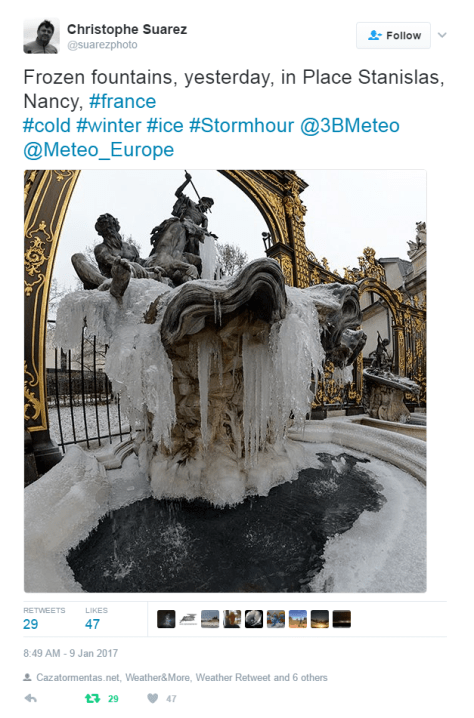
It was also a month of extremes in Europe and elsewhere. Here are a few examples I tweeted throughout January.


You must be logged in to post a comment.