Thunderstorms bring a Holyrood awakening

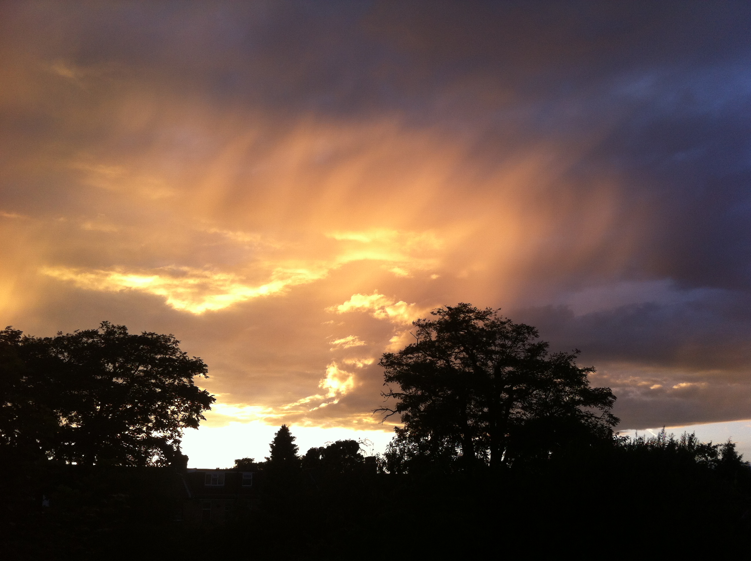
It was just before 3am that I was awoken by faint rumblings outside. I knew there was a risk of thunder before I’d retired to bed a few hours earlier but I’d discounted the risk along with any thoughts of staying up to watch the referendum results unfold in Scotland.

This radar shot shows the storm just beginning to hit Wanstead. The rain was far heavier to our east. 17.2mm was reported at Laindon, Essex. An observer at Woodford Wells recorded 19.9mm her in about 25 minutes 0310-0335 bst

Lightning then illuminated the room through the gaps in the curtains followed by more rumblings: it’ll pass, I thought. Crash – I grabbed my phone – was this an isolated event? The radar showed a line of slow moving storms moving up from the south. More lightning and loud thunder. My Twitter feed told me it wasn’t going too well for those wanting independence. At this point intensely bright lightning was rapidly followed by one of the loudest claps of thunder I’ve heard around 3.10am. Car alarms were set off – may as well get up I thought… The Inverclyde result was announced – ‘No’, by the narrowest of margins 50.1% to 49.9%. That’s it then, I thought. The lightning and thunder gradually began to fade away with hopes of an independent Scotland, on this night anyway. I glanced at my stats which seemed far less impressive than what was recorded elsewhere: 7.7mm, no big fall in temperature or pressure like previous storms during the summer.

Just a few hours later I walked my younger daughter into school, my bleary eyes struggling to focus – the humid and steamy atmosphere felt more like July than September. Indeed Thursday had been the warmest September 18th since 1997 which, strangely, was the same year that another momentous British event took place: the handover of Hong Kong to China. I remarked to a couple of parents that the only thing that had changed overnight was that Andy Murray will forever be the “Scottish” tennis player after his comment on Twitter.

The forecast advised that there was a continued threat of thunderstorms. It was humid but it didn’t ‘feel’ stormy – though around 2.30pm I could hear the beginning of faint rumblings in the distance.

Clouds above could be seen developing rapidly at 2.30pm

I left for work on my scooter at 3pm, carefully watching the sky for any developments all of which seemed to be in the distance. After stopping for petrol in Leytonstone High Road huge drops of rain began splattering the pavement. They were few and far between, however, and the sun defiantly continued to shine. After riding past Stratford I suddenly became aware that the buildings in the distance, past Bow flyover, were gradually beginning to disappear. I pulled in to a turning where Gala Bingo is situated. An electronic noticeboard enquired: “Do you feel lucky?” Not today I thought and retrieved my overtrousers that live under the seat, hastily pulling them on as I watched the impending storm begin to close in.

I continued on and was soon enveloped in the full force of another thunderstorm. Marble-sized hail clattered off my crash helmet while dangerous gusts, caused by wind funneling through the new high rise flats by the Olympic Park, did their best to push me off. Just as I crossed the canal a sheet of rain engulfed me and the drivers to my right. The road in front suddenly turned into a shallow river. I usually ride over the flyover – not today with the torrent of water cascading off the sides.

The 3.15pm storm that flooded large parts of East London. The white area shows where the heaviest rain was

By the time I reached Mile End the rain had almost stopped. The City looked fairly dry and on reaching London Bridge the roads were completely dry. The Friday crowds were out in force in Borough Market, enjoying the sunshine and seemingly oblivious to the chaos unfolding just a few miles away in East London. Within 10 minutes of walking into my office Alex Salmond announced his resignation. Another storm: another momentous event! It was another of those coincidental storms that, in my mind, seem to mark momentous events such as the Royal birth last July

I checked the stats of the storm back in Wanstead: 24.5mm  fell  with a peak rate of 76.5mm/hr at 15.47. The storm ended a run of 16 dry days bringing the total for the month up to 33mm – the 24hr total was 30.5mm. The explosive convection of this storm can be seen here. The associated hail and rain brought much flooding to Hackney, Hackney Wick and Leytonstone. This storm seemed to be the result of a convergence line over London between light southerlies to the south and easterlies to the north – the heavy rain was very localised.

Flooding images can be seen on the following links at Dalston, Wanstead Flats, Leytonstone Station, Wick Road. A short clip of flooding at Wick Road can be seen here.

The flooding wasn’t restricted to East London. In Southend water started pouring through the roof of the Dixons theatre though it failed to stop the performance. Shops in London Road were inundated.

http://www.echo-news.co.uk/news/11486080.Fire_crews_receive_100_calls_as_severe_flooding_hits_Southend/

See also:

http://www.echo-news.co.uk/news/local_news/11353521.FLOODING_CHAOS___Southend_Hospital_A_E_evacuated_as_south_Essex_is_battered_by_downpour/?ref=var_0

http://www.echo-news.co.uk/news/11486049.Updated__Flash_flooding_hits_homes_and_businesses/?ref=var_0


How the cloud man inspired Constable

It has been a superb year for cloud formations and cloudscapes. Spectacular towering cumulo-nimbus and deep-red sunsets have been more frequent than average in 2014. I can’t remember a week when I haven’t aimed the camera skywards to record the latest phenomena.

Distant rain cloud looking east on Wanstead Flats

The skies at the end of the 18th century were even more spectacular, thanks to a period of heightened volcanic activity, and captured the imagination of a boy whose work in later life would inspire one of Britain’s great landscape painters: John Constable.

Before the 19th century meteorologists thought of clouds as unique and transient and therefore unclassifiable. This changed when Luke Howard, who once lived in Plaistow, presented his Essay on the Modification of Clouds to the Askesian Society in the winter 1802/03.

The impact of the lecture was immense, and catapulted the subject of cloud formation as a serious scientific study. The cloud types: cumulus, Latin for ‘heap’; stratus, Latin for ‘layer’, and cirrus, Latin for ‘curl of hair’ are words still used today.

Although by trade Howard was a chemist, his pharmaceutical chemical factory located nearby on the banks of the River Lea, his passion was meteorology. His pioneering observations recorded in three volumes of The Climate of London provide a fascinating insight into this area’s weather all those years ago.

Following his presentation on Clouds Howard’s standing among the science community became more and more elevated. He presented seven Lectures in Meteorology in 1817. Within a year Constable, who was four years younger than Howard, made a decision to start painting six-foot landscapes which marked a significant turning point in his career. The son of a landowner Constable had a keen understanding of the weather from his time spent as an apprentice windmiller in his native Suffolk.

Historians of art and science have argued that Constable probably attended Howard’s fashionable lectures which were complemented by a number of watercolour illustrations for his classification method.

Although it could be argued that artists such as Gainsborough painted clouds decades previously it was Constable, his search for truth in painting nature leading him to Howard’s work on clouds, who took the art to another level.

Sunset on Wanstead Flats

The artist adapted Howard’s scientific observations of these transient phenomena with an artist’s eye. A popular method of the period was the use of the rapid oil sketch out in the field. Constable then used these sketches to help him bring to life the drama and emotional content of a scene for his larger set-piece paintings.

Constable completed and submitted to the Royal Academy The Hay Wain, arguably his best-known masterpiece, in 1821 – the same year that Howard was elected a Fellow of the Royal Society.

Many more paintings and sketches followed of landscapes around Suffolk, Hampstead Heath and Salisbury and the achievements of both men in their chosen fields continued. Howard in business and his beloved meteorology, publishing a third volume of The Climate of London in 1833 – among the first studies that recognised the urban heat island effect. His Seven Lectures were published in 1837, becoming the first textbook of meteorology. Constable died the same year but did not receive the recognition he deserved until after his death.

Constable is the focus of a new exhibition at the V&A museum that begins on Saturday, September 20.

The site where Luke Howard's Chesterton House stood in Balaam Street, Plaistow is now the West Ham ambulance depot. The property that boasted a rooftop observatory where he made many observations, has long gone though the boundary still remains.
The site where Luke Howard’s Chesterton House stood in Balaam Street, Plaistow, is now the West Ham ambulance depot. The property, which boasted a rooftop observatory where he made many observations, has long gone though the boundary still remains. It is not known if Howard and Constable ever met though the painter often visited and wrote to his sister, Martha Whalley, in East Ham, which is 2 miles west of Howard’s Plaistow residence
A selection of sketches Luke Howard used to illustrate his Clouds lecture

.


August 2014 – cool, wet and dull

Anyone hoping for a continuation of June and July’s hot weather would have been left sorely disappointed by last month which was characterised by frequent rain and the coldest August night for over 20 years.

A stunning example of sunlight illuminating the underside of cloud at sunset was seen mid-month

August 2014 was the first month this year to be cooler than average; the mean temperature of 17.2C was 1C below average, making it the 89th warmest August since 1797: 1.6C cooler than last August, the coolest for 7 years.

The month was marked with thunderstorms and heavy downpours, contributing to what was a much wetter than average month – some 76mm fell which is 152% of the monthly average and the wettest for 4 years.

The hottest day occurred on the 7th with 27.3C recorded – nothing special for August and a date that heralded the end of the hot spell during June and July.

A couple of nights were notably cool for August: 5C was recorded during the early hours of the 23rd – the coldest August night since 1993.

Sunshine was below average with 161 hours recorded – that’s 83 per cent of mean. The sunniest day was on the 3rd when 12 hours of sunshine were recorded. Throughout the month there were just 2 days with 10 hours or more of sunshine. There were 4 days with thunder recorded – the average for August is 3.

To view full stats follow this link:http://1drv.ms/1kiTuzv

Looking further afield there were many thunderstorms around the UK though many places missed out on the big downpours. It was yet another month where rainfall totals could vary greatly in the space of just a few miles.

On the 9th a station in Woodford Green recorded 24.4mm, double what fell in Wanstead. The legacy of TS Bertha coincided with the end of our extended hot spell – an excellent analysis of this storm can be found here.

There were some spectacular cloud formations not far from here. A particularly good one was seen in Witham. 

Squally storm line approaching Witham, panoramic shot!

Prolonged heavy rain on the 11th caused extensive flooding in Scotland.

On the 14th ‘Biblical’ flooding affected Lewisham in south east London.

On 25th a perfect curl could be seen on a depression centred off the west coast of Irleland. The rain associated with this low pressure brought the month's highest daily rainfall total: 23.4mm (the system bringing 27.5mm) - a thoroughly miserable Bank Holiday Monday where it rained ALL day, from 6am until 9.30pm. It was yet another example of how much even frontal rainfall can vary over a small area.
On 25th a perfect curl could be seen on a depression centred off the west coast of Irleland. The rain associated with this low pressure brought the month’s highest daily rainfall total: 23.4mm (the system bringing 27.5mm) – a thoroughly miserable Bank Holiday Monday where it rained ALL day, from 6am until 9.30pm. It was yet another example of how much even frontal rainfall can vary over a small area.

On 25th a perfect curl could be seen on a depression centred off the west coast of Irleland. The rain associated with this low pressure brought the month’s highest daily rainfall total: 23.4mm (the system bringing 27.5mm) – a thoroughly miserable Bank Holiday Monday where it rained ALL day, from 6am until 9.30pm. It was yet another example of how much even frontal rainfall can vary over a small area with St James Park recording 38.2mm. The top 30 totals for that day can be seen here.

sunset overlooking Wanstead Flats 2nd August

Looking even further afield four people were killed in a flash flood at an Italian festival early on in the month.