June 2014 continued this year’s theme of being milder than normal; the mean temperature of 17.1C was 1C above average, making it the 22nd warmest June since 1797.
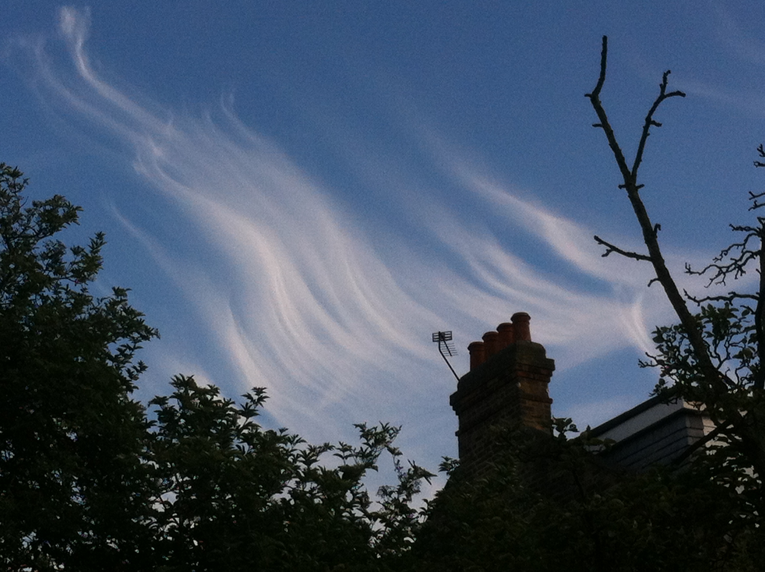
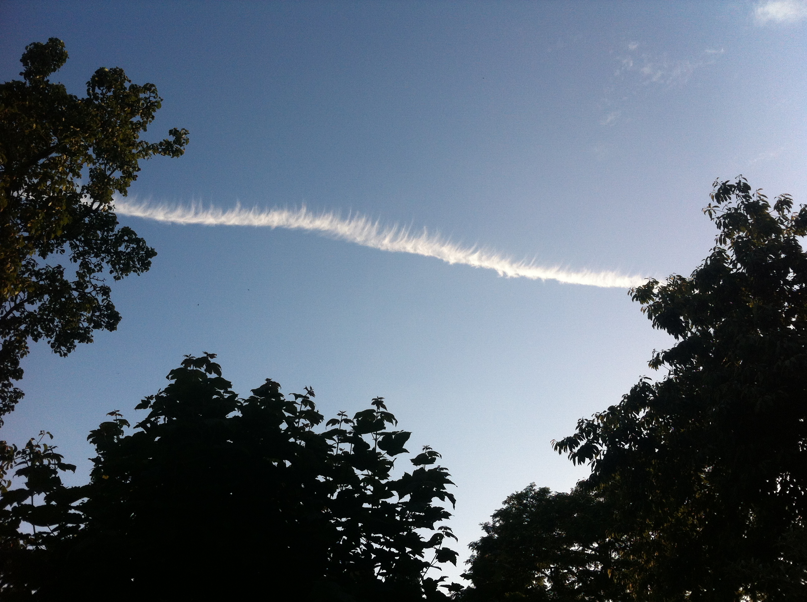
June was marked by some spectacular cloudscapes and sunsets. This was the view across Wanstead Flats from Centre Road looking toward Ilford on the 21st
June, like March and April, was dryer than average with just 15.2mm of rain, that’s just under 30 per cent of average.
The driest June since 2000 started off unsettled with frequent rain – 6mm falling on the 3rd. The following day was cool with the temperature reaching just 16.2C.
Though there were nine days when over 10 hours of sunshine was recorded the magic 80F was surpassed just once: on the 9th when 27.5C was reached under 6 hours of sunshine. This sunniest day was the 10th when 14 hours of sunshine nudged the thermometer to 24.5C. Overall there were 214.1 hours of sunshine – that’s 120% of average, the sunniest since 2011.
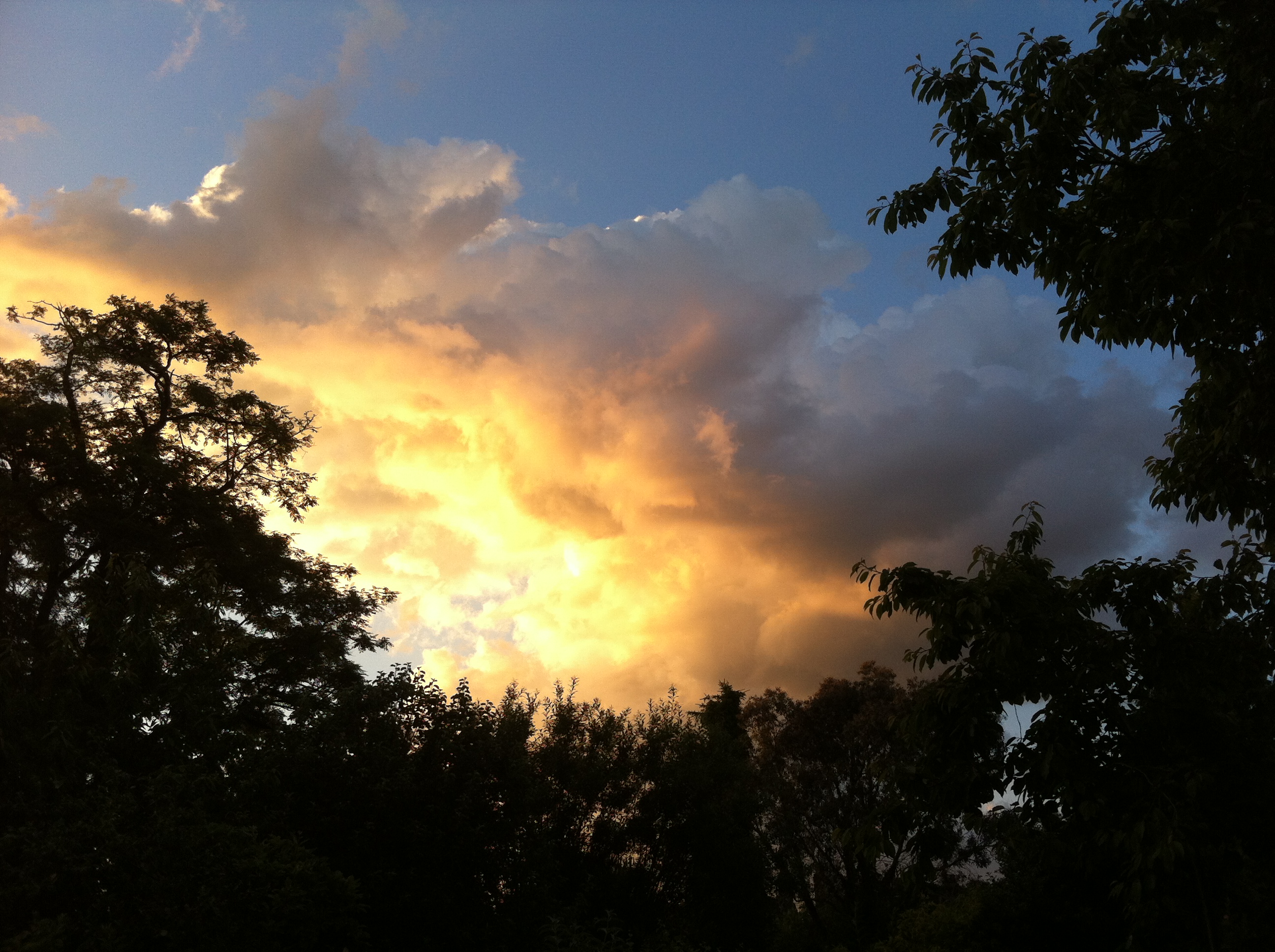
On many days during June, including the 30th shown here, the sky turned dark but just spits and spots of rain were often produced
Despite plenty of potential no incidents of thunder were recorded – the much-hyped weekend of the 7th / 8th saw less than 2mm of rain – all of the action staying well to our east in the France, Germany and the Low Countries. Further thundery potential on the 13th failed to produce anything in this area though a disturbance over Berkshire saw thunderstorms develop in the Oxford, Reading, Basingstoke and Wokingham region, with up to 38mm of rain falling over a wide area.
It is a typical feature of summer that rainfall can vary a great deal across a small area. The nearest official station to Wanstead, St James’s Park 8.4 miles to our south-west, recorded 33.8mm – more than double what fell here.
Some nights were chilly when the sky cleared but there was no air frost or ground frost.
Yet another occasion of impressive cloud formation during June included this example of late evening cirrus. The formation, seen at ground level, seemed similar to a display of the AuroraCircumhorizontal arc over Aldersbrook
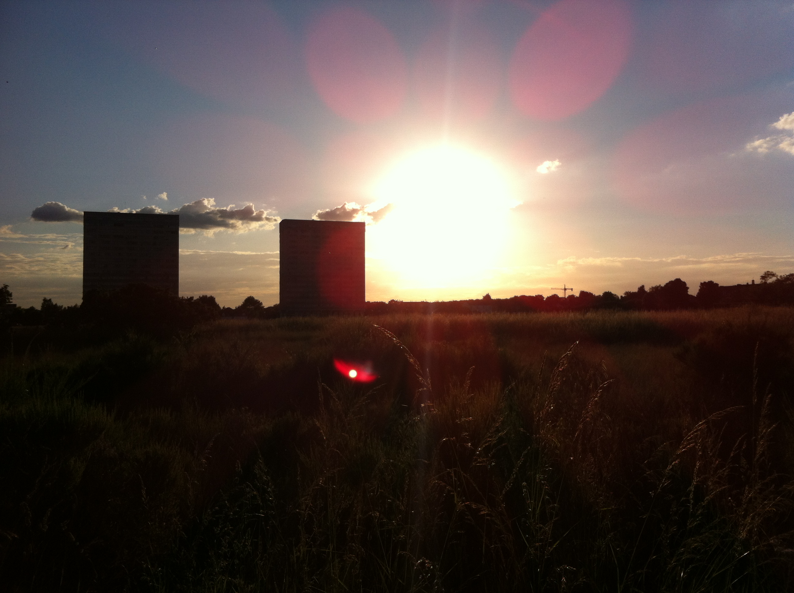
Considering we had no thunder to speak of and the threatened thunderstorms failed to materialise in this region we still saw some amazing skies at the weekend. Testament to the fact that the weather is never boring…
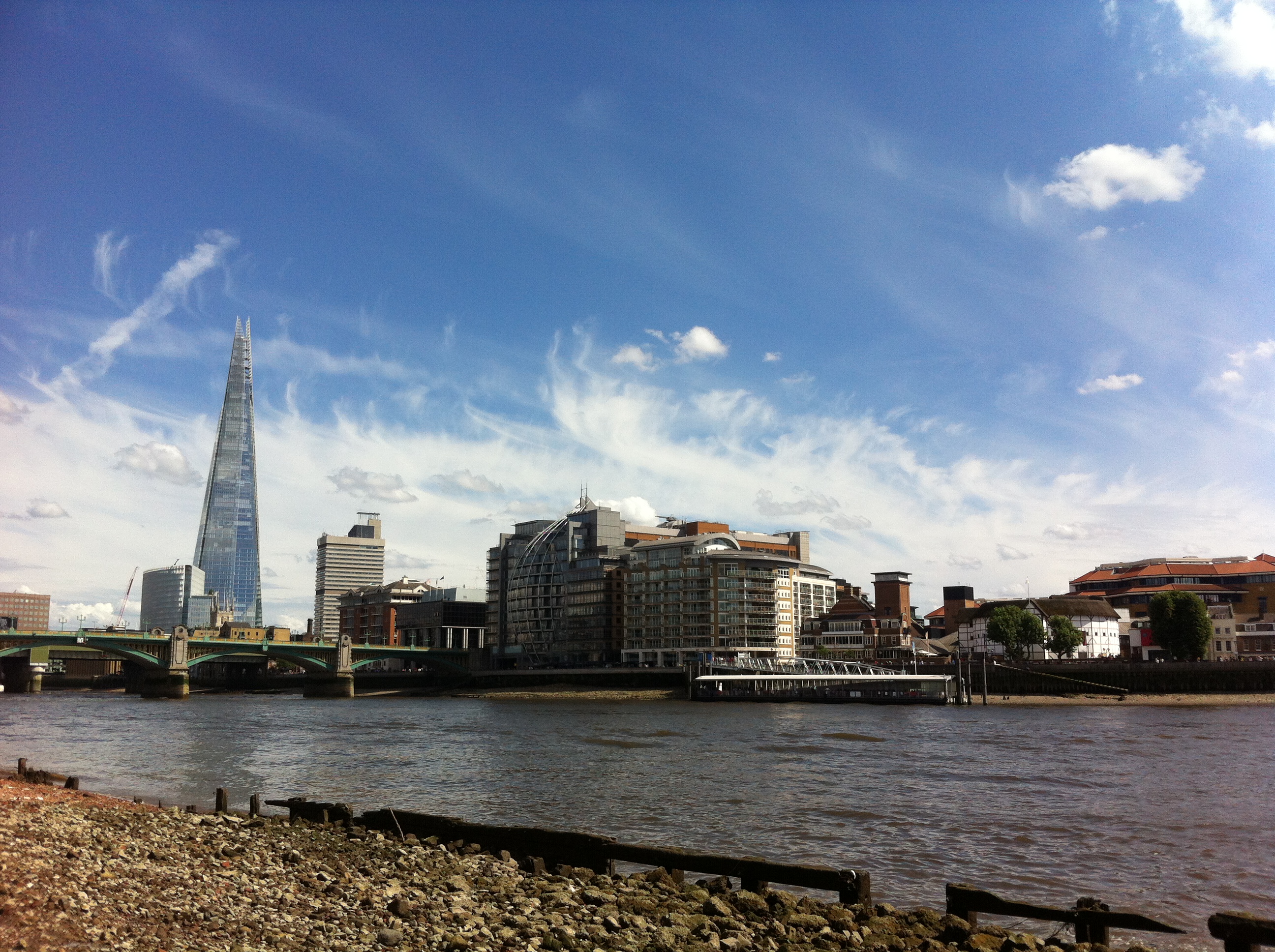
I took this yesterday evening. Windless, still and humid at ground level it was fascinating to look skyward and see the multi-level cloud continue to build into strange shapes, illuminated from below by the setting sun. A wonderful weekend for cloudspotting.Wanstead Flats looking westLittle Fluffy Clouds over Wanstead Flats. The contrast of the deep blue, white clouds and green grass never fails to disappoint as we approach the SolsticeA walk along the foreshore on the north bank of the Thames revealed this vista. The Shard looks very other worldly and looks like I’ve Photoshopped it in. Love it or hate it, the thing is there for good now…
Over the years significant weather events have, at least in my subconscience, at times signalled that something ‘big’ is about to happen – just one example being the Great Storm in October 1987 that was followed days later by the Black Monday stock market crash.
So an event that happened 100 years ago this month, to some, probably also brought a feeling of impending doom as the political situation in Europe became ever more fraught.
Account of the thunderstorm reported in The Times
A series of severe thunderstorms that broke out just after midday over south-west London on June 14, 1914, left people dead and a trail of destruction across areas south of the Thames. Fierce lightning, torrential rain, severe flooding and hail ‘the size of walnuts’ accompanied the storms. Six people were killed by lightning on Wandsworth Common and four others were injured. As with many thunderstorms the heaviest rain, 94mm in 3 hours at Richmond Park, was focused over a small area. South Kensington, just over 5 miles away, recorded just 6mm! I don’t have the figures for Wanstead but judging by the map published in the 1914 edition of British Rainfall it probable recorded even less than South Kensington.
Some reports by observers.
Dulwich: Violent hailstorms. Many hailstones were like acid tablets about one inch long, half an inch broad and over a quarter of an inch thick. A minute or two after these had fallen, a mist rose to a height of about 4ft above the ground.
Lewisham: A storm began at 12.24pm and came right overhead from the east with terrific flashes of lightning and loud thunder. At 12.31pm, rain fell with extraordinary fury; within 9 minutes 0.5 inches had fallen. The second storm came up just after 1pm, the lightning being even more severe. At 1.30pm, St Mark’s Church, and the Holy Cross were struck. A tree in Hither Green cemetery over 30ft high was splintered and two houses were struck at Catford. Another thunderstorm came up at 2.25pm with torrents of rain and hail as large as haricot beans fell for 5 minutes.
Rainfall in the London area – June 14, 1914 – shown in the publication British Rainfall
Richmond Park: Very severe storm passed over the house; an oak fence was struck by lightning in two places. Rainfall measurements were as follows: 1.80 inches in 45 minutes, 2.70 inches in 90 minutes, 3.2 inches in 2 hours, 3.60 inches in 2.5 hours, 3.70 inches in 2.75 hours.
Wimbledon Downs: There was a curious scene close to Kingston station, where the water was about 4ft feet deep at five o’clock and motor cars and omnibuses had to make a wide detour. The storm was especially severe in Wimbledon district, where, owing to the bursting of an overtaxed sewer, the District Railway line was submerged. At Tooting Junction station was a foot deep on the platform.
Judging by the 1881-1910 average 1914 was a warm year: the mean temperature of 10.7C was a full degree warmer than average. It was also 15 per cent wetter than average and the sun hours were nearly 108% of average. Of course by today’s standards (the 1981-2010 average) 1914 looks relatively cool as the average annual temperature has risen 1C in the past hundred years.
The weather on this day must have been synonimous with the deteriorating political situation in Europe: two weeks later Franz Ferdinand, Archduke of Austria, and his wife Sophie were assassinated in Sarajevo by a young Serbian nationalist Gavrilo Princip , the casus belli of the First World War.
What is fascinating is that a similar thunderstorm that left seven dead in Valentines Park, Ilford, 75 years ago this August, also happened about two weeks before Prime Minister Neville Chamberlain announced on September 3, 1939, that Britain was at war with Germany.
Ask a dozen people what they think is a heatwave in this country and you’ll probably get 12 different answers.
The view across to St Paul’s from Bankside at low tide.
The UK press is always keen to tell us that a ‘heatwave is on the way’ – even if it is March and the heatwave in question brings temperatures no greater than the high teens Celsius.
Although in the UK there is no official definition of a heatwave the World Meteorological Organization description is “when the daily maximum temperature on more than five consecutive days exceeds the average maximum temperature by 5 °C, the normal period being 1961-1990”. In other words that March heatwave would see the thermometer peak higher than 15.3C five days in a row. Pleasant enough – but no big deal.
The Met Office, working with the Department of Health, provides a ‘Heat-Health Watch System’ for England which is triggered when a threshold temperature in the South East is 31 °C by day and 16 °C overnight for at least two consecutive days.
I have vague memories of the weeks of sunshine in 1976 but the hot spells that stick in my mind the most are August 1990, when the UK temperature record was set in Cheltenham, Gloucestershire, and August 2003 when an 8-day hot spell saw the all-time UK temperature record broken when 38.5C was reached at Brogdale, near Faversham, Kent.
Last July, when compared with the previous summers, saw some of the best summer weather since 2006. But where does last year compare with the good summers of 2003, 1995, 1990 and 1976? I decided to have a look back at the daily records for this area which stretch back to 1959.
I have drawn up a list of all days back to 1959 that have an average mean daily temperature of 23.5C or higher. This shows that there has been 93 such days. However, to qualify for the Met Office’s Heat-Health Watch System – ie two days like this in a row the list narrows. To make my job easier, I have narrowed the list further to 3 consecutive days where the mean has been 23.5C or higher. Though I loathe really hot weather in my experience I can put up with it for a couple of days. It is only when it gets to the third day of hot, sleepless nights that it starts becoming unbearable.
In terms of intensity and hours of sunshine, 2003 comes out on top. Though many people will argue that 1976 is more impressive -that summer, which comes in second, only produced two spells that satisfy my criteria. The first heatwave saw temperatures soar above 31C for six consecutive days from June 23. The start of the second, on July 3, saw Bjorn Borg win the first of five Wimbledon mens’ titles as he prevailed over Ilie Nastase in 35C heat.
The summer of 1995, which saw my driest-ever August with just 0.7mm of rainfall all month, comes in 3rd, with six days of mean temperatures of 23.5C or higher.
Polo advert for the heatwave that coincided with the Queen Mother’s birthday in 1990
Looking at the data another way, ranking the average total daily mean temperature of each spell, sees 2003 again come out 1st, with August 1990 and July 1983, 2nd and 3rd. Looking back through history it is not really surprising that 2003 comes out on top. While it was hot in London the heatwave across the Channel contributed to the death of over 70,000 people throughout Europe, France being the most affected.
This weekend promises to be very warm and sunny but it will pale into insignificance compared with the hot spells of the past. The mean temperature on Saturday and Sunday is unlikely to exceed 17C.
April 2014 continued this year’s theme of being milder than normal; the mean temperature of 12C was 2.2C above average, making it the third warmest April since 1797.
Though many days were stunningly sunny the breeze made it feel chilly
April continued the dry theme of March and was indeed dryer on average. Just 19.6mm on rain fell over the 30 days – that’s 46 per cent of average.
The month saw some stunningly sunny days during the second week into the third week, though these were tempered by chilly east to north-easterly winds. The warmest day was the 21st when 21.5C was reached – the first ^70F temperature of the year.
Though it ‘felt’ quite a sunny month the 150 hours recorded was only 94 per cent of average.
Some nights were chilly when the sky cleared but there was no air frost and only two ground frosts, on the 15th and 16th
…then we’ll only see a splash. If the ash before the oak then we’re sure to get a soak.
If this old weather saying carries any weight then this summer should be a corker…
This young ash on the corner of Montalt Road and Chingford Lane, Woodford Green, is much later into leaf than the adjacent oak
Only I wonder how many of the ash trees I noticed on my ride back from Enfield this afternoon are struggling to survive let alone burst into leaf. The initial onset of chalara fraxinea (ash dieback) over the past couple of years now seems to be taking its toll in a much bigger way on ash specimens around the countryside.
The tell tale dead branches are becoming a lot more common.
Some have blamed the spread of Chalara on cheap imports of ash trees from Holland – the first cases were confirmed in a nursery in Bucks early in 2012. Efforts were made to find and contain affected specimens but, throughout East Anglia and the South East, the disease seems out of control. It could be only a matter of time before the disease scars the landscape with dead trees in the same way that Dutch Elm Disease did in the 1970s.
From one poor management of trees to another – namely the ultra harsh pollarding of the London planes in Wanstead High Street. Whilst this style of management is nothing new and seems to be de rigeur among most London councils it does nothing for the scene of many roads and streets through the capital. What was once a rich canopy of green providing shady relief from the sun during high summer is just a few stumps. It takes a good few years for the canopies to regenerate – by which time it’s time for another visit from the tree surgeons…
Plane ugly: the harshly pollarded planes in Wanstead High Street
To blame, partly, is the spread of another tree pest – Massaria. This unseen pest ‘eats’ away the tops of branches – compromising the strength of the wood eventually to the point where, if unchecked, the whole limb comes crashing to the ground. London plane is very heavy wood – with branches weighing dozens of kilos there’s obviously safety issues with limbs dropping on peoples’ heads.
Though councils would argue otherwise I think the harsh pollarding is a cost saving measure – without this they would have the added cost of constant monitoring.
The fast-growing, non-native London plane was planted on the understanding that growth would be carefully managed and limited in height. But looking at some of the monster specimens around the capital that seems to have gone by the wayside a long time ago.
The City of London Corporation is well aware of the problem and is closely monitoring the capital’s stock.
If you have magnificent London plane near you make the most of it – the buzz of the tree surgeons’ chainsaws are getting closer.
The last time Liverpool won the league in 1990 (by league I mean top tier of English football) the South East enjoyed a mostly dry, warm and sunny summer. A particularly hot spell in August of that year saw the UK high temperature record broken when the mercury reached 37.1C at Cheltenham on August 3rd, a record that stood until 2003.
Since the middle of December last year the weather has been remarkably similar to that football season when the Reds won their 18th league title. Both winters were remarkably mild and stormy with January 1990 seeing the Burns’ Day storm.
The mean temperature this year over the same period, December 13th to April 26th, is just 0.2C cooler than 1989-90, while rainfall is 2.1% greater and sunshine is 2.5% less. A remarkable singularity.
Will history repeat itself come the end of the season and the end of the summer? Up until early Sunday afternoon the stage seemed set. But a slip by Liverpool skipper Steven Gerrard at the end of the first half gifted Demba Ba with a chance that opened the way for Chelsea to complete the double over their title rivals.
The Liverpool squad of the 1989-1990 season won the club’s 18th league title
It must have been agonising for the Kop to watch, 24 years on from the exact same weekend the Reds lifted the title with two games left. The weather that followed that memorable day was dry, sunny and warm with temperatures reaching the mid 20s on many days.
Fast forward two dozen years and the weather looks decidedly unsettled, with frequent showers or longer spells of rain interspersed with sunshine. Though there’s doubtless many twists and turns left I wonder if Reds fans believe their title hopes are going the same way as the change in the weather?
Football’s a funny old game – just like the weather.
March 2014 will be most remembered for glorious sunny days that brought welcome relief after a run of seemingly endless wet months.
Many trees blossomed early this year, thanks to the mild winter
It also continued the mild theme of the winter; the mean temperature of 9.1C was 1.4C above average, making it the 11th warmest March since 1797. Looking at my other series back to 1881 the March mean maximum was second only to March 1938!
Just 25.8mm of rain fell over the 31 days – that’s 63 per cent of average.
The month started on the chilly side but with plenty of sun around it felt pleasant. Though many days were warm clear skies led to frost and fog forming. Hail was observed on three days.
The most notable weather occured on the 26th when the temperature fell from 10C at 1.30pm to 4C by 3pm. Heavy showers accompanied what was an utterly foul day. The cold pool persisted into the 27th with towering thunder clouds surrounding Wanstead, north, east and south – with reports of hail in Berkshire and snow in Folkestone.
The month ended with warm, sunny weather – the southerly flow bringing Saharan dust that deposited on cars. There were 4 air frosts and 14 ground frosts.
A southerly airstream brought dust that originated from the Sahara Desert
‘Worst-ever!’, ‘in living memory’, ‘highest on record!’, ‘unprecedented!’. These phrases, used often by newsreaders on the main networks including Sky and BBC, always set an alarm bell ringing in my head. None more so than weather stories which, with the stormy winter we’ve just had, has been happening almost daily since the middle of December.
As the winter has progressed the networks have tried to out do one another with the severity-value of a story. What starts with a reporter gingerly standing by the side of a flooded field within days changes to the reporter, donning a pair of fisherman’s waders, trawling waist-deep through a flooded Berkshire housing estate.
The media also seem to delight in rushing out Met Office data to proclaim these armageddon scenarios before the season is over and the statistics can be properly studied, absorbed and commented upon.
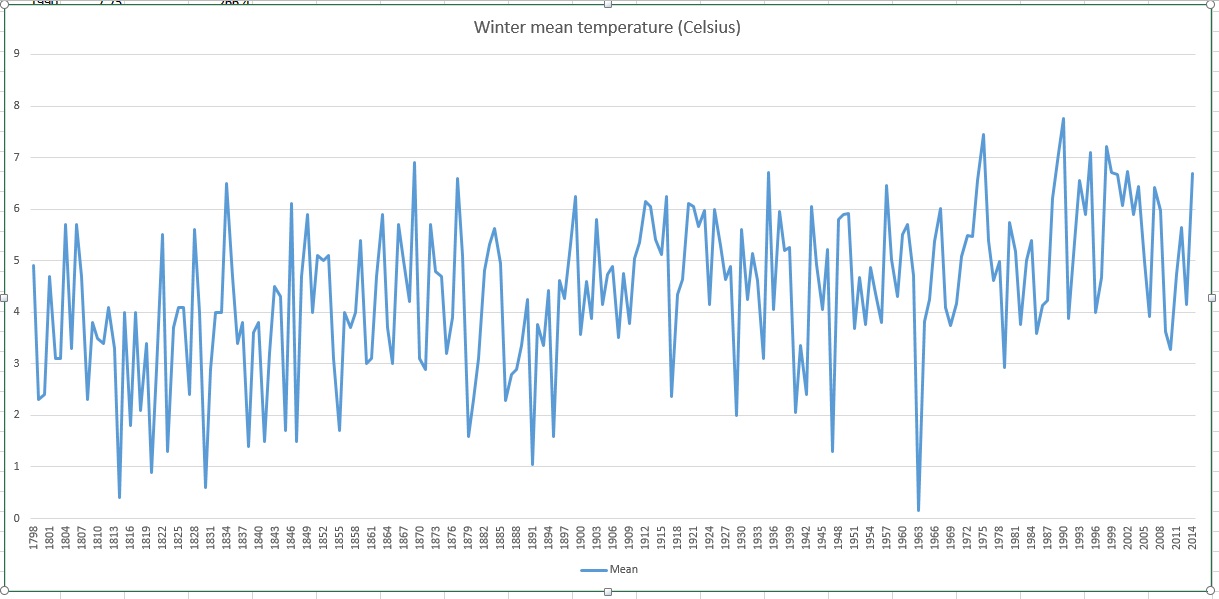
Last summer, I started to build a dataset for my own area – Wanstead. Using local figures from the City of London Cemetery I was able to take the daily series back to 1959. Beyond this I then sourced monthly data for Greenwich, 6 miles away, back to 1881. Using W.A.L Marshall’s A Century of London Weather and Luke Howard’s The Climate of London enabled me to take the series right back to 1797.
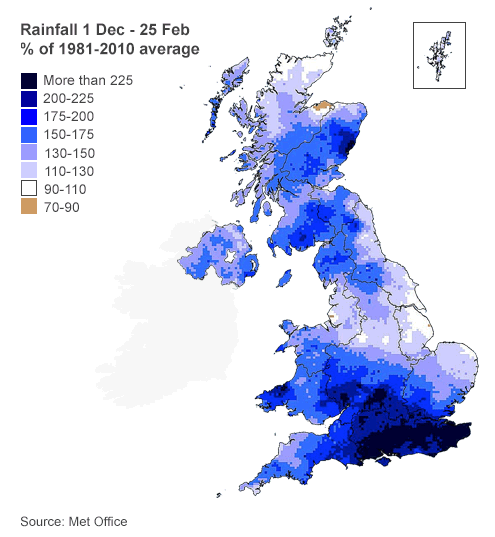
The series makes for interesting reading, putting this winter as 6th wettest since 1797. Scientists would say that because my series is only one dataset it cannot be regarded as a ‘catch-all’ for the country overall. But when statements like “England and Wales has had its heaviest rainfall since 1766” are put out by the media it is blatantly not true for the entire country. Just a quick look at the map shows that while parts of south and southeast England have been very wet – other parts of the country have been much less so.
But in this age of 24-hour rolling news the message to anyone who takes the headlines at face value is that this has been the wettest winter ever. You can view the winter mean temperature and rainfall stats here.
The mean temperature of 10.7C makes 2013 0.5C colder than the 1981-2010 average. And makes the year 46th warmest in the series going back to 1881.
Rainfall of 554.9mm is 92% of average for a year in this area, making it the 68th wettest in the series back to 1888. Some areas of the British Isles have been considerable wetter – this just reflects how variable rainfall can be.
Though the year appears fairly average it masks some notable events…
A couple of notable falls of snow were observed in January and February
January saw a couple of notable falls of snow, the first of which arrived on the 18th. By the morning of the 21st there was 13cm lying.
February saw a further snowy spell with 5cm falling on the 10th – but this only lasted a couple of days.
The mean temperature for March of 3.6C made it the coldest since 1892, the 3rd coldest in the series since 1881.
After a cool and dry spring and early summer July surprisingly turned out to be the warmest since 2006 – the mean temperature of 20.7C being the third warmest in the series going back to 1881. The warmest day of the year occurred on 22nd when 34C was recorded. This was followed by a very potent thunderstorm in the early hours of 23rd.
Autumn overlooking The Temple in Wanstead Park
An average August and September saw a couple of notable rainfall events with 32.8mm on 24/8 and 32.6mm on 13/9 being the the 27th and 28th highest 24hr totals in a series going back to 1961. In the August event Maldon in Essex saw in excess of 100mm leading to flooding. What made it more noticeable is that these events occurred during dry spells.
The end of October saw the St Jude storm blast through Wanstead. The strength of the gusts saw the demise of a few mature limes on Christchurch Green as well as trees in Wanstead Park.


You must be logged in to post a comment.