Category Archives: monthly summary

Spring in Wanstead Park

Spring in this neck of the woods was really mixed.

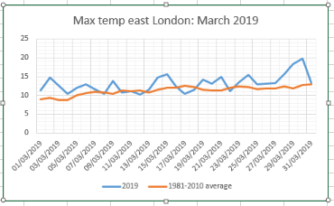
A chilly start to March became fairly benign before ending with the warmest March day locally since at least 1959.

April then turned much colder and drier; just 2.4mm of rain fell during the month – the driest April since 2007 and fourth driest in a local rainfall series back to 1797! Sunshine was abundant with over 200 hours. But clear skies at that time of year, with a polar continental airmass, often means air frost. And the ten recorded overnight was far higher than normal.

May saw things warm up slightly but the month still finished a degree colder than average. Some 80mm of rain fell which is over one and a half times what we’d normally expect. The wettest May since 2007 – the month playing catch up on the total absence of April showers that bring the spring flowers! It was a dull month with only 126 hours of sunshine, 69 per cent of average – the dullest since 1990 was third dullest back to 1881.


In terms of flora and fauna the colder weather played havoc with the trees, bud burst coming much later than recent years. As I write this on June 6th some of the later budders like false acacia have only just come into full leaf. The birds, as they normally do, just seem to get on with it raising their young. I’m not sure what the food supply has been like but judging by the amount of healthy juvenile fledglings I’ve seen I would guess that it has been a good season so far?


Here’s the stats.
March 8C (+0.3) 30.9mm (76%) 90.9 hours (84%)24.1C on 30th (a record that had stood since 1965)
April 7.2C (-2.6) 2.4mm (5.5%) 202.6 hours (127%)
10 air frosts in April, much higher than normal
May 12.1 (-1) 80mm (156%) 125.6hours (69%)
Spring 2021: Mean Thermometer: 9.1C (1.1C below average, coldest since 2013, 111th coldest) Rain Cloud with rain: 113mm (84% of average, wettest since 2018, 150th wettest ) Sun Sun with rays: 425.4 hrs (94% of average, dullest for three years. 51st dullest) The average masked extremes.

Advertisement

November 2019: coldest for nine years

The November monthly mean finished 6.4C, that’s 1.6C below average, the coldest November since 2010. It was the third month of 2019 where the monthly mean temperature finished below average.

The wet theme of October carried on into November; the 68.5mm collected was 116 per cent of the 1981-2010 average, slightly drier than last years.

Some 59.7hrs of sunshine were recorded, 102 per cent of average, the dullest for four years.

There were six air frosts.

You can find my thoughts on how winter is going to pan out here.

To view full stats follow this link:http://1drv.ms/1kiTuzv

nov t.PNG

Summary for November 2019 – to follow

October 2019: wettest since 2004

The wet theme of the final week of September carried on into October; the 100.3mm collected was 150 per cent of the 1981-2010 average, the wettest 10th month for 15 years.

The monthly mean finished 11C, that’s 0.8C below average, the coldest October since 2012. It is only the second month of 2019 where the monthly mean temperature finishes below average.

Only 72hrs of sunshine were recorded, 68 per cent of average, the dullest October since 2002.

The area’s first frost arrived 10 days before the median date back to 1959. And 3 days earlier than last year. A shower with >5mm hail was observed on the 9th.

To view full stats follow this link:http://1drv.ms/1kiTuzv

oct max

Summary for October 2019

Temperature (°C):
Mean (1 minute)  11.5
Mean (min+max)   11.3
Mean Minimum     7.6
Mean Maximum     15.0
Minimum          -0.8 day 27
Maximum          20.4 day 14
Highest Minimum  11.9 day 05
Lowest Maximum   10.3 day 28
Air frosts       1
Rainfall (mm):
Total for month  100.3
Wettest day      16.6 day 05
High rain rate   20.1 day 01
Rain days        20
Dry days         11
Wind (mph):
Highest Gust     21.3 day 25
Average Speed    2.0
Wind Run         1492.7 miles
Gale days        0
Pressure (mb):
Maximum          1026.6 day 29
Minimum          996.6 day 01
Days with snow falling         0
Days with snow lying at 0900   0
Total hours of sunshine        72

September 2019: wettest since 2006

Most of the rain of September 2019 fell in the last week making what was a fairly unremarkable month weatherwise the wettest September for 13 years.

Some 63.9mm of rain fell which is 123 per cent of average.

The monthly mean finished 15.8C, that’s 0.4C above average, the warmest September for 3 years, 0.6C warmer than last year.

Sunshine, at 150.5hrs, 107 per cent of average but over 30 hours fewer than last year.

To view full stats follow this link:http://1drv.ms/1kiTuzv

sept

Summary for September 2019

Temperature (°C):
Mean (1 minute)  15.5
Mean (min+max)   15.8
Mean Minimum     11.1
Mean Maximum     20.5
Minimum          5.2 day 17
Maximum          26.0 day 15
Highest Minimum  15.7 day 23
Lowest Maximum   16.1 day 09
Air frosts       0
Rainfall (mm):
Total for month  63.9
Wettest day      14.9 day 24
High rain rate   28.2 day 27
Rain days        14
Dry days         16
Wind (mph):
Highest Gust     23.5 day 27
Average Speed    2.5
Wind Run         1809.2 miles
Gale days        0
Pressure (mb):
Maximum          1036.8 day 13
Minimum          992.3 day 29
Days with snow falling         0
Days with snow lying at 0900   0
Total hours of sunshine        0.0

June 2019: record heat spike

June 2019 saw no high temperature records broken but a jump in anomaly, produced on the 29th by the 3rd hottest June day back to 1959, is higher than any I can find back to that year..

The only phenomena similar that I can find, albeit in the other direction, is the Beast from the East in March 2018 that sent temperatures plummeting.

The month finished a little above average though the final figure, like May and April, masked cool warm spells.

The mean temperature finished 16.9C that’s 0.8C above average, the coolest for 3 years.

Rainfall was 63mm, 123% of average, the wettest for 2 years. Sunshine was 158 hours, 88.7% of average, and dullest for 3 years.

A timelapse of the longest day can be found here.

To view full stats follow this link:http://1drv.ms/1kiTuzv

june 2019
‘Feels like’ maxima.
12.1
June 1981-2019 maximum anomalies
june anoms


The 12 month rolling rainfall total, thanks to a wetter than average month, has moved above 500mm again.

Summary for June 2019

Temperature (°C):
Mean (1 minute)  16.8
Mean (min+max)   16.9
Mean Minimum     12.1
Mean Maximum     21.7
Minimum          7.1 day 08
Maximum          33.6 day 29
Highest Minimum  18.0 day 24
Lowest Maximum   14.4 day 10
Air frosts       0
Rainfall (mm):
Total for month  63.3
Wettest day      18.7 day 10
High rain rate   20.1 day 09
Rain days        13
Dry days         17
Wind (mph):
Highest Gust     24.4 day 08
Average Speed    2.7
Wind Run         1932.6 miles
Gale days        0
Pressure (mb):
Maximum          1031.5 day 27
Minimum          998.4 day 07
Days with snow falling         0
Days with snow lying at 0900   0
Total hours of sunshine        0.0


May 2019: average but dry

May finished average though the final figure, like April, masked cool warm spells.

The mean temperature finished 13.2C that’s 0.1C above average and nearly 2C cooler than last May.

Only 28.3mm of precipitation were recorded, 55.3 per cent of the 1981-2010 average.

Some 175.8 hours of sunshine were recorded, that’s 96.8 per cent of average..

To view full stats follow this link:http://1drv.ms/1kiTuzv

may tmax.PNG
‘Feels like’ maxima.
may 2019 feels like.PNG
May 1981-2019 maximum anomalies
may since.PNG


The 12 month rolling rainfall total has fallen below 470mm for the first time since July 2017.

12 month.PNG

Summary for May 2019

Temperature (°C):
Mean (1 minute)  13.3
Mean (min+max)   13.2
Mean Minimum     8.1
Mean Maximum     18.4
Minimum          2.5 day 11
Maximum          25.3 day 23
Highest Minimum  16.0 day 25
Lowest Maximum   10.9 day 04
Air frosts       0
Rainfall (mm):
Total for month  28.3
Wettest day      7.3 day 07
High rain rate   52.3 day 26
Rain days        11
Dry days         20
Wind (mph):
Highest Gust     20.6 day 04
Average Speed    1.9
Wind Run         1637 miles
Gale days        0
Pressure (mb):
Maximum          1041.8 day 13
Minimum          991.6 day 08
Days with snow falling         0
Days with snow lying at 0900   0
Total hours of sunshine        0.0

March 2019: mild and wet

March was mild, particularly compared with last year. And wet though, like February, the rain fell at the start of the month, leaving a dry end.

The mean temperature finished 9.4C that’s 1.7C above average and over 3C warmer than last March.

Some 54.5mm of precipitation was recorded,  134 per cent of the 1981-2010 average.

Some  109 hours of sunshine were recorded, that’s  precisely average.

Just one air frost was recorded.

To view full stats follow this link:http://1drv.ms/1kiTuzv

march 2019
‘Feels like’ maxima.
march 2019 feels like
key

January 2019: rather cold, dry

January was most notable for being on the cold side, in contrast to December.

The mean temperature finished 4.1C, 1.1C below average, over 2C colder than last January.

Some 32.9mm of precipitation was recorded, 62 per cent of the 1981-2010 average, about half what fell last year, the driest January since 2006

Some 55 hours of sunshine were recorded, that’s 109 per cent of average, sunnier than last year.

Fourteen air frosts were recorded.

There were four days where snow fell but only one day of snow lying, 1cm on 23rd.

To view full stats follow this link:http://1drv.ms/1kiTuzv

My winter forecast went a bit awry in December – I predicted a mean of +0.8C, the outcome was +1.7C. January has been much better, I predicted -1.2C, the outcome is -1.1C! Also… “And another cold spell end of January into the first week of February?”
For February I predicted a mean of -1.7C. The current pattern to continue and signs on the EC of a more robust cold spell with air supplied by a Scandinavian high?

December 2018: average and benign

December was most notable for benign weather, totally in contrast to last December which saw snowfall.

The mean temperature finished 7.3C, 1.7C above average, the mildest December for three years though still over 3C cooler than that record breaking December

Some 60.4mm of rainfall was recorded, 114 per cent of the 1981-2010 average, over 20mm less than last year.

Some 39 hours of sunshine were recorded, that’s 97 per cent of average, duller than last year.

Five air frosts were recorded though only one was colder than -1C.

To view full stats follow this link:http://1drv.ms/1kiTuzv

Summary for December 2018

Temperature (°C):
Mean (min+max)   7.3
Mean Minimum     4.4
Mean Maximum     10.1
Minimum          -2.5 day 24
Maximum          15.5 day 2
Highest Minimum  11.5 day 06
Lowest Maximum   4.1 day 14
Air frosts       5
Rainfall (mm):
Total for month  60.4
Wettest day      11.4 day 20
High rain rate   20.1 day 20
Rain days        14
Dry days         17
Wind (mph):
Highest Gust     26.6 day 21
Average Speed    3.0
Wind Run         2223.4 miles
Gale days        0
Pressure (mb):
Maximum          1036.8 day 31
Minimum          980.4 day 01
Days with snow falling         0
Days with snow lying at 0900   0
Total hours of sunshine        39.0
december 2018

November 2018: average and rather sunny

November was most notable for the amount of sunshine. Some 79 hours were recorded, that’s 135 per cent of average, the sunniest November for two years.

The mean temperature finished 8.4C, 0.4C above average, the mildest November for three years.

Some 72.5mm of rainfall was recorded, 122 per cent of the 1981-2010 average, the wettest November for two years.

To view full stats follow this link:http://1drv.ms/1kiTuzv

november 2018