Category Archives: Forecast

November 2015: Very mild and dull

The final month of autumn was most notable for its warmth and lack of sunshine.

14112015 rain
Rainy days were common through November. This system brought 5.6mm 

The November mean was 10.5C, the third warmest on record back to 1797. Only 2011 and 1994 were warmer.

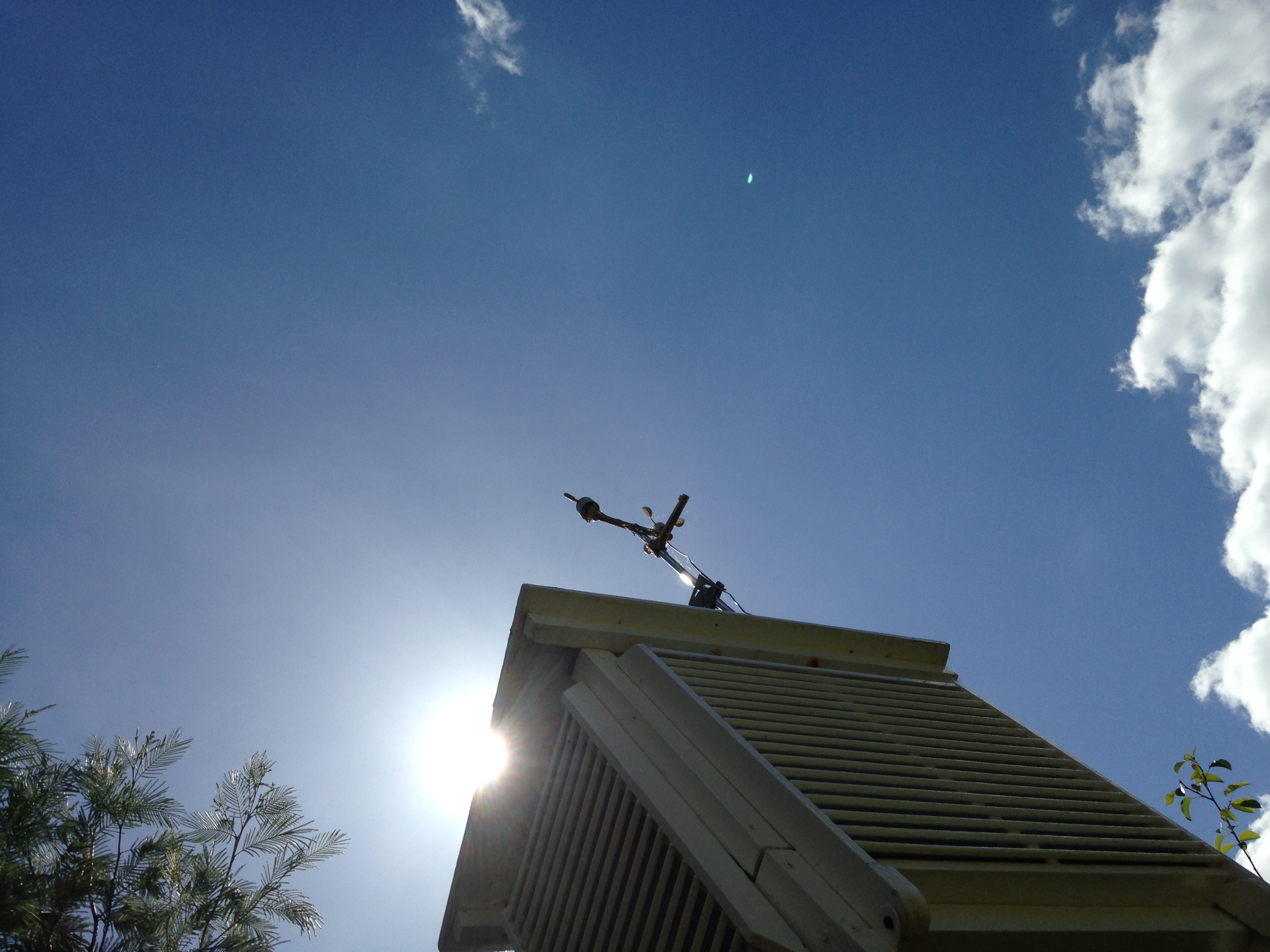
Just 31.7 hours of sunshine were recorded in this area: 54% of average, the dullest November for 47 years, and 9th dullest in the series going back to 1881

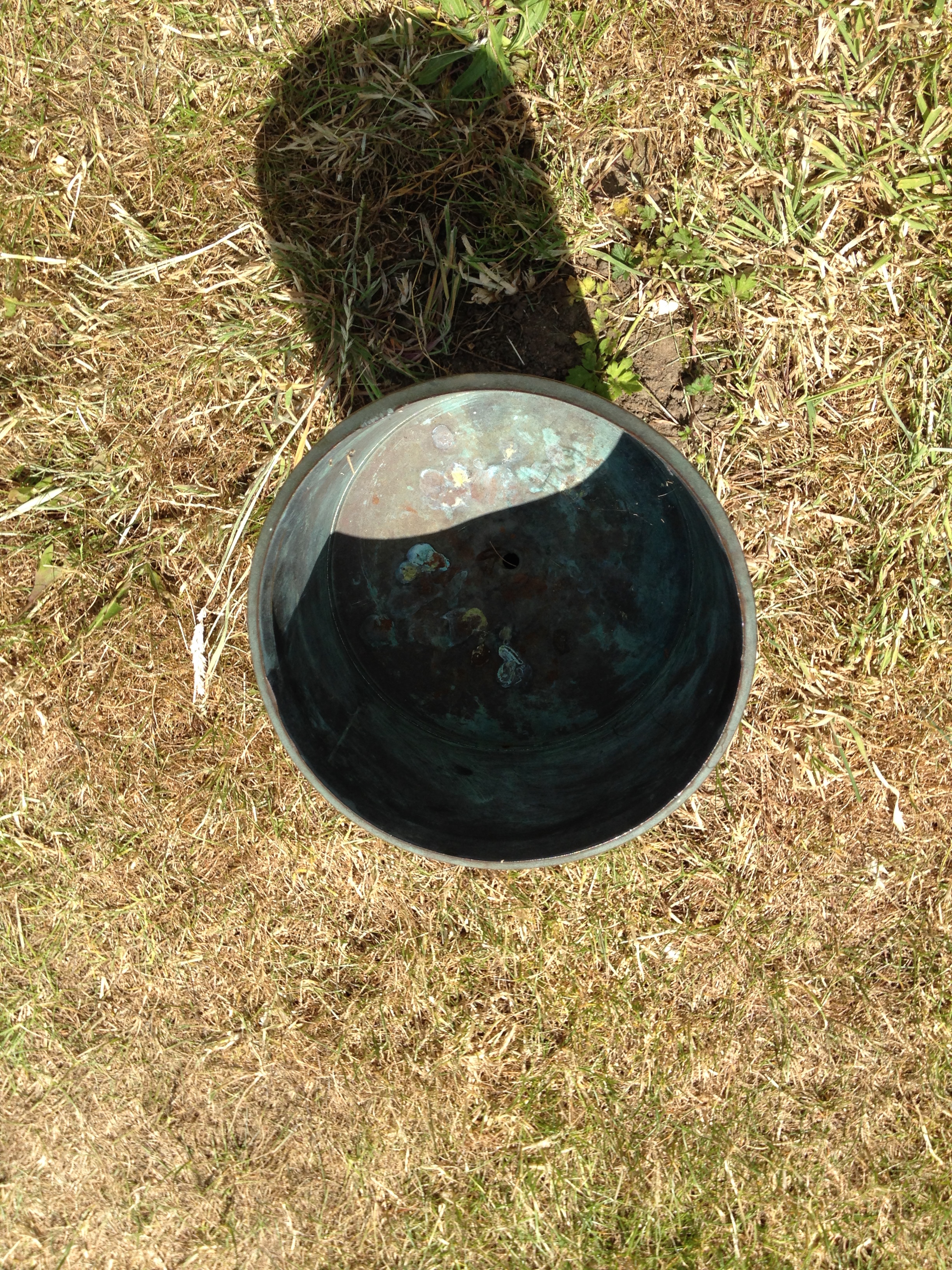
Rainfall was more run-of-the-mill: 64.3mm fell during the month: that’s 109% of average.

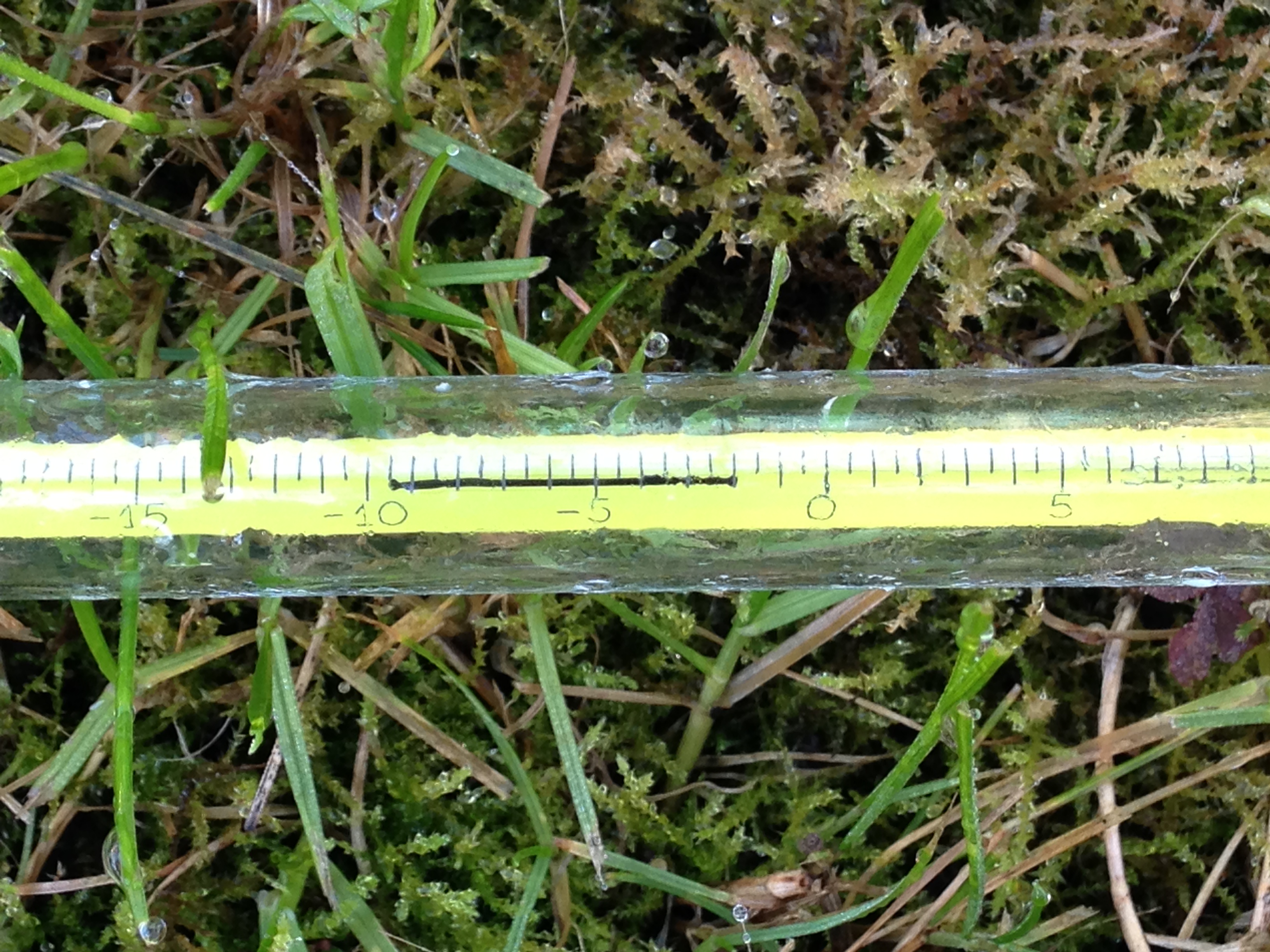
The warmest day occurred on the 6th with 17.2C recorded. The first air frosts of autumn were recorded. The lowest temperature occurred on the 21st when the mercury fell to -4.1C.

The wettest day was on the 3rd when 7.5mm of rain fell. There were only three completely dry days during the month – a real problem for anyone who works outside.

photo (8)
The beginning of the month was foggy

The sunniest days were on 21st and 22nd when four hours of sunshine were recorded.

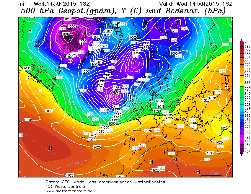
What has December got in store weatherwise? The models today (December 1st) suggest the beginning of winter will be held at bay with most model output keeping the Atlantic in control of the weather – persistent high pressure to the SW, south and SE and a strong jet stream funneled between this high pressure zone and low pressure to the north and NW.

Winds throughout the first 15 days will be blowing from between SW and NW.

Because of the exceptionally mild November I wonder how accurate my long range method will be in estimating December – but in the interests of consistency I’ll have a crack anyway.

A mean of about 5.1C with 70mm of rain, on the wetter side of average and with average to slightly below sunshine. The highest probability is for rather cold at 50% probability. Average 25% and rather mild, suggested in my winter forecast, comes in at 25% probability.

My November outlook for temperature was way off. I predicted a mean of about 9C, rather mild, but the result was 10.5C, very mild. This chance showed at just 6% probability.

Here follows the full weather diary for November. To view full stats follow this link:http://1drv.ms/1kiTuzv

1st Foggy start, lifted to brief sunny spells early afternoon before mist thickened up again and saw Wanstead Flats’ fireworks cancelled
2nd Foggy start. This cleared earlier than yesterday but sunshine was weak
3rd Cloudy start though turned brighter at 10.30am. Spots of rain at 5.30pm then cloud and mild. Rain at first light
4th Rain to start then briefly brighter
5th Cloudy then rain from 2.30pm to 5.30pm. Mild and damp overnight
6th Short burst of rain at 9am then more at 9.45am. Further short bursts of rain but then mostly cloudy
7th Light rain to start, this grew heavier through the morning with quite gusty winds – the first of the autumn. Heavier showers earlier afternoon before the rain cleared at dusk
8th Cloudy with only brief brightness. A light shower in the evening
9th Cloudy through most of the day and very breezy. F6 at Walkie Talkie
10th Cloudy to start and very breezy. Spots of rain at 2pm
11th Cloudy through the day and breezy
12th Sunny start though cloud tended to fill in as breeze picked up from ‘Abigail’
13th Sunny start , gradually clouding over with some sharp gusty showers and a heavy one at 2pm
14th Light rain, becoming heavier though turning patchy around noon. Heavier again at 2pm. Petering out in the evening
15th Bright blustery start, the wind continuing through the day
16th Cloudy start with some initial brightness, then cloudy. Rain when we turned up at 8.45, heaviest at 10.45pm
17th Cloudy up until 1pm when it started to rain. Breeze began to pick up with gusty evening – 33.6mph was strongest gust since St Jude storm – wind moderated after 10pm but remained breezy
18th Sunny, bright start though gradually clouded over as breeze picked up. Some squally showers around, mostly south of the river with rain lashing off side of buildings
19th Cloudy start with light rain spreading in at 10am. Outbreaks of light rain until lunchtime then a heavier shower at 3pm. Then overcast and cooler
20th Cloudy start – this cleared just before 1pm to give sunny spells. NW’ly set in through the day with ever cooling air. Sleet falling at 7am
21st Cloudy with heavy burst of sleety rain at obs time. Sky quickly broke to sunny spells but a very cold wind. A cold night
22nd Sunny and sub zero to start after heavy overnight frost. Sunny spells through the day, the frost returning at 2.50am
23rd Sunny, frosty start with some alto cumulus. Cloud grew thicker with rain before midnight that was light through the early hours
24th Cloudy start but with light rain spreading in from 11.30am then stopping and staying cloudy.  More rain overnight
25th Light rain to start, stopping at 9.40am then cloudy. Temp dropped through the day with sunny spells
26th Sunny start then turned more cloudy at 11am
27th Cloudy start. Some warm sunshine late morning then turned cloudier with strong gusty squall at 7.30pm. Clear spells overnight that led to ground frost
28th Sunny start, clouding over at 10.30am before light rain spread at 2pm and then gusty winds after dark
29th Cloudy and breezy most of the day thanks to Clodagh
30th Cloudy and breezy with occassonal drizzle

London winter forecast 2015/16

Winter in the London area this year is likely to be average overall, following the pattern of the past two winters that saw little snow.

winter 2015-16A rather mild December, dominated by a SW’ly flow with only brief, cooler, NW’ly incursions, will be followed by a rather cold January and average February. Rainfall throughout is likely to be average or slightly above. Probabilities of this scenario are listed in the tables.

The best chance of any snow is most likely to be at the end of January, though given the generally mild pattern it is not likely to last longer than two or three days.

Much has been said about how El Niño will affect this winter. The more hysterical parts of the media tell us we will see a repeat of 2009-10, a cold winter that saw frequent snowfall. But their assertion ignores the fact that other winters following a strong El Niño have been exceptionally mild.

decThis autumn has shown some striking similarities with 1997, a record El Niño year, that was followed by a very mild winter in this area, the third warmest since 1797. This autumn was also similar to 1994 – another El Niño year – followed by the fourth warmest winter on record.

But just as you think the pattern is the same the El Niño this year is different in that it is an El Niño Modoki – a full-Pacific basin El Niño that differs from the one in 1997. In other words we really are in unfamiliar territory.

janSo before I get too bogged down in finding teleconnections with El Niño, perhaps it is wiser to go back to more traditional ways of trying to predict the coming season.

Before I trawled through the figures my initial gut reaction to this winter was that it would be mild – because of some blocking in September/October.

febAs well as my method of using rainfall and temperature I also considered other methods. One, of which I see mentioned very little these days, was Russian research that states that the weather pattern in the winter will be the opposite to the weather on September 17th and November 7th. This autumn September 17th was NE’ly and November 7th was SW’ly. So, of little use this year.

You can read the method 0f how I reached my conclusion here.

DJF max
This chart shows that the coolest spell is likely to be around January 27th


Fog now rain put dampener on Bonfire Night

bonfire
Between 2mm and 3mm is estimated to fall between 6pm and 9pm . Fog cancelled fireworks organised for Wanstead Flats on Sunday

Bonfire Night celebrations are looking a bit damp tonight with rain spreading in just at the time many will be looking to light the fuses of fireworks as darkness falls.

According to the Euro4 model revellers can expect light but steady rain between 6pm and 9pm – annoying given that Sunday night’s festivities on Wanstead Flats were cancelled thanks to thick fog forming during the late afternoon as the sun began to set.

Wanstead Flats has put on some spectacular Guy Fawkes’ nights over the years. I didn’t realise quite how many years until I stumbled upon this old British Pathe clip which shows nurses at Wanstead Children’s Home building a huge bonfire for the children in 1934.

The footage shows the nurses struggling to get the Guy atop the bonfire, using numerous ladders, while the children, including 12 sat in an old perambulator, look on. The stats for the day reveal that the temperature fell to a chilly 2.7C after a day high of 7.9C. There was also some drizzly rain, though less than 1mm.

The Aldersbrooke Childrens Home for Waifs & Strays is still there in Brading Crescent on the Aldersbrook Estate, although the five lodges have been converted to flats.

'To Go Up in Smoke' is available to buy from British Pathe http://www.britishpathe.com/video/to-go-up-in-smoke/query/Guy
‘To Go Up in Smoke’ is available to buy from British Pathe http://www.britishpathe.com/video/to-go-up-in-smoke/query/Guy

In 1907, the West Ham Guardians purchased the Aldersbrook site. In 1911, five receiving homes were completed. The homes were called lodges and were: Elizabeth Fry Joseph Lister, Tom Hood, Edward North Buxton and William MorrisA bit of history…

In 1913, a workshop, for training of the older boys and girls was opened. Skills learnt were in tailoring, carpentry, laundry work and needlework, under skilled industrial trainers.

In 1930, on the 1st April, the ownership of Aldersbrook homes and the leases of the Scattered Homes, were under the 1929 Local Government Act, and by agreement with the Essex County Council and the West Ham Corporation, vested in the East Ham Corporation who are required to continue to receive destitute children from the Essex County Council and West Ham, formally comprised in the West Ham Union area.

On 27th May 1933, the Aldersbrook Children’s Homes new nursery was opened. The County Borough of East Ham owned it. Alderman T.W.Burden, Chairman of the Public Assistance Committee, opened it. The Mayor of East Ham, Alderman G.H.Manser J.P, proposed a vote of thanks, which was seconded by Alderman C.W.Brading J.P, and supported by Alderman Mrs Taylor (East Ham) and Councillor G.Doherty, of West Ham. After the official opening, the older children (14 to 16 years old) of the homes put on the play “David Garrick”.

The superintendent of the home was W.T.P. Steele, and the matron was E.M.Steele. S.R.N. The building was described as being divided into three sections – ground floor, babies under twelve months and toddlers one to three years, first floor staff. Accommodation is given for ninety infants under three years. Wards are provided for these age groups were newly admitted children will be housed for three weeks before being sent to the general rooms. Two ranges of isolation rooms are also provided where “suspects” can be nursed to reduce the risk of infection. The south end of the building is allotted to the youngest or cot babies and comprising of long dormitory with sun rooms at the end, designed to catch the winter sun.

The former Aldersbrook Children's Home is still there in Brading Crescent but has been converted to flats
The former Aldersbrook Children’s Home is still there in Brading Crescent but has been converted to flats

The programme went on to describe the building as being the most modern of children’s institutions. The building has a veranda at the front. The first floor has 21 separate staff bedrooms. The building had an oil fired heating system and flooring with fire resistant Terazzo material whilst the children’s play room and dormitories are protected by rubber flooring. The lighting and power points are controlled by locking device to prevent the children switching them on and off. The building was built by Messrs Hammond & Barr Ltd Chelsea.

The Nursery is now gone and the Aldersbrook estate covers the area, although the recreation Hall, the lodges (See photo) and the porters lodge are still there.

frost
The incident of frosts during the season from October to May. There has been a general uptick overall since 1999/2000

1934 and this year, together with the last couple of years, is a far cry from my memory of Bonfire Night being a frosty affair – despite the fact that frosty nights during the season from October to April have been showing an uptick since 1999/2000.

The synoptic chart on November 5th 1934 portrays an unsettled regime

October 2015: average temps and rather dry

This October was the coolest since 2012 though the mean of 11.7C is just 0.1C below average – nearly 2C colder than the same month last year.

The last week of the month saw the leaves turning in earnest. The horse chestnuts, such as this one in Wanstead Park however, turned much earlier because of the leaf miner pest

A persistent anticylone around mid-month pumped quite cool air from the north-east for a time, prompting some cold nights. Though we have yet to experience an air frost this autumn the ground temperature fell below freezing on five nights – that’s five occasions more than last year: -2C was recorded during the early hours of the 8th.

The month was rather dry: some 46.8mm of rain fell which is 70% of what we can expect in an average October. The wettest day was the 27th when 19.4mm fell. The heavy rain in the early hours of the 28th was quickly replaced by sunshine and a stunning day followed.

Just over 91 hours of sunshine were recorded – that’s 86% of what we can normally expect in an average October.

What has November got in store weatherwise? The models today (November 1st) suggest this week will see a gradual decline in conditions overall as the ridge from Europe weakens and weak Low pressure edges up from the south and SW. Thereafter it looks like winds will settle SW’ly as high pressure relocates to the south of the UK, bringing this area mild temperatures and mostly dry and bright conditions – though a little rain will be possible at times. Overall the models continue to have little appetite to serve us up anything remotely cold and stormy.

My long range outlook method suggests that November will be average to rather mild temperature-wise, a mean of about 8.9C, at 56% probability. The next highest probabilities are for rather cold or cold, at 18% probability. The chance of a very mild month comes out at just 6% probability.

The highest probability for rainfall is 69% for something average to rather dry, between 37mm and 59mm. A wet November comes in at 20% probability.

My data for sunshine only stretches back to 1878. The signal is for something average, at 60% probability.

Looking beyond November it is notable that October 2015 was very similar to October 1997 – the year another strong El Nino occurred. A very mild winter unfolded from 1997-98, though I’m sceptical about how much influence ENSO has on our part of the world.

With the sun lower in the sky at this time of year there's often a great opportunity for a decent sunset
With the sun lower in the sky at this time of year there’s often a great opportunity for a decent sunset

My October outlook for temperature was good in that I estimated that there was a 44% chance of the mean being average. My rain estimation was way out in that a signal for a rather dry October was only a 22% probability – though bearing in mind that the probability for a wet October was only 33% it is not surprising the outcome was wrong.

Here follows the full weather diary for October…Full stats for the month here:http://1drv.ms/1rSfT7Y

1st Sunny with just a few wispy clouds. Heavy overnight dew.
2nd Sunny and clear all day and evening. Mist thickened overnight with fog elsewhere in the UK.
3rd Misty start and cloudy till midday. Evenutally cleared to leave sunny spells. Cooler than yesterday.
4th Sunny start but with a few cumulus developing during the day. Clouding over during the night with few drops of rain from high-level feature before obs time.
5th Cloudy start with rain spreading in after midday, this being steady on and off into evening before turning to drizzle late evening and lasting into early hours. Another outbreak of rain at 9.30am to obs time.

There were five ground frosts during the month of October

6th Rain to start, some of it heavy. Drying up a bit at 11.30am. More rain in the evening and overnight into the early hours. Rain again at 9.20 until obs time.
7th Cloudy start but with rain moving in again. This rain dried up a bit at 11am but then more rain at 2.30pm before petering out and clearing overnight to leave it cold.
8th Sunny, clear start with just a few cirrus. More cloud at noon and through the day. Cleared at dusk to give a cold night and heavy dew.
9th Sunny start but cloud bubbled up from noon to give cloudier periods.
10th Bright start though stayed mostly cloudy and cool. Milder overnight than of late.
11th Sunny start with a bit more of a breeze. Some alto-cumulus late on made for a stunning sunset. Cloud overnight held up temperature.
12th Cloudy start, some brightness at 11am.
13th Cloudy, cold start with cloud off North Sea making it feel colder. Cloud was very thick at 3pm with drops of drizzle.
14th Clearer periods overnight saw temperature fall sharply but too much wind for frost.
15th Sunny with just a few cumulus – very cold wind though. Cloud thick enough at times for brief showers through day. Quite overcast at night
16th Cloudy start though with some brightness. Strong easterly breeze.
17th Cloudy though warmer than past week. Felt a bit muggy.
18th Cloudy and breezy start, cloud persisting through the day.
19th Bright start and was more glimpses of sunshine than past few days. However, cloud returned with a vengeance last afternoon – felt like it was getting dark at 5pm.
20th Cloudy all day. Clearer overnight.
21st Cloudy start. This turn to long sunny spells and a pleasant afternoon.
22nd Rain to start which fell until 2.30pm. Then outbreaks of rain into the afternoon. Cloudy and damp overnight.
23rd Bright start though mostly cloudy through the day.
24th Cloudy all day. Feeling colder.
25th Cloudy start with light rain around 10.40am then intermittent. Very heavy burst of rain after dark before the skies cleared to leave a cold night.
26th Bright start with cloud breaking to long sunny spells – pleasant in the sun. Temp fell away quickly at dusk. Precip was dew accumulation.
27th Sunny start. Some cloud developed through the day but then largely melted away to leave a warm late afternoon.
28th Cloudy start. This broke to sunny spells into the afternoon in Rye. Light rain seen in Rye at 8pm – this turned heavier into the evening but most fell at dawn.
29th Bright start but quickly clouding over with rain in the evening and overnight.
30th Light rain and drizzle to start then cloudy all day and overnight.
31st Bright start, the cloud gradually clearing to leave a warm afternoon.

June 2015: a little above average, very dry

June finished hot in complete contrast to the opening few days which were a continuation of a disappointing May.station

There were six occasions when the maximum exceeded 25C – the highest being 30.8C on 30th, the warmest June day for four years.

Mean temperature for the month was 16.9C, 0.8C above the 1981-2010 mean. Rainfall of 17.5mm was 34% of average – the last three Junes have been notably dry.

There were 189.5 hours of sunshine recorded in this area which is 106% of what we can expect to see during an average June. The wettest day occurred on the 20th with 11.1mm. There were two days of thunder recorded.

So what has July got in store weatherwise? The models this morning (July 1st) suggest a battleground between Atlantic cooler air and hot continental air, a common feature at this time of year. The persistent heat on the continent looks like it will waft back and forth across the south-east – creating the risk of thundery downpours as it meets resistance from successive cold fronts.

Just 17.5mm of rain fell in June - 34% of average
Just 17.5mm of rain fell in June – 34% of average

The model output suggests the Atlantic air will eventually win through, allowing more changeable conditions in a week’s time. There is also a signal that high pressure will re-establish with a return to fine and very warm weather. As things stand the models remain finely balanced.

In contrast to the models my long range method suggests overwhelmingly that we are in for a warm July, up to 1.7C above average, at 60% probability

The next highest chance is for rather warm at 40% probability. If you add the probabilities together the chance of a rather warm to warm July can be put at 100% – perhaps a repeat of last year’s and 2013’s classic July is about to unfold?

Rainfall is looking below average, at 60% probability. There’s obviously a risk here that a couple of direct hits from thunderstorms would see the monthly total exceeded. I don’t have enough data to estimate sunshine but I would guess average to slightly above.

My June outlook was only good in that it ruled out any chance of a very warm month – the final mean was rather higher than I thought. I was also out with the very low rainfall – the signal was for something average. Sunshine was broadly average as I’d estimated

The Heronry Pond in Wanstead Park is suffering low water levels again
The Heronry Pond in Wanstead Park is suffering from low water levels again

Full stats for the month here: http://1drv.ms/1rSfT7Y

Here follows the full weather diary for June…

1st Sunny, bright start quickly turned cloudy with intermittent drizzle through the day. Turned windy at 6pm and was really blowing around midnight.
2nd Drizzle in the wind at obs time and very windy, wind only decreasing by evening. A dreadful day though warm.
3rd Sunny start though cloud gradually increased. Feeling humid and summery at last.
4th Sunny start with cloud dotted with alto cumulus and cirrus. Rain between 5am and 6am – though storms passed to our west and east.
5th Bright start after earlier rain – the thunderstorms seemed to pass to our west and east. Very humid and felt oppresive in the morning.
6th Sunny start with cloud bubbling up. Much cooler and fresher feel. Lots of long sunny spells.
7th Sunny, gin clear start. Just a few fair weather cumulus all day. Gorgeous.
8th Bright start though alto cumulus shaded early sun. Variable cumulus after that – feeling chilly.
9th Cloudy and brisk wind from NE. Feeling chilly.
10th Bright start with sunny intervals throughout the day.
11th Sunny start with few cirrus, sky then completely cleared.
12th Sunny start though cloud bubbled up through the day – felt very close at sports day. Distant thunder heard at 8pm with light rain – much less than was threatened.
13th Cloudy start, mostly calm, still and dull – a real nothing day though some late brightness after 2pm pushed up the temperature briefly. Mild overnight with some light drizzle before obs time.
14th Drizzle in the wind up until 11pm and falling temp. Then a brief sunny interlude before it was cloudy again.
15th Cloudy start then briefly clearing before, at 1pm, more cloud appeared. Clear overnight allowing temp to fall until 4.10am but clouding over by morning – bright warm sunshine at 9am.
16th Sunny start but very cloudy at times. This continued all day – though the night was cloudier hence warmer.
17th Sunny start but with lots of cloud around.
18th Lots of long suuny spells but cooler than yesterday.
19th Cloudy up until 11.30pm and cooler. Broke to sunny spells and much warmer at 2pm.
20th Bright start though warm from started pushing through just before 1pm. Some sunny breaks but rain pushed in. Was in Cheltenham but Woodford Wells reported thunder:  Between 1650and 1730 12mm fell followed by a decreasing amount of 2.4mm up to 1814  all BST Two thunder claps at 1715 and 1728.
21st In Cheltenham it was a mostly cloudy day though with more sunny intervals after midday. Rain spread in just before midnight with more in the early hours.
22nd Cloudy start though with brief sunny break at 10am. Some drizzle 11.15am then drier with sunny intervals.
23rd Bright start. Cloud broke to give warm sunny spells .
24th Sunny periods after a rather cloudy start. Felt very warm in the sun during walk around London with Neil and family.
25th Sunny start though hazy cloud developed from 10.30am, rather obscuring the sun at times, though it was bright all day. 26th Warm till late into the evening – still 18C at 11pm.
26th Bright start though cloudy, broke to sunny spells and felt warmer than forecast.
27th Sunny start though with cloudier spells all through the day. A very warm evening.
28th Sunny start quickly became cloudy with rain turning up at noon during early lunch. This later cleared to sunny spells and a pleasant afternoon.
29th Sunny start though with high cloud obscuring the sun at times.
30th Sunny, gin clear all day. only ‘cloud’ was distant grass fire.

The 30th was wall-to-wall sunshine until late in the evening when alto-cumulus and cumulus were observed

May 2015: average temps and dry

After a sunny and dry April last month was disappointing for anyone looking for prolonged heat and sunshine. Indeed the month saw nearly two dozen less hours of sunshine than April.

During a very thundery day nationwide on 19th it was bright and sunny looking west on Southwark Bridge at 3.40pm...
During a very thundery day nationwide on 19th it was bright and sunny looking west on Southwark Bridge at 3.40pm…

Maximum temperatures were low for May – the highest being just 23.3C on 11th, 2C colder than the highest temperature in April.

Mean temperature for the month was 13.4C, 0.3C above the 1981-2010 mean. Rainfall of 38.9mm was 76% of average – six of the last seven Mays have been notably dry.

There were 178.5 hours of sunshine recorded in this area which is 98% of what we can expect to see during an average May. The wettest day occurred on the 4th with 8.2mm.

So what has June got in store weatherwise? The models this morning (June 1st) suggest a very unsettled start to the month before the Azores high builds a ridge to quieten things down for a couple of days. Beyond that is uncertain – the ensembles point to a very mixed picture with no clear trend shown to where we might be in a fortnight’s time.

Looking east was a different story which revealed a distant thunderstorm

Looking at the month as a whole my long range method suggests June will be average in terms of temperature: 54% probability. The next highest chance is for rather cool at 15% probability. If you add the probabilities together the chance of average to below average temperature is 85% – which would seem to rule out a ‘very warm’ month…

Rainfall is looking average to slightly above average, though at only 62% probability. It looks like another broadly average month in terms of sunshine.

So with a slightly changeable start to the month we can look forward to another average month without prolonged heatwaves?

My May outlook was good in that it saw the high chance (80%) of average temperatures. I was, however, out with the low rainfall – the signal was for something greater than average. Sunshine, as already mentioned, was also out – my forecast was for something 1.2 above average.

May 19th was a very thundery day across eastern England. This picture was taken looking east from Southwark

Full stats for the month here: http://1drv.ms/1rSfT7Y

Here follows the full weather diary for May…

1st: Sunny start but cloud quickly filled in. Though cloudy it remained bright. Cold wind.
2nd: Cloudy start but becoming brighter. Turned to hazy sun at 3.30pm but then turned cloudier. Rain by early hours, 5am and then again at 8.30am.
3rd: Cloudy after early rain then growing warm and muggy with sunshine at 2pm. It stayed bright and muggy into the evening.
4th: Sunny start then haze and cumulus soon thickened before clearing to sunny spells early lunchtime. Cloud built up again at 2pm. Rain spread in early evening with heavy bursts from 11pm to 1.30am – heaviest at midnight.
5th Cloudy start but becoming brighter albeit very windy through the morning and past lunchtime. Occasional showers with very heavy shower at 6am.
6th: Cloudy start with brighter interludes but turning very blustery with occasional light showers. These turned heavier through the day with a notable one at 2pm. Thunder heard at 5pm with more showers.
7th: Sunny start but with lots of cloud bubbling up

Wanstead was hit head-on by a thunderstorm at 2pm on 19th, clearly shown on this radar picture. Because the storms were fast moving rainfall accumulation was not remarkable

8th: Bright start after early light shower. Spots of rain during bright afternoon – these turned heavier at 3.30pm. Cloudy and mild overnight.
9th: Bright, slightly breezy start. Spells of very warm sunshine though also odd spots of rain during showers.
10th: Bright start with sunny spells through the day
11th: Bright start with altocumulus. Cloud broke to sunny spells though sky was very hazy at times. Feeling humid. Warm overnight but short, sharp shower moved in 10 minutes before obs time.
12th: Light rain to start from a frontal feature. This clearing to sunny spells and pleasant afternoon
13th: Sunny with few cirrus to start. More cloud bubbling up later. Clear at first overnight before cloud and light rain moved in before 9am.
14th: Cloudy but spits and spots of rain spread in, before more steady light rain at 10.30. This eased at noon before becoming heavier again at 3.30pm and rained into evening, easing up at midnight.
15th: Sunny start though cloud tended to fill in. Some rain around midnight
16th: Cloudy start though got progressively sunnier as cold front cleared, humidity fell and cloud melted away. Very pleasant. Cool overnight.
17th: Sunny, clear start with a few cirrus. Cloudier at times but still sunny spells. VERY breezy with f4/5 headwinds on ride to station. Rapidly changing skies with wind shear.
18th: Some light rain to start, this intermittent through the morning.
19th: Bright and breezy start. T-storm developed at 2.30pm but moved through quickly. Was two more, at 5pm and 7pm – notable rises in pressure as troughs moved through.
20th: Bright start. Light shower bubbled up late afternoon.
21st: Sunny start, cloud gradually filled in though.
22nd: Bright start with sunny spells. Warm.
23rd: Cloudy with a very thick layer of strato-cumulus making it dull. Two hours of light rain and drizzle followed but cleared to leave it bright with a couple of sunny intervals in the evening. It felt humid at first but turned much fresher once the drizzle cleared.
24th: Sunny start though cloud filling in to make it bright. Frontal light rain between 3 and 5pm.
25th: Cloudy most of the day, a few bright intervals though spits and spots of drizzle early evening.
26th: Sunny start with fluffy cumulus. Pleasant.
27th: Dry, warm and sunny all day. Heavy rain in York from 3pm to 8pm. Felt chilly in the wind.
28th: Dry, lots of cloud around
29th: Dry start though rain moved in between 11am and 1pm. Then sunny spells and breezy.
30th: Sunny though soon clouded over before clearing again to sunny spells. Mackerel sky observed at 8.30pm. Rain between 2.15am and 6.30am.
31st: Light rain to start with outbreaks throughout the morning. Some brightness mid to late afternoon.

UK media in a fog over El Niño predictions

When it comes to explaining weather phenomena the British media has often been found wanting over recent years. But when the Australian Bureau of Meteorology yesterday confirmed the emergence of a fresh El Niño newspapers and TV stations inevitably reached the conclusion that the phenomena will trigger a severe winter in the UK.

Sky News told us that it “could also result in a harsh winter for the UK; during the last El Nino in 2009/10, Britain suffered heavy snowfall”, before showing us newsreels of what looked like conditions in December 2010 – the winter after.

Not to be outdone the Daily Telegraph moved the effects forward to this summer, telling us the effect *could* herald a “damp summer with temperatures well below average”.

I decided to have a look at the facts to see what the effect of an El Nino episode was by comparing the US weather agency NOAA’s data on ENSO episodes going back to 1950 with my own data. For speed I used my top ten snowy winters and compared against the NOAA data.  The results showed that eight cold winters followed an ENSO pattern that was negative. The winter of 2009-10 seems to be the exception to the rule. Indeed, a significant El Niño episode in 1997/98, preceded the third warmest winter in my series going back to 1797!

el nino

El Niño / ENSO is just one variable when it comes to forecasting a season ahead. Other variables to consider are AO, QBO, MJO and this is before SSWs, sudden volcanic eruptions and sunspot activity throw spanners in the works.

It is exasperating that both the Sky and Telegraph stories were copiously shared on social media – prompting the inevitable comments along the lines of: “They’re talking rubbish, they can’t forecast what that weather will be tomorrow!”

But rather than badly informed journalists it is the Met Office and other noble agencies who will share the blame if the story is incorrect.

There is no doubt that El Niño will disrupt the weather around the Pacific rim but, considering the data we have available, I don’t think it, alone, will be the reason Britain may experience a severe winter this year.

* XMetman has had a long look at the data and couldn’t find a link either

** NOAA’s monthly diagnostic discussion just released (14/5) says:

There is an approximately 90% chance that El Niño will continue through Northern Hemisphere summer 2015, and a greater than 80% chance it will last through 2015.”

Read full advisory here


April 2015: very dry and sunny

April showers bring spring flowers – or so the saying goes. The month was actually sunny and very dry with less than 50% of what falls in a normal month.

The cold nights and often chilly days helped to preserve spring blossom, with some stunning displays on streets around the borough.

Indeed just one day, the 30th, was what you could say was a classic April day – a sunny, clear morning saw convection build towering cumulus clouds with a light shower around lunchtime.

Mean temperature for the month was 10.6C, 0.8C above the 1981-2010 mean, over 1C cooler than April last year. Rainfall of 18.9mm was 45% of average – six of the last seven Aprils have been notably dry.

There were 201 hours of sunshine recorded in this area which is 126% of what we can expect to see during an average April. The wettest day occurred on the 25th with 4.7mm. Air frosts: 5 Ground frosts: 13

So what has May got in store weatherwise? The models this morning (May 1st) suggest next days remain unchanged with troughs moving NE across the UK over the weekend introducing warmer air with a mix of sunshine and showers following. A new LP looks like developing over western France on Monday becoming absorbed in the main low to the west of the UK bringing a more sustained westerly feed ahead of rising pressure from the south later toward the weekend, bringing fine and summery conditions. The risk of rain should decrease as the week goes on.

Beyond that the outlook, as ever, is uncertain.

My long range method suggests the month will be average in terms of temperature: 80% probability. The next highest chance is for rather mild at 20% probability. Rainfall is looking average to slightly below average, though at only 60% probability. It looks like another sunny month is in prospect – 80% probability of sunshine at 1.2 times the mean.

So with a slightly changable start to the month we can look forward to another sunny, pleasant spring month without heatwaves?

Long spells of cirrus gave a solar halo on the 17th.

My April outlook was good in that it ruled out any chance of a very mild or very cold month. The combined probability of 72% for an average to rather mild month was correct. I was, however, completely off with the rainfall, the signal for which was greater than average

Full stats for the month here: http://1drv.ms/1rSfT7Y

Here follows the full weather diary for April…

1st: Bright start but very breezy through the morning and afternoon. Rain after 11pm and again at 3.30am.
2nd: Bright start though sunny spells increased through the day. Felt really pleasant out by noon. Some rain in the early hours before obs time.
3rd: Cloudy through the day with some rain late afternoon.
4th: Cloudy all day though with some drizzly rain. Some brightness was seen on way in to South Kensington in the Whitechapel area.
5th: Cloudy, cold start but with sunny spells developing through the day. Pleasant in the sun.
6th: Sunny start with cloud building from time to time. Cloud cleared overnight to give a ground frost.
7th: Sunny start with long clear periods through the day.
8th: Cloudy start gradually cleared to hazy sunshine. Cloudier again in afternoon.
9th: Cloudy start though soon brightening up for a sunny day in town.

Typical April days of sunshine and showers were in short supply. There were some stunning sunsets, including this one on the 30th

10th: Cloudy start though cloud quickly thinned to leave sunny day. However, cloud was hazy at times with bad pollution seen over London. Also a few drops of rain were observed rain around edge of Ornamental Waters. Humid.
11th: Drizzle turned to moderate rain that was over in 45 minutes and cleared to sunny intervals, then longer sunny periods through the day. Much cooler than yesterday.
12th: Sunny start led to a day of long sunny spells. Sky was initially a deep blue but hazy cumulus built up after 4pm.
13th: Cloudy start, some brightness in the afternoon.
14th: Sunny, gin clear start. Sunny all day with light breeze taking edge off temp.
15th: Sunny, clear start for RMetS meeting. Slight breeze kept edge off temp. Some light clouds late afternoon. Cooling off quickly in early hours.
16th: Sunny spells in the morning.
17th: Sunny though long spells of cirrus gave a solar halo. Chilly in the wind.
18th: Sunny spells to start though cloud decreased to leave gin clear afternoon. Dew point dropped to 1.5C making it feel very chilly.
19th: Bright start but cloud quickly filled in leaving it feeling cold in the wind. Some sunshine after 5pm making it a pleasant if a bit cold in the wind evening.
20th: Sunny and mostly clear all day. Much warmer.
21st: Sunny and mostly clear all day. More contrails though. Chilly overnight again.
22nd: Sunny start though cloud filled in earlier than yesterday. Nowhere near as warm.
23rd: Cloudy start though the cloud decreased and was gin clear by 12.15pm.
24th: Sunny start although hazy at times. Cloud gradually increased late afternoon and light rain arrived 1am.
25th: Cloudy start though plenty of breaks in the cloud developed allowing for a pleasant afternoon.
26th: Slight drizzle to start then cloudy and cold all day. Cold overnight in clearer spells.
27th: Sunny start. Clouds bubbled up though the day with showers reported elsewhere. It threatened rain in Wanstead but stayed dry.
28th: Sunny start with just a few clouds through the day. Feeling cold though.
29th: Light rain to start though this suddenly cleared at 10.15am before clouding over again.
30th: Sunny start with clouds bubbling up. A light shower in Snaresbrook.

Final GFS ‘pub’ run – saved for posterity

The weather model GFS (Global Forecasting System) has, for years, teased weather anoraks with mouthwatering possibilities of what the weather could be like 5 to 10 days away. Many ‘coldies’, that unexplained breed of weather anorak whom lust after extreme cold and snow every winter, often look at the end of the run, out to 384 hours, and cherry pick these charts, taking as gospel that the synoptics will come to pass, especially if there is high pressure plonked over Scandinavia.gfs logo

But 16 days is an eternity in weather forecasting and what happens on the day is, more often than not, a world away from what was modelled a fortnight before. But it doesn’t stop the blizzard of toys and dummies being thrown out of prams, often by grown men who really should know better that the weather they really want is always 10 days away.

Is this about to change? Probably not but the improved resolution, from 27km to 13km, will massively improve accuracy at short-range.

In the meantime it is perhaps ironic that the final 18z operational run of the GFS 27km resolution model had some of the most mouthwatering solutions for classic cold and snowy winter weather for nearly two years. But, just for a change, the operational is backed up by the ensemble.

Here are most of the 500hPa charts from that last run

1

2

34

5

6

7

8

9

10


12

13

14

15

16

17

18

19

20


21

22

29


24 25 26 27 28


Weatherlore: Colin Finch’s 38F rule

Signals for winter have always been well reported by the media. Back in the 1980s weather anoraks across Britain would wait with bated breath to read Bill Foggitt‘s latest prognostications for the coming winter. Though Foggitt had some success his observations, among other weather ‘gurus’, often amounted to weatherlore that has only a slightly greater than evens chance of being right.

One popular myth is that very large blackberries mean a harsh winter. The fact that this has more to do with plentiful rainfall plumping up the fruit at harvest time is ignored.

Colin Finch’s 38F minus rule is altogether different and provides a very good guide to the kind of weather we can expect in January and February. For the rule to work the maximum temperature must be 38F (3.3C) or less for four consecutive days before Christmas Day.

finchColin, an amateur meteorologist who passed away in 1991, spent much time researching his rule in the 1970s. He found that most of the coldest winters since the end of the second world war gave a hint of things to come in the weeks leading up to Christmas: the Decembers of 1946, 1955, 1962, 1968, 1969, 1978 were all followed by cold late winters. In 1984 and 1985 the cold spell arrived at Christmas. Other years to loosely follow the rule, 1986, and 1990.

A few weeks ago I was reminded about Colin’s findings and decided to have another look, using daily record data for this area stretching back to 1806.

The results were surprising. If there is a run of cold days (3.3C or less) around mid-month the chance of an average to colder than average January and February is 94% and 74% respectively. The chance of an average to colder than average March is 96%. Also notable is that the chance of a severe spell in January (4C colder than normal) is 30%.

So much for the figures. What are the chances of a run of cold days between now and Christmas Day?

Sunset Southwark Bridge

Up until this week the weather has been fairly quiet with little rain and cold, often frosty nights. But westerlies are now roaring back in from the Atlantic and could be a hint of what is likely to prevail later in the winter. However, the ‘crunch’ time for the 38F minus rule comes soon after the middle of the month. If a spell of Arctic weather develops at that time, even if it lasts only a few days, then the chances of a major cold spell after Christmas are much higher.

As I write this blog the models suggest that a run of cold days may just be possible. It is also notable that the likelihood of a sudden stratospheric warming event, argued by many to be a precursor for conditions that would favour the development of a cold spell, is increasing with a peak set for mid January.

We’ll see but Colin Finch’s findings all those years ago are fascinating and are still relevant today.

My method in using the rule can be found here.

Statistics on the rule can be found here.

* The following obituary appeared in an edition of Weather magazine, a publication of the Royal Meteorological Society, in 1991.

“Colin Finch – The news of the sudden death of Colin Finch on Friday, 23 August 1991 at the tragically early age of 55 will be received with sadness by Members of the society and readers of Weather.

There is no doubt that Colin was one of the most enthusiastic amateur meteorologists that the Society has ever had and, without seeking publicity for himself, he was responsible for making many other amateur enthusiasts aware of the Society and encouraging them to join.

Colin’s interest in the weather began when he was a small boy and received a considerable boost during the snowy and very cold winter of 1946/47 when he was 10 years old. In 1949, at the age of 13, he began to take regular temperature and rainfall readings and gradually added more sophisticated equipment. His record of daily weather data was unbroken until July 1991 when he became too ill to continue.

When he left school in 1953 he joined the Meteorological Office as a Scientific Assistant at Kingsway and was trained under the keen eye of Dick Ogden. Later, after a spell at Heathrow Airport, he left the Office frustrated by his inability to develop a career because he didn’t have sufficiently good educational qualifications. Instead, he turned to a successful business career but his enthusiasm for weather observing and forecasting increased.

Each day he plotted and analysed synoptic charts compiled from short-wave Morse code transmissions which he took down by hand. In the 1960s and 1970s it was quite normal for him to spend Saturdays plotting a chart for the whole of the Northern Hemisphere from Morse broadcasts. Later he had facsimile and satellite-receiving equipment installed at home.

By the late 1960s he was liaising with local authorities and the police in Surrey, warning them of the likelihood of severe weather events. In 1970 he joined the then newly introduced BBC Radio London and every Friday morning he would discuss current weather events and give climatological background data about the week ahead. For these broadcasts he would get up in the early hours to plot a synoptic chart before he went to the studio.

After the broadcasts he would go to the City for a normal day’s work. He kept up this punishing schedule for several years. When the Society introduced the highly successful one-day Saturday discussion meetings in September 1972 Colin was one of the first amateur meteorologists to give a presentation and he was a regular contributor to these occasions. He was an imposing figure, 6ft 4in tall, and was easy to seek out at meetings.”