Category Archives: monthly summary

December 2016: driest for over 80 years

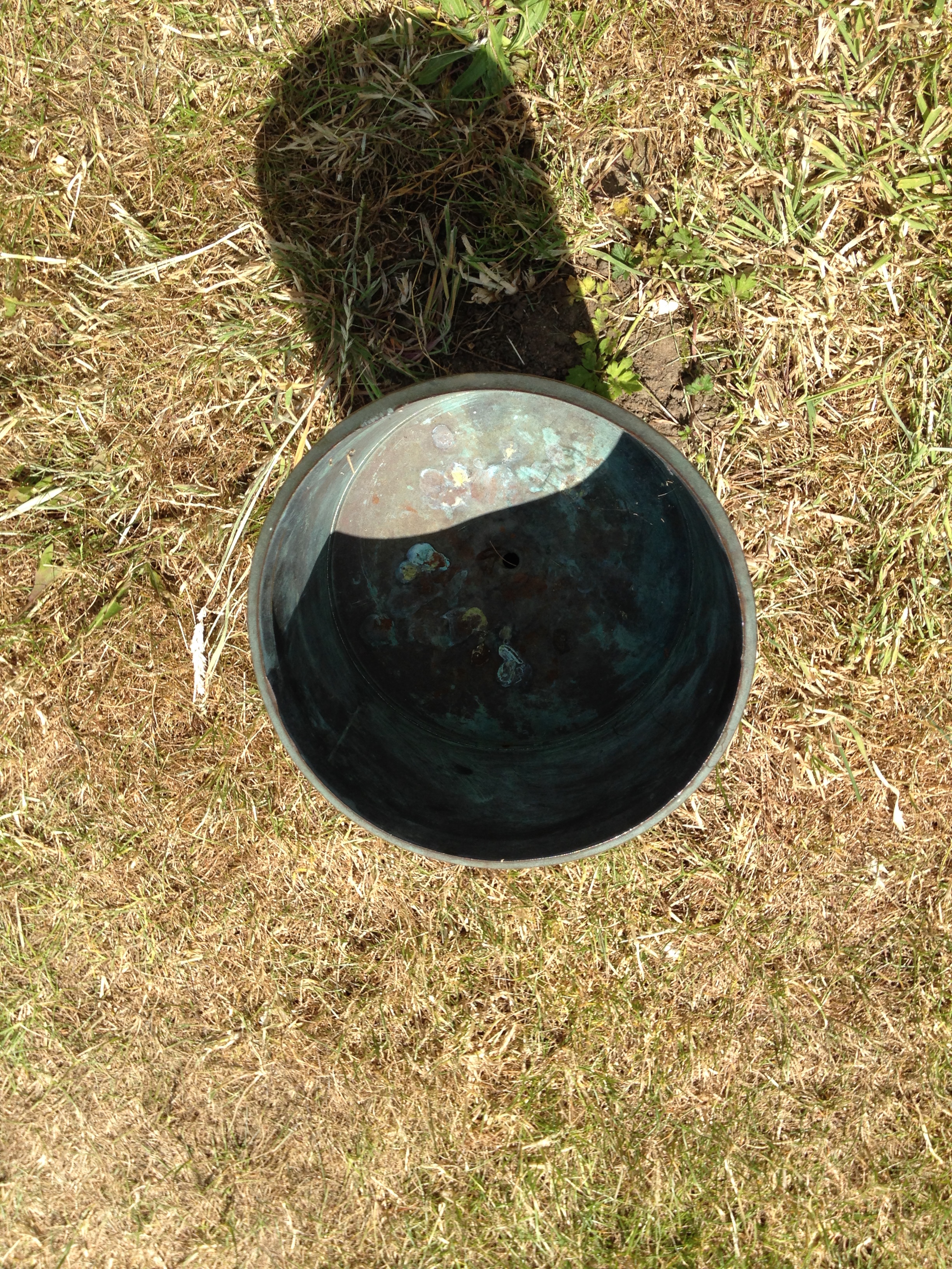
December 2016 was the driest 12th month in over 80 years and the 5th driest in a record going back to 1797.

screen-shot-2017-01-05-at-17-12-19
Christmas day was the second warmest on record in London

The total fall of 8.3mm is just 16 per cent of what normally falls in December, marginally more than December 1933. The mean temperature of 6.1C was 0.5C above average, though 4C colder than the record December last year.

There were 51hrs of sunshine, that’s 125 per cent of average.

The wettest day was on the 10th when 5.2mm of rain fell. The warmest day occurred on the 9th with 14.2C recorded. The lowest temperature occurred on the 28th when the spirit fell to -4C.

The sunniest days were on the 4th and 29th when seven hours of sunshine were recorded.

Air frosts: 8, Ground frosts: 14

screen-shot-2017-01-05-at-17-12-44
Fog, frost and black ice all featured during December

Though January has started on the chilly side in the short term the weather will turn mild. Beyond that there is a suggestion that the weather could turn on the colder side of average with some models suggesting a cold snap with snow around mid-month.

My usual method of prediction to the end of the month has been scotched by the very dry December. The only years that were similar were both far colder than last month – the usual pattern of a dry month being cold or very cold was broken.

With the unprecedented warmth at the North Pole, last year’s odd behaviour of the QBO and a weak polar vortex we are in unprecedented territory in terms of what could happen later in January. My hunch, though, suggests the month will end up average to rather cold with little precipitation. Any cold spell with probably be the short-lived variety with a couple of inches of snow that lasts three days.

So, to sum up, we’re looking at a mean of 4.4C, rainfall: 55mm, sunshine: 39hrs.

In view of the above my forecast last month was very poor: predicted mean 4.4C (result 6.1C). Rainfall: 55mm (result 8mm). Sunshine: 39hrs (result 51hrs)

I have also published a winter forecast covering the London area that you can find here.

Here follows the full weather diary for December…Full stats for the month here:http://1drv.ms/1rSfT7Y

1st: Sunny start though the frost lifted readily into low cloud and mist to leave a chilly afternoon.
2nd: Cloudy, quiet and cool weather all day.
3rd: Cloudy and quiet all day. Feeling cold.
4th: Sunny , frosty start. Quickly warming up to leave sunny, cloudless afternoon.
5th: Sunny start, then patchy cloud – this thickening before becoming foggy overnight.
6th: Misty start after fog overnight. Cloudy most of the day though there was a brief clearance around midday.
7th: Cloudy most of the day though there was occasional brightness.
8th: Dull day though with a little limited brightness early afternoon.
9th: Cloudy but wth more brightness than yesterday. Very mild. Cloud thickened with light rain around 11am. This gradually grew heavier as the day progressed and was moderate overnight.
10th: Bright start and feeling mild, then cloudier and damp.
11th: Cloudy and dull all day.
12th: Dull all day with light rain early and late. Clearer spells overnight but overcast again by dawn.
13th: Dull with bits and pieces of drizzle up to 11.20am.
14th: Bright start with lots of cirrus and altocumulus – this gradually cleared to leave a warm and pleasant afternoon.
15th: Dull and cloudy with limited brightness.
16th: Dull and cloudy start.
17th: Foggy and dull all day.
18th: Misty start with fog above 90m on cycle ride. Then dull and grey all day. Mild.
19th: Dull and cloudy all day – some spots of drizzle.
2oth: Sunny start but clouded over late morning. Cloudy thereafter with some drizzle overnight.
21st: Cloudy start then sunny. Cloud returned and turned dull and dreary in the afternoon with odd drizzle.
22nd: Bright, misty start
23rd: Cloudy start with breeze beginning to build as a result of Storm Barbera.
24th: Cloudy and dull all day. Very mild. Temp increasing overnight with approach of warm front .
25th: Cloudy, breezy start. Remained dull all day though brightness was seen over the Thames and North Downs, disrupting the SW’ly flow.
26th: Sunny, hazy start and turning colder.
27th: Sunny, frosty start, the air pressure record of 2012 has been broken.
28th: Foggy start, the fog persisting to late morning before sun broke through leaving a chilly afternoon. Frost returned quickly after dark, a clear night.
29th: Sunny and very cold and frosty start. Frost returning after dark with fog forming in the early hours.
30th: Foggy and dull all day, the fog thickening up at nightfall. Approaching cloud lifted the fog and temperature.
31st: Dull and overcast to start – this sticking around all day.

October 2016: average temps, dry

October 2016 was yet another dry month, a pattern that has emerged since the middle of June. Just 52 per cent of the October average was recorded.

sunny
October saw many pleasantly sunny days

The monthly mean finished 11.5C, 0.3C above average and ending a three-month run of warm temperatures.

Some 105 hours of sunshine were recorded, 98 per cent of average

Air frosts: 0, Ground frosts: 0

So what has November got in store weatherwise? The models on the 1st suggest an anticyclone anchored to our west over the Atlantic will bring a regime of, at times, chilly northerly winds and the potential for rainfall, much probably in the form of showers, driven by low pressure in the North Sea. Where skies clear at night there will be potential for the first air frosts of the autumn.

Beyond the grasp of the models my long range outlook method suggests an average or cold month is most likely: average and cold are both 30 per cent probability. Rather cold and severe are both 20%! There appears no chance of anything mild.

Rainfall appears that it will be skewed toward something above average at 40 per cent, though average and below average are both 30 per cent.

Sunshine looks average at 57 per cent probability.

So, to sum up, we’re looking at a mean of 6.8C, rainfall: 55mm, sunshine: 41hrs.

holes
Numerous holes dug by squirrels appeared in October. The squirrels have no more an idea than we do whether winter will be cold

Here follows the full weather diary for October…Full stats for the month here:http://1drv.ms/1rSfT7Y

1st: Rainy start with showery bursts to 11.25am then through afternoon mostly cloudy.
2nd: Sunny but chilly, feeling very autumnal. Clearing into the evening with a cold night to follow.
3rd: Sunny, gin clear all day until 2.08pm.
4th: Another sunny albeit slightly hazy start then patchy cumulus. Warm in the sunshine even with a easterly breeze.
5th: Sunny start though breezy and with quite a few cumulus around. Cloud streets observed at 10.30am, the cloud tending to decrease and completely melt away by 4pm.
6th: Sunny start but with much cloudier spells at times. Warm in the shelter.
7th: Cloudy all day, the cloud thick enough at lunch time for drizzle that damped the ground.
8th: Cloudy with bursts of light drizzle in the morning, some brightness. A heavy shower at 2pm was brief then cloudy. Clear and cold overnight.
9th: Sunny until 2pm with patchy cumulus – a really glorious morning. Sunny spells in afternoon with cold night to follow.
10th: Sunny with just patchy cirrus first thing. Thick patches of alto-cumulus drifted across from time to time. Cold overnight.
11th: Sunny with patchy cumulus which melted away through the day. Showers after dark, one at 2330z.
12th: Cloudy and damp start. Short, sharp shower at noon then mostly cloudy.
13th: Rainy , wet start thanks to a streamer of moderate to heavy showers.
14th: Cloudy am but with lots of sunshine mid-morning before clouding over again though staying bright.
15th: Bright start but with lots of cloud pushing in and light burst of drizzle at noon. Cloud thickened before rain moved in after 5pm and fell intermittently through the night.
16th: Damp start as the remnants of the overnight rain cleared away, then becoming brighter at 11.15am. Sunny spells for a time before turning cloudier with some very sharp showers on yet another convergence line.
17th: Cloudy start but soon brightening up with some pleasant sunny spells. Heavy burst of rainfall at 5.30pm with more showers at midnight and early hours.
18th: Cloudy though quickly turning bright and breezy with long sunny spells after clearance of the cold front.
19th: Bright start though more cloud around than sun all day. Feeling colder than of late.
20th: Bright and breezy with variable cloud and sunny spells. A short shower at 2pm damped the ground. Clear spells overnight made it chilly. A shower at 9.30am.
21st: Cloudy and chily start.
22nd: Cloudy and cold start, brief clearance at 11am then sunny spells.
23rd: Sunny and clear to start though cold. Sunny spells into the afternoon. Cloudy overnight.
24th: Cloudy and cool during the day and overnight.
25th: Dull and cloudy with only limited brightness. Clear early evening with temp falling before it turned misty. Cloud pushed in raising the temperature.
26th: Cloudy start and turning very dull before bright spells spread in at noon.
27th: Cloudy though getting brighter through the morning with a brief clearance at noon, then bright and sunny intervals.
28th: Sunny and very mild to start. Sunny spells through the day.
29th: Cloudy start with bright intervals after midday. Clear spells after dark with fog forming after 11pm which gave a foggy start.
30th: Foggy start then cloudy and miserable.
31st: Fog to start then clearing at 11am. Gorgeous sunny day thereafter.

September 2016: very warm, very dry

Last month was the second warmest September in a local record going back to 1797! The monthly mean finished 17.8C, 2.4C above average. Despite being an ‘autumn’ month September was actually a full degree warmer than June!

screen-shot-2016-10-01-at-11-55-19
September 2016 was the second warmest in a local record back to 1797, though we’re talking by fewer than tenths of a degree.

The hottest September day since 1959 was recorded on the 13th when 33.1C was reached, the sixth equal hottest in the local daily record back to 1848.

The month also saw the warmest minimum recorded since 1959 when the mercury failed to fall below 18.7C on the 6th.

It was another very dry month, the third much drier than average month in a row: just 27.7mm fell, 24 per cent of average, making it the driest September since since 2007 and the 12th driest in the local record.

Like August, the month only falls down in terms of impressiveness when sunshine hours are considered. Some 119 hours were recorded, that’s 85 per cent of average, making it the dullest September for 15 years.

Air frosts: 0, Ground frosts: 0

So what has September got in store weatherwise? The models on the 1st suggest that a large Scandinavian high will become established to our NE bringing lots of settled weather and showers on coasts. There’s obviously the chance of trough disruption as the month progresses if the anticyclone’s influence declines.

Beyond the grasp of the models my usual long range outlook method falls down this month due to September’s warmth and dryness – there is nothing within  +/- 10% of September’s statistics. I would guess, however, that we are looking at another drier than average month with frost becoming a risk as the month progresses where skies clear. There is also the chance of more pleasant autumn days where skies are clear during the day.

My September outlook for temperature was poor. I predicted a mean of 15.3C (outcome: 17.8C). It was much, much drier than I thought: 300mm (outcome: 27.7mm). Sunshine was poor: 140 hours (outcome: 119 hours).

Here follows the full weather diary for September…Full stats for the month here:http://1drv.ms/1rSfT7Y

1st: Sunny start but cloud gradually increased until it was overcast by 6pm. Clear spells overnight but warmer than previous nights.
2nd: Cloudy though some brighter intervals.
3rd: Sunny start, cloud began to pile in at 12.30pm with rain arriving at 5.30pm, this fell through the evening with some showers in the early hours.
4th: Bright, breezy start but rapidly turning cloudy and dull. Some rain overnight.
5th: Light rain and dull to start – this quickly clearing to cloud by 3pm. Things remained cloudy with a muggy night.
6th: Cloudy, dull and muggy start after warmest September night on record. Another warm night though muggy.screen-shot-2016-10-01-at-12-22-03
7th: Cloudy to 11am though sun breaking through as drier air arrived. Feeling humid.
8th: Sunny start but with plenty of cumulus, this quickly decreasing to leave clear sky.
9th: Cloudy morning though sky seemed to periodically clear of low cumulus before becoming overcast and very breezy in the afternoon. Some rain overnight and just before obs time.
10th: Cloudy start with patchy light rain, this briefly turning  heavy at 1pm  before turning occasionally moderate. Dreadful afternoon after recently. Clearing overnight to leave a sunny start.
11th: A glorious sunny day with only the odd patch of cirrus.
12th: Bright start with some sunshine, clouding over with a few splodges of rain with warm front. Then sunny and very warm.
13th: Sunny start with a few cirrus and castalanus around. Breezy at times with the thermals. The warmest September day since 1959 and 6th equal warmest since 1848.screen-shot-2016-10-01-at-12-13-54
14th: Sunny start with a few cirrus. A few patches of alto-cumulus later. Very warm but not as hot as yesterday. Warm, pleasant evening.
15th: Sunny with a few wispy cumulus, clearing to hot sunshine. Some alto-cumulus developed at 2pm and towering cumulus could be seen in distance. Thunderstorms reporting to NW of London. Cloudy and warm overnight with eight peals of thunder in the early hours and heavy rain.
16th: Light to moderate rain through the morning, petering out at 1.30pm.
17th: Cloudy, cool and breezy all day, at times dull.
18th: Cloudy all day, a bit warmer than the previous two days.
19th: Cloudy start though with sun breaking through briefly at 11am until 1pm then cloudy again. Rain at 1am that didn’t last long enough to register.
20th: Cloudy and fairly calm – a nothing day with odd very light drizzle.
21st: Bright start with cloud breaking to long spells of sunshine before more cloud moved in. Warmer than of late.
22nd: Cloudy but  sun broke through giving pleasant afternoon and cool overnight.
23rd: Sunny, gin clear and cold start. Just a few fair weather cumulus through the day.
24th: Sunny start with cloud decreasing. Very warm in sun but cloud and breeze built through the day. Overnight light rain between 6am and 9am.
25th: Bright start after overnight light rain.
26th: Bright start with a few cloud breaks here and there. Heavy shower at 12.15pm with further threat of rain but stayed dry.
27th: Bright start with signs of a cold front moving in from south then cloudy.
28th: Sunny start with patchy cirrus, this tending to thicken at lunchtime to turn mostly overcast with humidity increasing. Breeze also picked up with reappearance of sun mid afternoon. Cloudy, very mild and breezy rest of the day.
29th: Cold front and brief heavy rain swept in at 10.03am. Then intermittent falls until 11.23am.
30th: Sunny, gin-clear start, patchy cumulus bubbling up at 10.30am. Cloud grew thicker around 12 noon with brief shower at 1pm. Then sunny spells and cloudier periods. Another shower just after nightfall then clear. Cloud moved in after 2am with another shower. Early sunshine  gave way to moderate showers around 9.45am.

August 2016: warm and very dry

Though there were no records broken August 2016 goes down as a mighty fine summer month, the warmest for 12 years. The mean of 19.5C was 1.3C warmer than average and only 0.1C cooler than 2004.

wanstead park
Grasslands around Wanstead Park have gradually turned brown because of the lack of rainfall

The month ended a three-year run of poor or so-so Augusts: in terms of mean temperature the month was the 10th warmest in a local series going back to 1797.

It was another very dry month: just 11.9mm fell, 24 per cent of average, the driest August since 2003 and the 12th driest in the local record.

The month only falls down in terms of impressiveness when sunshine hours are considered. Some 192 hours were recorded, the 59th sunniest since 1797 – 1995 had 80hrs more sun.

Air frosts: 0, Ground frosts: 0

So what has September got in store weatherwise? The models on the 1st suggest the month will start mixed, though any precipitation will be below average. Temperatures remaining on the warm side.

warmest augustsBeyond the grasp of the models my long range outlook method is again hampered by a very dry August. However, the data I do have suggests an average month at 100 per cent probability.

A wetter than average month looks most likely at 75% probability.

The rainfall probability makes me wonder whether we are in for a very unsettled second half of September, the Atlantic cranking into life with the remnants of tropical storms and hurricanes having an ever-increasing influence as the month progresses.

So to sum up: mean 15.3C (average), rainfall 162mm (300%), sunshine 140 hours (100%).

driest augustMy August outlook for temperature was good. I predicted a mean of 19C (outcome: 19.5C). It was drier than I thought: 30.3mm (outcome: 11.9mm). Sunshine was poor: 239 hours (outcome: 192 hours).

Here follows the full weather diary for August…Full stats for the month here:http://1drv.ms/1rSfT7Y

1st: Cloudy start to 1pm. Rain started at 5pm through to 10pm. A brief interlude before more light to moderate rain through the night 4.30am, then drizzle
2nd: Damp, miserable start – the rain became light to moderate in the early afternoon before drying up – very high dew points through the day.
3rd: Bright and breezy with variable cloud.
4th: Bright start with variable cloud and sunny spells.
5th: Good sunny spells all day – perfect summer’s day, not too much humidity – though an isolated shower passed over at 8pm.
6th: Sunny, clear start. Lots of sunny spells during the day.
7th: Bright start though very breezy. Cloud decreased through the day to leave a gorgeous late afternoon and evening.
8th: Sunny, clear start with lots of fair weather cumulus throughout the day. Cloudier spells mid afternoon.
9th: Sunny with fair weather cumulus up until noon then cloudy afternoon.
10th: Sunny with fair weather cumulus, variable throughout the day. Breezy.
11th: Cloudy start with very brief light rain, barely enough to damp ground. Some sunny intervals later and bright and warm.
12th: Sunny start with a few clouds. Turned gin clear at 11am and stayed clear all day. Feeling hot.
13th: Bright start but turning cloudier. Sunny intervals PM.
14th: Cloudy start breaking to some long sunny spells. Feeling very warm in the sun.
15th: Bright start soon turned sunny with a clearance at 1pm.
16th: Bright start though a lot of haze around. Sunnier later though still hazy.
17th: Sunny with patchy cloud to start, this clearing late morning to leave a clear if rather hazy afternoon.
18th: Sunny if a bit hazy to start, this tending to decrease to leave warm sunshine.
19th: Cloudy with rain threatening. Low cloud at Stansted. Brief rain in afternoon then cloudy.
20th: Dull and overcast at 9am. Burst of heavy rain at 10.15am clearing to sunny spells at noon 30. Rain between 7pm and 8pm and 3am and 4am.
21st: Bright start. Sunny intervals till 3pm then sunny spells.
22nd: Bright after earlier rain at 0719 then sunny spells.
23rd: Clear and sunny start with a few cirrus clouds through the day. Hot.
24th: Sunny, gin clear start. Patchy cirrus through the day. Hot.
25th: Lots of altocumulus and sunny spells but felt sultry due to high dew points.
26th: Cloudy start but gradually decreased to leave clear pm.
27th: Overcast but bright start. Brightness through the day but hazy. Some heavy storms further north.
28th: Overcast until early afternoon, 5 minute shower at 2pm then sunny intervals..
29th: Bright start then sunny spells and cirro cumulus gradually clearing to leave a sunny evening and clear night.
30th: Clear and sunny start.
31st: Bright start though cloud filling in by 3pm, clearing again at 8.30pm

July 2016: rather warm and very dry

There was plenty of interest in the weather last month even though the overall stats suggest July 2016 wasn’t that remarkable.

july 9 sky
The sunset on July 9th was spectacular

Most notable was temperature: the warmest minimum on record for this area (21.1C) was recorded during the early hours of the 20th – coming hours after the hottest day of the year: 33.5C – the 14th hottest day on record. The mean temperature of 19.5C  was a degree warmer than average, the 18th warmest July since 1797.

Rainfall was very sparse. A total of 17.3mm fell during the month, that’s 40 per cent of average, the driest for six years and the 19th driest in the series going back to 1797.

After a very dull start to the month sunshine was always going to struggle: just under 172 hours were recorded – that’s 89 per cent of average and marginally down on last July.

Air frosts: 0, Ground frosts: 0

record warm min
The temperature didn’t fall below 21.1C on the night of 19th July, making it the warmest minimum on record in this area back to 1959

So what has August in store weatherwise? The models on the 1st suggest the month will start with a mixture of sunshine and showers. At the end of this week there are indications of a change to warm and later very warm weather.

Beyond the grasp of the models my long range outlook method is hampered this month because of the very dry July. However, the data I do have suggests a rather warm month at 50 per cent probability. The ‘worst case’ scenario suggests something average, a contrast to  the past couple of Augusts which have been poor. Perhaps we can look forward to another reasonable summer month, defined by plenty of fine, at times hot, weather – though anyone looking for unending days of 30C and higher will be disappointed.

A dryer than average month (possibly very dry) looks most likely at 50% probability. A very sunny month looks most probable.

So to sum up: mean 19C (0.8C above average), rainfall 30.3mm (60%), sunshine 239 hours (123%).

hottest dayMy July outlook for temperature was good. I predicted a mean of 18.8C (outcome: 19.5C). Rainfall was very poor: 50mm (outcome: 17.3mm). Sunshine not badr: 171.9 hours (outcome: 190 hours).

Here follows the full weather diary for July…Full stats for the month here:http://1drv.ms/1rSfT7Y

1st: Cloudy with sunny intervals. Some sharp showers.
2nd: Bright start though breezy. Very heavy shower at 1740.
3rd: Sunny though with lots of cumulus.
4th: Sunny, gin clear start though cumulus rolled in at 1.30pm.
5th: Cloudy start with very brief, very light drizzle though with sunny breaks developing.
6th: Hazy mix of cirrus and cumulus gradually decreased to a clear sky by 1pm. More cumulus bubbled up later but still mostly sunny and low humidity.
7th: Sunny start with lots of cumulus, cirrus and stratus around. Sunny spells through the day.
8th: Cloudy and breezy start.hants
9th: Bright start with sunny spells but also lots of cloud. Amazing sunset with fronts coming in.
1oth: Cloudy start with light rain spreading in but only lasting for 40 minutes. Some sunshine in the afternoon though was breezy.
11th: Cloudy start with heavy showers early afternoon.
12th: Sunny start though with plenty of cloud which bubbled up and gave heavy showers from 11.30am. More showers in the afternoon – miserable.
13th: Bright and sunny to start that cloud gradually built before heavy showers hit at 2pm, these lighter over Aldersbrook.
14th: Sunny, bright start with sunny spells, tending to turn cloudier.
15th: Bright start but cloud piled in and breeze picked up.
16th: Sunny start with lots of cirro-cumulus. Cloud tended to build at times and a front passed over at 4pm. Warm evening and night.
17th: Bright start though with lots of heavy cumulus around. This tended to break up at intervals during the day, making it feel hot in the sun because of the high humidity.
18th: Sunny start with patchy cirrus and cumulus. This decreased as day wore on leaving a hot day. Felt almost airless with variable cloud.
19th: Sunny with decreasing cirrus to start to leave a gin clear day. Breeze picked up at noon meaning it wasn’t as warm as it could have been.
20th: Sunny but hazy start but with more of a breeze than yesterday. Cloud tended to fill in but then burnt off to leave another hot day.
21st: Sunny but cooler start than yesterday with lots of milky cumulus around.
22nd: Cloudy start after overnight rain. Sun breaking through at 12.30pm.
23rd: Cloudy start with spots of drizzle at 11am then slowy getting brighter with evening sunshine.
24th: Cloudy start with early showers breaking to sunny spells.
25th: Sunny start with variable amounts of cloud through the day. Feeling cooler.
26th: Sunny start though with cloud bubbling up through the morning. Overcast by 2pm.
27th: Cloudy and damp with light rain before and after obs time.
28th: Sunny periods with variable cumulus
29th: Cloudy start with brief rain showers in Chigwell. Sky broke to allow long sunny spells before it clouded over again. Rain shower at 9pm.
30th: Cloudy and overcast start. Long sunny spells into the afternoon.
31st: Sunny start though more cloud tending to bubble up in the afternoon.

June 2016: extremely wet, dullest on record

Storm clouds gathering was a common sight in June 2016, but enough about the tumultuous political situation…

lake
The levels of Heronry pond have benefited immensely from the rainfall which was 2.5 times the average in June

For anyone looking for summery weather there was little to cheer about. For sunshine the month was the dullest June in a record going back to 1797. Just 96 hrs were recorded – which is just over half what we can expect in an average June.

Most notable was the rainfall: just over 139mm fell which is 272 per cent of average, and the third wettest since 1797. Only 1903 and 1860 were wetter. The month also saw the record broken for highest daily rainfall in a 24-hour period. A multi-cell thunderstorm in the early hours of the 23rd saw 60.8mm fall, most of it in two hours, bringing flash floods to the surrounding area.

fax
The synoptic situation at midnight on June 23 when the heaviest rainfall this area has seen since at least 1960 fell

With the lack of sunshine and copious rainfall it is, perhaps, surprising that the mean temperature for the month finished just above average: 16.8C is 0.7C above the June average. The warmest day was the 10th with 25.3C recorded – only one other day saw the mercury exceed 25C – very unusual for this time of years.

Air frosts: 0, Ground frosts: 0

So what has July got in store weatherwise? The models on the 1st suggest more of the same weather that we have seen during the last third of June. Sunshine and showers with the occasional ridge possibly calming things down for a few hours.

blake
Roads in Wanstead were turned into rivers in the early hours of June 23rd

Beyond the grasp of the models my long range outlook method suggests a rather warm month at 50 per cent – so given the cool start perhaps we can look forward to something summery in the final half to one third? Rainfall and sun looks inconclusive so I would guess average. Because of the high rainfall last month I think my long range method falls down.

A slightly wetter than average month looks most likely at 50% probability. Sunshine probably about average.

So to sum up: mean 18.8C (0.3C above average), rainfall 50mm, sunshine 190 hours.

My June outlook for temperature was good. I predicted a mean of 16.9C (outcome: 16.8C). Rainfall was very poor: 38mm (outcome: 139mm). Sunshine very poor: 178 hours (outcome: 96 hours).

Here follows the full weather diary for May…Full stats for the month here:http://1drv.ms/1rSfT7Y

1st: Cloudy and cool all day.
2nd: Cloudy and cold all day, brief brightness at 11am.
3rd: Cloudy and cool all day, limited brightness late morning. Cloudy overnight with limited breaks – air was very humid with warm front and visibility severely limited.
4th: Cloudy all day though cloud was lighter and air felt warmer because of the warm front that came in yesterday from Europe. Brief milky sunshine at 7pm.
5th: Cloudy up until 9.30am when the cloud began to thin. Sunny spells from 11am before a clearance at 1pm interspersed with occasional cloud.
6th: A gloriously sunny day all the way through. A lovely evening too.

sunsetflats
Sunny sunsets were rare in June

7th: Sunny start but cloud rolled in at 1.30pm with thunder heard all around Wanstead. Some serious flash flooding in Croydon. Highest official total was over 40mm in Kenley. Just 1.7mm during the day but trough brought rain at 5am, about 3mm.
8th: Sunny start but felt very humid and oppressive. A thunderstorm skirted Wanstead at 1.40pm with thunder and much rain in Chigwell, not much in Wanstead. More thunder at 2.10pm. Rain came and went for rest of day until 7pm – very little upper air movement. Mostly cloudy overnight.
9th: Cloudy start but some sunny spells developing.
10th: Cloudy start but soon decreased with long sunny spells developing. Lower humidity so felt pleasant.

chigwellrain
Heavy rain in Chigwell

11th: Cloudy and humid start with very heavy rain at 3pm. This lasted for 45 minutes. More rain fell sporadically through the day, evening and overnight.
12th: Cloudy after moderate rain. Showers and longer bursts of rain returned before a brief clearance at 3pm. More showers piled in with a real corker to the north of Wanstead.
13th: Damp start soon led to light rain, turning persistant at 11am. Then outbreaks of rain throughout the day, evening and overnight.
14th: Light rain to start but this quickly gave way to heavy showers all day. Some brightness at 6pm then turning drier overnight. Gin clear dawn.
15th: Sunny start but with lots of convective cloud. Some drizzle but a heavy shower stayed to the east of Ilford.
16th: Bright start with sunny spells, more breeze than recent days
17th: Lots of cloud around though sunny spells arrived early afternoon. Then showers between 5 and 6pm.
18th: Cloudy with spots of drizzle. Feeling cold all day – a maximum of only 16.5C.
19th: Sunny start but cloud gradually increasing all afternoon. Rain by nightfall that fell intermittently for hours. Rain again at obs time.
20th: Rain to start that lasted, with variable intensity, through the morning. Sunny spells from mid afternoon.
21st: Sunny start with just a few cirrus and cumulus, this tending to increase through the morning to leave an overcast afternoon. Cloudy overnight – a few spots of drizzle on school run as frontal wave started to move across UK.
22nd: Cloudy start with warm sector drizzle. Showers developed at 11pm, much thunder and lightning and the rain turned really heavy through the early hours.

rainjune
Extremely heavy rainfall during the early hours of the 23rd

23rd: Cloudy and humid to 1pm. Showers at 3pm.
24th: Sunny with variable cloud. Feeling humid in the sunshine.
25th: Bright start with sunny intervals. Light shower at midday. Thunderstorms at 2pm, 4pm and 9.30pm.
26th: Sunny spells though significant cloud at times. Rain between 4 and 6pm.
27th: Mostly cloudy though with some brightness after noon. Warmest point was in the evening at 7pm.
28th: Bright though cloudy start. Some sunny intervals but rain late afternoon into the evening. Cool overnight.
29th: Cloudy and breezy, some rain in the air early afternoon and again in the early hours
30th: Cloudy with slight breeze. Some light rain in the early hours.

May 2016: rather mild with average rain

A stunning first week of weather in May 2016 probably led a few people into believing that we were in for a glorious start to the summer. But the second Sunday in the month when temperatures reached 27.1C under 13 hours of sunshine was about as good as it got.

view
May 10th 2016 looking toward Crown Hill from Dunton in Essex

The warm first week helped maintain the mean temperature to finish above average: 14.3 which is 1.2C warmer than average, the warmest May for five years.

Though on paper rainfall looked a little under average 44 per cent of the monthly total fell on the last day. Some 43.4mm fell during the course of the month, that’s 85% of what we can expect during a normal May.

Sunshine was about average. Some 184.5 hours were were recorded, 101% of what we can expect to see during an average May.

The wettest day occurred during the meteorological 24hrs of the 30th (09-09 31st) with 14.7mm, rain associated with a depression in the North Sea. Incessant cloud held temperatures down to 12.6C, the coldest May 31st for 36 years!

convey
A conveyor belt of rain brought the coldest May 31st for 36 years

Air frosts: 0, Ground frosts: 5

So what has June got in store weatherwise? The models on the 1st suggest only slow changes in the next 3-4 days. These changes revolve around the release of low pressure from Europe towards high pressure later next week. This process begins as high pressure also begins to build down from the north at the weekend with several days of fine and increasingly warm conditions as the cool NE’ly flow is lost to warmer winds from the SE or south. Then next week with higher pressure over Europe and low pressure drifting slowly north or NE towards the west of the UK it could become very warm and humid in places and as that low to the west pushes troughs towards us from the SW it could feed some thundery rain and storms up from the SW at some stage by midweek. The pattern thereafter appears quite mixed. GFS suggests a more traditional pattern of low pressure to the NW and higher pressure to the SE with SW bringing rain at times to the north and west while the south and east see the best of prolonged dry and warm periods between intermittent rain.

high
High pressure to the north of Scotland brought often miserable, overcast weather to our region

Beyond the grasp of the models my long range outlook method suggests an average to rather mild month. The highest probability is 29% for something a little above average and rather mild. A little below average and mild both come in at 14% probability. Something cool or very cool comes in at 7%. If you combine the first two probabilities together something just over average would come in at 58%

A dryer than average month looks most likely at 57% probability. Sunshine probably about average.

So to sum up: mean 16.9C (0.8C above average), rainfall 38mm, sunshine 178 hours.

My May outlook for temperature was poor. I predicted a mean of 12.8C (outcome: 14.3C). Rainfall was also poor: 58mm (outcome: 43mm). Sunshine was good: 184.5 hours (outcome: 179 hours).


Here follows the full weather diary for May…Full stats for the month here:http://1drv.ms/1rSfT7Y

1st: Sunny start though with cirro cumulus around. Cloud tended to thicken up through the day to leave overcast late afternoon. A warm night followed.
2nd: Cloudy with spits and spots of rain to start. Some bright spells late morning but then overcast and some rain at 6.40pm – a decaying front gave little rain. Clearing overnight and cold.
3rd: Sunny with fair weather cumulus developing.
4th: Sunny, gin clear start with just a few fair weather cumulus developing. Clear and cold overnight.
5th: Sunny and warm, some hazy cloud in the afternoon.
6th: Sunny start though turned much more hazy than yesterday. Feeling humid.
7th: Hazy sunshine to start with high level strato-cumulus bringing cloudier periods.
8th Sunny start with just a few clouds. Air much clearer than yesterday and hot by mid afternoon on Canary Wharf.
9th: Cloudy start but became sunny late morning. Rain arrived 5pm, turning moderate 7.30pm and outbreaks through the night.
10th: Light rain to start, this turning moderate at times throughout the day, though petering out at 2.30pm.
11th: Dull, damp start that went into 11am. Heavy showers developing that lasted until late afternoon.
12th: Sunny start though with a fair bit of cirro cumulus floating around. Feeling very warm.
13th: Sunny start with spotted cirro cumulus. A pleasant day.
14th: Bright start with sunny spells into the morning. Cold wind took edge off sunshine.
15th: Sunny and cool with a cool breeze.
16th: Sunny start but quickly clouded over. Bright spells into the afternoon.
17th: Sunny start but cloud soon filled in. Sunny periods around lunchtime before more cloud arrived.
18th: Cloudy start after recent light rain. Bursts of rain at 11.20am, turning heavy at 12.30pm. Some more rain at midnight.
19th: Cloudy with brief sunny intervals before noon. Then cloudy.
20th: A Cloudy and breezy day. Feeling humid.
21st: Cloudy and breezy through the day though mild. Brief shower at 6pm while driving back from Broadstairs.
22nd: Sunny start though cloud increased during the day to fill in by 2.30pm. Showers, one moderate, from 6pm.
23rd: Sunny start but lots of cloud bubbled up. A lot of threatening cloud to west and east with funnel cloud spotted over Leighton Buzzard. https://twitter.com/Chxrlie_Mxrch/status/734818236211068930 Cleared overnight to leave cold night.
24th: Sunny start quickly clouded over by 11am, then just sunny intervals
25th: Cloudy and cool all day thanks to HP bringing drift off North Sea.
26th: Sunny start with sunny spells though the day
27th: Cloudy start though with sunny spells developing at lunchtime and a clearance around 1pm – 2pm. More convective cloud bubbled up however, to leave a humid evening. Rain developing at 7am.
28th: Cloudy, damp start though with a little brightness at 11am. Some sunny intervals in the afternoon though much cloud.
29th: Cloudy and cool start. Hazy sunny spells in early afternoon, though still much cloud around.
30th: Cloudy with just two sunny intervals that momentarily lifted the temperature. Rain started at 7.30am and was heavy at times up to obs time. Elderly man killed on crossing, possibly due to the bad weather
31st: Rain to start. Outbreaks lasted up until 1315z then stayed cloudy, damp and chilly into the evening and night.


January 2016: average and wet

The coldest night in three years was recorded last month together with the first lying snow in January since 2013 – though you had to be up early on Sunday 17th to see it.

epping snow
Snowfall on the 17th was just over 1cm deep at High Beech. In Wanstead it was just a thin covering that was gone by midday

For anyone looking for ‘traditional’ winter weather it was pretty desperate stuff and seems a continuation of the mild winters of the past three years.

Apart from a mild final week much of the month was rather cold with a couple of sharp night frosts that affected many early daffodils that bloomed during the super mild December.

Rainfall of 65.8mm was 124% of average – very similar to last January’s total. Mean temperature for the month was 5.8C, 0.6C above the 1981-2010 mean. It felt far cooler, however, because the December mean was 5C above average.

high beechSunshine was just above average. Over 54 hours were recorded, 108% of what we can expect to see during an average January.

The wettest day occurred on the 10th with 11.6mm.

Air frosts: 6

Ground frosts: 18

So what has February got in store weatherwise? There is no sign of any longer term changes in the pattern of synoptics across the UK. All models continue to suggest a very volatile jet stream with resultant low pressure close to or across the UK for much of the first half of February.

new street
The snow on the 17th fell during the early hours of the morning

This week westerly winds will remain strong with severe gales in the north in association with Storm Henry over the next 36 hours. The current mild and damp conditions in the south should be replaced with colder, showery air moving south later on Monday, lasting into Wednesday. On Thursday another large warm sector will move up across the UK from the SW returning mild and damp conditions.

At the weekend all models show low pressure areas taking a much more southerly route across the UK with gales and wet weather. While no cold weather looks likely there may be incidences of very heavy and thundery showers. Only GFS on Monday is showing any hint of more settled, colder weather at the end of the period.

Using my long range method February is looking average, very dry and dull.

A mean of about 5.9C, just over average, is the highest probability at 71%. Something ‘rather mild’ comes in at 29% probability.

Rainfall is looking low: 15mm represents something 38% of average.

Sunshine totals will be low and it could be a dull month, around 60 hours of sunshine, that’s just 82% of average.

My January outlook for temperature good. I predicted a mean of 5.2C (outcome: 5.8C) with 59mm of rain (outcome: 65.8mm).

Here follows the full weather diary for December. To view full stats follow this link:http://1drv.ms/1kiTuzv


1st: Bright after sunny, clear dawn before clouding over with light rain. Rain at midnight.
2nd: Cloudy start after early overnight rain. Rainy spells and blustery throughout the day.
3rd: Drizzle to start then damp before more rain moved in at 11.30am – this fell intermittently through the day and evening and was often heavy.
4th: Bright, damp start after overnight rain. Some light outbreaks up to 2pm.
5th: Sunny, clear and cold start with contrails dotting the sky. Clouding over later with rain after 6pm. Misty around midnight.
6th: Bright, very damp start. Mostly cloudy with rain in the evening and overnight.
7th: Dull start with outbreaks of rain spreading in, some heavy and very blustery. Drying up after lunchtime though feeling cold. Cool overnight with frost on cars with a very brief shower on school run.
8th: Bright start though light showers around. Gradually clouding over. Clearer spells overnight and cool.
9th: Bright start though with plenty of cloud around. Showers, some heavy with small hail at 8.30pm. Clear spells overnight.
10th: Bright start after overnight rain. Cloud gradually decreasing to leave it clear at noon. Cloud returned after dusk and thickened up around 9pm. Heavy rain from midnight.
11th: Cloudy, damp and cold start. Some breaks after noon then clear spells overnight and cold.
12th: Sunny, cold start. Clouding over at midday to leave cold-feeling afternoon and overnight – too much wind for a frost.
13th: Bright, cold start but turning mostly cloudy. Rain in the evening and on ride home.
14th: Rainy. cold start, then cloudy with sunny intervals. Cold air digging in from midday.
15th: Sunny all day with just a few cirrus. Took a while for frost to form properly.
16th: Sunny, frosty start with just a few cirrus. Variable cloud and evening in London felt freezing. Some drizzle, this turned heavier and by 4am thick flakes were falling to give a thin covering. Some 1cm at High Beach during a bike ride.
17th: Cloudy start. Thin covering of snow (<1cm) thawed by lunchtime. Cloud built into afternoon to leave chilly evening.
18th: Bright start but sunshine was weak so felt cold. Mostly clear into the evening allowed for an early frost. A classic radiative cooling night until the early hours, assisted by a very gentle low-level flow off the continent where there were some very low dew points. Between 2am and 6am there was some thin, high-level cloud that drifted across, which stopped the radiative cooling. Warmth from the ground then briefly lifted the temperature until, once more the cloud cleared after 6am and allowed the temperature to fall again to its minimum of -5C at 0809z. There was also a little mixing of the layers of air between 2 and 6 which would also have had a cooling effect. Had it not been for the cloud I’d suggest that the low could have fallen to -6.2C, which would have been the coldest since February 2012 when it fell to -9.2C over full snow cover.
19th: Sunny all day with occasional alto-cumulus drifting across. Another cold night, the coldest in 3 years.
20th: Bright start with lots of scattered cumulus. Sunnier early afternoon and less cold. Another frost quickly forming after dark.
21st: Frost lifting quickly then cloudy with limited brightness throughout the day.
22nd: Cloudy start with rain arriving at 9.05am. Bursts through the day until early afternoon. Some brief brightness in the late afternoon.
23rd: Sunny, cool start. Clouding over with rain in the evening. Very mild.
24th: Cloudy start after overnight rain. Mostly cloudy with odd spot of drizzle though bright.
25th: Sunny, clear start though cloud bubbled up at 11am to leave mostly cloudy afternoon. Clear spells overnight and chilly.
26th: Cloudy and increasingly gusty up to midday. Some rain in the evening.
27th: Cloudy, blustery start.
28th: Sunny all day with just a few clouds around noon.
29th: Cloudy and breezy with some drizzle in the wind early afternoon. Report of 101mph gust on Shetland from Storm Gertrude. Wind seemed to strengthen at midnight before rain arrived.
30th: Cloudy and damp start after overnight rain. Sky soon cleared to leave mostly sunny afternoon.
31st: Drizzle in morning as warm front moved in.

December 2015: Exceptionally mild

December 2015 was a ridiculously warm month, the mildest on record in my local series going back to 1797.Top 10 warmest Dec means

The mean temperature of 10.9C is 5.3C above the average for the first winter month and breaks the previous record set in 1974 by an increadible 2.2C.

Indeed the month was warmer than what was a very mild November and was air frost free.

sahara
A persistent flow of air from the Azores was responsible for the unseasonal warmth

Sunshine was below average: 34.6hrs (86% of average) was the lowest total recorded since 2010, another December that was as exceptionally cold as this month was mild.

Rainfall was more run-of-the-mill: 44mm fell during the month: that’s 83% of average.

The warmest day occurred on the 19th with 16.3C recorded, the second warmest December day in my daily record going back to 1959 – the record fell short by just 0.1C.

warmest xmas daysOther daily records were broken including for daily mean temperature: 14.3C on Boxing Day smashed the previous record set on December 4th 1985 by 0.4C. This day also saw the highest daily minimum for December recorded: 13.5C. It was also the warmest Christmas Day on record in a series going back beyond 1852.

decrainThe lowest temperature occurred on the 8th when the mercury fell to 2.4C.

The wettest day was on the 3oth when 5.9mm of rain fell. There were only three completely dry days during the month. Thanks to the synoptic situation this area thankfully escaped the awful flooding which affected the north of England and Scotland.

december mean 1797-2015
There is quite a marked upward trend in the December mean since 1797

What has January got in store weatherwise? The models today (January 1st) suggest that low pressure will continue to pile into the UK from the west on quite southerly latitudes over the next week with some colder air infiltrating into the east and north of the UK from Europe with rain at times for our area. From that point on most output suggests largely unsettled weather continuing until the end of the two week period though there is a hint that high pressure may try to edge up from the SW or west later with less wind and rain but still mild.

Because of the exceptionally mild December there are virtually no figures I can work with to try to estimate January – but I’ll have a crack anyway, using figures that were at least 1C above the 1981-2010 December average.

A mean of about 5.2C with 59mm of rain, both around average. The highest probability is for average temps at 33% probability. Interestingly something ‘very cold’ comes in at the same probability. Rather mild and rather cold come in at 16% probability. I emphasise that even at such low probability my confidence is even lower.

My December outlook for temperature was way off – there was no chance shown of anything ‘very mild’.

Here follows the full weather diary for November. To view full stats follow this link:http://1drv.ms/1kiTuzv

1st: A few spots of rain after deluge overnight then cloudy.
2nd: Cloudy to start, some sun mid morning before it clouded over with two spots of rain. Mild overnight.
3rd: Cloudy start with little brightness all day. Rain moving in at 7.15pm and intermittent into the evening, clearing later with temp falling from midnight.
4th: Sunny, clear start, tending to cloud over at 11am with limited brightness.
5th Cloudy and windy all day – the wind peaking at 9pm but remaining fresh through the night.
6th: Cloudy and dull most of the day.
7th: Cloudy start with some light drizzle mid morning.
8th: Dull, drizzly start with steadier bursts. Heavy rain as front cleared through at 2pm. Evening and overnight much colder than of late.
9th: Sunny start, clouded over afternoon.
10th Cloudy start and through the day. Rain spreading in in the evening, clearing by midnight.
11th: Cloudy through the day until 2pm when a narrow band of rain passed through then dry and feeling cooler.
12th: Cloudy start with some drizzle around 10am.
13th: Cloudy and drizzly to start then just cloudy.
14th: Cloudy start with some brightness at noon. Cloudy into the afternoon with some drizzle overnight.
15th: Cloudy and dull. Rain later in the evening.
16th: Cloudy with two sunny intervals then cloudy with odd drizzle.
17th: Cloudy with odd brightness then rain at 5pm.
18th: Cloudy all day.
19th: Bright and breezy start.
20th: Dull start with heavy rain at 3.40pm. Then cloudy but clear by morning.
21st: Sunny start but quickly clouded over with rain.
22nd: Dull start with patchy drizzle up to 11.30am. More rain later with squall at 8pm.
23rd: Sunny start with cloud moving in then sunny spells.
24th: Sunny start quickly turned cloudy with heavy rain around noon, clearing to sunny spells.
25th: Cloudy start with light rain spreading in at 10.10am. Cloudy rest of afternoon with temperature climbing through the day for record warm Christmas day. Temp didn’t fall below 14C all night.
26th: Cloudy and warm all day. Temp fell to just 13.9C though the day then rose again to give the warmest December night on record, and also warmest December mean.
27th: Dull with brief burst of drizzle early then breezy and very mild. Clearer overnight and cooler than of late. Sunny start with pink clouds am.
28th: Sunny start with just a few cirrus. Mostly sunny through the day.
29th: Sunny start with brief heavy shower at 10.05am. Then sunny intervals.
30th Cloudy and breezy to start. Rain spreading in in the evening, stopping around midnight
31st: Sunny and clear to start but with cloud bubbling up from late morning. Brief rain after dark then dry and turning colder. Frost in early hours of 1st

June 2015: a little above average, very dry

June finished hot in complete contrast to the opening few days which were a continuation of a disappointing May.station

There were six occasions when the maximum exceeded 25C – the highest being 30.8C on 30th, the warmest June day for four years.

Mean temperature for the month was 16.9C, 0.8C above the 1981-2010 mean. Rainfall of 17.5mm was 34% of average – the last three Junes have been notably dry.

There were 189.5 hours of sunshine recorded in this area which is 106% of what we can expect to see during an average June. The wettest day occurred on the 20th with 11.1mm. There were two days of thunder recorded.

So what has July got in store weatherwise? The models this morning (July 1st) suggest a battleground between Atlantic cooler air and hot continental air, a common feature at this time of year. The persistent heat on the continent looks like it will waft back and forth across the south-east – creating the risk of thundery downpours as it meets resistance from successive cold fronts.

Just 17.5mm of rain fell in June - 34% of average
Just 17.5mm of rain fell in June – 34% of average

The model output suggests the Atlantic air will eventually win through, allowing more changeable conditions in a week’s time. There is also a signal that high pressure will re-establish with a return to fine and very warm weather. As things stand the models remain finely balanced.

In contrast to the models my long range method suggests overwhelmingly that we are in for a warm July, up to 1.7C above average, at 60% probability

The next highest chance is for rather warm at 40% probability. If you add the probabilities together the chance of a rather warm to warm July can be put at 100% – perhaps a repeat of last year’s and 2013’s classic July is about to unfold?

Rainfall is looking below average, at 60% probability. There’s obviously a risk here that a couple of direct hits from thunderstorms would see the monthly total exceeded. I don’t have enough data to estimate sunshine but I would guess average to slightly above.

My June outlook was only good in that it ruled out any chance of a very warm month – the final mean was rather higher than I thought. I was also out with the very low rainfall – the signal was for something average. Sunshine was broadly average as I’d estimated

The Heronry Pond in Wanstead Park is suffering low water levels again
The Heronry Pond in Wanstead Park is suffering from low water levels again

Full stats for the month here: http://1drv.ms/1rSfT7Y

Here follows the full weather diary for June…

1st Sunny, bright start quickly turned cloudy with intermittent drizzle through the day. Turned windy at 6pm and was really blowing around midnight.
2nd Drizzle in the wind at obs time and very windy, wind only decreasing by evening. A dreadful day though warm.
3rd Sunny start though cloud gradually increased. Feeling humid and summery at last.
4th Sunny start with cloud dotted with alto cumulus and cirrus. Rain between 5am and 6am – though storms passed to our west and east.
5th Bright start after earlier rain – the thunderstorms seemed to pass to our west and east. Very humid and felt oppresive in the morning.
6th Sunny start with cloud bubbling up. Much cooler and fresher feel. Lots of long sunny spells.
7th Sunny, gin clear start. Just a few fair weather cumulus all day. Gorgeous.
8th Bright start though alto cumulus shaded early sun. Variable cumulus after that – feeling chilly.
9th Cloudy and brisk wind from NE. Feeling chilly.
10th Bright start with sunny intervals throughout the day.
11th Sunny start with few cirrus, sky then completely cleared.
12th Sunny start though cloud bubbled up through the day – felt very close at sports day. Distant thunder heard at 8pm with light rain – much less than was threatened.
13th Cloudy start, mostly calm, still and dull – a real nothing day though some late brightness after 2pm pushed up the temperature briefly. Mild overnight with some light drizzle before obs time.
14th Drizzle in the wind up until 11pm and falling temp. Then a brief sunny interlude before it was cloudy again.
15th Cloudy start then briefly clearing before, at 1pm, more cloud appeared. Clear overnight allowing temp to fall until 4.10am but clouding over by morning – bright warm sunshine at 9am.
16th Sunny start but very cloudy at times. This continued all day – though the night was cloudier hence warmer.
17th Sunny start but with lots of cloud around.
18th Lots of long suuny spells but cooler than yesterday.
19th Cloudy up until 11.30pm and cooler. Broke to sunny spells and much warmer at 2pm.
20th Bright start though warm from started pushing through just before 1pm. Some sunny breaks but rain pushed in. Was in Cheltenham but Woodford Wells reported thunder:  Between 1650and 1730 12mm fell followed by a decreasing amount of 2.4mm up to 1814  all BST Two thunder claps at 1715 and 1728.
21st In Cheltenham it was a mostly cloudy day though with more sunny intervals after midday. Rain spread in just before midnight with more in the early hours.
22nd Cloudy start though with brief sunny break at 10am. Some drizzle 11.15am then drier with sunny intervals.
23rd Bright start. Cloud broke to give warm sunny spells .
24th Sunny periods after a rather cloudy start. Felt very warm in the sun during walk around London with Neil and family.
25th Sunny start though hazy cloud developed from 10.30am, rather obscuring the sun at times, though it was bright all day. 26th Warm till late into the evening – still 18C at 11pm.
26th Bright start though cloudy, broke to sunny spells and felt warmer than forecast.
27th Sunny start though with cloudier spells all through the day. A very warm evening.
28th Sunny start quickly became cloudy with rain turning up at noon during early lunch. This later cleared to sunny spells and a pleasant afternoon.
29th Sunny start though with high cloud obscuring the sun at times.
30th Sunny, gin clear all day. only ‘cloud’ was distant grass fire.

The 30th was wall-to-wall sunshine until late in the evening when alto-cumulus and cumulus were observed