Tag Archives: Wanstead Park

London winter forecast 2015/16

Winter in the London area this year is likely to be average overall, following the pattern of the past two winters that saw little snow.

winter 2015-16A rather mild December, dominated by a SW’ly flow with only brief, cooler, NW’ly incursions, will be followed by a rather cold January and average February. Rainfall throughout is likely to be average or slightly above. Probabilities of this scenario are listed in the tables.

The best chance of any snow is most likely to be at the end of January, though given the generally mild pattern it is not likely to last longer than two or three days.

Much has been said about how El Niño will affect this winter. The more hysterical parts of the media tell us we will see a repeat of 2009-10, a cold winter that saw frequent snowfall. But their assertion ignores the fact that other winters following a strong El Niño have been exceptionally mild.

decThis autumn has shown some striking similarities with 1997, a record El Niño year, that was followed by a very mild winter in this area, the third warmest since 1797. This autumn was also similar to 1994 – another El Niño year – followed by the fourth warmest winter on record.

But just as you think the pattern is the same the El Niño this year is different in that it is an El Niño Modoki – a full-Pacific basin El Niño that differs from the one in 1997. In other words we really are in unfamiliar territory.

janSo before I get too bogged down in finding teleconnections with El Niño, perhaps it is wiser to go back to more traditional ways of trying to predict the coming season.

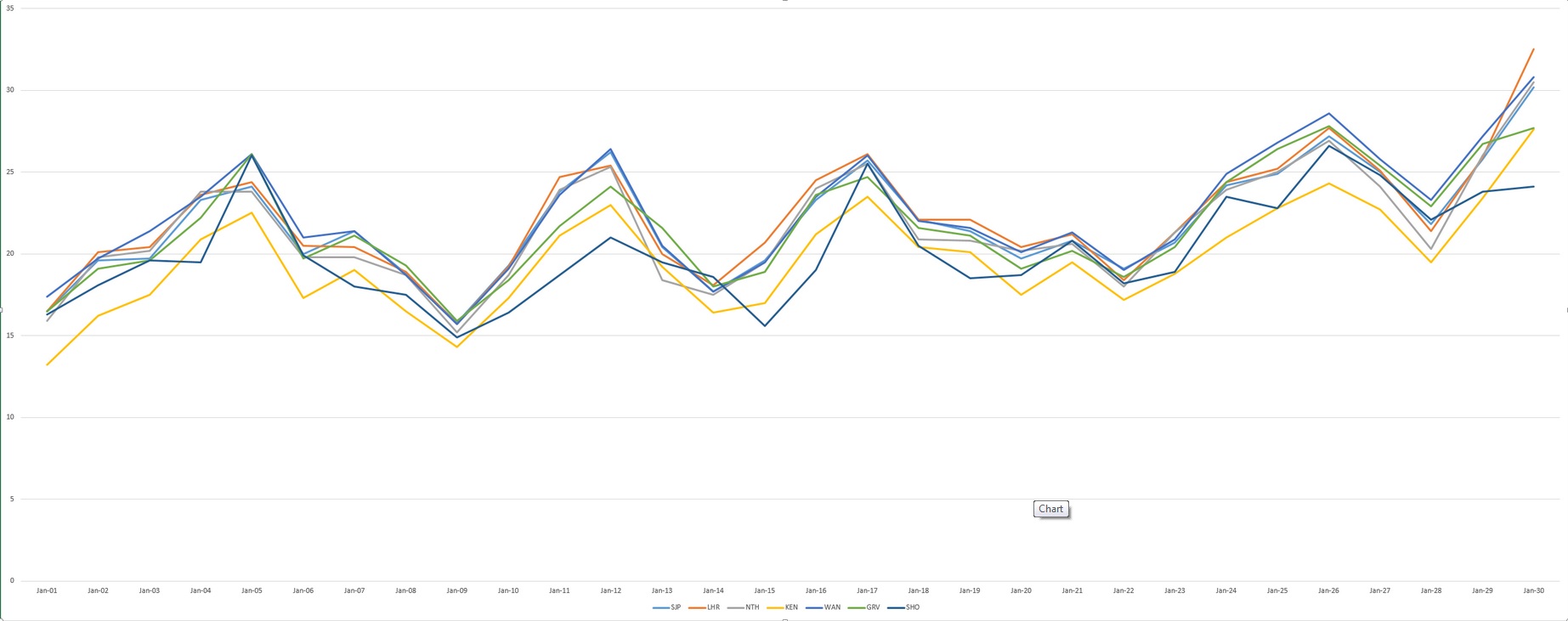
Before I trawled through the figures my initial gut reaction to this winter was that it would be mild – because of some blocking in September/October.

febAs well as my method of using rainfall and temperature I also considered other methods. One, of which I see mentioned very little these days, was Russian research that states that the weather pattern in the winter will be the opposite to the weather on September 17th and November 7th. This autumn September 17th was NE’ly and November 7th was SW’ly. So, of little use this year.

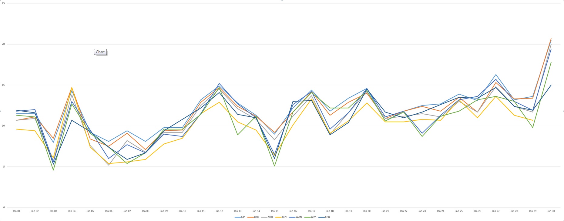
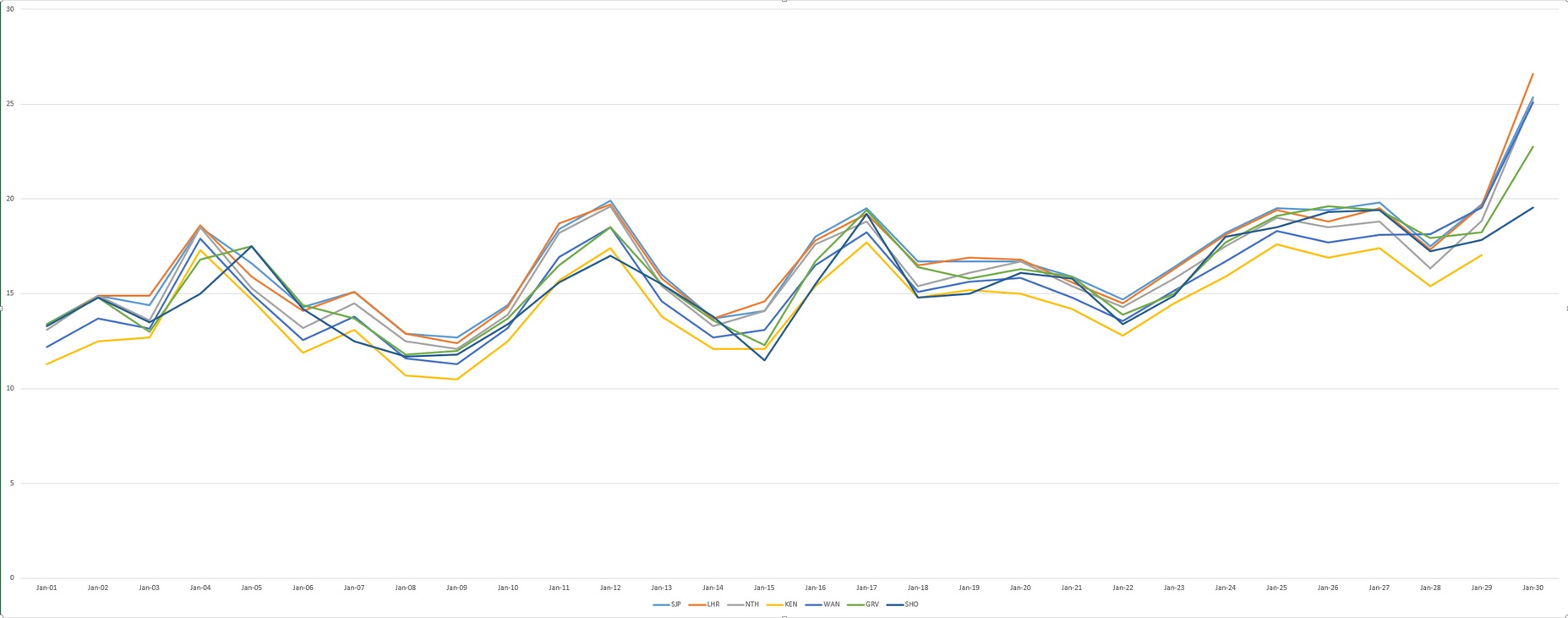
You can read the method 0f how I reached my conclusion here.

DJF max
This chart shows that the coolest spell is likely to be around January 27th


November 1940: London’s wettest on record

3:11:1940
The synoptic chart from 7am on November 3rd 1940 showed a deep depression crossing the country that brought over 40mm of rain to Greenwich Image: Courtesy of Met Office

November 1940 was the wettest on record for this area. Over 170mm of rain fell in Greenwich, beating the previous record set over a hundred years before in 1836.

Other areas of London were even wetter: Croydon was wettest with just under 196mm while Addington recorded just under 194mm, Bromley 179mm and Regent’s Park 175mm.

Nearly a quarter of the month’s rainfall fell on the 3rd. The total of 40.8mm is a daily November record that remains to this day. Indeed, throughout the month, there were falls of more than one inch (25.4mm) somewhere in the London area on four days: 40.8mm (3rd, Greenwich), 26.7mm (4th, East Ham), 26.4mm (11th, Camden Square), 27.4mm (13th, Southgate).

In Wanstead and Woodford the inclement weather coincided with a 6-day pause in bombing incidents during the Blitz. November was a very cyclonic month that probably hampered German air operations.

Another 6-day pause in the bombing happened after November 16th. When the Luftwaffe returned on Saturday, November 23rd, it was Wanstead that bore the brunt. At 4.12pm, as light was fading on a dull, dreary afternoon, high explosive bombs caused fires at and partly demolished nos 78 and 89 New Wanstead. A minute later another bomb ruptured water and gas mains in Spratt Hall Road. At 4.30pm a further high explosive bomb fell in the High Street, killing 4 people. The raid ended at 5.16pm as a bomb fell in Fitzgerald Road though this time there were no injuries.

By now the weather was beginning to quieten down though weeks of deep depressions with associated gales and heavy rain had taken their toll – many residents reported problems of Anderson bomb shelters being constantly flooded – but it was probably the design as much as the weather that was to blame.

As pressure built in the last few days of November the first frosts of winter arrived but the bombs returned. High explosive devices fell in Woodford New Road and Bunces Lane on the 30th, fracturing a water main.

To put November 1940 into some sort of perspective the average fall for the month in this area, with regard to the 1981-2010 average, is 59mm. The closest this area has come to matching the record was 2009 when 150mm was recorded and preceded a cold winter.

The following synoptic charts are for each day of November at 7am. All courtesy of the Met Office

October 2015: average temps and rather dry

This October was the coolest since 2012 though the mean of 11.7C is just 0.1C below average – nearly 2C colder than the same month last year.

The last week of the month saw the leaves turning in earnest. The horse chestnuts, such as this one in Wanstead Park however, turned much earlier because of the leaf miner pest

A persistent anticylone around mid-month pumped quite cool air from the north-east for a time, prompting some cold nights. Though we have yet to experience an air frost this autumn the ground temperature fell below freezing on five nights – that’s five occasions more than last year: -2C was recorded during the early hours of the 8th.

The month was rather dry: some 46.8mm of rain fell which is 70% of what we can expect in an average October. The wettest day was the 27th when 19.4mm fell. The heavy rain in the early hours of the 28th was quickly replaced by sunshine and a stunning day followed.

Just over 91 hours of sunshine were recorded – that’s 86% of what we can normally expect in an average October.

What has November got in store weatherwise? The models today (November 1st) suggest this week will see a gradual decline in conditions overall as the ridge from Europe weakens and weak Low pressure edges up from the south and SW. Thereafter it looks like winds will settle SW’ly as high pressure relocates to the south of the UK, bringing this area mild temperatures and mostly dry and bright conditions – though a little rain will be possible at times. Overall the models continue to have little appetite to serve us up anything remotely cold and stormy.

My long range outlook method suggests that November will be average to rather mild temperature-wise, a mean of about 8.9C, at 56% probability. The next highest probabilities are for rather cold or cold, at 18% probability. The chance of a very mild month comes out at just 6% probability.

The highest probability for rainfall is 69% for something average to rather dry, between 37mm and 59mm. A wet November comes in at 20% probability.

My data for sunshine only stretches back to 1878. The signal is for something average, at 60% probability.

Looking beyond November it is notable that October 2015 was very similar to October 1997 – the year another strong El Nino occurred. A very mild winter unfolded from 1997-98, though I’m sceptical about how much influence ENSO has on our part of the world.

With the sun lower in the sky at this time of year there's often a great opportunity for a decent sunset
With the sun lower in the sky at this time of year there’s often a great opportunity for a decent sunset

My October outlook for temperature was good in that I estimated that there was a 44% chance of the mean being average. My rain estimation was way out in that a signal for a rather dry October was only a 22% probability – though bearing in mind that the probability for a wet October was only 33% it is not surprising the outcome was wrong.

Here follows the full weather diary for October…Full stats for the month here:http://1drv.ms/1rSfT7Y

1st Sunny with just a few wispy clouds. Heavy overnight dew.
2nd Sunny and clear all day and evening. Mist thickened overnight with fog elsewhere in the UK.
3rd Misty start and cloudy till midday. Evenutally cleared to leave sunny spells. Cooler than yesterday.
4th Sunny start but with a few cumulus developing during the day. Clouding over during the night with few drops of rain from high-level feature before obs time.
5th Cloudy start with rain spreading in after midday, this being steady on and off into evening before turning to drizzle late evening and lasting into early hours. Another outbreak of rain at 9.30am to obs time.

There were five ground frosts during the month of October

6th Rain to start, some of it heavy. Drying up a bit at 11.30am. More rain in the evening and overnight into the early hours. Rain again at 9.20 until obs time.
7th Cloudy start but with rain moving in again. This rain dried up a bit at 11am but then more rain at 2.30pm before petering out and clearing overnight to leave it cold.
8th Sunny, clear start with just a few cirrus. More cloud at noon and through the day. Cleared at dusk to give a cold night and heavy dew.
9th Sunny start but cloud bubbled up from noon to give cloudier periods.
10th Bright start though stayed mostly cloudy and cool. Milder overnight than of late.
11th Sunny start with a bit more of a breeze. Some alto-cumulus late on made for a stunning sunset. Cloud overnight held up temperature.
12th Cloudy start, some brightness at 11am.
13th Cloudy, cold start with cloud off North Sea making it feel colder. Cloud was very thick at 3pm with drops of drizzle.
14th Clearer periods overnight saw temperature fall sharply but too much wind for frost.
15th Sunny with just a few cumulus – very cold wind though. Cloud thick enough at times for brief showers through day. Quite overcast at night
16th Cloudy start though with some brightness. Strong easterly breeze.
17th Cloudy though warmer than past week. Felt a bit muggy.
18th Cloudy and breezy start, cloud persisting through the day.
19th Bright start and was more glimpses of sunshine than past few days. However, cloud returned with a vengeance last afternoon – felt like it was getting dark at 5pm.
20th Cloudy all day. Clearer overnight.
21st Cloudy start. This turn to long sunny spells and a pleasant afternoon.
22nd Rain to start which fell until 2.30pm. Then outbreaks of rain into the afternoon. Cloudy and damp overnight.
23rd Bright start though mostly cloudy through the day.
24th Cloudy all day. Feeling colder.
25th Cloudy start with light rain around 10.40am then intermittent. Very heavy burst of rain after dark before the skies cleared to leave a cold night.
26th Bright start with cloud breaking to long sunny spells – pleasant in the sun. Temp fell away quickly at dusk. Precip was dew accumulation.
27th Sunny start. Some cloud developed through the day but then largely melted away to leave a warm late afternoon.
28th Cloudy start. This broke to sunny spells into the afternoon in Rye. Light rain seen in Rye at 8pm – this turned heavier into the evening but most fell at dawn.
29th Bright start but quickly clouding over with rain in the evening and overnight.
30th Light rain and drizzle to start then cloudy all day and overnight.
31st Bright start, the cloud gradually clearing to leave a warm afternoon.

September 2015: cool and rather dry

This September was the coolest since 1993. The average mean of 13.4C is 2C below average – a surprising statistic given that the month ended with many bright and sunny days with respectable temperatures. But, with the wind in the east, caused by an anticyclone anchored to the north of us at the end of the month, the air was dry and allowed temperatures to fall smartly away after dark. The average minimum temperature was just under 8.8C, 2.3C below average and the coldest since 1986.  convection

The month was rather dry: some 42mm of rain fell which is 81% of what we can expect in an average September. The wettest day was the 16th when 17.6mm fell.

Just over 140 hours of sunshine were recorded – that’s ‘on the nose’ of the monthly average and 20 hours more than was recorded during the very dull August.

What has October got in store weatherwise? The models today (October 1st) suggest an end to the fine and sunny weather as high pressure declines and is replaced by a trough moving up from the southwest on Monday. Less clear is how the weather evolves from then with the majority of models showing this feature opening the door to a lengthy period of SSW winds and possible rain at times. However, the rain would become more restricted to our northwest as pressure builds from the continent. So a return to something more autumnal looks likely though temperatures will remain on the mild side, especially at night.

This chart shows the low pressure system that brought September wettest day for this area

My long range outlook method suggests that October will be average temperature will be average temperature-wise, a mean of about 11.8C, at 44% probability. The next highest probabilities are for something cool, at 22% probability. Something rather cool or very cool comes out at 11%. There appears no chance for a mild month.

The highest probability for rainfall is 33% for something rather wet: between 84mm and 100mm. The next highest probabilities is for an average, rather dry and dry October at 22%.

My data for sunshine only stretches back to 1878. The signal is inconsistent so I would guess sunshine will be average.

My September outlook for sunshine was good in that I estimated that there was a 60% chance of average sunshine. Less good was the finding that there was only a 23% chance of a dry September – the highest probability was for something average. And my temperature estimation put the probability of a rather cool September at only 14%. So, all in all, not great.

Here follows the full weather diary for September…Full stats for the month here:http://1drv.ms/1rSfT7Y

1st Cloudy start though with some brightness. Small shower mid afternoon which was the edge of large storm that affected Essex.
2nd Sunny bright start though with lots of cloud from noon. Lots of convection.
3rd Cool, cloudy start. Some brightness but feeling cool in the wind. A few spots of rain.
4th Bright start with some sunshine tempered by the breeze. Mostly cloudy all day.
5th Light rain to start with brighter spells. Problem of being on the edge of high pressure. A sunny afternoon.
6th Sunny start with just a few clouds during the day.
7th Sunny start but cloud gradually increased during the day.
8th Cloudy start, overnight ‘rain’ was dew. Mostly cloudy all day. Warm overnight.
9th Cloudy start but a few holes appearing as the day wore on and sunshine at 1330.
10th Sunny start though with cloud bubbling up sunny spells followed. Clear with heavy dew overnight.
11th Sunny start with wispy cirrus – more cloud bubbling up during the day.
12th Cloudy start over overnight rain. This breaking up toward late morning to leave a sunny spells afternoon.
13th Cloudy start – this breaking up toward noon to leave bright afternoon. Some rain overnight.
14th Cloudy start, rain arrived soon after 10am and lasted over an hour. Then bright spells and more showers through the day and into the evening and overnight.
15th Cloudy start with heavy shower moving in at 12.30pm. Showers cleared through to leave cloudy early evening.
16th Cloudy start with rain spreading in at 12.30pm. Some heavy bursts through the day. Rain all the way in to work and torrential rain coming back from school at 5.30pm. Bursts through the evening and light drizzle was falling on way home at 1am, tending to peter out.
17th Sunny start tending to cloud in more.
18th Bright but cloudy start with clouds bubbling up. A heavy shower by 1pm.
19th Sunny all day with odd cloud. Warm in sun.
20th Sunny all day, any cloud decreased.
21st Spots of rain just before obs time. A mostly cloudy day. Heavy, showery rain between 5.30am and 7.30am.
22nd A cloudy, chilly day with rain after noon.
23rd Sunny, gin clear start. Clouding over by 2pm with rain at 1am.
24th Bright start after rain overnight. Sunny spells developing – a late shower at 1534. Dry and clear overnight.
25th Sunny start though with cloud bubbling up the sun disappeared at times. Cold overnight with a heavy dew.
26th Sunny and clear to start, though with cloudier periods through the day.
27th Sunny clear start with a few clouds bubbling up through the day. Mostly clear for lunar eclipse totality at 3.11am.
28th Sunny start with long clear periods during the day.
29th Mostly sunny with just some cirrus.
30th Sunny start with just a few cirrus. Stronger breeze than yesterday.

Varied summer climate leaves media stumped

Summer 2015 has got quite a bad press over the past couple of weeks but it hasn’t really been that bad overall in this area. And, as ever with the weather, it wasn’t without interest.

Though the summer was wet overall it was very dry well into July

Two extreme records were broken: The maximum on the 1st of July of 36.1C and the minimum on the 30th of July of 6.9C. There were also a couple of cracking thunderstorms.

Mean temperature for the three months was the lowest since 2012, the same year that saw more rain than this summer’s 167.7mm. Both 2012 and 2011 were a fair bit wetter than this summer and this season’s rainfall wasn’t a patch on some of the washout summers of my youth – both 1985 and 1987 were at least 150% wetter than summer 2015.

More notable was the lack of sunshine – it was the dullest summer since 2002.

Looking beyond Wanstead the perceived poor summer elsewhere was largely caused by cooler than normal sea temperatures west of Ireland, together with warmer water around the Azores. Simon Keeling explains this well here.

Three months ago I predicted that summer would be broadly average temperature-wise with average to slightly below average rainfall and average sunshine. So how did the forecast do?

In terms of temperature my predicted figure of 17.4C was 0.5C lower than the result. My rainfall prediction was only 76% of what actually fell and I over-estimated sunshine by 16%.

Despite some of the dire reviews of summer elsewhere in the UK there were some fine spells

With the Daily Telegraph reporting that the Met Office predicted a “dry, hot season” it’s probably not a bad effort.

summer2015

* The 1981-2010 average mean for summer in this region is 17.6C, with 144.9mm of rain and 564 hours of sunshine

August 2015: average, wet and very dull

This August was the third dullest since 1881. I’ve seen mentioned recently that August used to be regarded as an autumn month. For the past couple of years the final ‘summer’ month has been very disappointing for anyone looking for fine weather – much more akin to September or even October.

A storm in south London gave this eerie light seen at Southwark Bridge on the 5th

The first third of the month began pleasantly enough with a couple of days exceeding 27C. And on the 22nd the temperature reached 31.4C, only the third occasion that the mercury has risen above the 30C mark this summer. But summery highlights were few and far between.

Just under 120 hours of sunshine were recorded – that’s 62 per cent of the monthly average, the dullest August since 1968.

There were six occasions when the maximum exceeded 25C. Mean temperature for the month was 18.2C, which is on the nose of the 1981-2010 mean. Rainfall of 79.8mm was 159% of average. The wettest day occurred on the 24th with 18.4mm of rain.

What has September got in store weatherwise? The models today (September 1st) suggest a very slow progression of high pressure ridging into the UK from the west this weekend. Until then a cool northerly flow will persist with a mix of sunshine and possibly heavy showers. Most models suggest that by the end of the week a trough will run south, bringing a spell of cloud and rain before high pressure from the west eventually cuts off the cool northerly, replacing it with little or no wind, warmer sunny spells by day and misty nights – typical late summer / early autumn weather. Models then split over what will happen with the high next week. It could stay settled or, according to the ECMWF and GFS, the start of a breakdown could happen at the end of next week.

The synoptic chart shows the frontal set up that brought the greatest daily rainfall on the 24th

My long range outlook method suggests that September will be average temperature-wise, a mean of about 15.4C, at 52% probability. The next highest probabilities are for something rather warm and warm, both at 14% probability, though something rather cool also comes out 14% probability.

The highest probability for rainfall is 45% for something average. The next highest probability is for a dry September, at 23%. Rather wet works out at 14%.

My data for sunshine only stretches back to 1878. There is a 60% chance of average sunshine in September.

My August outlook was OK – I went for an average to rather cool August. I also said there was a 73% chance of a duller than average August – so not bad overall.

Here follows the full weather diary for August…Full stats for the month here:http://1drv.ms/1rSfT7Y

1st Bright but hazy start. Cloud gradually thinned to give a sunny afternoon with just a few clouds. Warmer.
2nd Sunny start with decreasing cloud.
3rd Sunny start quickly turned cloudy and blustery with brief burst of rain at 4pm. Then dry with variable cloud overnight and breezy.
4th Bright start but lots of cloud around and breezy. This lasting through the day.
5th Cloudy start, a few bright intervals and a strange light as thunder clouds passed to the south. Some light rain.
6th Cloudy start but cloud thinned to become sunny just before 2pm. Then variable cloud through the day with another eerie sunset.

Many places around the coast recorded far more sunshine than Wanstead, typical of the type of weather experienced in August

7th Sunny start though was very cloudy at times.
8th Bright start and cloud quickly melted away to leave a stunning, sunny day in Sussex and Camber. Some cloud was seen a few miles inland but even this eventually melted away. Night turned chilly with heavy dew by dawn.
9th Sunny until 3pm then a bank of cloud brought cloudier spells. Warm overnight.
10th Bright start with sunny intervals. A burst of rain at 2pm damped the ground then it was mostly cloudy for the rest of the day.
11th Cloudy, calm start, spits and spots of rain before more organised rain in evening.
12th Cloudy start then brief sunny spells late morning before clouding up again. Warm front stalled over South Coast dumping 32mm on Herstmonceux.
13th Cloudy with rain spreading in late morning, this lasting until 3pm with odd burst of drizzle for rest of night. Some 78mm in Polegate and flooding reported in Brighton.
14th Cloudy and very humid with some brightness late morning. Showers returned at 3.30pm then more general rain arrived at 8pm.

This radar shows the area of rain that brought over 10mm to Wanstead on 31st

15th Sunny start, clouded over at 2.30pm but then became sunny again at 5.30pm. Clear spells overnight.
16th Sunny start then cloudier in the afternoon. Very still air though made it feel pleasant.
17th Sunny start then cloudier around lunchtime. Sunny spells late afternoon though sun didn’t feel that strong.
18th Sunny start though quickly clouding over and dull. Some spots of rain on way to airport but dry in Wanstead.
19th Sunny start then going downhill with rain in the evening and overnight.
20th Bright start, clouding over.
21st Bright start before breaking to sunny spells and warm.
22nd Long sunny periods and 3rd occasion of 30C.
23rd Bright start but cloud built to give rain between 12.45 and 2.45pm.
24th Dull, rainy with rain between 9am and 11am.
25th Rain between 1pm and 3pm. Showers overnight then more general rain at obs time.
26th Dull and rain morning with squall blowing through at 1.30pm. Brightening up by 5pm then some bright spells late afternoon.
27th Bright start but with heavy cloud present. A brief shower in the afternoon before a clear evening made it chilly overnight.
28th Sunny start with light breeze, tending to cloud over middle part of the day. Skies cleared again to give sunny, pleasant evening.
29th Sunny start, cloud filled in by 3pm then rain arrived at 4pm, with moderate bursts.
30th Cloudy and humid start. Cloud stuck around all day – airless and therefore felt pleasant.
31st Cloudy start after overnight rain. The rain soon returned after 10.20am and fell, often heavily through until 12.30pm.

July 2015: average, wet and dull

The title of this monthly review is probably very misleading as July was a month that blew hot and cold.

The Casella 'check' thermometer registered 35.8C on July 1st - 0.3C lower than the AWS reading, within the contraints
The Casella ‘check’ thermometer registered 35.8C on July 1st – 0.3C lower than the AWS reading, within the contraints

The start of the month began with the July all-time record being set: 36.1C. The month ended with a couple of very chilly nights: 6.9C in the early hours of 31st with a grass minimum of 4.5C. I haven’t yet been able to go through my records but, according to the Met Office, temperatures in southern England on the same night that fell to 1C represent an all-time low July record.

There were ten occasions when the maximum exceeded 25C. Mean temperature for the month was 18.6C, 0.1C above the 1981-2010 mean and the coolest July since 2012. Rainfall of 70.4mm was 162% of average though it is worth noting that three quarters of this was recorded on two days.

There were 174 hours of sunshine recorded in this area which is 91% of what we can expect to see during an average July. The wettest day occurred on the 24th with 32.4mm of rain. There were two days of thunder recorded.

IMG_3877So what has August got in store weatherwise? The models this morning (August 1st) suggest very little change in the overall pattern of things. The jet stream is still well south across the Atlantic and is likely to remain so for the forseeable future. However, because we are on the eastern side of the troughed flow across the eastern Atlantic this allows the potential for some very warm or even hot conditions to be drawn up across the UK in the coming five days and possibly beyond. However, the longer projections turns the flow more west to east across the south of the UK again returning cooler air to the SE as well in week two.

This means a continuation of changeable conditions as low pressure remains anchored in the north-west or north of the UK. Thunder could be likely.

In contrast to the models my long range method suggests that we are in for a rather cool August, about 1C below average, at 41% probability. The next highest probability is for something average at 27% probability. So an average to rather cool August works out at 68% probability.

Rainfall is uncertain. There is the same probability for dry (50% average) and very wet (175% average): 23% probability. However, the next highest probability is for average at 18%.

This grainy image shows distant lightning illuminating a cloud. The storm was centred over St Albans
This grainy image shows distant lightning illuminating a cloud. The storm was centred over St Albans on July 16th

My data for sunshine only stretches back to 1878. There is a 73% chance of a duller than average August.

My July outlook was very poor, I predicted a rather warm to warm month – but it was nothing like last year’s or the 2013 classic. My rainfall and sunshine predictions were also hopelessly out. However, it was the first month since January that my temperature forecast has been wide of the mark. It’s just weather – in that it frequently doesn’t do what you think it’s going to do.

Here follows the full weather diary for July…Full stats for the month here:http://1drv.ms/1rSfT7Y

1st: Sunny until after midday when cloud bubbled up and took edge of temperature. Hottest July day ever was set at 5pm. Breeze made it feel bearable.
2nd: Sunny start though cloud quickly built with rain at midday. Just 0.3mm fell which evaporated on impact with the hot ground.
3rd: Sunny, clear day though humidity began to build from mid afternoon with the appearance of cloud. Still sunny spells till late into the evening. Big thunderstorm from around midnight for an hour.
4th: Sunny and muggy start. Long sunny spells, hardly a cloud in the sky until later. Sunny dawn but rain arrived at 9am.
5th: Light rain to start. This cleared late morning to sunny spells. Feeling muggy.
6th: Sunny start though lots of fair weather cumulus bubbled up.
7th: Cloudy start with light patchy rain around 11.30am, clearing to sunny spells. Some rain after 9am.
8th Cloudy and blustery with rain in the air. A few showers around.
9th: Sunny with just a few clouds, low humidity. Sky completely cleared after 3pm for a gorgeous evening.
10th: Sunny start. Some cloud bubbling up as jetstream neared – lots of cirrus and then cirrocumulus forming. Turned sunnier late afternoon. Also dawned clear and sunny.
11th: Long sunny spells with just a few cirrus and cumulus at times. Feeling warm and humid. Some light rain around midnight but not amounting to much.
12th: Cloudy and comparatively cool compared with recently. Light rain at 5pm with drizzle in wind through evening. More rain at 7.30am that fell intermittently up to obs time.
13th: Light rain to start with bursts through morning to 10.45am. Further bursts of light rain into early afternoon then overcast and muggy all night. More drizzle early am.
14th: Drizzly start – this continued into late morning. Then overcast and muggy. More drizzly burst overnight into the early hours – drizzle was persistent from 8.30am to 9am.
15th: Sunny intervals after light drizzle.
16th: Bright and sunny spells tending to turn more cloudy after midday. Big electrical storm around midnight with 67 flashes per minute seen to the north-west.
17th: Light drizzle to start turned to bright spells and a pleasant summer’s day.
18th: Sunny start with cloud bubbling up late afternoon. Light rain shower at 8.30 at end of Music in Wanstead Park and again in early hours at 6am.
19th: Sunny morning tended to cloud in at midday before cold front cleared to leave sunny evening. Mackerel sky at dusk with light rain at 8.15am.
20th: Showery rain to start.
21st: Sunny start but clouds bubbled up through the day for long sunny spells. Warm with a breeze.
22nd: Sunny start, cloud bubbling up during the day with spots of rain at 5pm – heavy shower in Wanstead.
23rd: Cloudy with occasional bright spells, feeling humid.
24th: Drizzly start. rain started falling at 11am. Outbreaks of prolonged rain through the day, heaviest between 5pm and 6pm. More rain after 8pm but then a drier interlude before more rain at midnight as occluded front came back. Last tip of the gauge just before 4am.
25th: Sunny and breezy though much cooler. A pleasant evening at John’s party though. Cloudy spells overnight before rain moved in at 9am.
26th: Rain to start with heavy outbreaks up to 1pm. Further outbreaks of rain through the day and into the evening.
27th: Drizzly bursts of rain to 11am. Then dry and bright.
28th: Bright and breezy to start. A light shower in evening then cool and clear – sunny start.
29th: Bright start but cloud filling in. Burst of rain at 8.30pm then variable cloud overnight.
30th: Bright but a burst of rain just after 10am. Then mostly cloudy with a few bright breaks.
31st: Sunny start but cloud filled in.

Fading faith in St Swithin

Legend has it that the weather on St Swithin’s will be the same for the next 40 days.

St Swithin’s day, if thou dost rain,
For forty days it will remain;
St Swithin’s day, if thou be fair,
For forty days ’twill rain na mair.

St Swithin’s Day is probably among the most well known of weather folklore – but, taken at face value, it is probably the most unreliable.

Grasslands around Wanstead Park have gradually turned brown because of the lack of rainfall since March

Since 1848 Wanstead and the surrounding region has enjoyed 93 dry St Swithin’s Days (56%). From these the longest dry spell that followed was just 18 days, in 2000. On average, if St Swithin’s is dry, the weather stays fair for 3 days, with rain arriving on the 18th. Many dry St Swithin’s Days (17%) are followed by rain the next day – these results skew the median for rain after a dry St Swithin’s to just 2 days!

Another interesting observation is that the 40-day period that followed a dry St Swithin’s is on average 13% WETTER than if it rained on July 15th.

So what does this mean for the rest of July and the summer? Looking back at other years that have seen a mostly dry and warm pattern in the run up to St Swithin’s Day we should see a continuation of frequently dry, warm and sunny conditions, interspersed with rainy days and, perhaps, thundery breakdowns. A typical British summer!

Putting superstition and singularities aside current weather models back this up.

St Swithun's reputation as a weather saint is said to have arisen from the translation of his body from a lowly grave to its golden shrine within Winchester cathedral, having been delayed by incessant rain for 40 days
St Swithin’s reputation as a weather saint is said to have arisen from the translation of his body from a lowly grave to its golden shrine within Winchester cathedral, having been delayed by incessant rain for 40 days

St Swithin was born around 800AD and died on July 2, 862, at Winchester, Hampshire. According to historians he was fond of building churches in places where there were none. St Swithin, who was bishop of Winchester, was buried in the churchyard of the Old Minster at Winchester, where passers by might tread on his grave and where the rain from the eaves might fall on it.

His reputation as a weather saint is said to have arisen from the translation of his body from this lowly grave to its golden shrine within the cathedral, having been delayed by incessant rain for 40 days.

The basis of the St Swithin’s saying follows the fact that by July 15th summer weather patterns are already well established and tend to persist through the coming weeks.

In meterological terms the position of the frontal zone around the end of June to early July, indicated by the position of the jet stream, determines the general weather patterns (hot, cold, dry, wet) for the rest of the summer. Like a little stream in its bed, the frontal zone tends to ‘dig in’ shortly after the summer solstice.

As the path of our weather systems is controlled by the jet stream, a more southerly location of the frontal zone – as happened last year – is likely to bring unsettled, wet and cool weather. On the other hand, a frontal zone shifted further to the north – as is happening this year – will help the Azores high to build over western Europe, thus bringing dry and pleasant weather to the UK.

Other western European countries also have similar St Swithin’s day sayings – that follow the principle rule. In France they say ‘Quand il pleut a la Saint Gervais Il pleut quarante jours apres’ – If it rains on St. Gervais’ day (July 19th), it will rain for fourty days afterward.
In Germany the Siebenschlaefer or seven sleepers day (July 7th, after the Gregorian calendar) refers to the weather patterns of the following seven weeks.

How accurate is Wanstead weather station?

The hottest July day on record was recorded at Heathrow airport on Wednesday 1st. The 36.7C recorded between 1500 and 1530 exceeded the previous record of 36.5C set at the Royal Horticultural Garden at Wisley, Surrey, in 2006.

The meteo is sited on the Aldersbrook Estate and uploads data to the web every 10 minutes, 24 hours a day

I recorded 36.1C in Wanstead, a reading that exceeded the previous July record of 35.9C set in 1868 – indeed it was the fourth highest temperature this area has seen since local records began in 1848.

Already, however, questions have arisen over the validity of the Heathrow value mainly because the official measurement far exceeded that of Northolt, an airfield and the closest official station, which recorded 35.7C, a full degree cooler.

I’ve always been a bit sceptical on the validity of airport readings – there’s a lot more concrete at Heathrow than Northolt and obviously far more jet engines. The previous July record at Wisley is surely far more representative of standard conditions? I fear that with a new runway Heathrow will only get hotter and, perhaps, a review of the official MetO station should be taken.

I’m often asked why my own station is not used for official readings. The simple answer is that, being in a suburban garden, it is too sheltered to qualify for the open exposure that the Met Office demands.

But, apart from the exposure, everything is as representative as possible to conditions set by the Met Office. When readings differ it is simply because the character of the area is warmer or colder than official stations, the closest of which is St James’s Park.

maxima
Maxima for stations near Wanstead SJP: St James’s Park, LHR: Heathrow, NTH: Northolt, KEN: Kenley, WAN: Wanstead, GRV: Gravesend, SHO: Shoeburyness
minima
Minima for stations near Wanstead SJP: St James’s Park, LHR: Heathrow, NTH: Northolt, KEN: Kenley, WAN: Wanstead, GRV: Gravesend, SHO: Shoeburyness

To try to quantify this I’ve had a look at all the official stations around Greater London throughout June. The results show that readings from Wanstead are remarkably similar to other stations.

I first had a look at maxima which revealed that Wanstead is 0.3C warmer than Heathrow and 0.6C warmer than St James’s Park.

mean
Mean for stations near Wanstead SJP: St James’s Park, LHR: Heathrow, NTH: Northolt, KEN: Kenley, WAN: Wanstead, GRV: Gravesend, SHO: Shoeburyness
rain
Rainfall for stations near Wanstead SJP: St James’s Park, LHR: Heathrow, NTH: Northolt, KEN: Kenley, WAN: Wanstead, GRV: Gravesend, SHO: Shoeburyness

Minima, on the other hand, revealed that Wanstead was 0.5C cooler than Heathrow and 0.9C cooler than St James’s Park – a stark illustration of how much warmer inner London is than the suburbs.

This obviously had a bearing on the mean temperatures of the region, Wanstead being 1.1C cooler than Heathrow and 1.2C cooler than St James’s Park.

In terms of rainfall Wanstead was wettest, but only by 4mm.

So, all in all, the weather station at Wanstead is a pretty good measure of our local climate, as close as possible to what official conditions for measurement of climate demand.

I am currently in the process of trying to find a site local to the area that will fulfil Met Office conditions but it is a long, drawn-out process that will take time to organise.

Maxima for stations near Wanstead SJP: St James's Park, LHR: Heathrow, NTH: Northolt, KEN: Kenley, WAN: Wanstead, GRV: Gravesend, SHO: Shoeburyness
Maxima for stations near Wanstead
SJP: St James’s Park, LHR: Heathrow, NTH: Northolt, KEN: Kenley, WAN: Wanstead, GRV: Gravesend, SHO: Shoeburyness
Minima for stations near Wanstead SJP: St James's Park, LHR: Heathrow, NTH: Northolt, KEN: Kenley, WAN: Wanstead, GRV: Gravesend, SHO: Shoeburyness
Minima for stations near Wanstead
SJP: St James’s Park, LHR: Heathrow, NTH: Northolt, KEN: Kenley, WAN: Wanstead, GRV: Gravesend, SHO: Shoeburyness
Mean for stations near Wanstead SJP: St James's Park, LHR: Heathrow, NTH: Northolt, KEN: Kenley, WAN: Wanstead, GRV: Gravesend, SHO: Shoeburyness
Mean for stations near Wanstead
SJP: St James’s Park, LHR: Heathrow, NTH: Northolt, KEN: Kenley, WAN: Wanstead, GRV: Gravesend, SHO: Shoeburyness

June 2015: a little above average, very dry

June finished hot in complete contrast to the opening few days which were a continuation of a disappointing May.station

There were six occasions when the maximum exceeded 25C – the highest being 30.8C on 30th, the warmest June day for four years.

Mean temperature for the month was 16.9C, 0.8C above the 1981-2010 mean. Rainfall of 17.5mm was 34% of average – the last three Junes have been notably dry.

There were 189.5 hours of sunshine recorded in this area which is 106% of what we can expect to see during an average June. The wettest day occurred on the 20th with 11.1mm. There were two days of thunder recorded.

So what has July got in store weatherwise? The models this morning (July 1st) suggest a battleground between Atlantic cooler air and hot continental air, a common feature at this time of year. The persistent heat on the continent looks like it will waft back and forth across the south-east – creating the risk of thundery downpours as it meets resistance from successive cold fronts.

Just 17.5mm of rain fell in June - 34% of average
Just 17.5mm of rain fell in June – 34% of average

The model output suggests the Atlantic air will eventually win through, allowing more changeable conditions in a week’s time. There is also a signal that high pressure will re-establish with a return to fine and very warm weather. As things stand the models remain finely balanced.

In contrast to the models my long range method suggests overwhelmingly that we are in for a warm July, up to 1.7C above average, at 60% probability

The next highest chance is for rather warm at 40% probability. If you add the probabilities together the chance of a rather warm to warm July can be put at 100% – perhaps a repeat of last year’s and 2013’s classic July is about to unfold?

Rainfall is looking below average, at 60% probability. There’s obviously a risk here that a couple of direct hits from thunderstorms would see the monthly total exceeded. I don’t have enough data to estimate sunshine but I would guess average to slightly above.

My June outlook was only good in that it ruled out any chance of a very warm month – the final mean was rather higher than I thought. I was also out with the very low rainfall – the signal was for something average. Sunshine was broadly average as I’d estimated

The Heronry Pond in Wanstead Park is suffering low water levels again
The Heronry Pond in Wanstead Park is suffering from low water levels again

Full stats for the month here: http://1drv.ms/1rSfT7Y

Here follows the full weather diary for June…

1st Sunny, bright start quickly turned cloudy with intermittent drizzle through the day. Turned windy at 6pm and was really blowing around midnight.
2nd Drizzle in the wind at obs time and very windy, wind only decreasing by evening. A dreadful day though warm.
3rd Sunny start though cloud gradually increased. Feeling humid and summery at last.
4th Sunny start with cloud dotted with alto cumulus and cirrus. Rain between 5am and 6am – though storms passed to our west and east.
5th Bright start after earlier rain – the thunderstorms seemed to pass to our west and east. Very humid and felt oppresive in the morning.
6th Sunny start with cloud bubbling up. Much cooler and fresher feel. Lots of long sunny spells.
7th Sunny, gin clear start. Just a few fair weather cumulus all day. Gorgeous.
8th Bright start though alto cumulus shaded early sun. Variable cumulus after that – feeling chilly.
9th Cloudy and brisk wind from NE. Feeling chilly.
10th Bright start with sunny intervals throughout the day.
11th Sunny start with few cirrus, sky then completely cleared.
12th Sunny start though cloud bubbled up through the day – felt very close at sports day. Distant thunder heard at 8pm with light rain – much less than was threatened.
13th Cloudy start, mostly calm, still and dull – a real nothing day though some late brightness after 2pm pushed up the temperature briefly. Mild overnight with some light drizzle before obs time.
14th Drizzle in the wind up until 11pm and falling temp. Then a brief sunny interlude before it was cloudy again.
15th Cloudy start then briefly clearing before, at 1pm, more cloud appeared. Clear overnight allowing temp to fall until 4.10am but clouding over by morning – bright warm sunshine at 9am.
16th Sunny start but very cloudy at times. This continued all day – though the night was cloudier hence warmer.
17th Sunny start but with lots of cloud around.
18th Lots of long suuny spells but cooler than yesterday.
19th Cloudy up until 11.30pm and cooler. Broke to sunny spells and much warmer at 2pm.
20th Bright start though warm from started pushing through just before 1pm. Some sunny breaks but rain pushed in. Was in Cheltenham but Woodford Wells reported thunder:  Between 1650and 1730 12mm fell followed by a decreasing amount of 2.4mm up to 1814  all BST Two thunder claps at 1715 and 1728.
21st In Cheltenham it was a mostly cloudy day though with more sunny intervals after midday. Rain spread in just before midnight with more in the early hours.
22nd Cloudy start though with brief sunny break at 10am. Some drizzle 11.15am then drier with sunny intervals.
23rd Bright start. Cloud broke to give warm sunny spells .
24th Sunny periods after a rather cloudy start. Felt very warm in the sun during walk around London with Neil and family.
25th Sunny start though hazy cloud developed from 10.30am, rather obscuring the sun at times, though it was bright all day. 26th Warm till late into the evening – still 18C at 11pm.
26th Bright start though cloudy, broke to sunny spells and felt warmer than forecast.
27th Sunny start though with cloudier spells all through the day. A very warm evening.
28th Sunny start quickly became cloudy with rain turning up at noon during early lunch. This later cleared to sunny spells and a pleasant afternoon.
29th Sunny start though with high cloud obscuring the sun at times.
30th Sunny, gin clear all day. only ‘cloud’ was distant grass fire.

The 30th was wall-to-wall sunshine until late in the evening when alto-cumulus and cumulus were observed