Tag Archives: wanstead

April 2015: very dry and sunny

April showers bring spring flowers – or so the saying goes. The month was actually sunny and very dry with less than 50% of what falls in a normal month.

The cold nights and often chilly days helped to preserve spring blossom, with some stunning displays on streets around the borough.

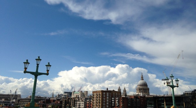
Indeed just one day, the 30th, was what you could say was a classic April day – a sunny, clear morning saw convection build towering cumulus clouds with a light shower around lunchtime.

Mean temperature for the month was 10.6C, 0.8C above the 1981-2010 mean, over 1C cooler than April last year. Rainfall of 18.9mm was 45% of average – six of the last seven Aprils have been notably dry.

There were 201 hours of sunshine recorded in this area which is 126% of what we can expect to see during an average April. The wettest day occurred on the 25th with 4.7mm. Air frosts: 5 Ground frosts: 13

So what has May got in store weatherwise? The models this morning (May 1st) suggest next days remain unchanged with troughs moving NE across the UK over the weekend introducing warmer air with a mix of sunshine and showers following. A new LP looks like developing over western France on Monday becoming absorbed in the main low to the west of the UK bringing a more sustained westerly feed ahead of rising pressure from the south later toward the weekend, bringing fine and summery conditions. The risk of rain should decrease as the week goes on.

Beyond that the outlook, as ever, is uncertain.

My long range method suggests the month will be average in terms of temperature: 80% probability. The next highest chance is for rather mild at 20% probability. Rainfall is looking average to slightly below average, though at only 60% probability. It looks like another sunny month is in prospect – 80% probability of sunshine at 1.2 times the mean.

So with a slightly changable start to the month we can look forward to another sunny, pleasant spring month without heatwaves?

Long spells of cirrus gave a solar halo on the 17th.

My April outlook was good in that it ruled out any chance of a very mild or very cold month. The combined probability of 72% for an average to rather mild month was correct. I was, however, completely off with the rainfall, the signal for which was greater than average

Full stats for the month here: http://1drv.ms/1rSfT7Y

Here follows the full weather diary for April…

1st: Bright start but very breezy through the morning and afternoon. Rain after 11pm and again at 3.30am.
2nd: Bright start though sunny spells increased through the day. Felt really pleasant out by noon. Some rain in the early hours before obs time.
3rd: Cloudy through the day with some rain late afternoon.
4th: Cloudy all day though with some drizzly rain. Some brightness was seen on way in to South Kensington in the Whitechapel area.
5th: Cloudy, cold start but with sunny spells developing through the day. Pleasant in the sun.
6th: Sunny start with cloud building from time to time. Cloud cleared overnight to give a ground frost.
7th: Sunny start with long clear periods through the day.
8th: Cloudy start gradually cleared to hazy sunshine. Cloudier again in afternoon.
9th: Cloudy start though soon brightening up for a sunny day in town.

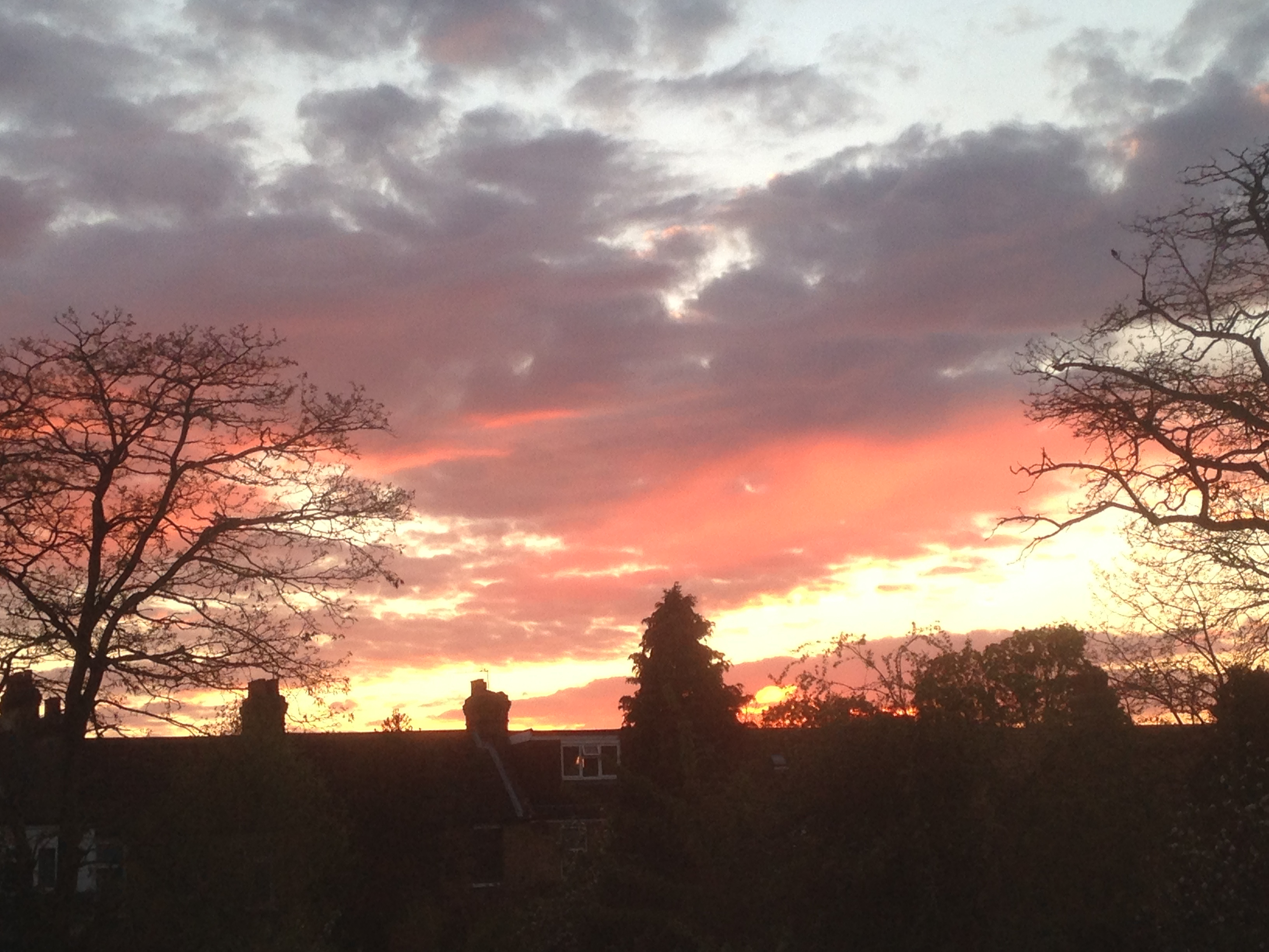
Typical April days of sunshine and showers were in short supply. There were some stunning sunsets, including this one on the 30th

10th: Cloudy start though cloud quickly thinned to leave sunny day. However, cloud was hazy at times with bad pollution seen over London. Also a few drops of rain were observed rain around edge of Ornamental Waters. Humid.
11th: Drizzle turned to moderate rain that was over in 45 minutes and cleared to sunny intervals, then longer sunny periods through the day. Much cooler than yesterday.
12th: Sunny start led to a day of long sunny spells. Sky was initially a deep blue but hazy cumulus built up after 4pm.
13th: Cloudy start, some brightness in the afternoon.
14th: Sunny, gin clear start. Sunny all day with light breeze taking edge off temp.
15th: Sunny, clear start for RMetS meeting. Slight breeze kept edge off temp. Some light clouds late afternoon. Cooling off quickly in early hours.
16th: Sunny spells in the morning.
17th: Sunny though long spells of cirrus gave a solar halo. Chilly in the wind.
18th: Sunny spells to start though cloud decreased to leave gin clear afternoon. Dew point dropped to 1.5C making it feel very chilly.
19th: Bright start but cloud quickly filled in leaving it feeling cold in the wind. Some sunshine after 5pm making it a pleasant if a bit cold in the wind evening.
20th: Sunny and mostly clear all day. Much warmer.
21st: Sunny and mostly clear all day. More contrails though. Chilly overnight again.
22nd: Sunny start though cloud filled in earlier than yesterday. Nowhere near as warm.
23rd: Cloudy start though the cloud decreased and was gin clear by 12.15pm.
24th: Sunny start although hazy at times. Cloud gradually increased late afternoon and light rain arrived 1am.
25th: Cloudy start though plenty of breaks in the cloud developed allowing for a pleasant afternoon.
26th: Slight drizzle to start then cloudy and cold all day. Cold overnight in clearer spells.
27th: Sunny start. Clouds bubbled up though the day with showers reported elsewhere. It threatened rain in Wanstead but stayed dry.
28th: Sunny start with just a few clouds through the day. Feeling cold though.
29th: Light rain to start though this suddenly cleared at 10.15am before clouding over again.
30th: Sunny start with clouds bubbling up. A light shower in Snaresbrook.

Veteran trees that make Wanstead Park

As the trees in Wanstead Park start bursting into life it is interesting to note that the oaks seem to be beating the ash trees into leaf.

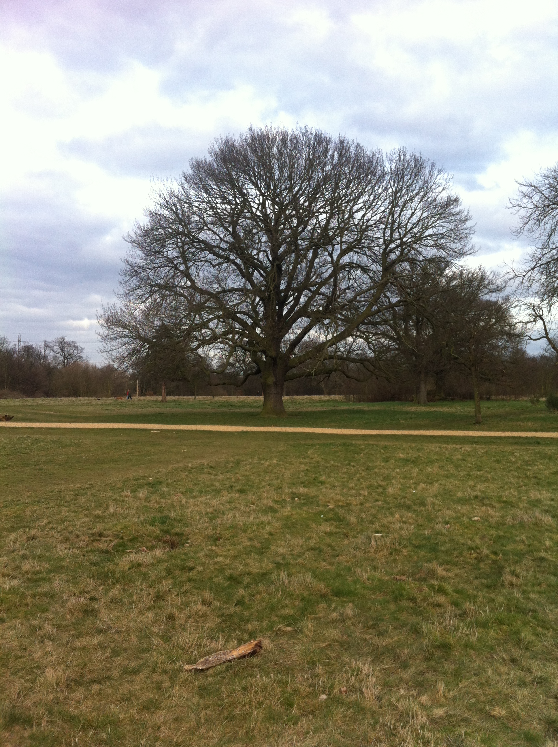
One of the magnificent oaks that provide the backdrop to Music in WansteadPark was in leaf on Friday, April 11th.

After the dry vernal equinox period this could be another sign of a dry summer to come as the saying goes…

If the oak before the ash then we’ll only see a splash.

If the ash before the oak then we’re sure to get a soak.

The story behind the mature trees in Wanstead Park – several of which will turn 200 this year – is a fascinating one.

The park is virtually on my doorstep and it’s like watching a living painting as the trees change from season to season. Spring is my favourite time of year, as the character of the park transforms so quickly. Chalet Wood bursts into colour with a carpet of bluebells, and leaves once again clothe the trees.

Magnificent specimens of oak, horse chestnut, sycamore and holly stand alongside half-rotten victims of gales over the last 200-odd years. But despite storms and floods, the biggest nemesis to these trees was the former owner of the park, William Long-Wellesley. As well as demolishing Wanstead House in 1823 to help clear his debts, Long-Wellesley also sold thousands of mature trees, despite local opposition and a court injunction brought by Sir Edward Sugden, who was seeking to restrain Long-Wellesley’s depredations on his children’s inheritance.

A court report from the time states that Long-Wellesley had marked 2,000 trees for sale, which would have included hardwoods, such as oak, chestnut and elm and perhaps walnut and lime. To quantify that figure, it should be noted that the last full tree survey of the park, not including Bush Wood, in April 1990, listed just over 800 trees.

Richard Arnopp, committee member of the Friends of Wanstead Parklands, said: “There is general agreement that Long-Wellesley left the park more or less devastated, but the wooded areas subsequently regenerated within their former footprints, helped by later planting and management by the Corporation of London.”

It is not clear who bought the trees, though oak was especially valuable at the time for shipbuilding, which was still some decades away from the shift from timber to iron. Britain was at the end of the first Industrial Revolution and timber suitable for making masts, a crucial requirement for any sailing ship, and one that often had to be replaced after storms or wear, was difficult to find.

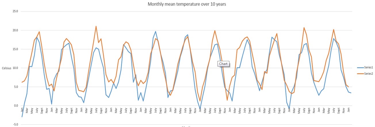
This graph shows the monthly mean temperature for the periods 1814-1825 (series  1, blue line) and 2004-2015 (series 2, orange line). Notice how much colder most winters were 1814-1825
This graph shows the monthly mean temperature for the periods 1814-1825 (series 1, blue line) and 2004-2015 (series 2, orange line). Notice how much colder most winters were 1814-1825

It was also a cold period. Just over 10 years previous the Thames froze over for the last time and winters were frequently very cold and snowy. Wood was one of the principal methods of keeping warm – house fires would have been burning through the winter – anyone with a wood stove would know just how much wood you can get through, even in an average winter.

As well as selling timber, Long-Wellesley reportedly sold the topsoil of Wanstead Flats to nurseries as potting compost. Most of the mature trees in the park today would have been saplings in the 1820s, thus escaping the attention of Long-Wellesley. According to the Debois survey from 1990, the cedar tree near the Ornamental Water has this year reached its 200th birthday. Also 200 years old this year are the three magnificent oaks next to the Temple, one of which has increased in girth from 319cm to 372cm since 1990.

The trees were protected for future generations when the Epping Forest Act was passed in 1878. Since that time, the Corporation of London has managed their welfare and a new initiative will soon step up this care and reinstate even more of what was lost during Long-Wellesley’s tenure.

* There is much more detail at the site http://www.wansteadpark.org.uk/

** The author has studied forestry and arboriculture at Capel Manor College in Enfield

March 2015: dry and sunny with av temps

The saying March: in like a lion, out like a lamb and vice versa is frequently wrong. This March saw it windy at the beginning, end and middle of the month.

This graph shows the 'wind run' of every day in March. Notice how the peaks are at the beginning, middle and end of the month
This graph shows the ‘wind run’ of every day in March. Notice how the peaks are at the beginning, middle and end of the month

Mean temperature for the month was 7.6C, 0.1C below the 1981-2010 mean, over 1C cooler than March last year. Rainfall of 17.9mm was 44% of average – four of the last five Marches have been notably dry.

There were 131.5 hours of sunshine recorded in this area which is precisely 121% of what we can expect to see during an average March. The wettest day occurred on the 29th with 4.2mm. Hail fell on 1 day. Air frosts: 5 Ground frosts: 13

So what has april got in store weatherwise? The models this morning (April 1st) suggest a dominance of high pressure though there’s lots of uncertainty as to where this will drift once it has formed over the Easter weekend. If it moves north there is a risk of chilly easterly winds at times that will take the edge off temperatures.

Rainfall amounts will be small after the next couple of days though sunshine amounts will be reduced if we get the cold easterly feed off the continent. Beyond that the outlook, as ever, is uncertain.

My long range method suggests the month will be average in terms of temperature: 43% probability. The next highest chance is for rather mild at 29% probability. Rainfall is looking greater than average, though at 57% probability.

My March outlook was good in that it ruled out any chance of a very mild month. Though the signal was for a cold month overall I think the fact that Scandinavia and Russia had a relatively mild winter meant that the resulting overall temperature was far milder than it normally would have been, given the air flow.

treewpFull stats for the month here: http://1drv.ms/1rSfT7Y

Here follows the full weather diary for March…

1st: Sunny start with more cloud afternoon and a rain squall sweeping through at 5.30pm. Cold wind.
2nd: Sunny start though cold wind. Odd shower.
3rd: Sunny start but with cloudier periods and odd spot of rain up to 2pm. Skies turned really dark to the north but no reports of heavy rain. Cold overnight but no air frost due to the wind.
4th: Sunny spells with cloudier intervals.
5th: Sunny, frosty start. Cloud bubbling up with sun becoming scarcer.
6th: Sunny and clear with just a few cirrus.
7th: Sunny start, just a few cirrus though more breeze
8th: Sunny start though more clouds bubbling up than yesterday.
9th: Sunny start was quickly replaced by overcast conditions. Spots of rain on way into work – signs of something heavier when left work at midnight. Clear again by morning.
10th Sunny start with some cirrus type haze. Cloud bubbled up but sunnier than yesterday.
11th: Sunny start, cloud growing thicker through the day before a pink sunset. Some light rain before a clear night.
12th Sunny start and just a few clouds around. Cloud thicker in afternoon.
13th Hazy bright start though cloud thickened.
14th: Sunny start quickly turned cloudy and dull. More brightness in afternoon though cold wind. Early shower at 6.30am.
15th: Dull start into the morning. Some light rain late morning and during the afternoon. More rain after midnight and just beofre dawn.
16th: Cloudy start though with bright intervals in the afternoon. Area of light rain around 4am.
17th: Cloudy start with light rain spreading in. Brighter by 1pm though very misty on ride in to work. Misty again overnight.
18th: Cloudy, misty start though much more sunshine than yesterday on ride to Lea Valley. Cloudier overnight.
19th: Cloudy and dull all day, feeling cold – the cloud persisting into the evening.
20th; Cloudy start for the eclipse. The sky cleared about 12.30pm to leave bright sunshine and a pleasant, springlike afternoon. Early ground frost before sky clouded over.
21st: Cloudy but some spots of drizzle mid-morning. Dry and cloudy afternoon.
22nd: Sunny start though cloud increased through the day. Felt cold in the wind.
23rd: Bright start with lots of sunshine through the morning. Gradually filling in though feeling much milder than of late. Some light rain in the evening, heaviest between 3.30am and 5am.
24th: Cloudy start though with some bright spells. A short shower at 3ish.
25th: Sunny, cloudy start though with lots of high cloud filling in. Brief ground frost moved in just before midnight before rain moved in just before 4.30am.
26th: Drizzly light rain to start – felt cold. Not a nice day.
27th: Bright start with lots of watery sunshine through the day. Spits and spots of rain later as walked home from Wanstead.
28th: Cloudy start and mild with some brightness. Feeling mild. Some rain overnnight.
29th: Drizzly start with heavier bursts of rain, these fell through the day, drying up in the evening.
30th: Bright start with some sunny spells. Wind increased in strength through the day and was very strong overnight.
31st: Bright start after a stormy overnight that prompted a tug rescue that overturned in the Solent. Dartford Bridge was also closed. Showers surrounding Wanstead but only trace here – hail seen in City. Cold and windy overnight.

Eclipse 2015 in Wanstead

While heavy low cloud obscured the partial eclipse in this area there were a couple of interesting factors that I observed.

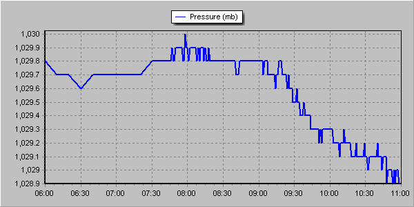
At 9.45am, shortly after the maximum obscuration of the solar disc the air pressure suddenly dropped. This coincided with sudden relief to my blocked nasal passages, symptoms of which appeared last night. Eighteen minutes later the fall in air pressure became less steep and the nasal symptoms returned.

The pressure dropped from 1029.8mb at 9.15am to 1029mb at 10.15am. I'm not sure if it was an effect of the eclipse or just a change in the synoptic situation that would have happened anyway
The pressure dropped from 1029.8mb at 9.15am to 1029mb at 10.15am. I’m not sure if it was an effect of the eclipse or just a change in the synoptic situation that would have happened anyway

As the light began to fade it seemed to turn colder though, on looking at the actual figures, the effect of the partial eclipse through heavy cloud was a depression in temperature of 0.3C. I worked this out by comparing today with yesterday which had almost identical weather conditions. People remarked that it turned noticeably colder though perhaps this was more caused by standing out in temperatures of 4.9C for a long period.

Like the eclipse in 1999 I noticed that the birdsong quietened somewhat though there was not the same crescendo of noise that you normally get at dusk when birds roost.

Here is the temperature trace from the 19th. Even with the heavy cloud yesterday there was more warming from the sun, albeit by a very small 0.3C
This graph shows the temperature from 6am until 11am. Though the depression during the eclipse was just 0.1C comparison with the previous day, which saw near identical weather conditions, shows just how much solar heating was depressed

Winter 2014/15 – second sunniest on record

This winter was the second sunniest on record in this region. Sunshine hours totalled 238 hours during December, January and February – that’s 142% of average and second only to 2007/08.

It was the sunniest December on record in the series going back to 1979. Some 11 mornings were completely clear at the 9am observation time
Winter 2014/15 was the second sunniest on record with 238 hours of sunshine

The first lying snow for two years is also a notable observation of winter 2014/15. That it lasted just a few hours emphasises how little snow there was at sea-level for the second winter in succession.

The mean temperature of 5.2C was just 0.3C below the 1981-2010 average. Some 152mm of rain fell – that’s just 7mm over the winter average.

Winter began with the sunniest December on record in my series going back to 1877. Over 90 hours of sunshine was recorded in this area which is 224% of what we can expect to see during an average December.

January saw the first falling snow in nearly two years with the last three days of the month seeing the first flakes of winter – nothing much to write home about by average winter standards.

February produced the first lying snow in nearly two years. The 1cm depth at 9am on 3rd, however, is nothing much to write home about by average winter standards.

The wettest day during the three months was January 12th when 13.1mm fell.

Snow fell on 6 days. Air frosts: 27 Ground frosts: 48

Full stats for winter can be found here: http://1drv.ms/1rSfT7Y

At the end of November I published my annual winter forecast. I said the season would *probably* be colder with a better chance of snow than last winter. If I’m honest I thought we’d see more incidents of snowfall though, with my predicted mean temperature of 4.2C being exceeded by 1C, the air around the UK just wasn’t cold enough for snow at sea level. My predicted rainfall was more impressive – I forecast 156mm and was out by just 4mm!

Obviously when the season is average long-range forecasts like this have a much higher chance of being correct. One could argue that basic climatology has made my forecast look a reasonable one. But I stick to what the stats suggest and try to steer clear of the endless hyperbole published almost daily by certain tabloids.

February 2015: average

feb3rd snow
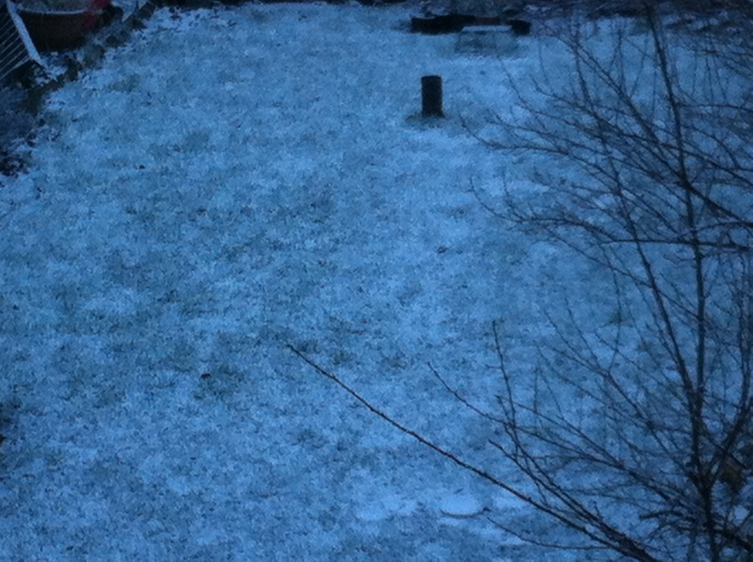
A snowfall on the 3rd just about covered the ground for a few hours, though was barely enough to make a snowball

Though it only lasted a couple of hours this February saw the first lying snow in nearly two years. The 1cm depth at 9am on 3rd, however, is nothing much to write home about by average winter standards.

Mean temperature for the month was 4.9C, 0.4C below the 1981-2010 mean, 2.5C cooler than the mild and stormy February of last year. Rainfall of 43.6mm was 111% of average.

There were 73.6 hours of sunshine recorded in this area which is precisely 100% of what we can expect to see during an average February. The wettest day occurred on the 19th with 8.7mm. Snow fell on 3 days, hail on 2. Air frosts: 4 Ground frosts: 19

So what has March got in store weatherwise? The models this morning (March 1st) suggest a taste of spring – the recent cold and showery regime being replaced by quiet, anticyclonic weather. Output suggests variable cloud cover with a mild SW wind. Obviously sunny days will see quite respectable temperatures though any clear nights will see frost and mist developing.

View from top of Ditchling Beacon in Sussex during a  half-term walk
View from top of Ditchling Beacon in Sussex during a half-term walk

Beyond that the outlook is uncertain. Using a similar method to my Christmas forecast, which was correct at 25 days ahead and my January and February outlooks, I’ve had a look back in the archives to see if there is any precedent in the pattern we’ve had this February.

There appears no chance of a very mild March. The strongest signal (67%) is for a cold March. The strongest signal for precipitation is for average to slightly below (83%). Sunshine, no overall signal, so my guess is average.

Though we are now out of the meteorological winter there is still a risk of snow. Any falls, however, would be thin and transitory because of the strength of the sun now.

Full stats for the month here: http://1drv.ms/1rSfT7Y

Here follows the full weather diary for February…

1st Bright start with sunny spells thoughout the day

2nd Sunny start but soon clouded over. Cleared again in evening though with lunar halo. Showers moved in after midnight and into early hours to leave thin coating of snow by 8am.

3rd 1cm at 9am. A bright start though with lots of cloud around. Sunnier in afternoon, the snow had melted by 1pm. Variable clear spells through the night but too cloudy for frost.

4th Cloudy start but some brightness. The sunshine felt warm at times. Variiable cloud overnight. Woke up to see snow falling but too warm to settle – the air being 1.2C, dew point 0.5C

5th Some spots of sleet to start and during the day. Colder air digging in from 3pm. Feeling bitter.

6th Bright start, cloud decreasing through the day to give long sunny spells. Cold wind

7th Cloudy and cold start

8th A sunny start with long sunny spells all day

9th Mostly cloudy to start though bright and breaking to sunny spells and then unbroken sunshine.

10th Cloudy and cold all day

11th Dull and cloudy all day

12th Dull start and stayed dull all day. Cold. Warming up after 2am with some very light rain with warm front.

13th Bright spells through the morning with a brief clearance around 1pm. Rain soon arrived though and fell through the afternoon and into the evening. Rain again from midnight until 2am

14th Bright intervals to start though mostly cloudy through the day. Some very light rain showers through the day and into the night

15th Cloudy start though with bright intervals becoming more frequent. Clear by dusk allowing temp to fall quickly

16th Cloudy start with rain spreading in after 1pm, moderate at times

17th Unbroken sunshine until 1pm then a few clouds. Cold overnight on boat

18th Sunny most of the day with only a few high clouds

19th Sunny until mid morning then clouding over quickly. Rain pushed in late lunchtime and lingered all day and into evening. Stayed dry on walk until 2.30pm but very stong wind ahead of rain band

20th Cloudy start though bright through haze at times. Feeling cold. Cloudy into evening with area of rain at 7am

21st Sunny start after rain at 7am. Very cloudy at times with light hail <5mm – the sky suggested the hail was heavy elsewhere. Reports of snow in Oxford. Frosty overnight

22nd Sunny start but cloud quickly filled in before rain arrived at 3pm. Temp then rose to a high of 9.5C at 11pm before falling at midnight

23rd Sunny start but with cloud bubbled up and some light hail mixed in with showers. Feeling cold

24th Sunny start with some cloud bubbling up. Heavy hail shower at 3.30pm. Temp built through the night with rain 5.30am – 7.30am

25th Drizzly start broke to sunny spells. Much milder. Drizzle overnight after 3.30am

26th Cloudy start with rain late morning. Cold front blew through around 2pm. Clear and frosty overnight

27th Sunny, cold start. Cloud gradually increased through the day. Temperature lifted a little – spits and spots of rain felt on way home

Luke Howard’s solar eclipse of 1820

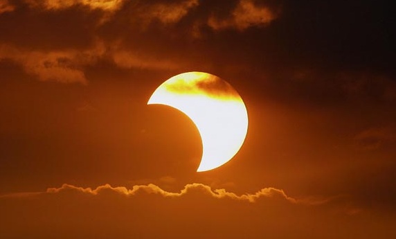
The partial solar eclipse taking place on March 20th left me wondering if there is any record of past events for this area.

luke-howardLuke Howard‘s The Climate of London describes a similar such event that took place on September 7th, 1820. Howard describes how the thermometer fell from 68.5°F to 62.5°F. After making observations at his home in Tottenham at 10.30am Howard made his way to Stoke Newington to visit fellow scientist and Quaker, William Allen, to observe and record the eclipse.

From his account it appears that, though the weather was settled, there was a fair bit of cirrocumulus drifting across the sun during the eclipse.

As well as the fall in temperature Howard’s account describes the strange light: “The sunshine against the house was so dim as to be quite striking; and the view before us to south, which included the nearer parts of London, showed much the same as afterwards at six In the evening – dusky but not dark.”

sunHoward noted that the lowest temperature was observed about seven minutes after the greatest obscuration. He also mentions that his son noticed that spots of light falling through the shade of trees were in the shape of crescents, mirroring the lunar disc across the sun, rather than globular. He also states that Venus was very easily visible during the eclipse.

Though Howard’s account is by no means groundbreaking, it would be another hundred years before another eclipse proved Einstein’s theory of general relativity, it is fascinating how we are still just as fascinated by the sun as our forbears were.

I was in southern Turkey for the last solar eclipse which I believe was overcast in the London area. I had some data from my then AWS but I’ve misplaced it. That Oregon unit didn’t have the means of recording every minute.

Though I was outside the area of totality I still experienced the classic eclipse effects: the birds singing before going silent, reduced warmth of the sun and a very strange and eerie ‘blue’ light that is cast over everything. I’ve not experienced anything like it since and only hope that the sky on March 20th is a bit clearer than it was 16 years ago.

It is impossible to know what the weather will be like on the day at this range though a look back through my records to 1981 reveals that weather conditions on March 20th, the Vernal equinox this year, can vary greatly. In 2003 a high of 17.5C was recorded with 6.9 hrs of sunshine. However, two years earlier, the temperature reached just 4C as 8.2mm of rain fell.

It seems the media is working itself up into a frenzy over the eclipse, talking up the possibility that the event will cause a power surge that could interrupt supplies across Europe. However, the fact that solar accounts for just 10% of Europe’s renewable energy would suggest that such hyperbole is similar to the hysteria over the Y2K ‘Millennium Bug’ that  failed to materialise?

* I will be revisiting this blog after the eclipse has happened to post results from my AWS readings.

** There’s a full account of Luke Howard’s eclipse here

January 2015 – average, wet and sunny

This January saw the first falling snow in nearly two years with the last three days of the month seeing the first flakes of winter – nothing much to write home about by average winter standards.

Cold front clearance over Wanstead Flats on 28th. The day saw three potent cold fronts with steep temperature falls. <5mm hail in the last and thunder heard in Woodford Green
Cold front clearance over Wanstead Flats on 28th. The day saw three potent cold fronts with steep temperature falls.

Mean temperature for the month was 5C, 0.2C below the 1981-2010 mean – the first below average month since August and 1.6C cooler than the mild and stormy January of last year.

Rainfall of 69.2mm was 130% of average – though over 60mm less than last year’s record-breaking wet January.

It was the 6th sunniest January on record in my series going back to 1877. Over 73 hours of sunshine was recorded in this area which is 147% of what we can expect to see during an average January.

The wettest day occurred on the 12th with 13.1mm.

Air frosts: 11

Ground frosts: 14

So what has February got in store weatherwise? The general consensus of the models suggest the first half of the month is going to be on the cold side and relatively dry though there is a chance of some precipitation from troughs forming in an unstable airflow off the North Sea. Pressure looks like it will build from Wednesday, blocking any advance of Atlantic weather systems. It is the location of the high which will be crucial to the weather we can expect. At this time of year anticyclonic gloom can be a problem during the day and where clouds clear at night fog and frost may form.

The Shard in fog from Southward Bridge
The Shard in fog from Southwark Bridge on January 4th

Beyond that, for anyone seeking any snowy weather, the outlook, as ever, is uncertain. Using a similar method to my Christmas forecast, which was correct at 25 days ahead and my January outlook, I’ve had a look back in the archives to see if there is any precedent in the pattern we’ve had this January.

There appears no chance of a very mild February. The strongest signal (72%) is for an average to rather cold February. The strongest signal for precipitation is for very dry (50% of average) at 43%. After the disappointment of the last week here regarding snow I am not about to guess if there will be any snowfall for us this coming month. If we do see any though I would imagine any cover will be thin and lasting only a day or two…

Full stats for the month here: http://1drv.ms/1rSfT7Y

Here follows the full weather diary for January

1st Cloudy and cold.

2nd Sunny most of the day before cloud spread in in the evening and rain fell just before 4am.

3rd Mostly wet with moderate bursts of rain on what was a cold and miserable day – the fields between Grays and Basildon were flooded.

4th Skies cleared early morning with fog and mist forming to give a cold, grey day and a maximum of only 3C – some parts of East Anglia recorded an ‘ice day’. The temperature started to lift at midnight on 5th meaning that day 5s ‘high’ temperature was at 8.32am on 6th.

5th Cloudy and very calm up to midday.

6th rain at midday as cold front passed through, bright and sunny spells and brief frost at 1am. Cloud moved in.

7th a sunny start though chilly, cloud built through the morning. Light rain around 7pm and through the evening. This turned heavier at 4.30am and really got going at 7.30am.

8th Heavy rain to start, this easing at 11.30am before the sun came out at 1pm to give afternoon of sunny spells. Brief rain again around midnight.

9th Bright start, wind building through the day as storms struck off north Scotland. Very mild in the warm sector: +15.2C at 8pm. Shetland badly affected by cloud head in early hours. Windy through the night.

10th Bright start though cloud built quickly with cold front passing through around 10am. Dew point dropped from 11C to 3C in matter of hours. Felt very cold in the wind.

A storm passed over Shetland on January 10th

11th Sunny start, clouded over by 2pm with temp building through day and odd drizzle.

12th Cloudy start with spits and spots of rain up until 2pm.

13th Sunny until lunchtime . Clouded over though with some light rain. Thunderstorm reported in Bracknell and snow reported above 125m in Wales Lampeter.

14th Sunny start but lots of cloud from embedded instability in the airflow. Temperature rose all day with drizzle at 6pm. Pressure bottomed out at 985.3mb at 0345z. Peak gust 21.3mph at 0320z. Rain heaviest at 0412z 12.1mm/hr

15th Sunny start with lots of cloud around, feeling cold in the wind

16th Cloudy and much calmer

17th Cloudy start with threat of snow showers at 11am, remained as rain though snow reported at Berkhampsted and Watford. Pleasant day with sunshine.

18th Mostly cloudy in morning but with weak sunshine. Temperature plunged after dark but cloud prevented further cooling at midnight.

A warm sector saw the temperature rise to 12.7C in the early hours of New Year's Day
A warm sector saw the temperature rise to 12.7C in the early hours of New Year’s Day

19th Sunny , cold start with a few clouds. Frost returned at 6.40pm with coldest night since Jan 2013.

20th Sunny start but took till 11am to rise above freezing with some frost lingering well into the afternoon. Snowflakes reported at Laindon and dusting in parts of Kent. More general snow PM from Chilterns northwards – too warm here.

21st Cloudy, dull and cold all day with some drizzle. Snow reported in Laindon. Dull and cold in Reading.

22nd Hazy sun to start, sunny spells all day. Very cold overnight

23rd Sunny start with high alto-cumulus. Gradually becoming more cloudy though staying bright. Temperature started rising after dark with approach of warm front. Temp peaked at 2am as cold front whistled through with brief heavy rain. Sunny again by dawn.

24th Sunny with occasional cloudier spells. Feeling cold in the wind.

25th Sunny start but gradually clouding over. Temperature climbed through the day and night. Drizzle in the wind.

26th Cloudy with bright periods. Temp and dew point started falling after 10am with passing of warm sector.

27th Hazy sun to start then wintry sunny spells all day.

28th Cloudy start quickly gave wave to at least three potent cold fronts with steep temperature falls. <5mm hail in the last and thunder heard in Woodford Green. Clearer spells overnight and possibly spots of rain.

29th Sunny, cold start . Clouding over with potent shower at 4.30pm that gave a brief covering of snow pellets. Snow and sleet at 9.30pm but no accumulation here. Snow falling.

30th Cloudy, cold and damp day with some drizzle pm. Lots of snow in Derbyshire – one report of 41cm. Reports of snow falling in the early hours at  Hollow Ponds. Snow falling.

31st Cloudy with intermittent light rain through day. Reports of snow in north Essex and  Southend. Some sleet in the early hours


December 2014: Sunny, dryer than average

This December was the sunniest on record in my series going back to 1877. Over 90 hours of sunshine was recorded in this area which is 224% of what we can expect to see during an average December.

It was the sunniest December on record in the series going back to 1979. Some 11 mornings were completely clear at the 9am observation time

Mean temperature for the month was precisely average at 5.6C. Rainfall of 39.9mm was 75% of average – the driest since 2010.

The month was 0.7C cooler than last December – with just under half the rain that fell in that wet and stormy month.

The first day of December was cloudy, dull and dreary with drizzle in a keen east wind. The following days alternated between rain and sun and some night frost. On the 6th the day started sunny with just a few cirrus clouds – overnight frost persisted all day in my garden with a grass min at -2C. The 9th began sunny after a hard frost but then the temperature climbed for 19 hours with cloud building and brief rain at 2am before the cold front passed.

The wettest day occurred on the 11th. The day started sunny but blustery showers blown in on strong WSW winds coupled together with 6 hours of rain overnight produced 11.5mm.
Things turned much milder in the 3rd week with frequent, chiefly light rain, abundant sunshine and an absence of frost. On the 18th the temperature reached 14C.

Christmas Eve saw the weather begin to cool down again with progressively colder nights. Boxing Day was a cloudy, cold day with rain spreading in during the evening and a notable warm sector raising the temperature to nearly 9C at midnight. The first lowland snow of the winter was reported up north. The month ended with long sunny days and sharp frosts, a couple persisting through the day.

Air frosts: 12

Ground frosts: 15

This satellite picture taken on December 27th, 2014, shows the LP clearing through to leave us in clear, deep cold air

From this month, using a similar method for predicting winter, I am going to finish these monthly reviews with a look ahead to see what next month has in store.

The general consensus of the models suggest the first half of the month is going to be mostly unsettled with a mixture of wind and rain off the Atlantic and transient ridges from the south bringing mild, sunny days.

Looking at the 10-day ahead forecast on Netweather suggests the temperature will be just above average with rainfall also slightly higher than normal.

Beyond that, for anyone seeking any snowy weather, the outlook is uncertain. Using a similar method to my Christmas forecast, which was correct at 25 days ahead, I’ve had a look back in the archives to see if there is any precedent in the pattern we’ve had this December.

The simple answer is there is no over-riding signal for any weather type, save that there appears no chance of a repeat of the very mild January of last year. Taking all the probabilities together gives an 88% chance that January will be average to cold – so perhaps there will be some snow in the second half of the month.

january probabilities

Weatherlore: Colin Finch’s 38F rule

Signals for winter have always been well reported by the media. Back in the 1980s weather anoraks across Britain would wait with bated breath to read Bill Foggitt‘s latest prognostications for the coming winter. Though Foggitt had some success his observations, among other weather ‘gurus’, often amounted to weatherlore that has only a slightly greater than evens chance of being right.

One popular myth is that very large blackberries mean a harsh winter. The fact that this has more to do with plentiful rainfall plumping up the fruit at harvest time is ignored.

Colin Finch’s 38F minus rule is altogether different and provides a very good guide to the kind of weather we can expect in January and February. For the rule to work the maximum temperature must be 38F (3.3C) or less for four consecutive days before Christmas Day.

finchColin, an amateur meteorologist who passed away in 1991, spent much time researching his rule in the 1970s. He found that most of the coldest winters since the end of the second world war gave a hint of things to come in the weeks leading up to Christmas: the Decembers of 1946, 1955, 1962, 1968, 1969, 1978 were all followed by cold late winters. In 1984 and 1985 the cold spell arrived at Christmas. Other years to loosely follow the rule, 1986, and 1990.

A few weeks ago I was reminded about Colin’s findings and decided to have another look, using daily record data for this area stretching back to 1806.

The results were surprising. If there is a run of cold days (3.3C or less) around mid-month the chance of an average to colder than average January and February is 94% and 74% respectively. The chance of an average to colder than average March is 96%. Also notable is that the chance of a severe spell in January (4C colder than normal) is 30%.

So much for the figures. What are the chances of a run of cold days between now and Christmas Day?

Sunset Southwark Bridge

Up until this week the weather has been fairly quiet with little rain and cold, often frosty nights. But westerlies are now roaring back in from the Atlantic and could be a hint of what is likely to prevail later in the winter. However, the ‘crunch’ time for the 38F minus rule comes soon after the middle of the month. If a spell of Arctic weather develops at that time, even if it lasts only a few days, then the chances of a major cold spell after Christmas are much higher.

As I write this blog the models suggest that a run of cold days may just be possible. It is also notable that the likelihood of a sudden stratospheric warming event, argued by many to be a precursor for conditions that would favour the development of a cold spell, is increasing with a peak set for mid January.

We’ll see but Colin Finch’s findings all those years ago are fascinating and are still relevant today.

My method in using the rule can be found here.

Statistics on the rule can be found here.

* The following obituary appeared in an edition of Weather magazine, a publication of the Royal Meteorological Society, in 1991.

“Colin Finch – The news of the sudden death of Colin Finch on Friday, 23 August 1991 at the tragically early age of 55 will be received with sadness by Members of the society and readers of Weather.

There is no doubt that Colin was one of the most enthusiastic amateur meteorologists that the Society has ever had and, without seeking publicity for himself, he was responsible for making many other amateur enthusiasts aware of the Society and encouraging them to join.

Colin’s interest in the weather began when he was a small boy and received a considerable boost during the snowy and very cold winter of 1946/47 when he was 10 years old. In 1949, at the age of 13, he began to take regular temperature and rainfall readings and gradually added more sophisticated equipment. His record of daily weather data was unbroken until July 1991 when he became too ill to continue.

When he left school in 1953 he joined the Meteorological Office as a Scientific Assistant at Kingsway and was trained under the keen eye of Dick Ogden. Later, after a spell at Heathrow Airport, he left the Office frustrated by his inability to develop a career because he didn’t have sufficiently good educational qualifications. Instead, he turned to a successful business career but his enthusiasm for weather observing and forecasting increased.

Each day he plotted and analysed synoptic charts compiled from short-wave Morse code transmissions which he took down by hand. In the 1960s and 1970s it was quite normal for him to spend Saturdays plotting a chart for the whole of the Northern Hemisphere from Morse broadcasts. Later he had facsimile and satellite-receiving equipment installed at home.

By the late 1960s he was liaising with local authorities and the police in Surrey, warning them of the likelihood of severe weather events. In 1970 he joined the then newly introduced BBC Radio London and every Friday morning he would discuss current weather events and give climatological background data about the week ahead. For these broadcasts he would get up in the early hours to plot a synoptic chart before he went to the studio.

After the broadcasts he would go to the City for a normal day’s work. He kept up this punishing schedule for several years. When the Society introduced the highly successful one-day Saturday discussion meetings in September 1972 Colin was one of the first amateur meteorologists to give a presentation and he was a regular contributor to these occasions. He was an imposing figure, 6ft 4in tall, and was easy to seek out at meetings.”