
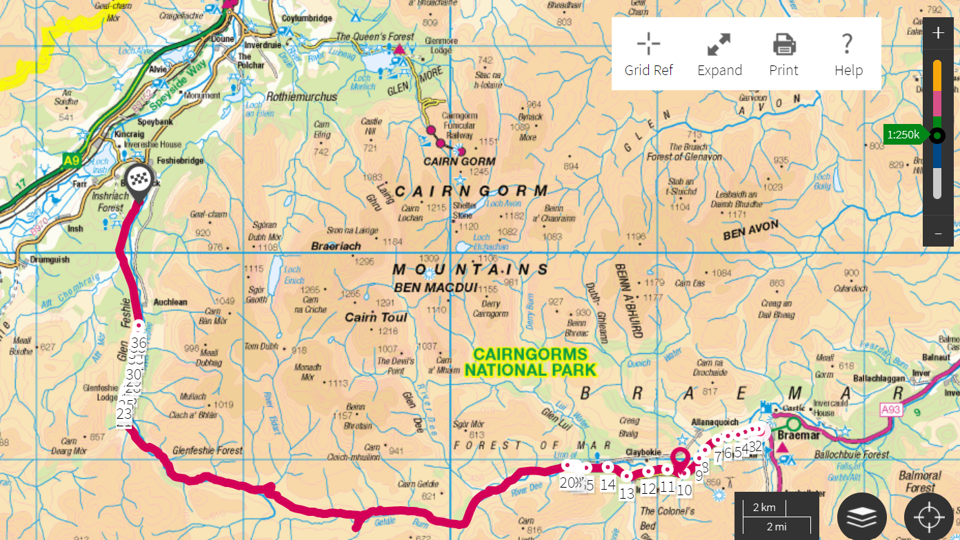
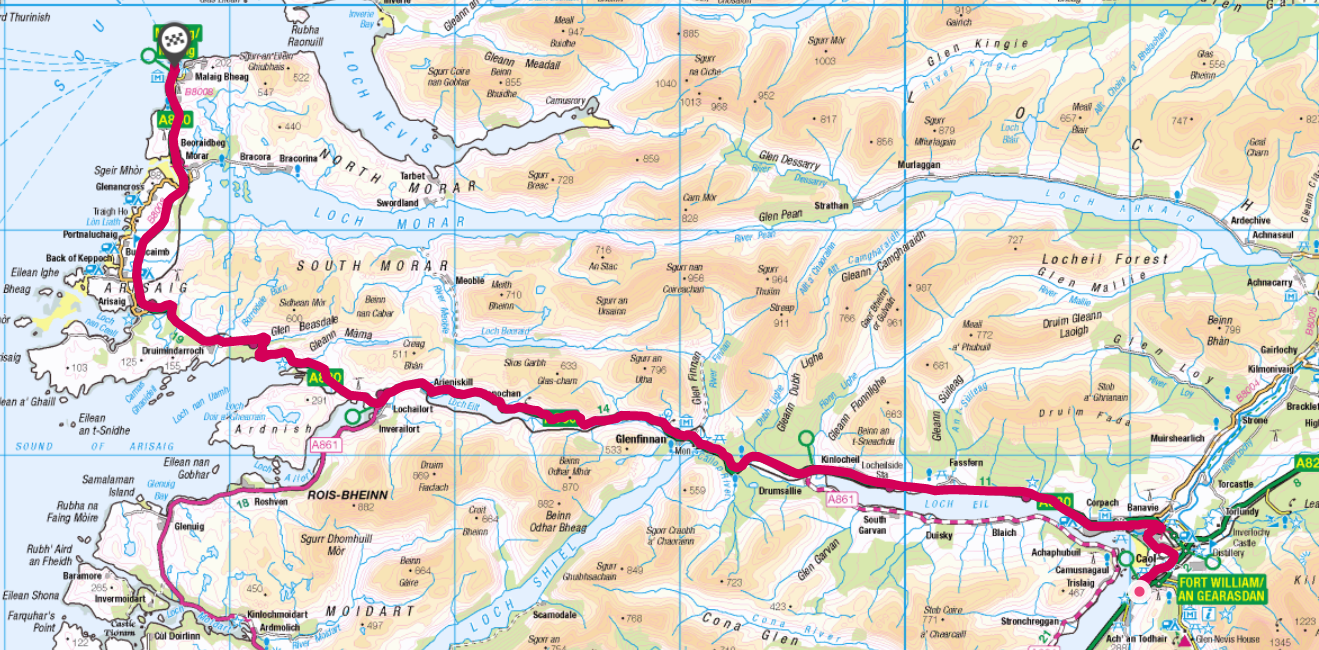
At the end of April I cycled and skied my way across Scotland, from Aberdeen to Mallaig, incorporating the ‘Scottish Haute Route’ across the Grampian Mountains.
The route of some 225 miles has a total ascent of 34,000ft, covering some of the highest peaks in the UK including Ben Nevis. Paths that crossed deep into the Cairngorm national park made it necessary to use a mix of wild camping and b&b accommodation that was open after the lockdown.
Probably against my better judgement I also strapped my skis to the bike to traverse any snow on offer.
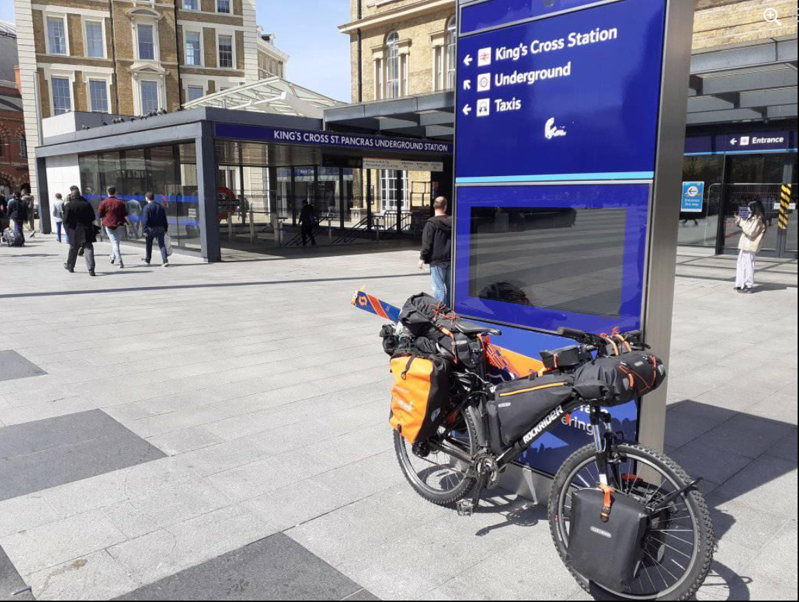
I accessed the route by taking the train from Kings Cross to Aberdeen; leaving at 2pm the direct LNER East Coast journey is a real treat, speeding its way through the English and Scottish countryside to arrive just after dark.
Aberdeen is a bit of a strange city. All that oil money but there seemed to be more than the usual share of depravation. The main drag was like a ghost-town after 10pm – perhaps it was lockdown. I quickly fled back to my hotel.
Day 1: Aberdeen to Ballater
47 miles, 2,500ft (7hrs)
Weather: Max 6.9 Min 2.1 Rain 4mm Wind NE 9mph
Fisheries, old railway lines, River Dee

A bit of an inauspicious start in Aberdeen – a glitchy phone led me a merry dance around the town including a tour of the various fisheries by the harbour. I rode back to the city beach to perform the customary wheel dip in the North Sea; a cold day with a freezing onshore breeze and intermittent light rain.
I was soon on my way inland via the A93 and Deeside Cycle Way formed from the Old Deeside Railway Line. A real cycling delight; miles and miles of smooth Tarmac path often very close to the River Dee with its delightful wildlife. Finches of all descriptions seemed to lead the way and far outnumbered people – I probably saw about a dozen others all day.

Wheel dip in North Sea 
A raw, damp easterly 
The start of the journey 
North Sea views 
Signs to the west 
Overgrown platforms 
River Dee vista 
Cycling the Dee 
A part of the Deeside line is still used for a tourist railway 
An ideal camping spot 
Aboyne weather station recorded 25 frosts in April 
The old line stretches into the forest 
Bridge over the Dee
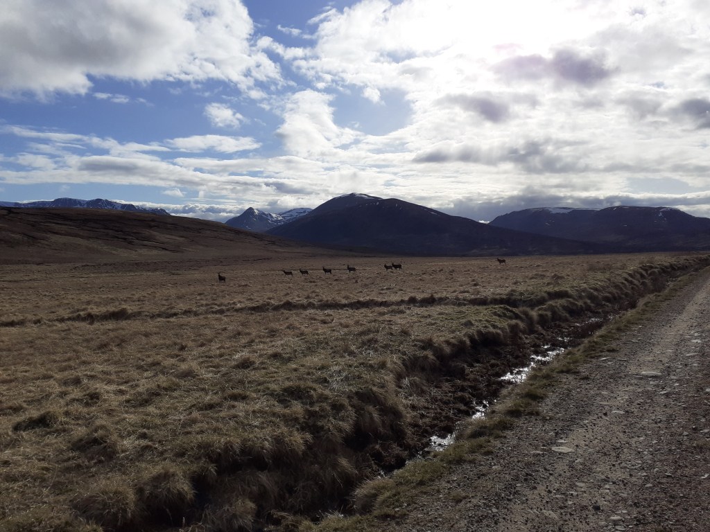
Day 2: Ballater to Braemar
31 miles, 4,000ft (7hrs)
Weather: Max 8.9 Min 0.5 Rain 1.2mm Wind NNW 7.7mph
Royal castles, abandoned bothies and steep paths
After staying at the excellent Netherley Guest House I was soon on my way to Crathie where I would ‘turn right’ to finally get off the beaten track for the remoter legs of my trip.
Crathie was far smaller than I imagined – the car park for Balmoral was empty, no doubt a result of it being early season and lockdown having only just been lifted. The B976 was soon heading relentlessly uphill, the first test of my endurance pedalling something like 20kg and the bike. I was soon pushing on the steepest section, a local on a racing bike told me where to leave the road.
The gravel / sand track at the start of the section was excellent and progress quick – I was surprised just how good it was. Another cyclist heading toward me remarked that he hadn’t seen so much on a bike since his cycle trek in Tibet 20 years previously.
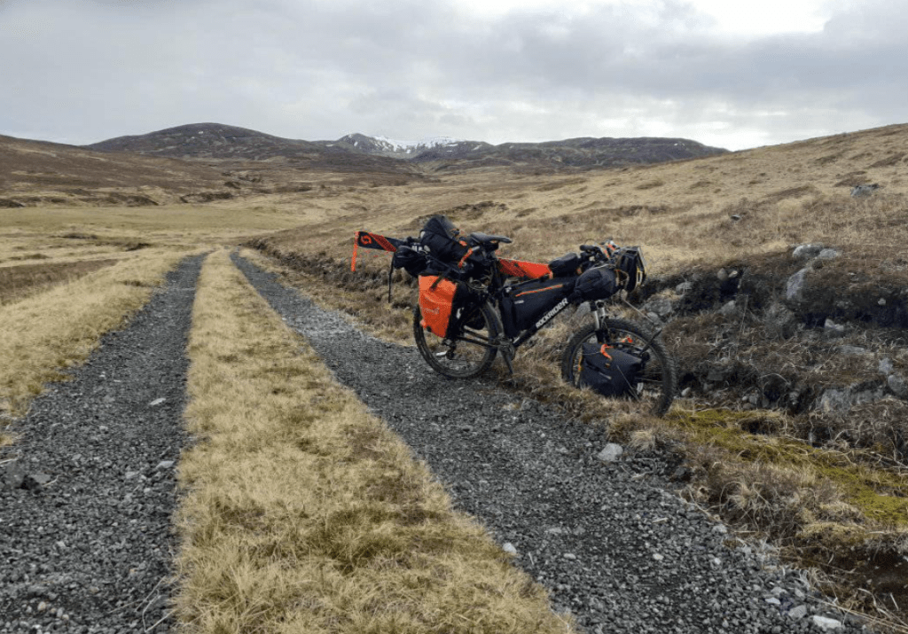
On reaching Corndavon Lodge I was faced with my first ford to cross, a relatively simple task were it not for the fact that I’d have to get myself and the machine across. The lodge, the first bothy on the Scottish Ski Club’s 1978 traverse, was boarded up.
I pressed on, soon reaching Loch Builg and on to the ruin of Lochbuilg Lodge. It was at this point that I was faced with a steep, single-track, path up to Carn Drochaid and upward to Ben Avon. It was also at this point that I realised that the weight on my bike was going to make it impossible to adhere to my intention of following all the ridges.
After 15 minutes sat among the ruins I changed my plan and retreated back to the River Gairn. I planned to follow the track to Braemar while keeping one eye on other paths westward – none of which appeared to offer any bike friendly options without double backing to Braemar.
As I ascended the path up the shoulder of the 900m Culardoch it was obvious that I’d made the right choice. Despite good weather it was a real struggle at times. I was also a bit deflated as I looked across the valley at the large cornices on Ben Avon in the distance.
From the plateau of Tom na h-Eilrig it was a general downhill descent into Braemar. Time was getting on and I knew I had to arrange a b&b before the dusk chill turned into night.

A Rapunzel like tower 
Crathie Kirk 
The Kirk 
Gates to the wilderness 
Views stretched to Lochnagar 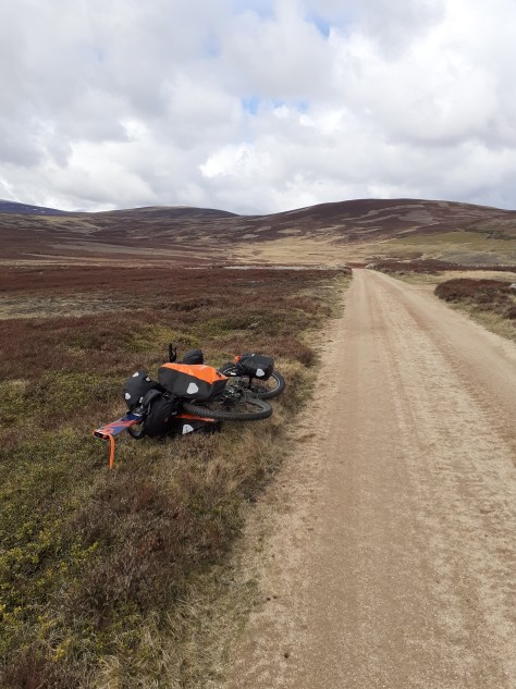
An Creagan 573m 
Daldownie ruins 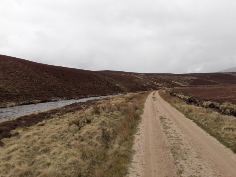
Path along the Gairn 
Corndavon Lodge 
Carn Dearg 772m 
Loch Builg 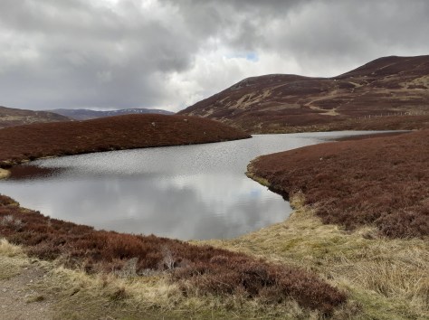
Loch Builg 
Loch Builg 
LochBuilg Lodge ruins 
Mountain bothy 
Ben Avon massive 1171m 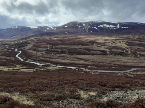
Ben Avon massive 1171m 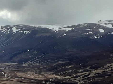
Ben Avon massive 1171m 
Cornices on Ben Avon 
Corrie Cula c700m 
Corrie Cula c700m 
Corrie Cula c700m 
Looking south to Meall Gorm 
Looking south to Meall Gorm 
Braemar weather station, the coldest place in the UK. -27.2C was recorded here on January 10, 1982
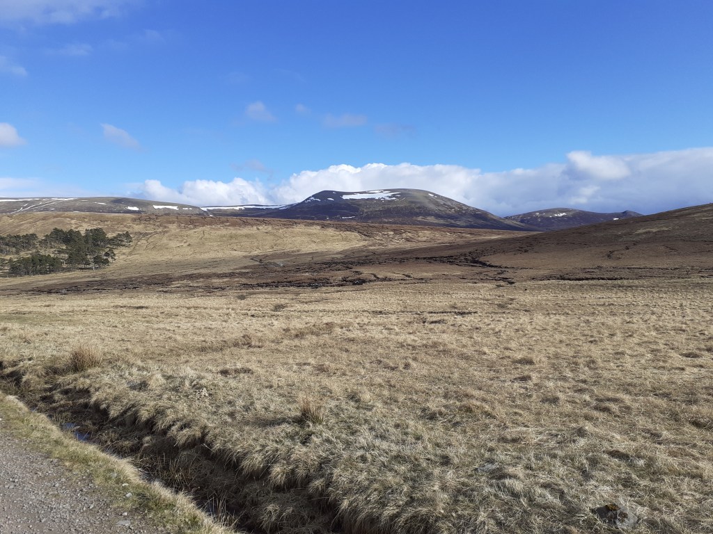
Day 3: Braemar to Glen Feshie
40 miles, 2,159ft (10.5 hrs)
Weather: Max 7.7 Min 1.2 Rain 2.4mm Wind NNE 8.2mph
Smooth bridleways, rocky paths, rickety old bridges, knee deep fords, bogs
After resolving overnight that I wasn’t going to be able to follow my original planned route across the Cairngorms I’d decided a loose plan to make a decision once I’d reached Linn of Dee, effectively the end of the road – you either retreat or continue on
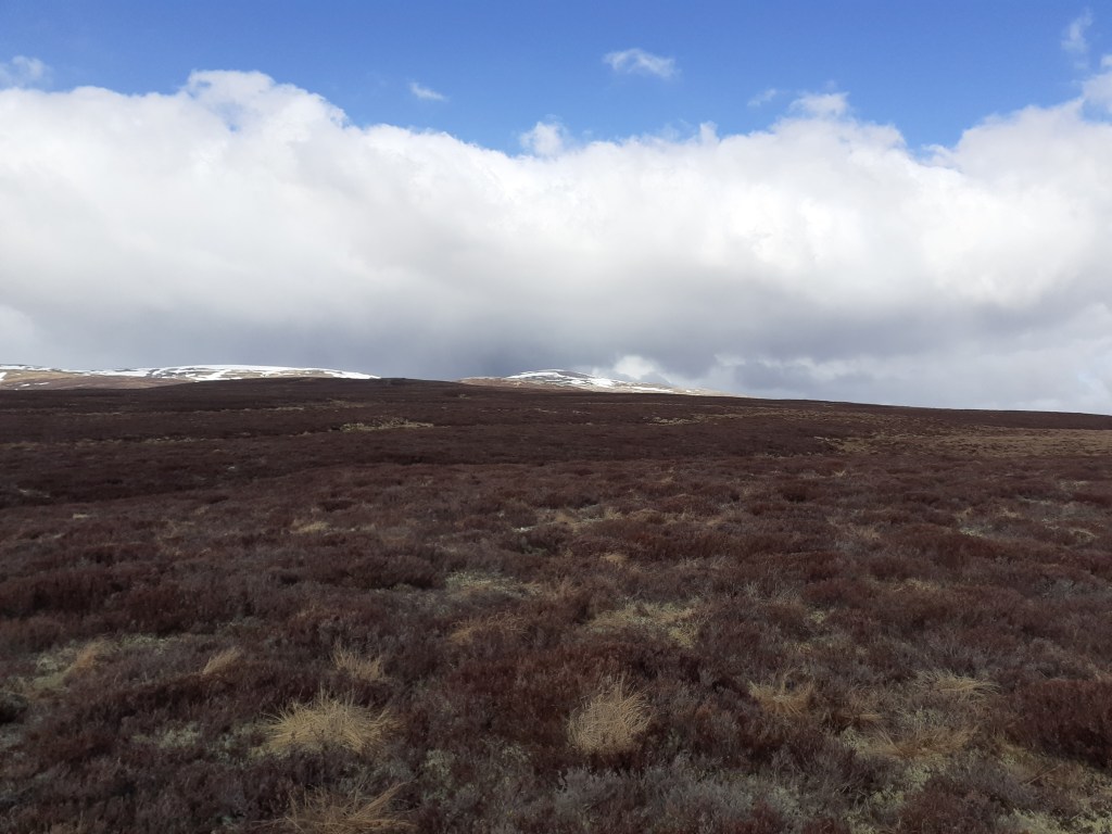
One idea was to continue on a path to Derry Lodge, an option that would have allowed me to complete a circuit of the Cairngorm 4000s. But the weather was less than ideal – frequent snow and hail showers would have hampered visability high up and on hearing thunder I decided on a plan B and take the low road, a 27-mile wilderness path to Glen Feshie.

The track starts off well and I noticed a few other walkers plus a game keeper on the opposite path. After White Bridge the terrain turns into proper moor – you get the feeling you are a long way from civilisation as you glance up at distant, snow-capped fells.
I was soon faced with a junction at a ford, a walker was changing into ‘sand shoes’ before he headed on his way to Blair Atholl. The path from here soon deteriorated – I made the mistake of fording Geldie Burn on my way to the ruin of Geldie Lodge. These old buildings seem to have a magnetism that draws you in for a closer look. As I stood among the ruins I realised that I’d made yet another wrong turn – the path onward seemed to peter out so I had to re-ford the burn onto the path that deteriorated further – many sections were little more than boggy streams. Progress was slow with the heavy bike – the front wheel kept sinking and at one point I bent the outer chain ring catching a rock. I managed a repair but effectively lost a third of my gears.
You hear the River Eidart before you see it – a waterfall flows through the deep cut in the landscape, progress from here is over a rickety bridge. A couple of the wooden slats were rotten; I decided to carry the panniers across rather than chance the weight of the whole bike.
The bridge more or less marks the high point of the ride after which progress is more or less all downhill. The change in the landscape is quite marked; the valley becoming much steeper and more wooded, it reminded me a lot of Valsesia in Piemonte.
Serious erosion on the path of the eastern bank of the River Feshie made it necessary to ford the river three times. With the light starting to fade I began looking for a suitable camping spot. Ruigh Aiteachain, my scheduled overnight stop was now on the wrong side of the river and Glenfeshie Lodge was still not open after the lockdown. Because it was a good road I decided to keep going and after passing through a hamlet I found a spot on the river bank as light really was fast fading. Conscious that cows were in the vicinity I crossed over to a dried overflow bed and pitched the tent. This was the first time I’d had the tent out of its bag and though easy to pitch I was cursing that I hadn’t had a least one practice in the garden in the months since I’d bought it.
Forty miles and nearly 11 hours in the saddle it had been the hardest day’s biking ever. After brushing my teeth I crawled into my sleeping bag and sleep quickly followed.
Incoming showers of hail seen from the road to Linn of Dee 
A gorge under the bridge at Linn of Dee 
A gorge under the bridge at Linn of Dee 
A gorge under the bridge at Linn of Dee 
No going back 
The path from Linn of Dee 
Carn Mor, 634m 
Carn Liath, 818m 
Sgor Mor, 813m 
White Bridge over the Dee 
Cairn Toul at the top of the valley from White Bridge 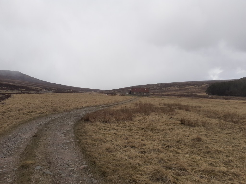
A bothy seen from where the track splits. Turn left for Blair Atholl, right for Glen Feshie 

Cnapan Garbh, 674m 
A ford over Geldie Burn, one of many 
Heavy snow showers really hampered visibility at times 
Heavy snow showers really hampered visibility at times 
An Sgarsoch, 1006m 
From heavy snow to bright sun in minutes 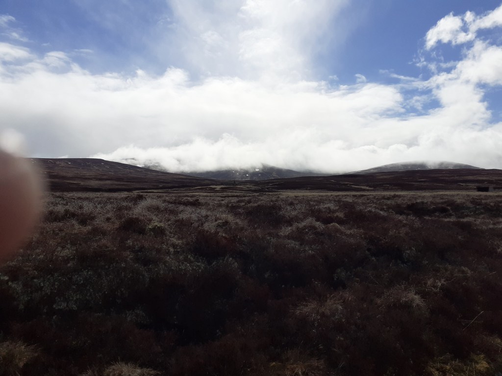
From heavy snow to bright sun in minutes 
The ruin of Geldie Lodge at 530m 
The ruin of Geldie Lodge at 530m. This turned out to be yet another wrong turning 
An Sgarsoch, 1006m 
Back on track though the path turned into a narrow one which hampered progress, especially with the low panniers. Cairn Meall Tionail can be seen distant 
One of many rests on the rocky path 
The path and burn could be seen stretching into the distance 
The foothills of the Cairngorm 4000s 
A snowpatch, below me for a change 
The waterfalls on the River Eidart can be heard long before you see them 
The waterfalls on the River Eidart can be heard long before you see them 
A rickety bridge spans the River Eidart – some of the wooden slats have seen better days 
A rickety bridge spans the River Eidart – some of the wooden slats have seen better days. I was surprised to see that it was engineered in the 1950s. 
Safely over, I imagine the waterfalls present a refreshing rest stop in the summer 
The waterfalls on the River Eidart 
Subtle changes in the landscape as the valley morphs into Glen Feshie 
Glen Feshie. The steep-sided valley with abundant woodland reminded me of Val Sesia in Piemonte 
A huge tree, possibly felled in a storm 

This tree had completely snapped at the base of the trunk 
This tree had completely snapped at the base of the trunk 
The River Feshie. Yet another ford 
Safely over the other side. Because of erosion of the path the river had to be forded three times 
Distant snowy peaks 
Camping on the banks of the Feshie 

Bridge over the Dee at Linn of Dee 
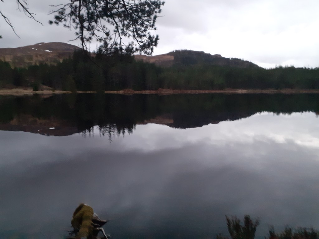
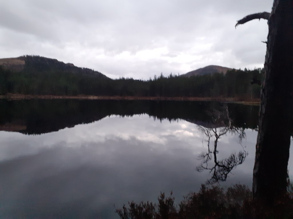
Day 4: Feshiebridge to Loch Doire nan Sgiath 38 miles 3,431ft ascent 11 hours (2 hours in Kingussie)
Weather: Max 7.6 Min 0.4 Rain 2mm Wind NNE 4.4mph
Castles, lochs, distilleries and dozens of deer

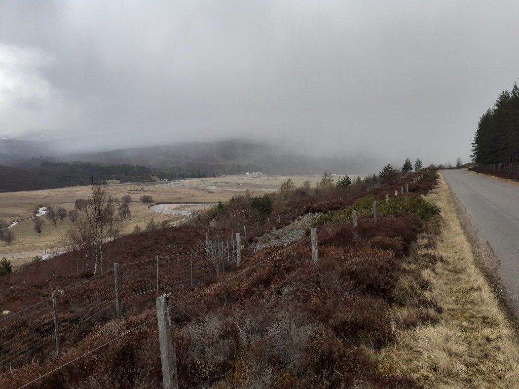
The dawn chorus awoke me just before 6am along with the reassuring sound of raindrops – not to mention the comforting hum of the fast-flowing River Feshie. It was time to break camp.
Packing everything up seemed to take an age, it wasn’t much before I was pedalling again back to the road at Feshiebridge. With a dead phone I made a beeline for Kingcraig but soon found myself pedalling on to Kingussie where I found a cafe to recharge my electronics and myself.
Although polite I found the locals to be a bit standoffish after exchanging the usual initial pleasantries. I resolved to listen to the conversations of others as they came and went; the hot topic seemed to be the coming election and more than one person exclaimed that they had ‘no interest whatsoever in who bought Boris’s curtains’.
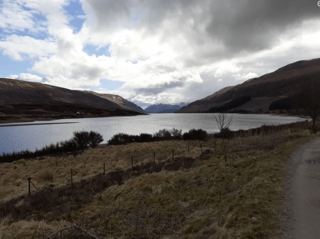
At Newtonmore I swapped the old A86 for the B9150 and another cycle path that more or less trekked all the way to Dalwhinnie. From here it was another delightful lochside path along Loch Ericht.
Old castle-like lodges


Day 5: Loch Doire nan Sgiath to Fort William
32 miles, 1287ft (4.5 hrs)
Weather: Max 8.1 Min 2.8 Rain 1mm Wind NE 4.3mph
Glass-smooth lochs, giant pines, empty castles
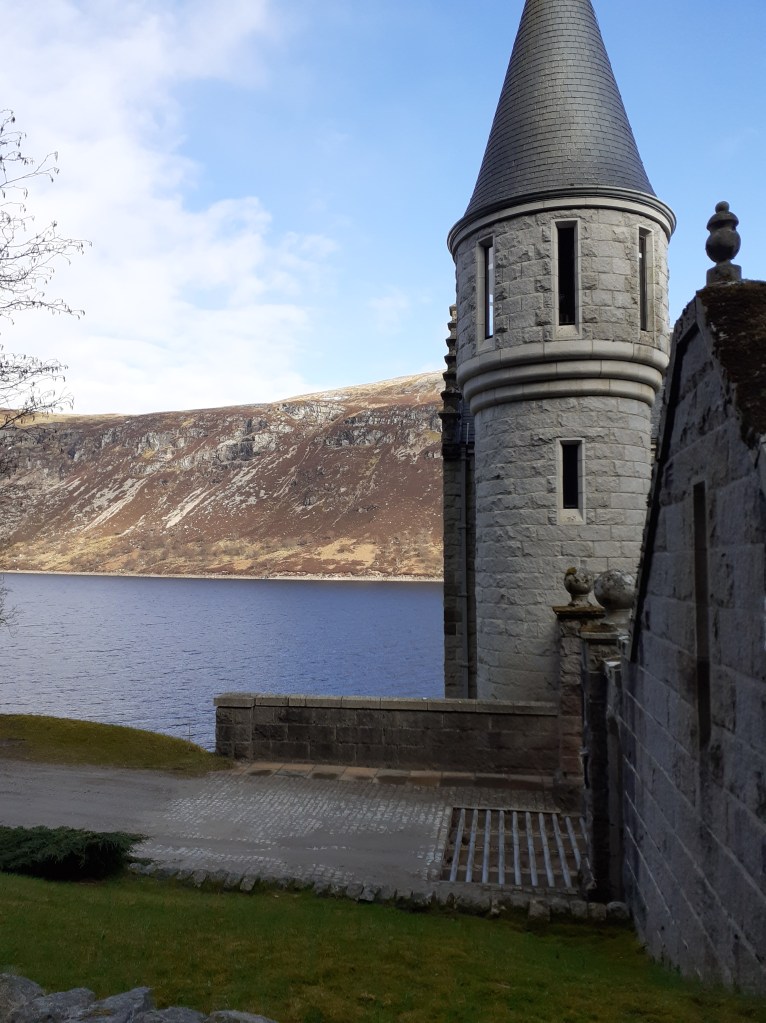
After a much better overnight camping stop I rode on to Fort William. The path down to Loch Laggan, a gravel track suddenly turns into the smoothest Tarmac road before you reach ‘Kings Grave’, a Scottish castle that looks like something out of a Hammer studios production. There wasn’t a soul around – I was half expecting Klove to suddenly appear at the door.
The path along the southern shore of Loch Laggan offered superb views of snow-capped Creag Meagaidh – clouds of vapour could be seen as the strong spring sunshine evaporated the wintry precipitation that had fallen overnight.
The original plan to proceed to Corrour shooting lodge was abandoned as steep paths beyond effectively blocked my way west. From here it was a straightforward, mostly downhill, onward path into Fort William.


Day 6: Fort William – Observatory Gully, Ben Nevis
30 miles, 5,194ft (11.5 hrs)
Weather: Max 8.6 Min -2.1 Rain tr Wind WSW 7.5mph
A little skiing at last

After abandoning efforts to go up Aonach Mor – impossible even with half the panniers / weight left in the b&b – the day’s climbing didn’t really start until 3pm from the North Face car park.Lots of ‘you’re mad’ odd looks though with words of encouragement from walkers and climbers on the way up to the CIC hut at 2,231ft.Knackered but with the sight of the snowline just a few hundred feet higher I transferred the skis to the pack, locked the bike and continued on to the snowline, around 2,700ft up Observatory Gully. Ski boots and crampons on at 6pm I went higher to the small buttress at 3,900ft. With one eye on the clock the skis went on and a slide back down lumpy snow. I’d travelled 210 miles and climbed 18,571ft for a ski descent of 1,246ft. Is this the longest ‘walk in’ to a ‘ski tour’ ever?I made it back to Fort William as the last light of the day faded at 9.30pm
Day 7: Fort William – Mallaig:
43 miles, 3,031ft (5 hrs ish)
Weather: Max 6.3 Min 2.3 Rain 4mm Wind NE 16.3mph
Stormy lochs, rusting boats, Harry Potter steam trains, railway viaducts, Bonnie Prince Charlie and the best wee dram I’ve ever tasted.
I totally underestimated this leg, thinking it would be a plod to the coast. The last fifth turned me directly into the stormy winds – even on declines I seemed to be buffeted back uphill, I had to resort to walking on large sections.
What I thought was the last hill turned out to be the last but three. I cursed my lot out loud and, approaching delirium, convinced myself that Scottish miles must be longer than English miles.
No matter, I arrived in Mallaig and dipped the wheel in the harbour before finding a pub for the best pint and wee dram I’ve ever tasted.
I’d been lucky with the weather though days like this would have made the tour impossible in this timescale.


Though the challenge is complete I’m still raising funds for Young Minds, a brilliant charity for our youth who have suffered greatly being cooped up over the past year.
https://uk.virginmoneygiving.com/fundraiser-portal/fundraiserPage?pageId=1277128


 As the peak started to level out around 1,150m snow was now beginning to settle on the rime that had built up on the cairns; we’d got what we’d come for! It was here, however, that I realised my waterproof trousers weren’t so waterproof. First dampness then rivulets of water began flowing into my boots.


You must be logged in to post a comment.