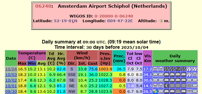
Gliding along on billiard table-smooth paths in the dunes of the Hollandse Duinen National Park: there can’t be many better cycling experiences in the world.
Hours earlier we’d disembarked the Stena Britannica at Hoek van Holland with only a vague timetable of getting to Amsterdam and back in time for our return ferry four days later.
We decided to head for a town called Monster that was far enough to get our cycling legs going but also close enough for that all-important first caffeine shot of the day. Rolling into the town I was struck by the number of old people on two wheels, something you don’t see that much of aound east London.
A day after cycling the potholed roads from Dedham Vale to Harwich the Dutch paths were a revelation. After mile upon mile of stunning beaches we soon arrived in The Hague bathed in warm October sunshine – the old town the perfect place to stop for lunch.
Conscious of time and that my daughter had never cycled further than three miles I figured we ought to get some accomodation booked for that evening; Stayokay Noordwijck was a good 30km further north.
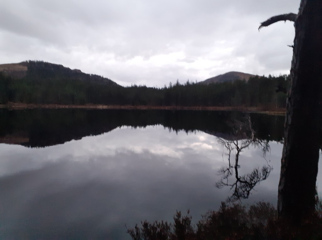
The dunes of the Hollandse Duinen National Park with the contrails of Schiphol
We pedalled on, taking in the International Criminal Court, before the paths of the Dutch capital slowly emerged into the dunes of the Hollandse Duinen National Park. It was probably the nicest afternoon’s cycling I’ve ever had the joy of experiencing.
Following days provided further interest with stops in Zandvoort, Haarlem, Amsterdam and Gouda before returning through Rotterdam on our way to Hoek for the return overnight ferry.
Since my return I’ve wondered why Dutch cycling infrastructure is so much better than the UK. I thought it was bound to be paid by higher taxes in the Netherlands but, using a median income of £100k, the overall income tax rate set by The Hague would be 32% compared with Westminster’s 30%.
Yet, according to findings on the web, the amount spent on cycling infrastructure in England is just 56% what the Dutch spend, despite the area of England being three times bigger than the Netherlands.
The per capita spending on cycling, therefore, is £28.77 in the Nethlands compared with £5.10 in England. The Dutch argue that such high spending on cycling has societal benefits, including factors like public health, travel time, and reduced pollution.
I realise the above is a back of the envelope take on the economic situation of both countries but there is a good study on this published here.
Background
Every four years or so I look to do something on two wheels as a bit of challenge. The idea was first sparked in 2012 on my first work sabbatical – I’d listened with envy to a colleague’s account of cycling the C2C, a coast to coast route across England from Whitehaven to Sunderland.
The seed was sown and that autumn I completed my own C2C, raising nearly £4k for Sarcoma UK in honour of my late sister, Jane.
Four years later I completed the Dunwich Dynamo, a 120 mile ride from London Fields to the Suffolk coast.
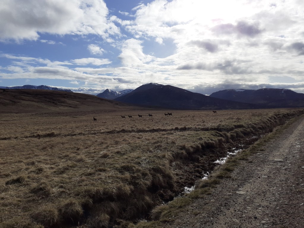
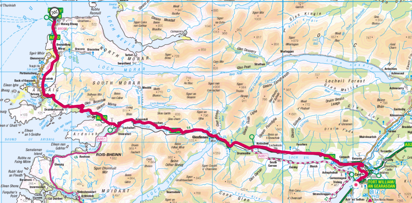
And in 2021, just as the pandemic lockdown loosened I undertook my own version of the Scottish coast-to-coast, cycling from Aberdeen to Mallaig.
Hoek van Holland – Monster – Den Haag – Noordwijck – Haarlem – Amsterdam – Gouda – Rotterdam – Hoek
The weather was glorious all week until the last day as Storm Amy bore down
The Scottish Haute Route with lead in and out from Aberdeen to Mallaig
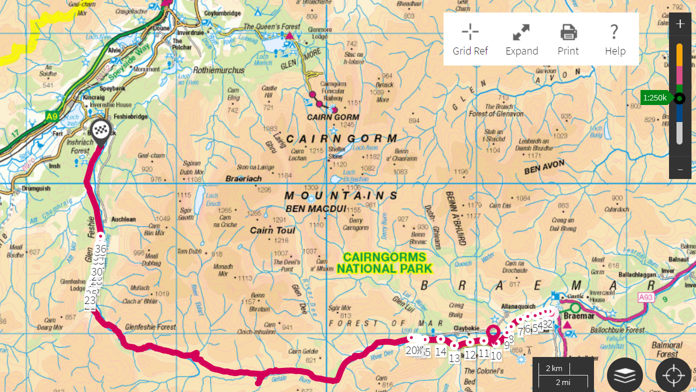
At the end of April I cycled and skied my way across Scotland, from Aberdeen to Mallaig, incorporating the ‘Scottish Haute Route’ across the Grampian Mountains.
The route of some 225 miles has a total ascent of 34,000ft, covering some of the highest peaks in the UK including Ben Nevis. Paths that crossed deep into the Cairngorm national park made it necessary to use a mix of wild camping and b&b accommodation that was open after the lockdown.
Probably against my better judgement I also strapped my skis to the bike to traverse any snow on offer.
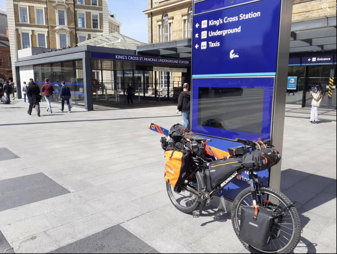
I accessed the route by taking the train from Kings Cross to Aberdeen; leaving at 2pm the direct LNER East Coast journey is a real treat, speeding its way through the English and Scottish countryside to arrive just after dark.
The journey started with a cycle into Kings Cross for the 2pm train to Aberdeen
Aberdeen is a bit of a strange city. All that oil money but there seemed to be more than the usual share of depravation. The main drag was like a ghost-town after 10pm – perhaps it was lockdown. I quickly fled back to my hotel.
Day 1: Aberdeen to Ballater 47 miles, 2,500ft (7hrs) Weather: Max 6.9 Min 2.1 Rain 4mm Wind NE 9mph Fisheries, old railway lines, River Dee
The leg from Aberdeen to Ballater generally follows the River Dee
A bit of an inauspicious start in Aberdeen – a glitchy phone led me a merry dance around the town including a tour of the various fisheries by the harbour. I rode back to the city beach to perform the customary wheel dip in the North Sea; a cold day with a freezing onshore breeze and intermittent light rain.
I was soon on my way inland via the A93 and Deeside Cycle Way formed from the Old Deeside Railway Line. A real cycling delight; miles and miles of smooth Tarmac path often very close to the River Dee with its delightful wildlife. Finches of all descriptions seemed to lead the way and far outnumbered people – I probably saw about a dozen others all day.
Wheel dip in North Sea
A raw, damp easterly
The start of the journey
North Sea views
Signs to the west
Overgrown platforms
River Dee vista
Cycling the Dee
A part of the Deeside line is still used for a tourist railway
An ideal camping spot
Aboyne weather station recorded 25 frosts in April
The old line stretches into the forest
Bridge over the Dee
Day 2: Ballater to Braemar 31 miles, 4,000ft (7hrs) Weather: Max 8.9 Min 0.5 Rain 1.2mm Wind NNW 7.7mph Royal castles, abandoned bothies and steep paths
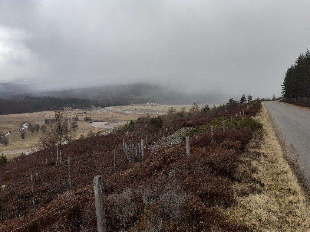
After staying at the excellent Netherley Guest House I was soon on my way to Crathie where I would ‘turn right’ to finally get off the beaten track for the remoter legs of my trip.
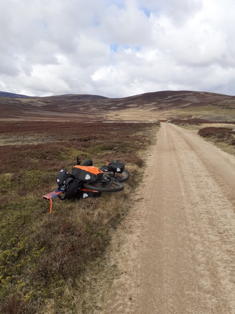
Crathie was far smaller than I imagined – the car park for Balmoral was empty, no doubt a result of it being early season and lockdown having only just been lifted. The B976 was soon heading relentlessly uphill, the first test of my endurance pedalling something like 20kg and the bike. I was soon pushing on the steepest section, a local on a racing bike told me where to leave the road.
The gravel / sand track at the start of the section was excellent and progress quick – I was surprised just how good it was. Another cyclist heading toward me remarked that he hadn’t seen so much on a bike since his cycle trek in Tibet 20 years previously.
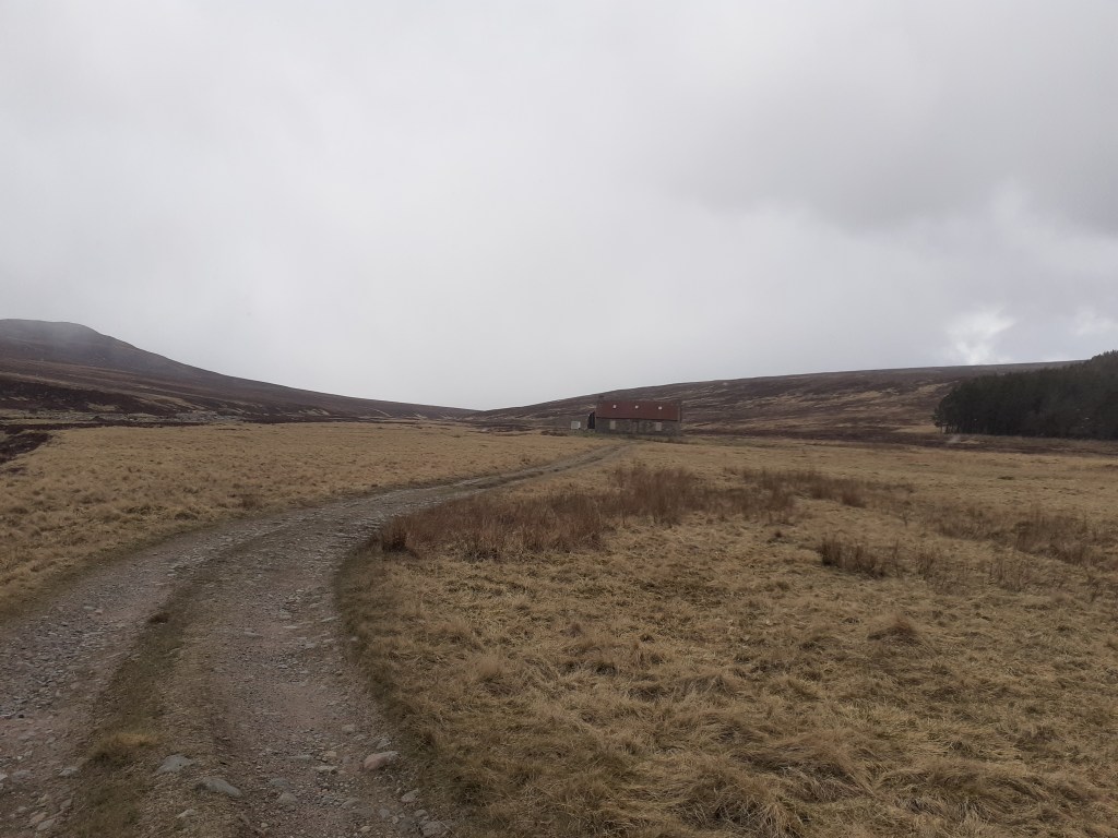
On reaching Corndavon Lodge I was faced with my first ford to cross, a relatively simple task were it not for the fact that I’d have to get myself and the machine across. The lodge, the first bothy on the Scottish Ski Club’s 1978 traverse, was boarded up.
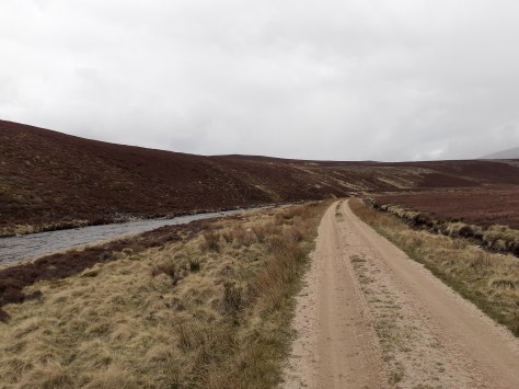
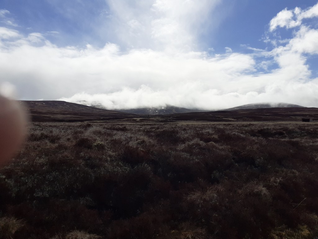
I pressed on, soon reaching Loch Builg and on to the ruin of Lochbuilg Lodge. It was at this point that I was faced with a steep, single-track, path up to Carn Drochaid and upward to Ben Avon. It was also at this point that I realised that the weight on my bike was going to make it impossible to adhere to my intention of following all the ridges.
After 15 minutes sat among the ruins I changed my plan and retreated back to the River Gairn. I planned to follow the track to Braemar while keeping one eye on other paths westward – none of which appeared to offer any bike friendly options without double backing to Braemar.
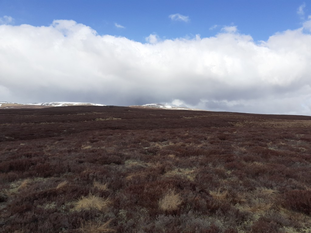
As I ascended the path up the shoulder of the 900m Culardoch it was obvious that I’d made the right choice. Despite good weather it was a real struggle at times. I was also a bit deflated as I looked across the valley at the large cornices on Ben Avon in the distance.
From the plateau of Tom na h-Eilrig it was a general downhill descent into Braemar. Time was getting on and I knew I had to arrange a b&b before the dusk chill turned into night.
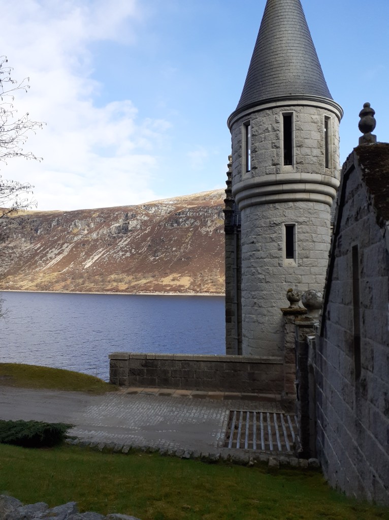
A Rapunzel like tower
Crathie Kirk
The Kirk
Gates to the wilderness
Views stretched to Lochnagar
An Creagan 573m
Daldownie ruins
Path along the Gairn
Corndavon Lodge
Carn Dearg 772m
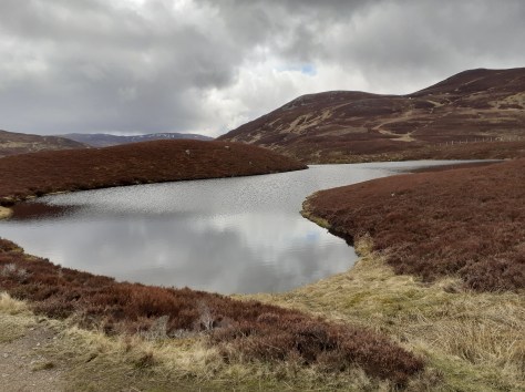
Loch Builg
Loch Builg
Loch Builg
LochBuilg Lodge ruins
Mountain bothy
Ben Avon massive 1171m
Ben Avon massive 1171m
Ben Avon massive 1171m
Cornices on Ben Avon
Corrie Cula c700m
Corrie Cula c700m
Corrie Cula c700m
Looking south to Meall Gorm
Looking south to Meall Gorm
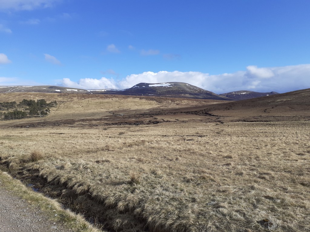
Braemar weather station, the coldest place in the UK. -27.2C was recorded here on January 10, 1982
Day 3: Braemar to Glen Feshie 40 miles, 2,159ft (10.5 hrs) Weather: Max 7.7 Min 1.2 Rain 2.4mm Wind NNE 8.2mph Smooth bridleways, rocky paths, rickety old bridges, knee deep fords, bogs
After resolving overnight that I wasn’t going to be able to follow my original planned route across the Cairngorms I’d decided a loose plan to make a decision once I’d reached Linn of Dee, effectively the end of the road – you either retreat or continue on
One idea was to continue on a path to Derry Lodge, an option that would have allowed me to complete a circuit of the Cairngorm 4000s. But the weather was less than ideal – frequent snow and hail showers would have hampered visability high up and on hearing thunder I decided on a plan B and take the low road, a 27-mile wilderness path to Glen Feshie.
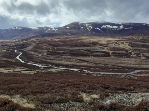
The track starts off well and I noticed a few other walkers plus a game keeper on the opposite path. After White Bridge the terrain turns into proper moor – you get the feeling you are a long way from civilisation as you glance up at distant, snow-capped fells.
I was soon faced with a junction at a ford, a walker was changing into ‘sand shoes’ before he headed on his way to Blair Atholl. The path from here soon deteriorated – I made the mistake of fording Geldie Burn on my way to the ruin of Geldie Lodge. These old buildings seem to have a magnetism that draws you in for a closer look. As I stood among the ruins I realised that I’d made yet another wrong turn – the path onward seemed to peter out so I had to re-ford the burn onto the path that deteriorated further – many sections were little more than boggy streams. Progress was slow with the heavy bike – the front wheel kept sinking and at one point I bent the outer chain ring catching a rock. I managed a repair but effectively lost a third of my gears.
You hear the River Eidart before you see it – a waterfall flows through the deep cut in the landscape, progress from here is over a rickety bridge. A couple of the wooden slats were rotten; I decided to carry the panniers across rather than chance the weight of the whole bike.
The bridge more or less marks the high point of the ride after which progress is more or less all downhill. The change in the landscape is quite marked; the valley becoming much steeper and more wooded, it reminded me a lot of Valsesia in Piemonte.
Serious erosion on the path of the eastern bank of the River Feshie made it necessary to ford the river three times. With the light starting to fade I began looking for a suitable camping spot. Ruigh Aiteachain, my scheduled overnight stop was now on the wrong side of the river and Glenfeshie Lodge was still not open after the lockdown. Because it was a good road I decided to keep going and after passing through a hamlet I found a spot on the river bank as light really was fast fading. Conscious that cows were in the vicinity I crossed over to a dried overflow bed and pitched the tent. This was the first time I’d had the tent out of its bag and though easy to pitch I was cursing that I hadn’t had a least one practice in the garden in the months since I’d bought it.
Forty miles and nearly 11 hours in the saddle it had been the hardest day’s biking ever. After brushing my teeth I crawled into my sleeping bag and sleep quickly followed.
Incoming showers of hail seen from the road to Linn of Dee
A gorge under the bridge at Linn of Dee
A gorge under the bridge at Linn of Dee
A gorge under the bridge at Linn of Dee
No going back
The path from Linn of Dee
Carn Mor, 634m
Carn Liath, 818m
Sgor Mor, 813m
White Bridge over the Dee
Cairn Toul at the top of the valley from White Bridge
A bothy seen from where the track splits. Turn left for Blair Atholl, right for Glen Feshie
Cnapan Garbh, 674m
A ford over Geldie Burn, one of many
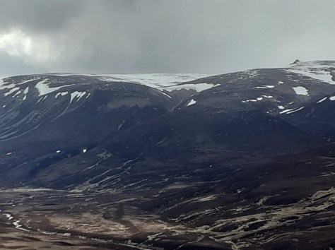
Heavy snow showers really hampered visibility at times
Heavy snow showers really hampered visibility at times
An Sgarsoch, 1006m
From heavy snow to bright sun in minutes
From heavy snow to bright sun in minutes
The ruin of Geldie Lodge at 530m
The ruin of Geldie Lodge at 530m. This turned out to be yet another wrong turning
An Sgarsoch, 1006m
Back on track though the path turned into a narrow one which hampered progress, especially with the low panniers. Cairn Meall Tionail can be seen distant
One of many rests on the rocky path
The path and burn could be seen stretching into the distance
The foothills of the Cairngorm 4000s
A snowpatch, below me for a change
The waterfalls on the River Eidart can be heard long before you see them
The waterfalls on the River Eidart can be heard long before you see them
A rickety bridge spans the River Eidart – some of the wooden slats have seen better days
A rickety bridge spans the River Eidart – some of the wooden slats have seen better days. I was surprised to see that it was engineered in the 1950s.
Safely over, I imagine the waterfalls present a refreshing rest stop in the summer
The waterfalls on the River Eidart
Subtle changes in the landscape as the valley morphs into Glen Feshie
Glen Feshie. The steep-sided valley with abundant woodland reminded me of Val Sesia in Piemonte
A huge tree, possibly felled in a storm
This tree had completely snapped at the base of the trunk
This tree had completely snapped at the base of the trunk
The River Feshie. Yet another ford
Safely over the other side. Because of erosion of the path the river had to be forded three times
Distant snowy peaks
Camping on the banks of the Feshie
Bridge over the Dee at Linn of Dee
Day 4: Feshiebridge to Loch Doire nan Sgiath 38 miles 3,431ft ascent 11 hours (2 hours in Kingussie) Weather: Max 7.6 Min 0.4 Rain 2mm Wind NNE 4.4mph Castles, lochs, distilleries and dozens of deer
The dawn chorus awoke me just before 6am along with the reassuring sound of raindrops – not to mention the comforting hum of the fast-flowing River Feshie. It was time to break camp.
Packing everything up seemed to take an age, it wasn’t much before I was pedalling again back to the road at Feshiebridge. With a dead phone I made a beeline for Kingcraig but soon found myself pedalling on to Kingussie where I found a cafe to recharge my electronics and myself.
Although polite I found the locals to be a bit standoffish after exchanging the usual initial pleasantries. I resolved to listen to the conversations of others as they came and went; the hot topic seemed to be the coming election and more than one person exclaimed that they had ‘no interest whatsoever in who bought Boris’s curtains’.
At Newtonmore I swapped the old A86 for the B9150 and another cycle path that more or less trekked all the way to Dalwhinnie. From here it was another delightful lochside path along Loch Ericht.
Old castle-like lodges
Day 5: Loch Doire nan Sgiath to Fort William 32 miles, 1287ft (4.5 hrs) Weather: Max 8.1 Min 2.8 Rain 1mm Wind NE 4.3mph Glass-smooth lochs, giant pines, empty castles
After a much better overnight camping stop I rode on to Fort William. The path down to Loch Laggan, a gravel track suddenly turns into the smoothest Tarmac road before you reach ‘Kings Grave’, a Scottish castle that looks like something out of a Hammer studios production. There wasn’t a soul around – I was half expecting Klove to suddenly appear at the door.
The path along the southern shore of Loch Laggan offered superb views of snow-capped Creag Meagaidh – clouds of vapour could be seen as the strong spring sunshine evaporated the wintry precipitation that had fallen overnight.
The original plan to proceed to Corrour shooting lodge was abandoned as steep paths beyond effectively blocked my way west. From here it was a straightforward, mostly downhill, onward path into Fort William.
Day 6: Fort William – Observatory Gully, Ben Nevis 30 miles, 5,194ft (11.5 hrs) Weather: Max 8.6 Min -2.1 Rain tr Wind WSW 7.5mph A little skiing at last
After abandoning efforts to go up Aonach Mor – impossible even with half the panniers / weight left in the b&b – the day’s climbing didn’t really start until 3pm from the North Face car park.Lots of ‘you’re mad’ odd looks though with words of encouragement from walkers and climbers on the way up to the CIC hut at 2,231ft.Knackered but with the sight of the snowline just a few hundred feet higher I transferred the skis to the pack, locked the bike and continued on to the snowline, around 2,700ft up Observatory Gully. Ski boots and crampons on at 6pm I went higher to the small buttress at 3,900ft. With one eye on the clock the skis went on and a slide back down lumpy snow. I’d travelled 210 miles and climbed 18,571ft for a ski descent of 1,246ft. Is this the longest ‘walk in’ to a ‘ski tour’ ever?I made it back to Fort William as the last light of the day faded at 9.30pm
Day 7: Fort William – Mallaig: 43 miles, 3,031ft (5 hrs ish) Weather: Max 6.3 Min 2.3 Rain 4mm Wind NE 16.3mph Stormy lochs, rusting boats, Harry Potter steam trains, railway viaducts, Bonnie Prince Charlie and the best wee dram I’ve ever tasted.
I totally underestimated this leg, thinking it would be a plod to the coast. The last fifth turned me directly into the stormy winds – even on declines I seemed to be buffeted back uphill, I had to resort to walking on large sections.
What I thought was the last hill turned out to be the last but three. I cursed my lot out loud and, approaching delirium, convinced myself that Scottish miles must be longer than English miles.
No matter, I arrived in Mallaig and dipped the wheel in the harbour before finding a pub for the best pint and wee dram I’ve ever tasted.
I’d been lucky with the weather though days like this would have made the tour impossible in this timescale.
A rusting boat on the shores of Loch Linnhe
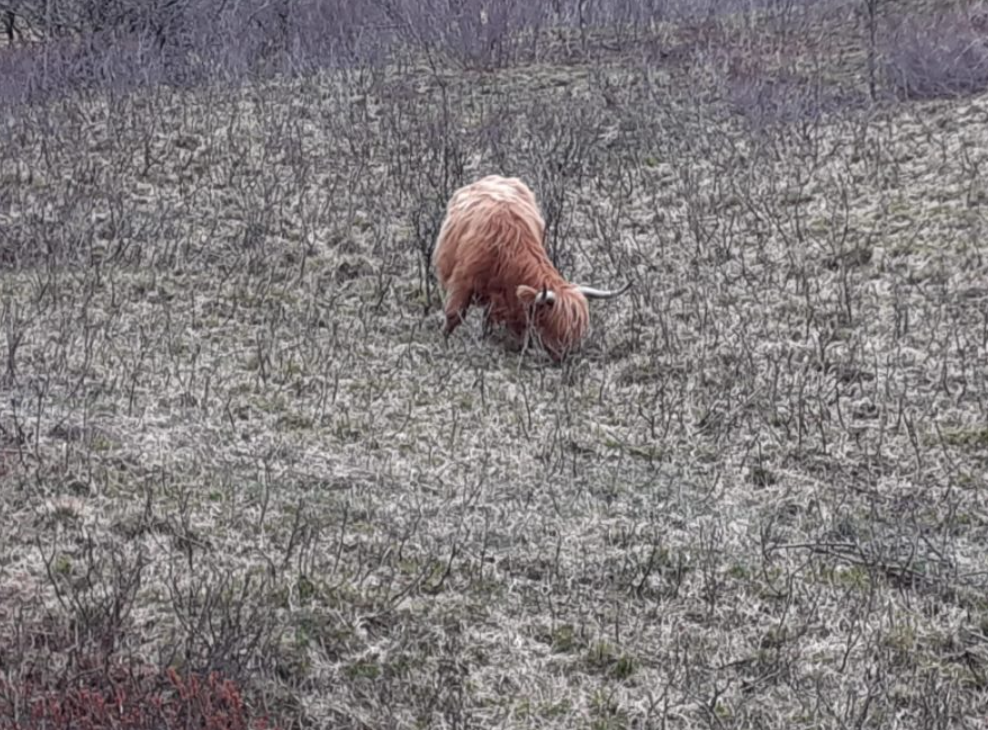
Highland cow
Steam locomotive
Loch Shiel
Jacobite fells distant
A beach
Bonnie Prince Charlie
Journey’s end
The best wee dram. Ever
After a fairly benign week weatherwise I had to cycle into the full fury of this beast
Though the challenge is complete I’m still raising funds for Young Minds, a brilliant charity for our youth who have suffered greatly being cooped up over the past year.
The tow paths along the river Lea have provided generations of Londoners a place to escape – the route coming into its own following the legacy of London 2012 and the creation of the Queen Elizabeth Olympic Park.
The river Lea near the Bow flyover is roughly where Luke Howard’s chemical factory was situated
It also provided a means for Luke Howard’s commute to work when he moved his family from Plaistow to Tottenham in 1812.
Seven years earlier Howard set up his pharmaceutical laboratory on the banks of the Lea in the area where Bow flyover now stands. From this vantage point, as the factory produced chemicals including quinine, Howard kept a meticulous record of the atmosphere later publishing results in The Climate of London, among the first texts to discuss urban meteorology.
Development in the region was in its infancy and it would be years before the river banks became covered by factories and warehouses, these now fast making way for luxury flats and restaurants.
The river is lined with canal boats, breweries, old factories, residential development and street art
I’ve often wondered what his journey to and from the factory was like so on Tuesday, tempted out by cloudless skies and a warm 23C I grabbed my bike and headed to the Olympic Park. Despite numerous visits I still got lost in the myriad paths in the park, turning into dead ends and finding myself on the ‘wrong side’ of canals.
Anyone familiar with Bow Flyover will know it’s not the most inspiring place; it probably represents the low point of the way north.
It was at this point in 1809 that Howard noted that the river had swelled to a width beyond a mile wide. Five years later Howard also noted how the Lea had become choked with ice following a bitterly cold winter, the year the last Thames’ Frost Fair was held.
Anchor and Hope: a good spot to stop for a pint
As you ride north the familiar sites of the Olympic Park hove into view on the right while, if you look left, beyond the cacophony of the A12, the old Bryant & May match factory can be seen. Opened in 1861 the factory, which was one of the first east London renewal projects to feature luxury flats, is yet another landmark that simply wasn’t there in Howard’s time.
Just after Old Ford locks is a canal that turns left. This ‘cut’, called the Hertford union canal or Duckett’s canal, was in the process of being dug when in July 1829 lightning during a thunderstorm killed three workers. Howard, in one of many weather-based accounts in the The Climate of London, takes up the story:
A tremendous storm of thunder and lightning broke upon the metropolis about 1 o’clock on Saturday morning. The sky had been lighted up the whole evening by vivid electrical flashes and so late as half past twelve the stars were visible when a dark cloud suddenly arose and in a few minutes one of toe heaviest showers of rain and hail ever witnessed fell in torrents from its bosom.
Peals of thunder soon followed and continued rolling with scarcely any intermission for upwards of two hours accompanied with awful bursts of lightning; the residents of Bow, Stratford and Bromley were thrown into the greatest consternation by the violence of the storm, one poor fellow lost his life and two others have been so severely injured that but faint hopes are entertained of their recovery.
The three sufferers Sullivan, Salter and Fitzpatrick were engaged in excavating a canal, at present constructing by Sir George Duckett at Old Ford, and were at half past two o’clock diligently employed in their work when the storm commenced. Sullivan was at once struck lifeless and Fitzpatrick and Salter were so seriously injured as to make it necessary to procure immediate medical attendance.
Fitzpatrick was removed to his lodgings at Bow where he was attended by Dr Fairhead who on examining his person found that his left side had been most seriously injured and that there was reason to believe his intestines had suffered severely from the shock. The damage which Salter sustained has not been of so serious a nature.
Deaths caused by lightning were a much more common occurrence in the 19th century, mostly because so many people worked outside and the dangers of this natural phenomenon were not well document. The thunderstorm in July 1829 was particularly severe, as Howard continues:
During the continuance of the lightning on Friday evening a man who was employed in pumping in Bethnal Green fields which the late heavy rains have flooded was struck by a sudden flash which caused his instantaneous death.
The clothes exhibited a singular appearance being literally torn to atoms and every part of the metal in his buttons had the appearance of having been fused. The body itself showed no traces of the electric fluid with the exception of a slight mark on the forehead.
As you cycle on the factories / flats gradually thin out until you reach Lea Bridge Road when Leyton and Walthamstow Marshes become visible on the right. The big skies probably the same as they were during the 19th century. On reaching Tottenham Hale it is time to leave the river and turn left toward the town centre.
7 Bruce Grove, Tottenham.
A total of 6 miles later brings you to Howard’s family home, 7 Bruce Grove. It still stands but, despite having a blue plaque, is in a terrible state of repair – internal walls have collapsed and the roof is clearly porous. The owners have a plan to turn the building into flats but nothing has happened in years. A petition to save the building was set up a while ago but this, too, seems to have had little impact.
Howard and his family divided their time between here and Ackworth, Yorkshire. I’ve known about 7 Bruce Grove for years but I didn’t realise just how long the garden was, stretching back hundreds of feet.. It was here that Howard also kept a weather station and was the venue for his account of the partial solar eclipse in 1820.
The monkey puzzle tree
There is precious little left of the original garden, it being overgrown with bramble, nettles and alder. I did notice a tall money puzzle tree which I wonder once had pride of place in one of the borders.
Because of the dense undergrowth and it being behind a large wall there is precious little you can see but I wonder if there is any evidence of Howard’s meteorological enclosure somewhere in the garden?
It would be a fitting tribute Luke Howard if any future development would allow the provision of a weather station somewhere on the property.
The rear of 7 Bruce Grove, Tottenham
Walthamstow Marshes were flooded to a depth so great that many trees briefly disappeared
Hypnotised by a long line of red lights and a sudden feeling of being totally alone in the darkness were surreal sensations I experienced as I took on the challenge of the Dunwich Dynamo last weekend.
I’d read a few personal accounts of this 120-mile blast through the Essex and Suffolk countryside but nothing really prepares you for the ride that starts in the fading light of East London.
A sea of cyclists greeted you as you arrive in London Fields – a mix of serious lycra together with quite a few souls in regular clothes who look as if they were popping down the shops for a pint of milk rather than an overnight ride to the coast. The park was also still busy with people out enjoying the warm weather with the thermometer still hovering around 25C. Though the event has been running for 24 years a couple of bemused onlookers asked me “what the hell is going on”.
“This is NOT a race”, screams the first line of a sheet of A4 directions handed to me by one of the organisers. And without any fanfare, at 8pm, legions got on their bikes by the Pub on the Park. My intentions of grabbing a big bowl of pasta before the start were soon forgotten as I joined the throng making its way through the narrow confines of Martello Street bike path.
The procession through Hackney was not everyone’s idea of fun though the sheer number of cycles was enough to stave off even the most impatient motorists.
East London quickly turned into suburban Essex and the scrum of cyclists had already turned into a single file. The sun was already set by the time we reached the Wake Arms roundabout though I assured my two cycling buddies that there would be plenty of options for pasta and coffee in Epping – noble intentions that ended up as pork pies and cans of Coke from Londis…
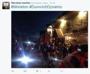
I’d never cycled beyond Epping – unknown roads even harder to navigate in the darkness. Familiar names started to flash past: Moreton, Fyfield, Leaden Roding and the 32-mile point Great Dunmow. Pockets of villagers screamed encouragement at cyclists including a four-person handbuilt contraption, tandems and one brave cyclist who’d brought his child along in a trailer.
We stopped for a pint in Great Bardfield at 43 miles; locals joining in the party atmosphere as cyclists either stopped or pedalled on. Although just gone midnight conversations seemed to hover over the fast pace of the tour, probably helped by the fine weather and almost constant light westerly breeze. Finchingfield, Wethersfield, Sible and Castle Hedingham then passed in quick succession before we reached the halfway point at Sudbury about 1am where huge queues had formed for coffee and a barbeque put on by the local fire crews.
Though the temperature never fell below 16C over the entire event tiredness was now starting to set in but before we got too ensconced in our chairs we decided to push on.
It was this part of the event where groups of cyclists started to spread out though, because most were cycling at roughly the same speed, you started to notice the same people: the guy in the Heinz baked beans top, the group cycling for Alzheimers, the guy with the kiddie trailer (again) comes into view, the child still awake and appearing to be transfixed by a tablet. I exchanged pleasantries with a guy in a top with the dragon of Wales emblazoned on the back – inane conversations though most seem happy to just get their heads down and eat up a few more miles.
Sizewell B is getting closer
It was around Bildeston that the roads suddenly seemed to turn really dark. Pedalling on I focus on the line of red lights in the distance – almost hynotised by the rhythm of the whole thing – but then suddenly realised that I was cycling downhill at roughly the same speed as I would in daylight. I turned my head to find that my two cycling buddies were nowhere to be seen, and neither were any other riders. An overwhelming feeling of being alone suddenly dawned on me and I eased back on the pedals though it was a good 10 minutes before my companions catch up – one asked just what exactly was in the muesli bars that I had been munching away on for six hours.
At 3am the delirium started to set in: the University Challenge theme tune was going on a loop in my head – a couple of cyclists that have brought along loud speakers failed to distract me. Our charge to the coast was eventually interrupted by a puncture, my cycling buddy exclaiming in the darkness: “This wheel doesn’t feel right!”.
By 4am the sky had long begun to lighten and the fading batteries of many riders’ headlamps was no longer such a pressing issue. I think it was around Sibton Lake that pop-up cafes started to emerge at the side of the road. Alas, the long queues prevented us from stopping, so terrified were we that if we stopped for too long our bodies would cease up. No matter. Many other cyclists by now were beginning to stop and rest on verges; a few oblivious that the sun was beginning to rise as quick as they were falling into a slumber.
The last 10 miles from Framlingham, once the sun had risen, seemed to be the hardest. I’m not sure if it was my brain being unable to cope with the additional distraction of having to deal with looking at beautiful countryside. And a couple more inclines seemed to be the last straw for a few cyclists who got off and walked.
The pine scrub of Minsmere spread out after passing through Darsham before our ultimate destination Dunwich, the Lost City, ended our odyssey. After 10-and-a-half hours we’d done it.
I’ve managed to raise over £1,000 for Sarcoma, the soft tissue and bone cancer charity
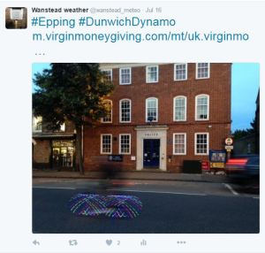
On a Saturday closest to full moon in July thousands of cyclists congregate in London Fields and ride 200km through the night to Dunwich on the coast of Suffolk.
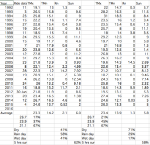
Weather stats for London during the Dunwich Dynamo
Modestly described by the organisers as a “gentle bike ride to the beach, through soft country on good roads” the hours of darkness present a huge challenge for participants.
Michael Barry, the retired Canadian professional road racing cyclist, rated the challenge 5/10, harder than the 280 mile London to Paris ride which he ranked only 2/10.
Taking place in summer you would expect long hours of moonlight to be a welcome assist for these brave souls who peddle hours through the night to reach their goal. A look at the synoptic charts and statistics of each ride, however, reveals weather that is often a long way from being summery.
Looking in detail there appears to be very little chance of the ride coinciding with a heatwave. In 1999, 2003, 2004 and 2014 riders left the capital during days where the mercury reached above 80F (26.7C) – though this represents only 17% of starts. Temperatures around 70F (21.1C) are much more common.
Over 40% of the rides have seen over 1mm of rain on the opening day, this falls to 17% on the second day – a dry end to the marathon challenge is perhaps to be expected.
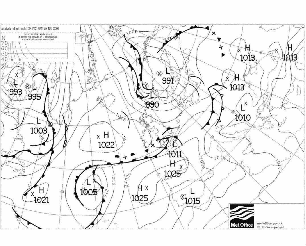
Patrick Field, of the London School of Cycling, said that 2007, the wettest start day to a Dynamo, was “gloriously wet”.
Perhaps what this blog also reveals is that UK weather at full moon, even in high summer, is notoriously unpredictable. Luke Howard , the father of meteorology, tried for 50 years to
prove a link between the weather and phases of the moon, but died still mystified at the ripe old age of 91.
Low pressure centred along the south coast brought a ‘gloriously wet’ Dynamo in 2007.
A movie of all synoptic charts highlights just how unsettled this time of year can be found here.
* The author is planning to take part in this year’s event to raise money for Cancer Research.
** Full stats for the weather in London during the Dunwich Dynamo back to 1992 can be found here: https://onedrive.live.com/redir?resid=A148835276FAFDEE!2561&authkey=!AEMmoeUZRVSq7uU&ithint=file%2cxlsx


 East London quickly turned into suburban Essex and the scrum of cyclists had already turned into a single file. The sun was already set by the time we reached the Wake Arms roundabout though I assured my two cycling buddies that there would be plenty of options for pasta and coffee in Epping – noble intentions that ended up as pork pies and cans of Coke from Londis…
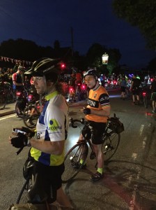 We stopped for a pint in Great Bardfield at 43 miles; locals joining in the party atmosphere as cyclists either stopped or pedalled on. Although just gone midnight conversations seemed to hover over the fast pace of the tour, probably helped by the fine weather and almost constant light westerly breeze. Finchingfield, Wethersfield, Sible and Castle Hedingham then passed in quick succession before we reached the halfway point at Sudbury about 1am where huge queues had formed for coffee and a barbeque put on by the local fire crews.
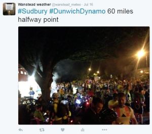 It was this part of the event where groups of cyclists started to spread out though, because most were cycling at roughly the same speed, you started to notice the same people: the guy in the Heinz baked beans top, the group cycling for Alzheimers, the guy with the kiddie trailer (again) comes into view, the child still awake and appearing to be transfixed by a tablet. I exchanged pleasantries with a guy in a top with the dragon of Wales emblazoned on the back – inane conversations though most seem happy to just get their heads down and eat up a few more miles.
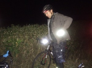
 By 4am the sky had long begun to lighten and the fading batteries of many riders’ headlamps was no longer such a pressing issue. I think it was around Sibton Lake that pop-up cafes started to emerge at the side of the road. Alas, the long queues prevented us from stopping, so terrified were we that if we stopped for too long our bodies would cease up. No matter. Many other cyclists by now were beginning to stop and rest on verges; a few oblivious that the sun was beginning to rise as quick as they were falling into a slumber.
 The last 10 miles from Framlingham, once the sun had risen, seemed to be the hardest. I’m not sure if it was my brain being unable to cope with the additional distraction of having to deal with looking at beautiful countryside. And a couple more inclines seemed to be the last straw for a few cyclists who got off and walked.
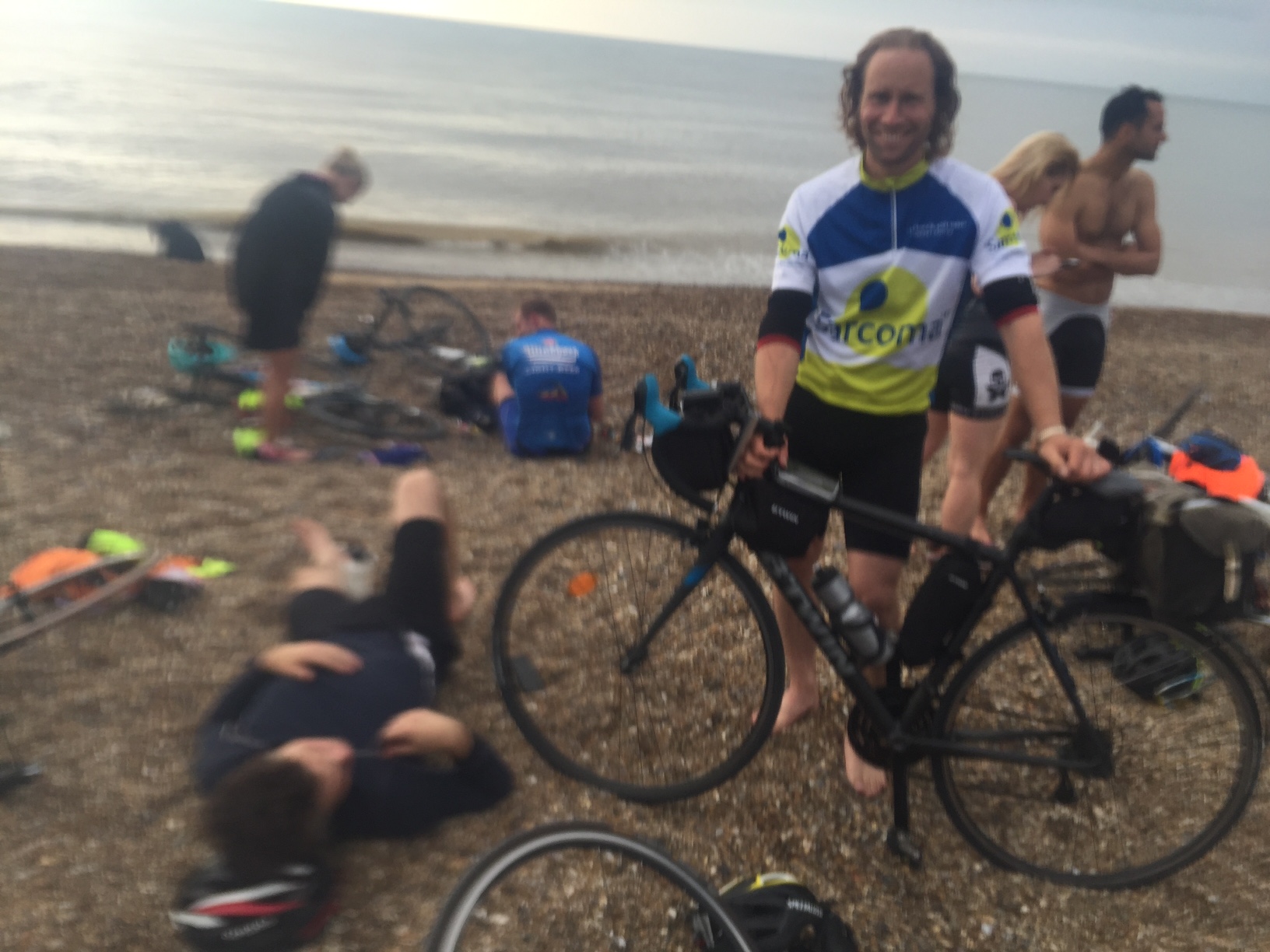


You must be logged in to post a comment.