This mountaineering challenge was first drawn to my attention by Iain Cameron’s Flickr post featuring the Scottish Mountaineering Club’s week long tour from Balmoral to Glen Nevis.
It’s a fascinating feat that was repeated in 2010 by father and son team, Roger and Finlay Wild. Alas, the weather has not allowed the achievement again, at least on skis.
I’d often wondered about what sort of snow you’d need to complete and recently discovered a feature on Ogimet that can scrape old weather data and place it into a table.
Just look at the snow depths below! As the SMC account says the participants would have been better undertaking the tour a week earlier, rather than starting four days into a thaw. The depths in earlier February, however, illustrate just how good the conditions would have been, compared with today!
A full account of the original tour can be found here.
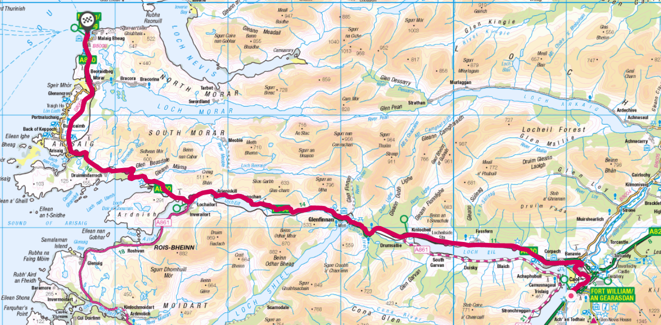
The Scottish Haute Route with lead in and out from Aberdeen to Mallaig
At the end of April I cycled and skied my way across Scotland, from Aberdeen to Mallaig, incorporating the ‘Scottish Haute Route’ across the Grampian Mountains.
The route of some 225 miles has a total ascent of 34,000ft, covering some of the highest peaks in the UK including Ben Nevis. Paths that crossed deep into the Cairngorm national park made it necessary to use a mix of wild camping and b&b accommodation that was open after the lockdown.
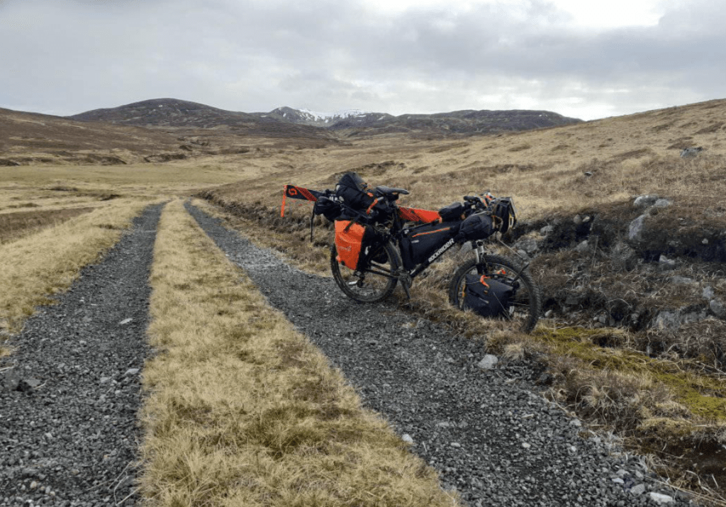
Probably against my better judgement I also strapped my skis to the bike to traverse any snow on offer.
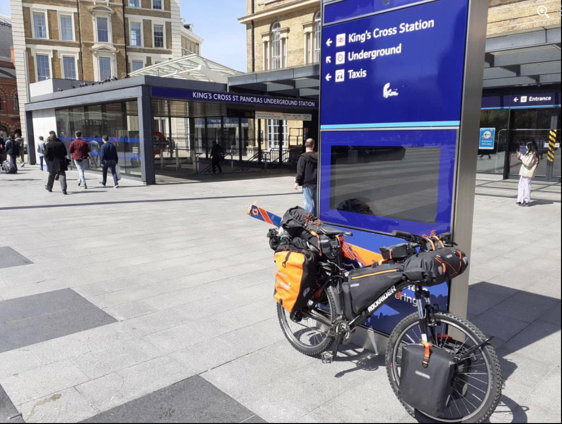
I accessed the route by taking the train from Kings Cross to Aberdeen; leaving at 2pm the direct LNER East Coast journey is a real treat, speeding its way through the English and Scottish countryside to arrive just after dark.
The journey started with a cycle into Kings Cross for the 2pm train to Aberdeen
Aberdeen is a bit of a strange city. All that oil money but there seemed to be more than the usual share of depravation. The main drag was like a ghost-town after 10pm – perhaps it was lockdown. I quickly fled back to my hotel.
Day 1: Aberdeen to Ballater 47 miles, 2,500ft (7hrs) Weather: Max 6.9 Min 2.1 Rain 4mm Wind NE 9mph Fisheries, old railway lines, River Dee
The leg from Aberdeen to Ballater generally follows the River Dee
A bit of an inauspicious start in Aberdeen – a glitchy phone led me a merry dance around the town including a tour of the various fisheries by the harbour. I rode back to the city beach to perform the customary wheel dip in the North Sea; a cold day with a freezing onshore breeze and intermittent light rain.
I was soon on my way inland via the A93 and Deeside Cycle Way formed from the Old Deeside Railway Line. A real cycling delight; miles and miles of smooth Tarmac path often very close to the River Dee with its delightful wildlife. Finches of all descriptions seemed to lead the way and far outnumbered people – I probably saw about a dozen others all day.
Wheel dip in North Sea
A raw, damp easterly
The start of the journey
North Sea views
Signs to the west
Overgrown platforms
River Dee vista
Cycling the Dee
A part of the Deeside line is still used for a tourist railway
An ideal camping spot
Aboyne weather station recorded 25 frosts in April
The old line stretches into the forest
Bridge over the Dee
Day 2: Ballater to Braemar 31 miles, 4,000ft (7hrs) Weather: Max 8.9 Min 0.5 Rain 1.2mm Wind NNW 7.7mph Royal castles, abandoned bothies and steep paths
After staying at the excellent Netherley Guest House I was soon on my way to Crathie where I would ‘turn right’ to finally get off the beaten track for the remoter legs of my trip.
Crathie was far smaller than I imagined – the car park for Balmoral was empty, no doubt a result of it being early season and lockdown having only just been lifted. The B976 was soon heading relentlessly uphill, the first test of my endurance pedalling something like 20kg and the bike. I was soon pushing on the steepest section, a local on a racing bike told me where to leave the road.
The gravel / sand track at the start of the section was excellent and progress quick – I was surprised just how good it was. Another cyclist heading toward me remarked that he hadn’t seen so much on a bike since his cycle trek in Tibet 20 years previously.
On reaching Corndavon Lodge I was faced with my first ford to cross, a relatively simple task were it not for the fact that I’d have to get myself and the machine across. The lodge, the first bothy on the Scottish Ski Club’s 1978 traverse, was boarded up.
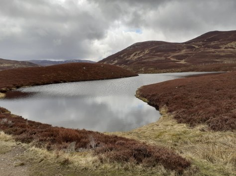
I pressed on, soon reaching Loch Builg and on to the ruin of Lochbuilg Lodge. It was at this point that I was faced with a steep, single-track, path up to Carn Drochaid and upward to Ben Avon. It was also at this point that I realised that the weight on my bike was going to make it impossible to adhere to my intention of following all the ridges.
After 15 minutes sat among the ruins I changed my plan and retreated back to the River Gairn. I planned to follow the track to Braemar while keeping one eye on other paths westward – none of which appeared to offer any bike friendly options without double backing to Braemar.
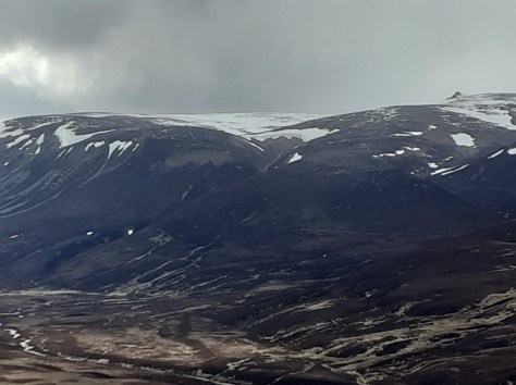
As I ascended the path up the shoulder of the 900m Culardoch it was obvious that I’d made the right choice. Despite good weather it was a real struggle at times. I was also a bit deflated as I looked across the valley at the large cornices on Ben Avon in the distance.
From the plateau of Tom na h-Eilrig it was a general downhill descent into Braemar. Time was getting on and I knew I had to arrange a b&b before the dusk chill turned into night.
A Rapunzel like tower
Crathie Kirk
The Kirk
Gates to the wilderness
Views stretched to Lochnagar
An Creagan 573m
Daldownie ruins
Path along the Gairn
Corndavon Lodge
Carn Dearg 772m
Loch Builg
Loch Builg
Loch Builg
LochBuilg Lodge ruins
Mountain bothy
Ben Avon massive 1171m
Ben Avon massive 1171m
Ben Avon massive 1171m
Cornices on Ben Avon
Corrie Cula c700m
Corrie Cula c700m
Corrie Cula c700m
Looking south to Meall Gorm
Looking south to Meall Gorm
Braemar weather station, the coldest place in the UK. -27.2C was recorded here on January 10, 1982
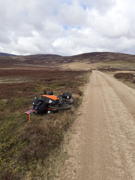
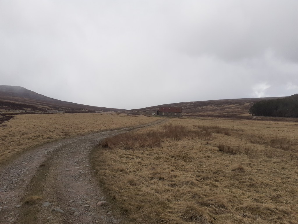
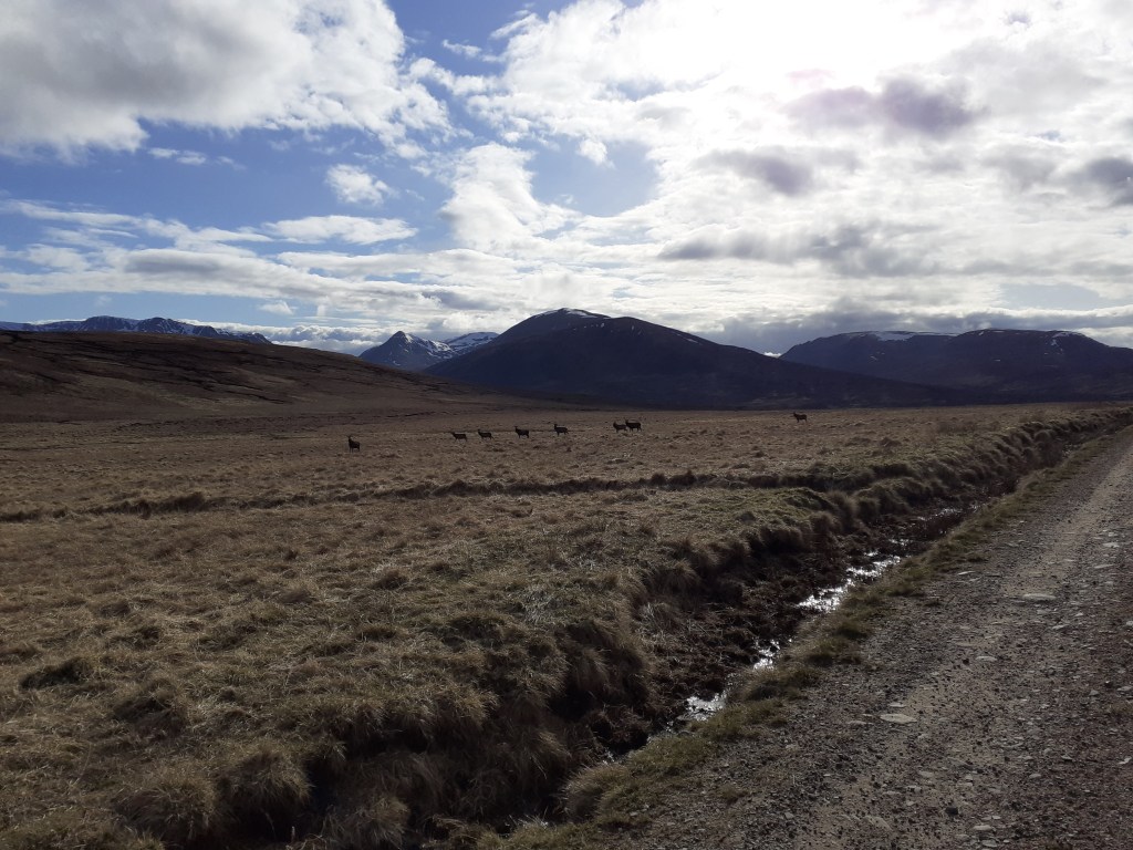
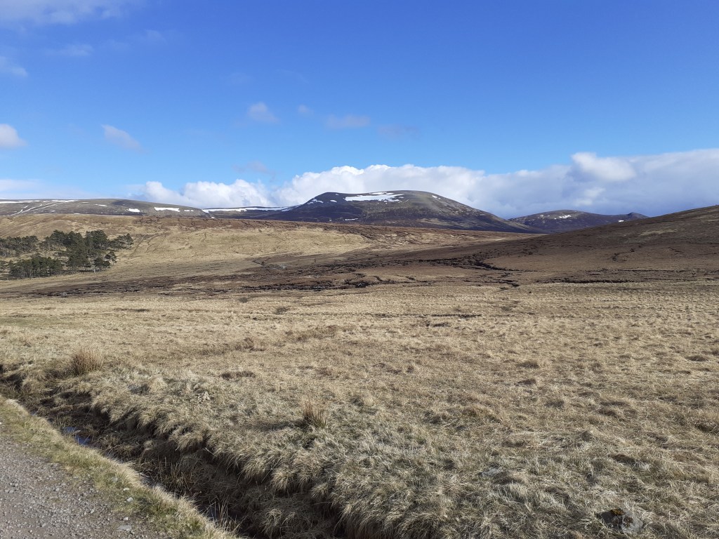
Day 3: Braemar to Glen Feshie 40 miles, 2,159ft (10.5 hrs) Weather: Max 7.7 Min 1.2 Rain 2.4mm Wind NNE 8.2mph Smooth bridleways, rocky paths, rickety old bridges, knee deep fords, bogs
After resolving overnight that I wasn’t going to be able to follow my original planned route across the Cairngorms I’d decided a loose plan to make a decision once I’d reached Linn of Dee, effectively the end of the road – you either retreat or continue on
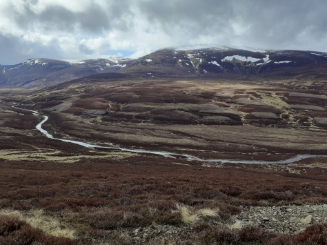
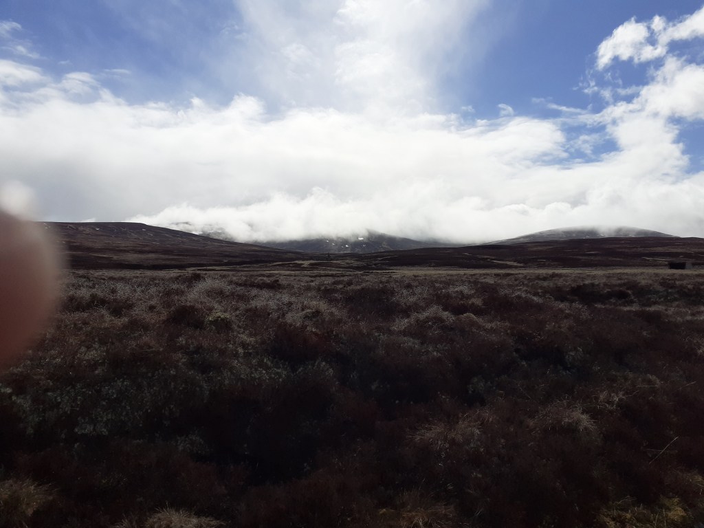
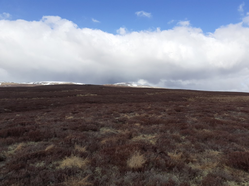
One idea was to continue on a path to Derry Lodge, an option that would have allowed me to complete a circuit of the Cairngorm 4000s. But the weather was less than ideal – frequent snow and hail showers would have hampered visability high up and on hearing thunder I decided on a plan B and take the low road, a 27-mile wilderness path to Glen Feshie.
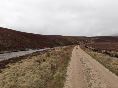
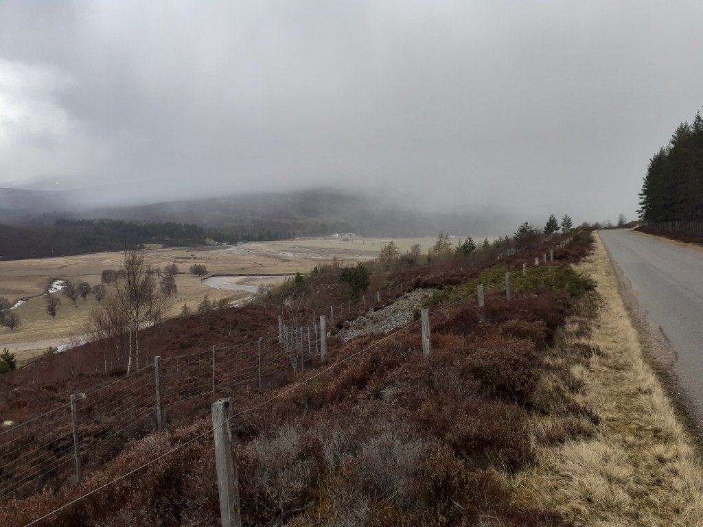
The track starts off well and I noticed a few other walkers plus a game keeper on the opposite path. After White Bridge the terrain turns into proper moor – you get the feeling you are a long way from civilisation as you glance up at distant, snow-capped fells.
I was soon faced with a junction at a ford, a walker was changing into ‘sand shoes’ before he headed on his way to Blair Atholl. The path from here soon deteriorated – I made the mistake of fording Geldie Burn on my way to the ruin of Geldie Lodge. These old buildings seem to have a magnetism that draws you in for a closer look. As I stood among the ruins I realised that I’d made yet another wrong turn – the path onward seemed to peter out so I had to re-ford the burn onto the path that deteriorated further – many sections were little more than boggy streams. Progress was slow with the heavy bike – the front wheel kept sinking and at one point I bent the outer chain ring catching a rock. I managed a repair but effectively lost a third of my gears.
You hear the River Eidart before you see it – a waterfall flows through the deep cut in the landscape, progress from here is over a rickety bridge. A couple of the wooden slats were rotten; I decided to carry the panniers across rather than chance the weight of the whole bike.
The bridge more or less marks the high point of the ride after which progress is more or less all downhill. The change in the landscape is quite marked; the valley becoming much steeper and more wooded, it reminded me a lot of Valsesia in Piemonte.
Serious erosion on the path of the eastern bank of the River Feshie made it necessary to ford the river three times. With the light starting to fade I began looking for a suitable camping spot. Ruigh Aiteachain, my scheduled overnight stop was now on the wrong side of the river and Glenfeshie Lodge was still not open after the lockdown. Because it was a good road I decided to keep going and after passing through a hamlet I found a spot on the river bank as light really was fast fading. Conscious that cows were in the vicinity I crossed over to a dried overflow bed and pitched the tent. This was the first time I’d had the tent out of its bag and though easy to pitch I was cursing that I hadn’t had a least one practice in the garden in the months since I’d bought it.
Forty miles and nearly 11 hours in the saddle it had been the hardest day’s biking ever. After brushing my teeth I crawled into my sleeping bag and sleep quickly followed.
Incoming showers of hail seen from the road to Linn of Dee
A gorge under the bridge at Linn of Dee
A gorge under the bridge at Linn of Dee
A gorge under the bridge at Linn of Dee
No going back
The path from Linn of Dee
Carn Mor, 634m
Carn Liath, 818m
Sgor Mor, 813m
White Bridge over the Dee
Cairn Toul at the top of the valley from White Bridge
A bothy seen from where the track splits. Turn left for Blair Atholl, right for Glen Feshie
Cnapan Garbh, 674m
A ford over Geldie Burn, one of many
Heavy snow showers really hampered visibility at times
Heavy snow showers really hampered visibility at times
An Sgarsoch, 1006m
From heavy snow to bright sun in minutes
From heavy snow to bright sun in minutes
The ruin of Geldie Lodge at 530m
The ruin of Geldie Lodge at 530m. This turned out to be yet another wrong turning
An Sgarsoch, 1006m
Back on track though the path turned into a narrow one which hampered progress, especially with the low panniers. Cairn Meall Tionail can be seen distant
One of many rests on the rocky path
The path and burn could be seen stretching into the distance
The foothills of the Cairngorm 4000s
A snowpatch, below me for a change
The waterfalls on the River Eidart can be heard long before you see them
The waterfalls on the River Eidart can be heard long before you see them
A rickety bridge spans the River Eidart – some of the wooden slats have seen better days
A rickety bridge spans the River Eidart – some of the wooden slats have seen better days. I was surprised to see that it was engineered in the 1950s.
Safely over, I imagine the waterfalls present a refreshing rest stop in the summer
The waterfalls on the River Eidart
Subtle changes in the landscape as the valley morphs into Glen Feshie
Glen Feshie. The steep-sided valley with abundant woodland reminded me of Val Sesia in Piemonte
A huge tree, possibly felled in a storm
This tree had completely snapped at the base of the trunk
This tree had completely snapped at the base of the trunk
The River Feshie. Yet another ford
Safely over the other side. Because of erosion of the path the river had to be forded three times
Distant snowy peaks
Camping on the banks of the Feshie
Bridge over the Dee at Linn of Dee
Day 4: Feshiebridge to Loch Doire nan Sgiath 38 miles 3,431ft ascent 11 hours (2 hours in Kingussie) Weather: Max 7.6 Min 0.4 Rain 2mm Wind NNE 4.4mph Castles, lochs, distilleries and dozens of deer
The dawn chorus awoke me just before 6am along with the reassuring sound of raindrops – not to mention the comforting hum of the fast-flowing River Feshie. It was time to break camp.
Packing everything up seemed to take an age, it wasn’t much before I was pedalling again back to the road at Feshiebridge. With a dead phone I made a beeline for Kingcraig but soon found myself pedalling on to Kingussie where I found a cafe to recharge my electronics and myself.
Although polite I found the locals to be a bit standoffish after exchanging the usual initial pleasantries. I resolved to listen to the conversations of others as they came and went; the hot topic seemed to be the coming election and more than one person exclaimed that they had ‘no interest whatsoever in who bought Boris’s curtains’.
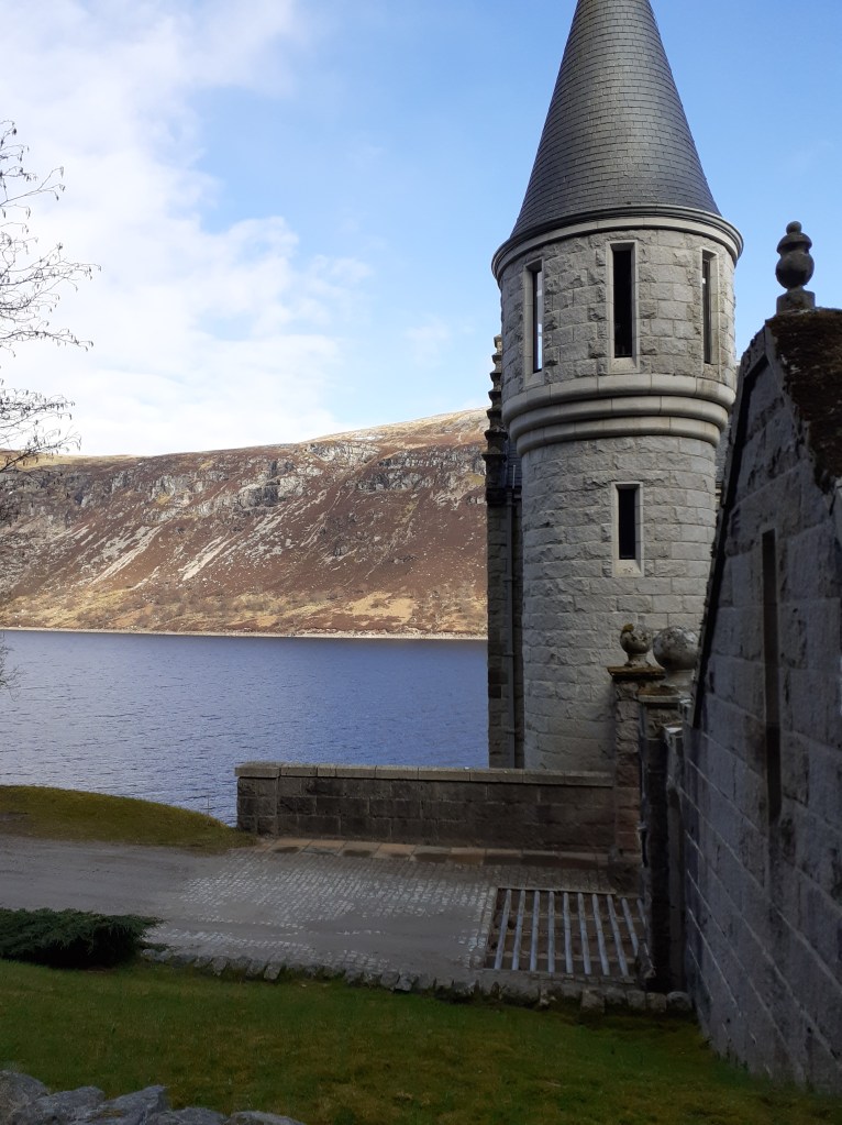
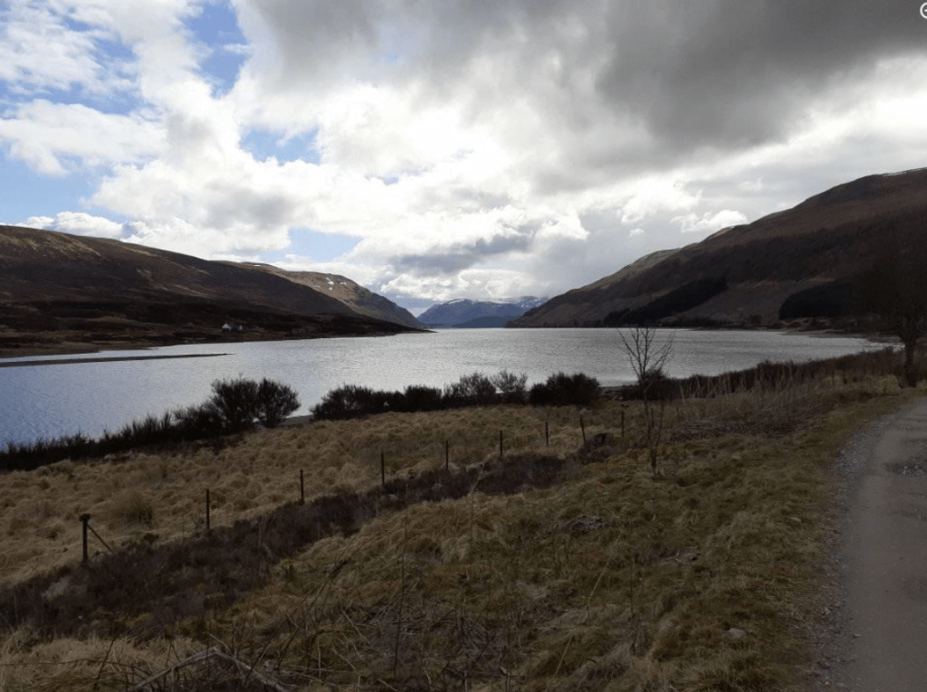
At Newtonmore I swapped the old A86 for the B9150 and another cycle path that more or less trekked all the way to Dalwhinnie. From here it was another delightful lochside path along Loch Ericht.
Old castle-like lodges
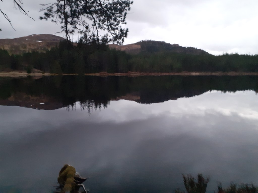
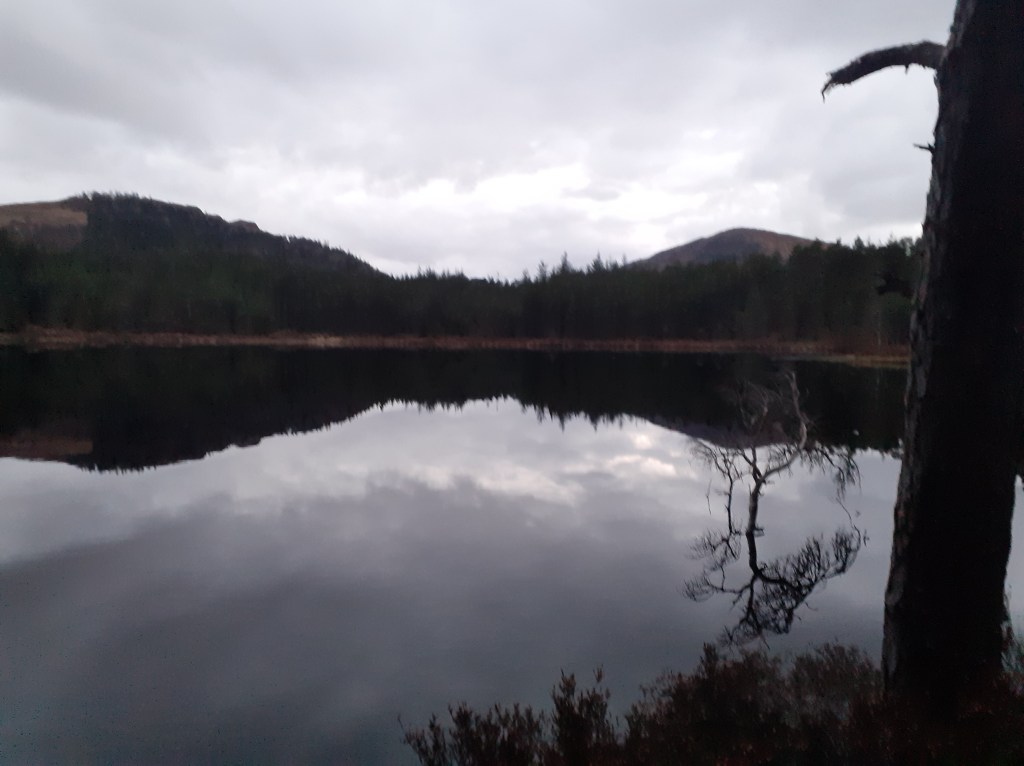
Day 5: Loch Doire nan Sgiath to Fort William 32 miles, 1287ft (4.5 hrs) Weather: Max 8.1 Min 2.8 Rain 1mm Wind NE 4.3mph Glass-smooth lochs, giant pines, empty castles
After a much better overnight camping stop I rode on to Fort William. The path down to Loch Laggan, a gravel track suddenly turns into the smoothest Tarmac road before you reach ‘Kings Grave’, a Scottish castle that looks like something out of a Hammer studios production. There wasn’t a soul around – I was half expecting Klove to suddenly appear at the door.
The path along the southern shore of Loch Laggan offered superb views of snow-capped Creag Meagaidh – clouds of vapour could be seen as the strong spring sunshine evaporated the wintry precipitation that had fallen overnight.
The original plan to proceed to Corrour shooting lodge was abandoned as steep paths beyond effectively blocked my way west. From here it was a straightforward, mostly downhill, onward path into Fort William.
Day 6: Fort William – Observatory Gully, Ben Nevis 30 miles, 5,194ft (11.5 hrs) Weather: Max 8.6 Min -2.1 Rain tr Wind WSW 7.5mph A little skiing at last
After abandoning efforts to go up Aonach Mor – impossible even with half the panniers / weight left in the b&b – the day’s climbing didn’t really start until 3pm from the North Face car park.Lots of ‘you’re mad’ odd looks though with words of encouragement from walkers and climbers on the way up to the CIC hut at 2,231ft.Knackered but with the sight of the snowline just a few hundred feet higher I transferred the skis to the pack, locked the bike and continued on to the snowline, around 2,700ft up Observatory Gully. Ski boots and crampons on at 6pm I went higher to the small buttress at 3,900ft. With one eye on the clock the skis went on and a slide back down lumpy snow. I’d travelled 210 miles and climbed 18,571ft for a ski descent of 1,246ft. Is this the longest ‘walk in’ to a ‘ski tour’ ever?I made it back to Fort William as the last light of the day faded at 9.30pm
Day 7: Fort William – Mallaig: 43 miles, 3,031ft (5 hrs ish) Weather: Max 6.3 Min 2.3 Rain 4mm Wind NE 16.3mph Stormy lochs, rusting boats, Harry Potter steam trains, railway viaducts, Bonnie Prince Charlie and the best wee dram I’ve ever tasted.
I totally underestimated this leg, thinking it would be a plod to the coast. The last fifth turned me directly into the stormy winds – even on declines I seemed to be buffeted back uphill, I had to resort to walking on large sections.
What I thought was the last hill turned out to be the last but three. I cursed my lot out loud and, approaching delirium, convinced myself that Scottish miles must be longer than English miles.
No matter, I arrived in Mallaig and dipped the wheel in the harbour before finding a pub for the best pint and wee dram I’ve ever tasted.
I’d been lucky with the weather though days like this would have made the tour impossible in this timescale.
A rusting boat on the shores of Loch Linnhe
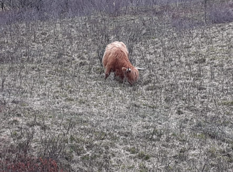
Highland cow
Steam locomotive
Loch Shiel
Jacobite fells distant
A beach
Bonnie Prince Charlie
Journey’s end
The best wee dram. Ever
After a fairly benign week weatherwise I had to cycle into the full fury of this beast
Though the challenge is complete I’m still raising funds for Young Minds, a brilliant charity for our youth who have suffered greatly being cooped up over the past year.
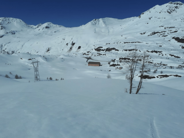
Zermatt and the surrounding Valais area in Switzerland has a varied Alpine climate. But a study of weather data back to the beginning of 2011 reveals distinct seasonal patterns in terms of air pressure and precipitation.
Although these patterns can’t be relied on completely in terms of planning a wintersport or summer climbing trip awareness of the extremes can be a big help. Knowing when pressure is usually highest can help mountaineers pick that ideal week in summer to tackle 4,000m peaks. Similarly pinpointing weeks with lowest pressure and highest precipitation is the holy grail for those hunting for powder snow.
Looking at the averages pressure is highest on December 23rd. Further scrutiny of rolling weekly averages shows this date coincides with the week commencing December 20th. Anyone who’s been to the Alps at Christmas time will know that this period can be very unreliable for deep snow cover. In terms of summer pressure is highest on August 21st.
Pressure is lowest on February 2nd. Again this date often coincides when the deepest snowfalls often arrive after weeks of dry weather. Despite the unsettled pattern at this time annual precipitation is usually greatest at the end of October / beginning of November. I’ve lost count of the number of times the press interpret these early snowfalls to be a sign of a bumper season ahead only for the skies to clear at the end of November and, sometimes, the arrival of unseasonably warm weather.
The second wettest period is usually the end of April / beginning of May. Again, this past week has seen some parts of the Alps record the best snowfalls this season.
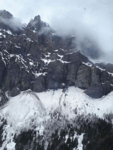
Climbing further into the cloud the silence was suddenly broken by what sounded like thunder. I soon realised that this distinctive noise echoing around the surrounding peaks was an avalanche that wasn’t that far away.
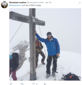
The summit of the Daubenhorn, like many peaks, is marked by a cross
My guide, Davide, seemed unconcerned and as we closed in on the summit of the Daubenhorn, 1,500m above Leukerbad, the cloud started to thin. Two French tourers above us had roped up and were nearing the top as we stepped out of our skis and carefully continued on to the peak.
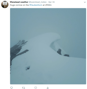
Just as I was edging close to a huge cornice Davide advised me that it would be a good idea to stop as should it have given way there would be little between me and a 1,500m plunge down a cliff through the mist into Leukerbad. Heights don’t usually phase me but there was something about peering down into that foggy abyss that felt even more un-nerving.
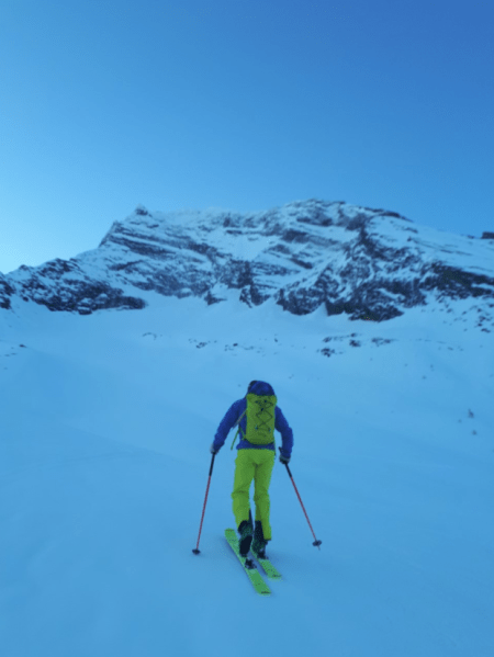
My four-day tour of Valais and Bernese Oberland started just over 24 hours previously at the Gemmi pass, 2,350m up. My first tracks were an icy traverse to the bottom of a wide snowfield; lack of experience on super light touring skis was evident as I wobbled all over the place on the bullet-hard early morning ice.
Crossing the high valley floor the early morning chill soon disappeared as the sun edged higher. My poor, laboured technique, together with my body being used to life at sea level, made the ascent a real slog.
As the angle of the path grew steeper I soon discovered another alpine touring tool to make life easier: ski crampons.
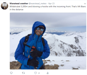
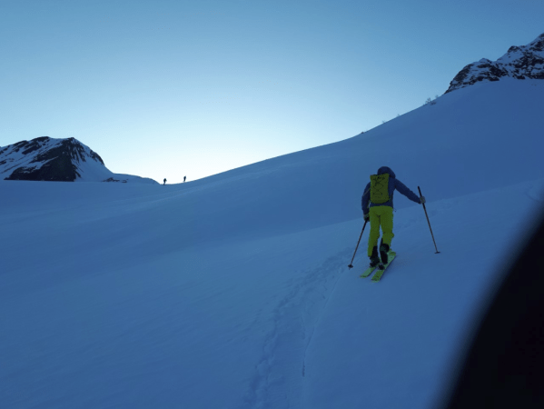
We advanced higher and I was mystified by Davide’s lack of thirst as I polished off the recommended 1.5L of water for a day’s tour before we made it to the foot of the Wildstrubel glacer; I was not in a good way.
I soon forgot my predicament as I rounded a ridge and got my first glimpse of a glacier. About two thirds the way up the 3,200m Wildstrubel, however, mild altitude sickness started to kick in – the final 100m were a real effort. Advancing over the crest it was blowing a hoolie – Davide managed to capture the customary shot with Mont Blanc standing proud in the distance. The queasiness I felt below the summit was replaced by sheer elation of climbing a peak over 3,000m for the first time.
As we began our descent I was all over the place, my usual neat and tidy skiing style severely hampered by sheer exhaustion and pain in my feet.
Lammeurenhutte
It was a combination of downhill and skinning before we reached the Lammeurenhutte at 2,500m, the elation of this establishment appearing mirage-like over the brow of a hill was enough to spur me on to the finish.
The bright skies and good vis of earlier had now been replaced by thickening cloud and light snow. No matter. I collapsed onto a bench outside and watched as other tourers arrive and nonchalantly take off their skis and disappear inside. I’m left looking at my destroyed feet, the sorest they’ve ever been with a large blister on the inside of both heels.
Davide reappeared with some hut slippers, basically moulded ‘Crocs’, which are provided for tourers who refrain from carrying the extra weight of footwear.
After taking all the equipment inside we were showed to our ‘rooms’. Davide, as a guide, was allowed to stay free in the guides’ room while I’m shown to a bunkroom made up of beds with three mattresses side by side on two levels.
I fled to the dining room which was the only common area in the building. Davide was already seated with two large beers. We chatted about the day and possibilities for the Monday. There were a couple of hours to kill before dinner, like many huts a single sitting, which I spent coming to terms with my altitude discomfort.
An early night followed after a wholesome meal of lentil loaf and vegetables. There’s not much to do after dinner except read and, because everyone is exhausted from touring, the dining room empties well before the 10pm lights out. Despite my exhaustion it was a fairly restless sleep, no doubt caused by the altitude.
After a hearty breakfast we were back in our skis and descended 400m to the valley floor, over icy terrain, some of which passed some incredibly steep sections.
Southern aspects were being stripped of snow by the strong sun
In milky, warm sunshine we began our ascent of the 2,950m Daubenhorn. The sun was taking its toll on south-facing slopes across the valley, whole sections of the pack started to rip away from the surface. After the bright start the weather started to close to close in again. And I had my first experience of being close to an avalanche.
Though the customary summit photo was shrouded in cloud the weather changed again for our descent – my ski legs finally seemed to be coming back but before I knew it we were back on the valley floor for the hour or so walk back to the top of the cable car that we last saw 24hrs previously.
Two German guys I met in the hut the previous night were waiting – they told me they’d abandoned efforts to climb Wildstrubel because of poor weather and seem impressed when I told them we’d bagged that and the Daubenhorn in reasonable weather.
The sheer rock face looking up to Gemmi pass
On disembarking the cable car it was evident that summer was fast approaching in the low valley – cascades of water could be seen running off the horseshoe of sheer cliffs, triggering mesmerising avalanches. I stared in wonder but the locals seemed to just take it in their stride: “Summer is coming!” said one.
Driving back from Leukerbad we began to discuss what the options would be for my final two days. One was to get the 4.30pm cable car from Saas Fee for another night in a hut. Another was to take the Jungfrau railway up to the summit to spend a night there. But both these options looked less attractive than a return to Chalet Isabel and a hot shower!
We settled on a very early start for Tuesday for a tour of the mountains above the Simplon Pass. I enjoyed a couple of hours of late afternoon sunshine on the terrace before dinner which, as the previous night, was a delicious three-course affair. Being alone I felt compelled to utter the usual: “Is there anything I can do?” despite the fact I’d paid for half board; I’ve never been one to lord it over others.
We discussed local politics, flora and fauna as well as the Davide’s wife Jennifer’s ties to the area and how they stretch back generations.
As with previous nights I retired to bed early as we had to be up at 4.30am for the 50 minute journey to Simplon. I told them not to bother with the cooked eggs and to go for the lightest of breakfasts as my stomach really can’t take the numerous hairpin bends at that time of the day.
We started off in pitch dark – I did my best to keep the conversation flowing at this ungodly hour. I noticed Davide listened intently to a news bulletin at the top of the hour – the announcer saying that extreme heat was expected: never good for avalanches.
After twisting our way upwards toward the pass we emerged from the tunnel and were suddenly confronted by a deer that seemed to jump out of nowhere from the side of the road. Davide managed to slam on the brakes; to swerve would have sent us careering into the path of the huge artic.
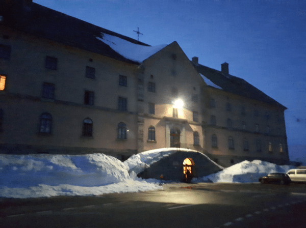
The Simplon Hospiz
We were both now wide awake and within minutes were pulling into the car park of the hugely imposing Simplon Hospiz. Built in 1801 under decree by Napoleon this establishment, run by priests, has provided shelter and refreshment for tired souls who are halfway across the Alps for over 200 years.
We weren’t there for the hospitality, however, and Davide was quickly ushering me toward the side of the building where the path starts toward the Breithorn which, literally, translates as ‘wide mountain’. Desperate for the loo, however, I fled toward the hospiz for a toilet stop. I go inside and despite seeing corridors of rooms there is not a soul around. The deathly silence is quite unnerving and I am reminded of that scene in the horror film The Shining.
Davide skins toward the Hübschhorn
After leaving as quickly as possible we were soon back in bindings and skinning toward the Hübschhorn, a majestic ice-encrusted peak in front of the Breithorn. It was barely light and the first rays of sunshine were just beginning to strike peaks across the valley above Leuker. It was incredibly quiet, about half a dozen tourers had beaten us to it and were making speedy progress. Across the valley I could see one of the ski areas of the Bernese Oberland.
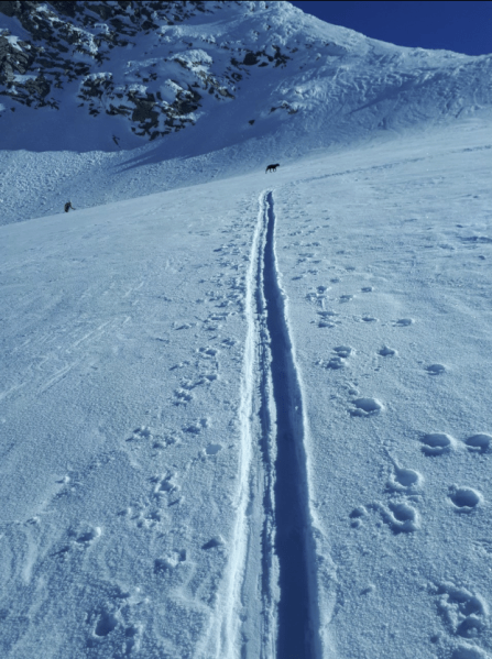
A couple of miles in the terrain began to steepen markedly; my progress became erratic and Davide called a halt to enable us to attach our ski crampons. As I fished about in my rucksack Davide rebuked: “This stuff should be on the top so it is easy to grab!” Second nature to seasoned tourers, I beat myself up about making such an elementary mistake. I never ‘gave it back’ to Davide as it is the safety of a client that is paramount: “If you go over here it is all the way down to the bottom.” I peered down the slope that was littered with huge chunks of snow from earlier avalanches. We pressed on and a sense of relief was evident once we cleared the avalanche zone. I was once more able to relax and take in the surroundings. As we reached a rocky outcrop a ptarmigan-like bird appeared but scarpered too quickly for a photo.
Two tourers appear on the ridge
We pushed on. By now I could feel my heels starting to rub again. Every time I saw a likely stopping place it was to no avail. We stopped briefly for a drink and snack but there is no time on these hikes to really kick back. Davide let it be known that he was worried about the time we were taking and that we might not reach the summit; I think the earlier news bulletin about possible record hot weather was playing on his mind.
We left hastily, I said I was willing to walk faster, not giving too much away that my heels were feeling sore again. With about 300m still to go Davide could see I was dropping back off the pace again. He offered to take some of the weight out of my pack – the water alone probably weighed a kilo or so.
Just before the summit I became aware of a dog that was running uphill even faster than his master
For a brief moment I felt like somebody was lifting me up the mountain – though it was only a kilo the altitude has an exponential effect. Within 30 minutes, however, I was struggling again, and Davide, without argument, took my entire backpack. I’d usually protest but such was the pain in my heels I didn’t argue. To add insult to injury soon after I noticed a spaniel-type dog running upward in front of me, his master clad in lycra and pushing toward the summit using extra long sticks.
If anything seeing this guy virtually running toward the summit helped take my mind off my blistered heels.
We made it to the col de Briethorn, about 100m below the summit. “There is not much more to see at the top,” said Davide, as I stared at Italy in the distance in the valley below.
After a few pictures we adjusted our skis for the downhill leg. For the first time since my arrival I felt like I was getting my ski legs though such is the light weight of touring skis that it feels impossible to ‘feel’ as good as you can on normal downhill skis, the added weight making you more stable.
Col di Breithorn with Italy in the distance
In virtually no time we were back to the avalanche zone. The smooth terrain with still powdery pockets of snow becoming full of lumps and bumps, the remains of previous falls from above thawed then frozen in time.
We were soon back at the steep section which by now was in full sun. “In 45-50 minutes this will avalanche!” said Davide, confidently. We saw another tourer making his way upward: “You just cannot tell some people” Davide said, annoyed.
We inched our way across the slope, gingerly making our way upward. Though it was only just gone 11am the heat of the sun was powerful and I could feel beads of sweat running down inside of my merino wool top, it was also partly nerves.
Once we cleared the slope we settled on a rocky outcrop and ate our lunch. An Italian skier was there chatting to Davide about his climb.
After lunch it was a couple of hundred metres further down back to the hospiz
From here it was just another couple of hundred metres down to the hospiz which loomed in the valley below. Big, sweeping turns were the order of the day, the crusty snow of this morning now very soft and forgiving. At the end of big ski runs you normally have a bit of time to relax but such was the state of the snow I found that I needed to concentrate to make sure I didn’t do the customary splayed herringbone faceplant.
Back in the car park we discovered it was summer, a few people milling around in shorts and T-shirts. A French couple in a campervan saw us and began walking toward us armed with touring maps. Davide, ever the mine of information, was happy to oblige with advice on where to go.
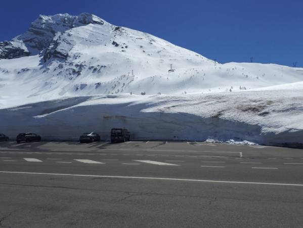
The car park for the Simplon Pass cafe had huge 18ft drifts that had been previously ploughed
“Shall we go for a beer?” With that we were soon driving to the pass cafe, the kind of place that gets full up with bikers in summer. On this day there were just a couple of tables of people enjoying beers and the customary bratwurst and frites. I marvelled at the wall of snow piled up by the side of the road – it was that time in the year when you can see the depth of each snowfall.
What seemed a deserted mountain pass at dawn was now the busy trunk road; roadtrain trucks from all over Europe crossed back and forth. Davide said it was one of the most intensely maintained roads in the world – being above 2,000m snowploughs are utilised almost 24 hours a day during winter storms.
This was probably my favourite day out of the four. The area has unlimited possibilities and everything feels so close to nature, and so far away from it all. As we finished our beers I asked Davide what he thought of the UK’s current political predicament: “Brexit? What is Brexit?” was his bewildered reply.
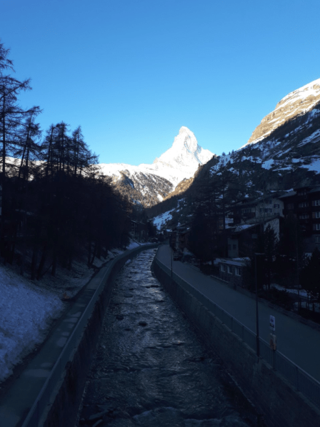
Zermatt with the iconic Matterhorn in the distance
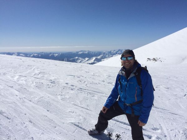
Though I’d visited Zermatt a couple of times before they were both flying visits and was keen to return with someone who knew the area inside out. And though my final peak, another mountain call the Breithorn, was by far the highest at 4,164m we were able to get a lift all the way up to the Klein Matterhorn at 3,883m.
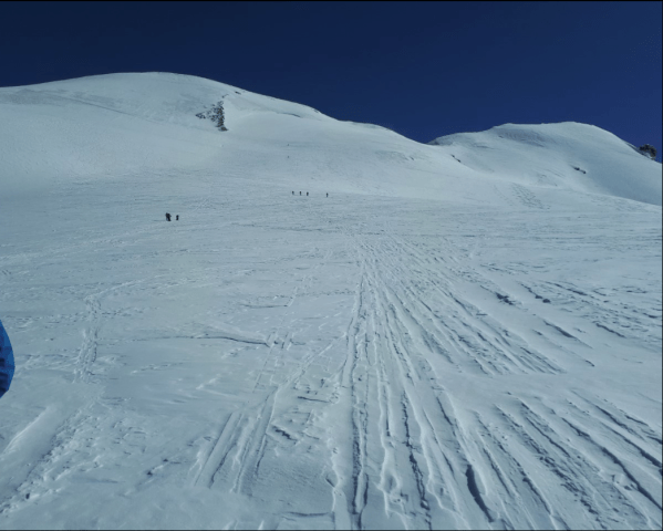
Though the lift took a huge amount of leg work out of reaching a peak of the same height there was still much left to do technically to get to the summit. And though the weather was perfect with just a bit of a cross breeze it was still an unforgiving environment; you had to keep your wits at all times, especially when you began to cross part of the glacier that is sheet ice, the result of countless freeze-thaw cycles.
The huge glacier field on the way to the Breithorn summit
And though the final ascent was under 400m the added altitude made a huge difference on speed of progress, a question of small movements and keeping to a rhythm.
Being more accessible there were far more people around than previous days, most taking advantage of the incredible weather.
We were able to spend longer on the summit this time, being much earlier in the day avalanches are much less of a risk. The view from the crest of the ridge was breathtaking, you could see for miles down into the green valleys below.
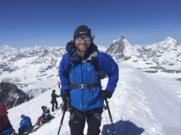
The summit of the Breithorn with the Matterhorn in the distance
Our descent was rapid, catching the snow at just the right time. We were more than ready for lunch. After four of the hardest days skiing of my life I took my time over lunch on a sunny terrace but it wasn’t long before we were back in our skis. It felt strange to be skiing a piste for the first time after being in the mountains for nearly a week.
I was keen to get a good look around the area and, with empty, end-of-season, pistes we were able to cover a lot, taking in the glacier slopes on the Klein Matterhorn side before moving over to the even quieter Stockhorn/Gornergrat which has a very charming old railway that’s full of tourists.


 I soon forgot my predicament as I rounded a ridge and got my first glimpse of a glacier. About two thirds the way up the 3,200m Wildstrubel, however, mild altitude sickness started to kick in – the final 100m were a real effort. Advancing over the crest it was blowing a hoolie – Davide managed to capture the customary shot with Mont Blanc standing proud in the distance. The queasiness I felt below the summit was replaced by sheer elation of climbing a peak over 3,000m for the first time.
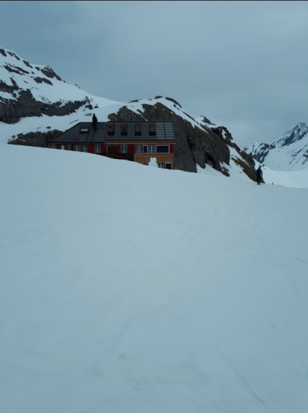
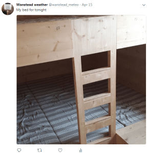 After taking all the equipment inside we were showed to our ‘rooms’. Davide, as a guide, was allowed to stay free in the guides’ room while I’m shown to a bunkroom made up of beds with three mattresses side by side on two levels.
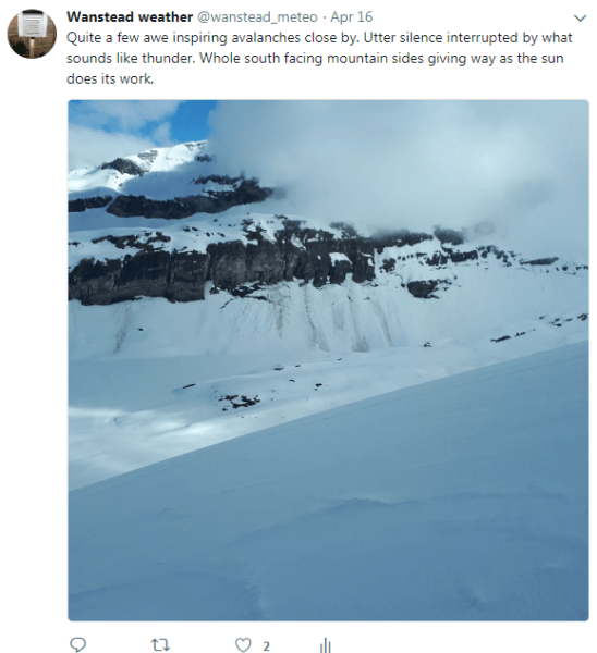

You must be logged in to post a comment.