Category Archives: Alpine snowfall

Collapse of the Weisshorn glacier in 1819

Two hundred years ago this December a huge part of the Weisshorn glacier in Switzerland crashed down several thousand feet to the valley below.

saas fee glacier
A glacier above the village of Saas Grund, Switzerland. Viewed from below I am always struck by how precarious they look.

At 6am on December 27th 1819 the villagers of Randa, near Zermatt, were awoken as millions of tonnes of snow and ice swept away boulders, rocks, gravel and mature larch trees. Though the debris missed the village the force of the slide created a blast of air that moved entire buildings and their contents, burying 12 people, all but two of whom escaped with their lives.

Eyewitnesses described the noise of the falling mass as the loudest thunder and said a bright flash accompanied the slide before darkness once again enveloped the village.

First light revealed the utter devastation of the avalanche that have covered an area of pasture 2,400ft by 1,000ft by 150ft high.

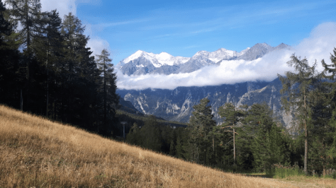
It was not the first avalanche to bring disaster to Randa. In 1636 the village was destroyed by a similar avalanche when 36 people were killed. It is said that that occasion saw a much greater chunk of the flacier fall from the slopes of the mountain, at 14,783ft the 5th highest in the Alps.

Two other less serious falls happened in 1736 and 1786 but not precisely in the same place. This time only a small part of the glacier fell down.

Could a similar disaster happen again? With climate change and the nature of the Alps being constantly on the move it is possible. Earlier this month it was reported that part of a glacier on the Mont Blanc Massif, just 40 miles away as the crow flies, was on the brink of collapse.

I don’t have local figures but a look at the recent climatology in London shows that anomalies during the past couple of years – warmer than average summers and low rainfall – have been similar to what happened in 1819.

summer mean

summer rainfall

Of course the difference between now and 1819 is that we have early warning systems in place that can help prevent loss of human life in the event of a catastrophic avalanche.

weisshorn
The Weisshorn in the far distance seen from the slopes above Grächen
Advertisement

The climatology of Zermatt

Zermatt and the surrounding Valais area in Switzerland has a varied Alpine climate. But a study of weather data back to the beginning of 2011 reveals distinct seasonal patterns in terms of air pressure and precipitation.

Although these patterns can’t be relied on completely in terms of planning a wintersport or summer climbing trip awareness of the extremes can be a big help. Knowing when pressure is usually highest can help mountaineers pick that ideal week in summer to tackle 4,000m peaks. Similarly pinpointing weeks with lowest pressure and highest precipitation is the holy grail for those hunting for powder snow.

Looking at the averages pressure is highest on December 23rd. Further scrutiny of rolling weekly averages shows this date coincides with the week commencing December 20th. Anyone who’s been to the Alps at Christmas time will know that this period can be very unreliable for deep snow cover. In terms of summer pressure is highest on August 21st.

Pressure is lowest on February 2nd. Again this date often coincides when the deepest snowfalls often arrive after weeks of dry weather. Despite the unsettled pattern at this time annual precipitation is usually greatest at the end of October / beginning of November. I’ve lost count of the number of times the press interpret these early snowfalls to be a sign of a bumper season ahead only for the skies to clear at the end of November and, sometimes, the arrival of unseasonably warm weather.

The second wettest period is usually the end of April / beginning of May. Again, this past week has seen some parts of the Alps record the best snowfalls this season.

zermatt pressure

zermatt rainfall

An erratic season for snow in the Alps

Earlier this winter there were many reports on how good snowfall had been in Austria. But on closer inspection it was clear that the weather pattern at that time only favoured certain resorts.

In contrast with last year the totals I’ve used in my cross section of the range don’t look that exciting; Bourg-St-Maurice, the jumping off point for Savoie resorts including Les Arcs and Val d’Isere, has recorded 96mm of precipitation this season, in stark contrast to the 433mm it recorded last season between Christmas Day and February 5th.

In Switzerland Arosa, a resort well placed to pick up snow from any direction, has recorded the same this season as last. Totals in Davos are well down on last season. Similarly San Bernardino has recorded about half the amount of precipitation than it did last season. Its location toward the southern side of the range has been sheltered from the prevailing winds this year. That said it did enjoy a big dump last week.

Going further south and east St Vallentin in Italy has recorded about a third what it did at this stage last season.

Mean temperatures overall are about 2C to 3C lower than they were last season.

snowmap update
30-day precipitation totals reveal that Bourg St Maurice recorded just 96mm, compared with last year’s 433mm while Obertauern in the east recorded 77mm, compared with 106mm the same period last year


Galtür avalanche 20 years on

With all the snow falling in Austria I noticed that next month is the 20th anniversary of the Galtür avalanche that left 31 dead, 26 injured and left a trail of devastation.

This animation shows its devastating power. https://youtu.be/PBxl3i8Bzro

The avalanche was considered the worst in 40 years. Three weather systems originating from the Atlantic accounted for large snowfalls up to 4m deep. Freeze-thaw conditions created a weak layer on top of an existing snowpack; further snow then settled. This, together with high wind speeds, created large drifts and caused roughly 170,000 tons of snow to be deposited.

Even more snow is expected in this and surrounding regions.

alps

The extreme amounts will fall mostly on the north of the range with very little on the south side, more or less the opposite of what happened last year.

Of course Alpine snowfall, from year to year, has always varied greatly as this study of San Bernadino shows.


Best Alpine snow for 30 years?

There’s been countless reports about amazing amounts of snow falling across the French, Swiss and Italian Alps to the point where some agencies have been proclaiming that it has been the best season for the white stuff in 30 years.

Extraordinary totals have fallen in some areas. Bourg-St-Maurice, the jumping off point for Savoie resorts including Les Arcs and Val d’Isere, has recorded over 400mm of precipitation over the past 30 days, equating to around 4m of snow at the resort summits.

In Switzerland, large amounts of snow in a short period caused chaos in Zermatt, stranding tourists after the area’s rail services suffered disruption.

Away from the north and west side of the Alps, however, snowfall, while good, has been less impressive the further south and east you look.

alps arrow
30-day precipitation totals reveal that Bourg St Maurice recorded 422mm while Obertauern in the east recorded 99mm. 

It is a far cry from last year where some resorts on the southern side of the range were particularly dry. San Bernardino, during the last 30-days, has recorded 179mm of precipitation. During the same period last year just 14.6mm fell!

The outlook for the Alps continues to look unsettled with snow forecast to fall at resorts that are in deficit to the Valais and Savoie areas.

snow