
If you like thunderstorms Wanstead seems to be leading something of a charmed life these past couple of years.

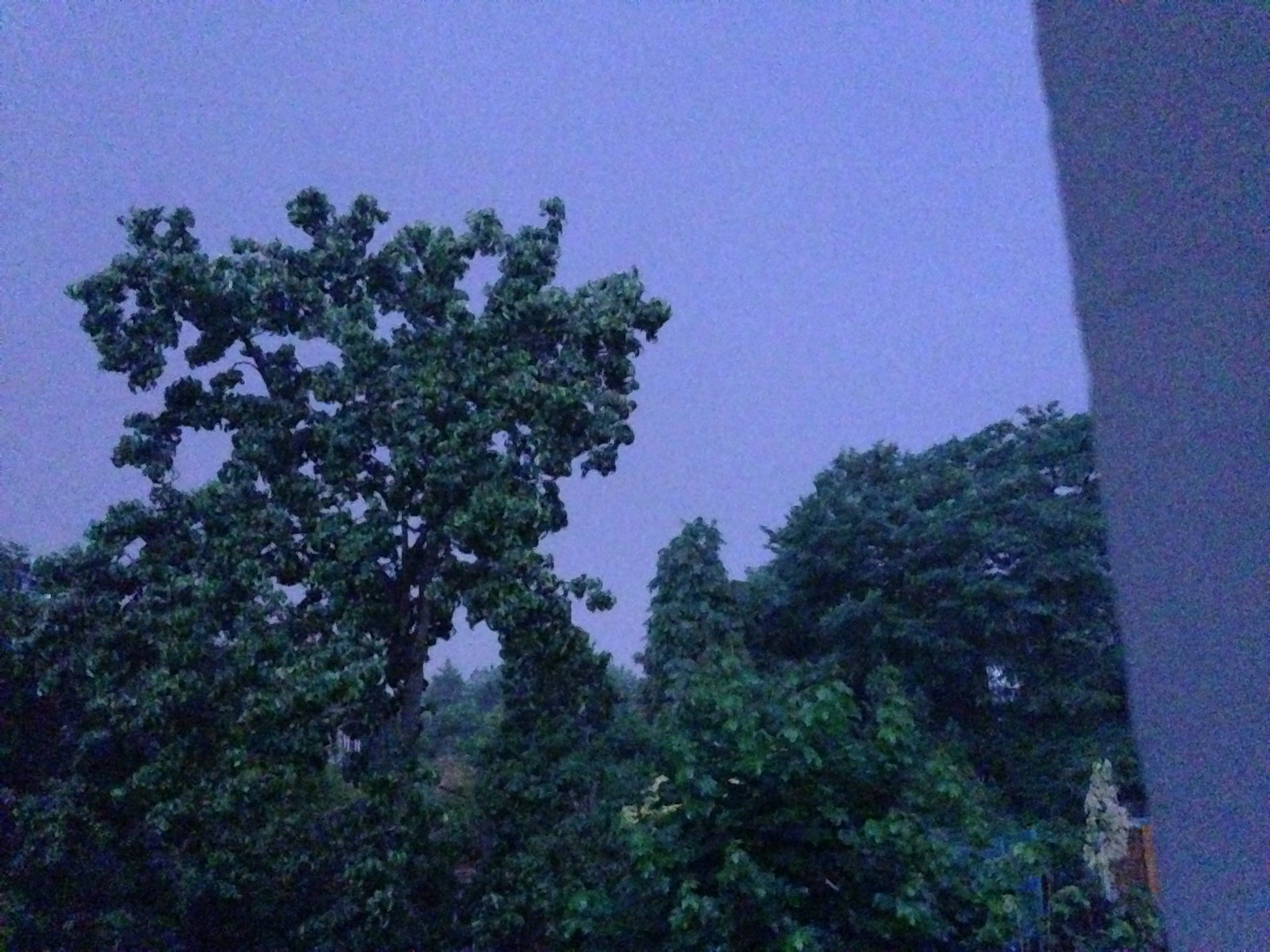
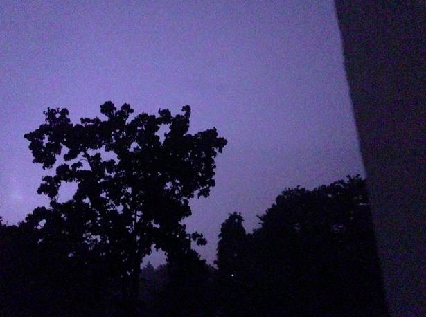
Two years ago I wrote a blog asking what had happened to decent summer thunderstorms that were so common during my youth in the 1980s. Last night was the fourth time Wanstead has experienced a really good light show, complete with multiple lightning strikes and Hammer Horror-esque thunderclaps. The first storm passed over at 23:43, delivering 3.7mm rain at a rate of 20mm/hr. Another followed shortly after at 23:58, a pressure trace revealed a 1mb fall as the storm passed through. Nothing special as I have seen a 6mb drop in similar circumstances. By this time the sky was alive with lightning – yet again I failed to capture any lightning bolt but did manage to photograph my garden at the moment night became day – the world’s most powerful flashgun!
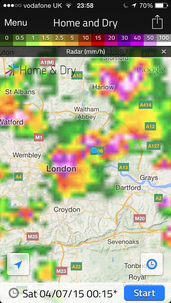
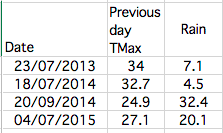
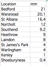
At 00:19pm occurred the brightest flash of lightning almost instantly followed by a very loud crack of thunder, the kind you hear on those Hammer Horror films with Peter Cushing. Looking at the rainfall of weather stations around the south-east it appears that Wanstead was in the thick of the action, clocking up 20.1mm of rain and second only to Bedford. The amount represents 47% of what normally falls in an average July. As always in these situations some places get a deluge while others remain almost dry.

Image courtesy of Blitzortung
Looking further afield around London an observer in Blackheath reported an hour to 90 minutes of ‘roaringly good storminess’ that brought a house party to an abrupt end. He counted 15 flashes of lightning a minute, lots of CC but a few CGs too, including one close as the storm kicked off.
Elsewhere an observer in Highams Park reported 30 flashes per minute. In Dorset another observer 50mm of rain, most of which fell in an hour. The storm that tracked over the Salisbury region had what seemed like 3x the lightning of the storms in the SE corner.
Forecasting of the event was handled better by some agencies than others. For location accuracy the MeteoGroup discussion had an edge over the Met Office.
The Trappes (Paris) ‘loaded gun’ ascent for July 3 can be found here – warm / dry layers between 900 and 800 hPa and ~2000 J/kg of CAPE, with high CAPE values expanding aerially as the trough neared. Approach of the trough caused cooling aloft – not sufficient for the capping inversion to break around Paris itself but farther west and north.


One thought on “Overnight thunderstorms of July 4th 2015”