
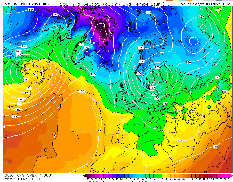
It’s that time of year again! With the midnight run of this model bringing the start of the 25th into range the prognosis for the big day is a rare white one – with snow likely almost anywhere.
But 15 days is an eternity in modelling so we can take this with a council depot load of salt.
It’s often not until 10 days out that models will start to get a firm grip on what the weather will be like on Christmas day.
My guess at this range is a quiet one with fog and frost and a high of 6C in London.
Friday, December 10th
24hrs on and, interestingly, the pattern hasn’t completely flipped to something opposite to above…

Saturday, December 11th
The high is more centrally located over the UK with proper cold air from eastern Switzerland eastwards. Cold, calm with frost and fog in London.

Sunday 12th December
Little change though any colder air is even further east. A Eurotrash high with declining air quality.

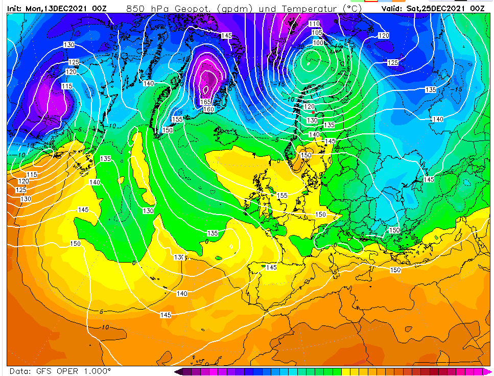
Monday 13th December
The models are in a state of flux, more so than usual by the looks of it. No change on my thoughts though.
Tuesday 14th December
Another slack flow with any true, cold air well to the east. My guess remains a dull and cold Christmas day after a slight morning frost.

Wednesday 15th December
Within the much more reliable 10-day range now and the GFS is throwing out quite an odd looking chart. It shows a mass of cold air just to our east, the start of a cold spell that takes us up to New Year’s Eve.

Thursday 16th December
My thoughts on Christmas day still remain the same as they were days ago. Cold, calm with a high of 5C. Beyond that GFS is hinting the Atlantic floodgates will open. I suspect it is jumping the gun by a couple of days and we’ll see a couple of cold days, the 27th being notably cold?

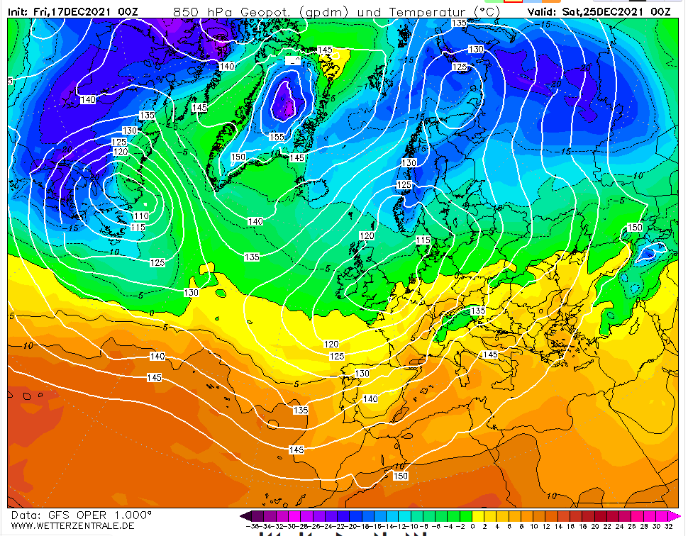
Friday 17th December
The GFS having another hiccup overnight. The situation at 0z hours probably 5C and cloudy in London. But it’s a deteriorating situation with 850mb temps plunging from the north – the conditions that could bring being consistent with the title of this blog. But I’d pay little notice to output like this until it is 48-72 hours away.
Saturday 18th December
A classic battleground scenario on the midnight operational. An even spread on ensembles, too. My hunch is that the high pressure will survive long enough for a quiet Christmas day. After that?

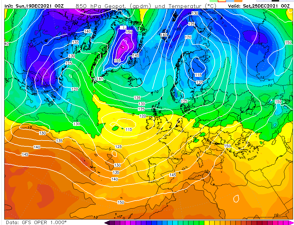
Sunday 19th December
GFS wants to bring 11C, outbreaks of rain this morning…
Monday 20th December
Mild with showers in London.

