Category Archives: weather pattern

An erratic season for snow in the Alps

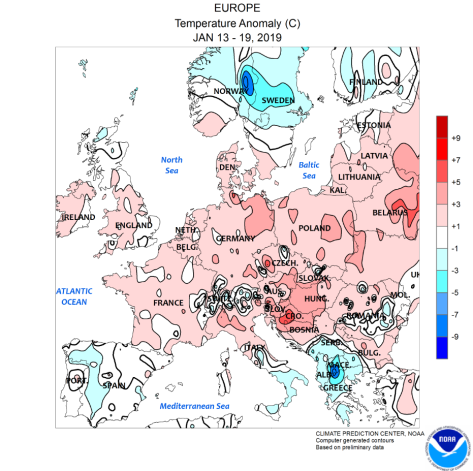
Earlier this winter there were many reports on how good snowfall had been in Austria. But on closer inspection it was clear that the weather pattern at that time only favoured certain resorts.

In contrast with last year the totals I’ve used in my cross section of the range don’t look that exciting; Bourg-St-Maurice, the jumping off point for Savoie resorts including Les Arcs and Val d’Isere, has recorded 96mm of precipitation this season, in stark contrast to the 433mm it recorded last season between Christmas Day and February 5th.

In Switzerland Arosa, a resort well placed to pick up snow from any direction, has recorded the same this season as last. Totals in Davos are well down on last season. Similarly San Bernardino has recorded about half the amount of precipitation than it did last season. Its location toward the southern side of the range has been sheltered from the prevailing winds this year. That said it did enjoy a big dump last week.

Going further south and east St Vallentin in Italy has recorded about a third what it did at this stage last season.

Mean temperatures overall are about 2C to 3C lower than they were last season.

snowmap update
30-day precipitation totals reveal that Bourg St Maurice recorded just 96mm, compared with last year’s 433mm while Obertauern in the east recorded 77mm, compared with 106mm the same period last year


A winter heatwave

It is 21 years ago this month that London and most of the southern half of the UK experienced a remarkably warm spell of weather during what had been a mild winter.

The spell, which saw the record warmest February day on the 13th (19.7C), satisfies the Met Office’s old criteria of a heatwave whereby the maximum temperature is 5C or more above average for five consecutive days.

While these spells are fairly common in summer they are very rare during a meteorological winter. During the last 60 years the only other periods to have experienced a heatwave in winter are December 1966 and 2015.

Weather charts for this week look remarkably similar though, according to the latest forecasts, values will be nothing like they were in 1998.

Since this was published this 2019 spell has satisfied the Met Office criteria. But the anomalies are not yet as impressive as 1998.

1998 2019

This slideshow requires JavaScript.


feb 1998 maxes


Update on effects of the polar vortex split

More than three weeks have now past since the polar vortex split on January 1st.

London’s weather has turned colder and there’s even been a (small) fall of snow but the negative anomalies recorded so far are less than those experienced during the ‘Beast from the Eastevents last March.

In the graph below I have plotted the mean anomalies since the day of the PV split against the mean anomalies recorded from the day of the PV split in February 2018.

The effect this year is much less pronouced so far: over the last 24 days the average mean anomaly has been -0.7C, compared with -2.1C last February/ March.

jan 2018 2019

The NOAA anomaly map for the week of January 13th-19th shows much of NW Europe has experienced a positive anomaly with any serious cold restricted to Norway and Sweden and Greece.anom jan 13th to 19th

It has been mentioned that the variables with this SSW are very similar to 2004. Using the anomalies generated after the 2004 event resulted in the graphic below.

3 years compared

Taking it at face value would suggest that two more snow events could be possible at the beginning and middle of February – a cold but not severe pattern currently reflected in the models – but forget any repeat of last year’s Beast from the East.

A winter drought

Rain today (January 16th) is the first meaningful fall since before Christmas, putting an end to the 23-day long dry spell.

This meteorological drought, rare given that it spanned Christmas and New Year Storm singularities, these having 84 and 86 per cent probabilities respectively, was the 3rd equal longest winter drought.

The only other similar droughts in a list that dates back to 1887 were 19/12/2008 – 03/01/2009 and 17/12/1972 – 02/01/1973.

winter droughts

The last precipitation I recorded was from a weak occlusion that followed a cold front on the evening of December 23rd.

This synoptic set-up was followed by a build in air pressure that peaked on the morning of January 3rd; 1043.8mb was the highest reading in this area for at least 10 years and is the highest pressure I have measured.

A fuller version of London droughts in all seasons can be found here.

Winter proper to arrive mid January

Weather models are continuing to struggle in the aftermath of the stratospheric sudden warming on January 1st. The GFS and ECMWF have flip-flopped: on one run decent northern blocking extends southward only for the dreaded European high to appear on the next.

Using a combination of QBO and ENSO data featured in my winter forecast and statistics from previous SSWs (including 2013 and 2018) achieved the following results shown in this graphic.

jan max

Although some days in the next week or so will be cold it is not until the 14th that conditions start to bite, the start of a week-long cold spell that will probably be more notable for cold than snowfall.

The rapid recovery in temperature would suggest that the Azores / European high making a return. With the MJO moving back and forth between phase 7 and 8, and looking at the behaviour of previous cold spells, this would make sense.

14th
The GFS has been churning out some very strange charts of late

As for February, unless there are further SSWs to disrupt the polar vortex, and depending on its recovery, it is unlikely we will see a repeat of the winter of 1984/85 that I hinted at last month. The graphic below, however, would suggest another cold spell in the third week of February.

feb m


A third of winter gone…

…And not a flake of snow. There’s been lots of talk about how an SSW will eventually usher in a cold January and February but it is by no means guaranteed.

The average maxima for this December will finish 10.2C, precisely the same as December 1985. Other Decembers that finished close to this average maximum are shown below.
As you can see apart from the middle of the month the temperatures are all over the place. And so are the conditions that followed in January and February.

december all.PNG

A closer inspection of every year reveals that just three were very similar to 2018: 1974, 1986 and 1988.

748688.PNG

Again, there’s plenty of spread. The 500mb reanalysis charts below show the situation of the northern hemisphere on December 31st of each year, including this year.

What followed in January 1975, 1987 and 1989?
January 1975 in this area was the warmest on record, back to 1797, while January 1989 was the 12th warmest. Conversely, January 1987 saw one of the coldest spells on record.

Perhaps it is fair to say that there is a 66 per cent chance of a very mild January, though you cannot discount the 34 per chance of another January 1987…


Heading for a 1984/85 style winter?

With talk of an imminent statospheric sudden warming (SSW) I thought it would be interesting to have a look back at previous SSWs and see what precedents could be found.

December so far is showing similarities with 1984: mean maxima is within 0.3C of 1984 while rainfall is virtually the same at around 30mm!

During the winter of 1984-85 the polar vortex split on January 2nd, setting up that month to be among the coldest of the 20th century, on a par with 1979 and 1987. A more recent January that was just as cold was 2010.

Indeed, the winter of 1984-85 was among the snowiest of the past 70 years, ranking at number 5 in my survey of winters.

1984-2018.PNG

een

London winter forecast 2018-19

Long range modelled forecasts have been all over the place of late and, looking at the underlying signals, it is easy to see why.

When I’ve produced these forecast in the past, in terms of QBO and ENSO data, there’s usually a lot of analogues to compare with. This year, however, seems to be an exception.

Considering QBO first I looked back over data to 1950 and found nothing similar for October. However, looking over the whole series the cyclical nature of this circulation may give some clue.

bestfit

Some 20 months were revealed, ranging from June 1959 to June 2015.  Using NOAA’s  Niño 3.4 region I narrowed this list down to the few that had an ENSO value of around +1 with a rising trend. With NOAA’s forecast of a Modoki El Nino (one that occurs in the central Pacific) this narrowed the list to just 1 period: June 2015. Considering maxima anomalies this would give the following winter.

winter 2018-19 max anomaly.PNG

The above would suggest there being a general cool down through December with a cold spell starting just before Christmas into the new year? And another cold spell end of January into the first week of February?

winter 2018-19 precip anomaly

The above precipitation anomaly chart would suggest a wetter than average December,  January and February, though February by much less so.

It’s been a very busy autumn so I’m keeping this short.

The below figures, particularly January and February, may be different in the event of an SSW occurring. In all then.

The mean:
December: +0.8C
January: -1.2C
February: -1.7C
Overall: -0.3C (broadly average)

Precipitation:
December: 158%
January: 155%
February: 120%
Overall: 134%


How cold will November end?

Twitter and other forums have been at fever pitch with excitement for a ‘nailed-on’ cold spell. 

But with many getting carried away over tales of a repeat of March’s ‘Beast from the East’ it is important to remember that snow in November is extremely rare in the south-east; despite predictions of the incoming upper air being very cold the ground is still very warm and will take time to cool.

However, as seen in November 1993, a week of hard frosts were enough to chill the ground enough for a decent week-long cold spell. Similarly, although the snow didn’t arrive in London until December, November 2010 was also cold enough.

The weather of late has been in an ‘average mood’ with the mean temperature in September and October both finishing at 0.2C below. The mean for the this month is currently (on the 15th) running 1.8C above average, therefore for the mean to finish the same as September / October would require a big cool down, as hinted by the models.

Will we see another an average, 1993 or a 2010 end to the month. My hunch is it will be something between the three.

Below is a graph that shows this November so far with average, 1993 and 2010 ends.
2018: 0.4
1993: -0.8
2010: -1.4

November: an Indian summer before turning cold?

With the mean temperature of both October and September finishing 0.2C below average it is probably safe to say that the weather is in an average kind of mood.

Conditions during the first part of November look changeable, according to the Met Office’s 30-day forecast . After mid month, however, the agency says the forecast is uncertain.

Now that much of the UK has had its first frost any warm spell in November will, correctly, be called an Indian summer. A singularity called the St Martin’s Summer occurs in 66 per cent of years, occurring between 15th and 21st and peaking on the 18th.

And, as if by magic, the GFS model today has this chart for the 16th, an Atlantic ridge of high pressure with daytime temperatures about 6C to 8C above average. Though warm during the day I would imagine there being a risk of fog forming at night

16th

Beyond that there could be a tendency for much more unsettled weather at the end of the month. The early December storms singularity occurs in 98 per cent of years, starting between November 24th and December 14th, often peaking on December 9th.

November, the last autumn month, can often surprise with its extremes, though it can also often be characterised by days of anticyclonic gloom. The warmest, coldest and wettest November conditions in London back to 1959 can be found here.